Browse Maps
| map | Title | Year | Last Updated  |
Status |
|---|---|---|---|---|

|
これはテスト
aa
|
2023 | about 22 hours ago | 9 control points |
|
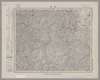
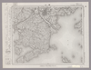
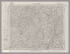
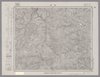
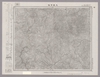
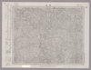
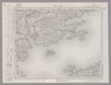
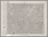
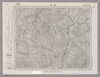
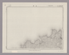
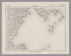
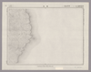
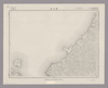
Image from the Map Collections courtesy Stanford University Libraries, licensed under a Creative Commons Attribution-Noncommercial 3.0 Unported License. © Stanford University. 【図幅名】 寄居 【測量時期】 明治40年測図/昭和4年修正/昭和9年要部修正/昭和14年部分修正 【発行時期】 昭和15年8月発行 【記号】 宇都宮16号 【測量機関】 大日本帝国陸地測量部 【備考】 (In 1 layer)
Links: Source / Biblio Ref
|
7 days ago | 4 control points | |
|
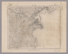
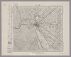
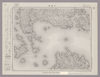
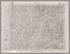
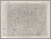
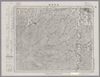
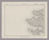
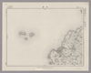
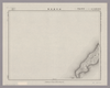
Image from the Map Collections courtesy Stanford University Libraries, licensed under a Creative Commons Attribution-Noncommercial 3.0 Unported License. © Stanford University. 【図幅名】 横浜 【測量時期】 明治39年測図/昭和7年測図の縮図、第2回修正、測図の縮図 【発行時期】 昭和21年8月発行 【記号】 東京8号 【測量機関】 内務省地理調査所 【備考】 (In 1 layer)
Links: Source / Biblio Ref
|
7 days ago | 4 control points | |
|
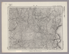
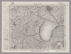
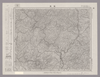
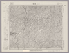
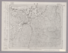
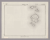
Image from the Map Collections courtesy Stanford University Libraries, licensed under a Creative Commons Attribution-Noncommercial 3.0 Unported License. © Stanford University. 【図幅名】 津田 【測量時期】 明治32年測圖/昭和2年修正測圖 【発行時期】 【記号】 広島十四号 【測量機関】 参謀本部 【備考】 祕
Links: Source / Biblio Ref
|
7 days ago | 4 control points | |
|
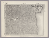
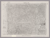
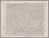
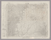
Image from the Map Collections courtesy Stanford University Libraries, licensed under a Creative Commons Attribution-Noncommercial 3.0 Unported License. © Stanford University. 【図幅名】 岩国 【測量時期】 明治27年測図の縮図/明治34年測図/昭和2年修正、測図の縮図/昭和7年鉄道補入、測図の縮図 【発行時期】 昭和22年2月発行 【記号】 広島16号(共16面) 【測量機関】 内務省地理調査所 【備考】
Links: Source / Biblio Ref
|
7 days ago | 4 control points | |
|
Image from the Map Collections courtesy Stanford University Libraries, licensed under a Creative Commons Attribution-Noncommercial 3.0 Unported License. © Stanford University. 【図幅名】 福山 【測量時期】 明治31年測図/大正14年第2回修正 【発行時期】 【記号】 岡山及丸亀10号(共14面) 【測量機関】 参謀本部 【備考】 秘
Links: Source / Biblio Ref
|
7 days ago | 4 control points | |
|
Image from the Map Collections courtesy Stanford University Libraries, licensed under a Creative Commons Attribution-Noncommercial 3.0 Unported License. © Stanford University. 【図幅名】 旭川 【測量時期】 大正5年測図/昭和6年鉄道補入 【発行時期】 昭和7年8月発行 【記号】 旭川10号(共16面) 【測量機関】 大日本帝国陸地測量部 【備考】 (In 1 layer)
Links: Source / Biblio Ref
|
8 days ago | 4 control points | |
|
Image from the Map Collections courtesy Stanford University Libraries, licensed under a Creative Commons Attribution-Noncommercial 3.0 Unported License. © Stanford University. 【図幅名】 大甕 【測量時期】 明治41年測図/昭和8年修正 【発行時期】 昭和10年12月発行 【記号】 福島3号東部(共18面) 【測量機関】 大日本帝国陸地測量部 【備考】
Links: Source / Biblio Ref
|
15 days ago | 4 control points | |
|
Image from the Map Collections courtesy Stanford University Libraries, licensed under a Creative Commons Attribution-Noncommercial 3.0 Unported License. © Stanford University. 【図幅名】 磐城富岡 【測量時期】 明治41年測図/昭和8年修正 【発行時期】 昭和10年10月発行 【記号】 福島4号東部(共18面) 【測量機関】 大日本帝国陸地測量部 【備考】
Links: Source / Biblio Ref
|
15 days ago | 4 control points | |
|
Image from the Map Collections courtesy Stanford University Libraries, licensed under a Creative Commons Attribution-Noncommercial 3.0 Unported License. © Stanford University. 【図幅名】 井出 【測量時期】 明治41年測図/昭和8年要部修正 【発行時期】 【記号】 白河1号東部(共17面) 【測量機関】 参謀本部 【備考】 秘
Links: Source / Biblio Ref
|
15 days ago | 4 control points | |
|
Image from the Map Collections courtesy Stanford University Libraries, licensed under a Creative Commons Attribution-Noncommercial 3.0 Unported License. © Stanford University. 【図幅名】 岡山北部 【測量時期】 明治30年測図/大正12年第2回修正 【発行時期】 昭和4年4月発行 【記号】 高梁4号(共16面) 【測量機関】 大日本帝国陸地測量部 【備考】
Links: Source / Biblio Ref
|
17 days ago | 4 control points | |
|
Image from the Map Collections courtesy Stanford University Libraries, licensed under a Creative Commons Attribution-Noncommercial 3.0 Unported License. © Stanford University. 【図幅名】 村岡 【測量時期】 明治31年測図/昭和7年修正 【発行時期】 昭和10年2月発行 【記号】 鳥取8号(共9面) 【測量機関】 大日本帝国陸地測量部 【備考】
Links: Source / Biblio Ref
|
17 days ago | 4 control points | |
|
Image from the Map Collections courtesy Stanford University Libraries, licensed under a Creative Commons Attribution-Noncommercial 3.0 Unported License. © Stanford University. 【図幅名】 大屋市場 【測量時期】 明治31年測圖/昭和7年要部修正測圖 【発行時期】 【記号】 姫路五号 【測量機関】 参謀本部 【備考】 祕
Links: Source / Biblio Ref
|
17 days ago | 4 control points | |
|
Image from the Map Collections courtesy Stanford University Libraries, licensed under a Creative Commons Attribution-Noncommercial 3.0 Unported License. © Stanford University. 【図幅名】 周匝 【測量時期】 明治27年測図の縮図/明治29年測図/昭和4年要部修正、測図の縮図 【発行時期】 昭和9年6月発行 【記号】 姫路15号(共16面) 【測量機関】 大日本帝国陸地測量部 【備考】
Links: Source / Biblio Ref
|
17 days ago | 4 control points | |
|
Image from the Map Collections courtesy Stanford University Libraries, licensed under a Creative Commons Attribution-Noncommercial 3.0 Unported License. © Stanford University. 【図幅名】 高松 【測量時期】 明治30年測図の縮図/昭和3年修正、測図の縮図/昭和7年鉄道補入、測図の縮図 【発行時期】 【記号】 徳島14号(共14面) 【測量機関】 参謀本部 【備考】 秘
Links: Source / Biblio Ref
|
17 days ago | 4 control points | |
|
Image from the Map Collections courtesy Stanford University Libraries, licensed under a Creative Commons Attribution-Noncommercial 3.0 Unported License. © Stanford University. 【図幅名】 下津井 【測量時期】 明治35年測図/大正14年測図/昭和3年第2回修正 【発行時期】 昭和6年10月発行 【記号】 岡山及丸亀2号(共16面) 【測量機関】 大日本帝国陸地測量部 【備考】
Links: Source / Biblio Ref
|
17 days ago | 4 control points | |
|
Image from the Map Collections courtesy Stanford University Libraries, licensed under a Creative Commons Attribution-Noncommercial 3.0 Unported License. © Stanford University. 【図幅名】 岡山南部 【測量時期】 明治30年測図/大正14年修正 【発行時期】 【記号】 岡山及丸亀1号(共16面) 【測量機関】 参謀本部 【備考】 秘
Links: Source / Biblio Ref
|
17 days ago | 4 control points | |
|
Image from the Map Collections courtesy Stanford University Libraries, licensed under a Creative Commons Attribution-Noncommercial 3.0 Unported License. © Stanford University. 【図幅名】 西大寺 【測量時期】 明治30年測図/大正14年第2回修正/昭和3年部分修正 【発行時期】 【記号】 徳島13号(共14面) 【測量機関】 参謀本部 【備考】 秘
Links: Source / Biblio Ref
|
17 days ago | 4 control points | |
|
Image from the Map Collections courtesy Stanford University Libraries, licensed under a Creative Commons Attribution-Noncommercial 3.0 Unported License. © Stanford University. 【図幅名】 和気 【測量時期】 明治28年測図/大正14年第2回修正 【発行時期】 昭和2年12月発行 【記号】 姫路16号(共16面) 【測量機関】 大日本帝国陸地測量部 【備考】
Links: Source / Biblio Ref
|
17 days ago | 4 control points | |
|
Image from the Map Collections courtesy Stanford University Libraries, licensed under a Creative Commons Attribution-Noncommercial 3.0 Unported License. © Stanford University. 【図幅名】 福渡 【測量時期】 明治30年測圖/昭和7年要部修正測圖 【発行時期】 【記号】 高梁三号 【測量機関】 参謀本部 【備考】 祕
Links: Source / Biblio Ref
|
17 days ago | 4 control points | |
|
Image from the Map Collections courtesy Stanford University Libraries, licensed under a Creative Commons Attribution-Noncommercial 3.0 Unported License. © Stanford University. 【図幅名】 津山西部 【測量時期】 明治31年測量/昭和7年要部修正、測図の縮図 【発行時期】 昭和9年7月発行 【記号】 高梁2号(共16面) 【測量機関】 大日本帝国陸地測量部 【備考】
Links: Source / Biblio Ref
|
17 days ago | 4 control points | |
|
Image from the Map Collections courtesy Stanford University Libraries, licensed under a Creative Commons Attribution-Noncommercial 3.0 Unported License. © Stanford University. 【図幅名】 山崎 【測量時期】 明治30年測図/昭和7年要部修正 【発行時期】 【記号】 姫路6号(共16面) 【測量機関】 参謀本部 【備考】 秘
Links: Source / Biblio Ref
|
17 days ago | 4 control points | |
|
Image from the Map Collections courtesy Stanford University Libraries, licensed under a Creative Commons Attribution-Noncommercial 3.0 Unported License. © Stanford University. 【図幅名】 龍野 【測量時期】 明治28年測図/大正12年第2回修正/昭和7年鉄道補入 【発行時期】 【記号】 姫路7号(共16面) 【測量機関】 参謀本部 【備考】 秘
Links: Source / Biblio Ref
|
17 days ago | 4 control points | |
|
Image from the Map Collections courtesy Stanford University Libraries, licensed under a Creative Commons Attribution-Noncommercial 3.0 Unported License. © Stanford University. 【図幅名】 津山東部 【測量時期】 明治30年測図/大正14年測図の縮図/昭和7年第2回修正 【発行時期】 昭和35年9月発行 【記号】 姫路14号(共16面) 【測量機関】 国土地理院 【備考】 応急修正版
Links: Source / Biblio Ref
|
17 days ago | 4 control points | |
|
Image from the Map Collections courtesy Stanford University Libraries, licensed under a Creative Commons Attribution-Noncommercial 3.0 Unported License. © Stanford University. 【図幅名】 智頭 【測量時期】 明治31年測図/昭和7年要部修正 【発行時期】 昭和9年7月発行 【記号】 姫路13号 【測量機関】 大日本帝国陸地測量部 【備考】
Links: Source / Biblio Ref
|
17 days ago | 4 control points | |
|
Image from the Map Collections courtesy Stanford University Libraries, licensed under a Creative Commons Attribution-Noncommercial 3.0 Unported License. © Stanford University. 【図幅名】 奥津 【測量時期】 明治31年測圖/昭和7年要部修正測圖 【発行時期】 【記号】 高梁一号 【測量機関】 参謀本部 【備考】 祕
Links: Source / Biblio Ref
|
17 days ago | 4 control points | |
|
Image from the Map Collections courtesy Stanford University Libraries, licensed under a Creative Commons Attribution-Noncommercial 3.0 Unported License. © Stanford University. 【図幅名】 鳥取南部 【測量時期】 明治30年測図/明治31年測図の縮図/昭和7年修正 【発行時期】 昭和9年8月発行 【記号】 鳥取16号(共9面) 【測量機関】 大日本帝国陸地測量部 【備考】
Links: Source / Biblio Ref
|
17 days ago | 4 control points | |
|
Image from the Map Collections courtesy Stanford University Libraries, licensed under a Creative Commons Attribution-Noncommercial 3.0 Unported License. © Stanford University. 【図幅名】 倉吉 【測量時期】 明治31年測量/昭和7年修正測量 【発行時期】 昭和9年7月発行 【記号】 松江4号 【測量機関】 大日本帝国陸地測量部 【備考】
Links: Source / Biblio Ref
|
17 days ago | 4 control points | |
|
Image from the Map Collections courtesy Stanford University Libraries, licensed under a Creative Commons Attribution-Noncommercial 3.0 Unported License. © Stanford University. 【図幅名】 富士山 【測量時期】 明治21年測圖/昭和3年第二回修正測圖 【発行時期】 【記号】 甲府八号 【測量機関】 参謀本部 【備考】 祕
Links: Source / Biblio Ref
|
19 days ago | 4 control points | |
|
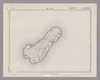
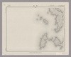
Image from the Map Collections courtesy Stanford University Libraries, licensed under a Creative Commons Attribution-Noncommercial 3.0 Unported License. © Stanford University. 【図幅名】 臥蛇島 【測量時期】 昭和5年測圖(海上寫眞測量) 【発行時期】 昭和11年発行 【記号】 奄美大島要塞近傍一号 【測量機関】 陸地測量部・参謀本部 【備考】 軍事極祕(戦地ニ在りテハ軍事祕密トス) 假製版
Links: Source / Biblio Ref
|
19 days ago | 4 control points | |
|
Image from the Map Collections courtesy Stanford University Libraries, licensed under a Creative Commons Attribution-Noncommercial 3.0 Unported License. © Stanford University. 【図幅名】 小宝島 【測量時期】 昭和5年測圖(海上寫眞測量) 【発行時期】 昭和11年発行 【記号】 奄美大島要塞近傍三号 【測量機関】 陸地測量部・参謀本部 【備考】 軍事極祕(戦地ニ在りテハ軍事祕密トス) 假製版
Links: Source / Biblio Ref
|
19 days ago | 4 control points | |
|
Image from the Map Collections courtesy Stanford University Libraries, licensed under a Creative Commons Attribution-Noncommercial 3.0 Unported License. © Stanford University. 【図幅名】 宝島 【測量時期】 昭和5年測圖(海上寫眞測量) 【発行時期】 昭和11年発行 【記号】 奄美大島要塞近傍四号 【測量機関】 陸地測量部・参謀本部 【備考】 軍事極祕(戦地ニ在りテハ軍事祕密トス) 假製版
Links: Source / Biblio Ref
|
19 days ago | 4 control points | |
|
Image from the Map Collections courtesy Stanford University Libraries, licensed under a Creative Commons Attribution-Noncommercial 3.0 Unported License. © Stanford University. 【図幅名】 笠利崎 【測量時期】 大正9年測圖 【発行時期】 大正10年発行 【記号】 奄美大島要塞近傍七号 【測量機関】 陸地測量部・参謀本部 【備考】 軍事極祕(戦地ニ在りテハ軍事祕密トス)
Links: Source / Biblio Ref
|
19 days ago | 4 control points | |
|
Image from the Map Collections courtesy Stanford University Libraries, licensed under a Creative Commons Attribution-Noncommercial 3.0 Unported License. © Stanford University. 【図幅名】 名瀬 【測量時期】 大正9年測圖 【発行時期】 大正11年発行 【記号】 奄美大島要塞近傍十号 【測量機関】 陸地測量部・参謀本部 【備考】 軍事極祕(戦地ニ在りテハ軍事祕密トス)
Links: Source / Biblio Ref
|
19 days ago | 4 control points | |
|
Image from the Map Collections courtesy Stanford University Libraries, licensed under a Creative Commons Attribution-Noncommercial 3.0 Unported License. © Stanford University. 【図幅名】 喜界島 【測量時期】 大正9年測圖 【発行時期】 昭和11年発行 【記号】 奄美大島要塞近傍六号 【測量機関】 陸地測量部・参謀本部 【備考】 軍事極祕(戦地ニ在りテハ軍事祕密トス)
Links: Source / Biblio Ref
|
19 days ago | 4 control points | |
|
Image from the Map Collections courtesy Stanford University Libraries, licensed under a Creative Commons Attribution-Noncommercial 3.0 Unported License. © Stanford University. 【図幅名】 小湊 【測量時期】 大正9年測圖 【発行時期】 大正10年発行 【記号】 奄美大島要塞近傍九号 【測量機関】 陸地測量部・参謀本部 【備考】 軍事極祕(戦地ニ在りテハ軍事祕密トス)
Links: Source / Biblio Ref
|
19 days ago | 4 control points | |
|
Image from the Map Collections courtesy Stanford University Libraries, licensed under a Creative Commons Attribution-Noncommercial 3.0 Unported License. © Stanford University. 【図幅名】 西古見 【測量時期】 大正8年測圖 【発行時期】 大正10年発行 【記号】 奄美大島要塞近傍十三号 【測量機関】 陸地測量部・参謀本部 【備考】 軍事極祕(戦地ニ在りテハ軍事祕密トス)
Links: Source / Biblio Ref
|
19 days ago | 4 control points | |
|
Image from the Map Collections courtesy Stanford University Libraries, licensed under a Creative Commons Attribution-Noncommercial 3.0 Unported License. © Stanford University. 【図幅名】 請島 【測量時期】 大正8年測圖 【発行時期】 大正11年発行 【記号】 奄美大島要塞近傍十四号 【測量機関】 陸地測量部・参謀本部 【備考】 軍事極祕(戦地ニ在りテハ軍事祕密トス)
Links: Source / Biblio Ref
|
19 days ago | 4 control points | |
|
Image from the Map Collections courtesy Stanford University Libraries, licensed under a Creative Commons Attribution-Noncommercial 3.0 Unported License. © Stanford University. 【図幅名】 久米島南部 【測量時期】 大正10年測圖 【発行時期】 昭和11年発行 【記号】 沖縄郡島二十三号 【測量機関】 陸地測量部・参謀本部 【備考】 軍事極祕(戦地ニ在りテハ軍事祕密トス)
Links: Source / Biblio Ref
|
19 days ago | 4 control points | |
|
Image from the Map Collections courtesy Stanford University Libraries, licensed under a Creative Commons Attribution-Noncommercial 3.0 Unported License. © Stanford University. 【図幅名】 久米島東部 【測量時期】 大正10年測圖 【発行時期】 昭和11年発行 【記号】 沖縄郡島二十二号 【測量機関】 陸地測量部・参謀本部 【備考】 軍事極祕(戦地ニ在りテハ軍事祕密トス)
Links: Source / Biblio Ref
|
19 days ago | 4 control points | |
|
Image from the Map Collections courtesy Stanford University Libraries, licensed under a Creative Commons Attribution-Noncommercial 3.0 Unported License. © Stanford University. 【図幅名】 渡名喜島 【測量時期】 大正10年測図 【発行時期】 昭和11年発行 【記号】 沖縄群島20号 【測量機関】 陸地測量部・参謀本部 【備考】 那覇14号
Links: Source / Biblio Ref
|
19 days ago | 4 control points | |
|
Image from the Map Collections courtesy Stanford University Libraries, licensed under a Creative Commons Attribution-Noncommercial 3.0 Unported License. © Stanford University. 【図幅名】 慶良間列島南部 【測量時期】 大正10年測圖 【発行時期】 昭和11年発行 【記号】 沖縄郡島十八号 【測量機関】 陸地測量部・参謀本部 【備考】 軍事極祕(戦地ニ在りテハ軍事祕密トス)
Links: Source / Biblio Ref
|
19 days ago | 4 control points | |
|
Image from the Map Collections courtesy Stanford University Libraries, licensed under a Creative Commons Attribution-Noncommercial 3.0 Unported License. © Stanford University. 【図幅名】 與那原 【測量時期】 大正8年測圖 【発行時期】 大正11年発行 【記号】 沖縄郡島十二号 【測量機関】 陸地測量部・参謀本部 【備考】 軍事極祕(戦地ニ在りテハ軍事祕密トス)
Links: Source / Biblio Ref
|
19 days ago | 4 control points | |
|
Image from the Map Collections courtesy Stanford University Libraries, licensed under a Creative Commons Attribution-Noncommercial 3.0 Unported License. © Stanford University. 【図幅名】 那覇 【測量時期】 大正10年測圖 【発行時期】 大正12年発行 【記号】 沖縄郡島十五号 【測量機関】 陸地測量部・参謀本部 【備考】 軍事極祕(戦地ニ在りテハ軍事祕密トス)
Links: Source / Biblio Ref
|
19 days ago | 4 control points | |
|
Image from the Map Collections courtesy Stanford University Libraries, licensed under a Creative Commons Attribution-Noncommercial 3.0 Unported License. © Stanford University. 【図幅名】 座喜味 【測量時期】 大正10年測圖 【発行時期】 大正12年発行 【記号】 沖縄郡島十四号 【測量機関】 陸地測量部・参謀本部 【備考】 軍事極祕(戦地ニ在りテハ軍事祕密トス)
Links: Source / Biblio Ref
|
19 days ago | 4 control points | |
|
Image from the Map Collections courtesy Stanford University Libraries, licensed under a Creative Commons Attribution-Noncommercial 3.0 Unported License. © Stanford University. 【図幅名】 安波 【測量時期】 大正10年測圖 【発行時期】 大正12年発行 【記号】 沖縄郡島二号 【測量機関】 陸地測量部・参謀本部 【備考】 軍事極祕(戦地ニ在りテハ軍事祕密トス)
Links: Source / Biblio Ref
|
19 days ago | 4 control points | |
|
Image from the Map Collections courtesy Stanford University Libraries, licensed under a Creative Commons Attribution-Noncommercial 3.0 Unported License. © Stanford University. 【図幅名】 田名崎 【測量時期】 大正10年測圖 【発行時期】 昭和11年発行 【記号】 沖縄郡島四号 【測量機関】 陸地測量部・参謀本部 【備考】 軍事極祕(戦地ニ在りテハ軍事祕密トス)
Links: Source / Biblio Ref
|
19 days ago | 4 control points | |
|
Image from the Map Collections courtesy Stanford University Libraries, licensed under a Creative Commons Attribution-Noncommercial 3.0 Unported License. © Stanford University. 【図幅名】 伊平屋後島 【測量時期】 大正10年測圖 【発行時期】 昭和11年発行 【記号】 沖縄郡島七号 【測量機関】 陸地測量部・参謀本部 【備考】 軍事極祕(戦地ニ在りテハ軍事祕密トス)
Links: Source / Biblio Ref
|
19 days ago | 4 control points | |
|
Image from the Map Collections courtesy Stanford University Libraries, licensed under a Creative Commons Attribution-Noncommercial 3.0 Unported License. © Stanford University. 【図幅名】 伊平屋前島 【測量時期】 大正10年測圖 【発行時期】 大正12年発行 【記号】 沖縄郡島八号 【測量機関】 陸地測量部・参謀本部 【備考】 軍事極祕(戦地ニ在りテハ軍事祕密トス)
Links: Source / Biblio Ref
|
19 days ago | 4 control points | |
|
Image from the Map Collections courtesy Stanford University Libraries, licensed under a Creative Commons Attribution-Noncommercial 3.0 Unported License. © Stanford University. 【図幅名】 邊土名 【測量時期】 大正10年測圖 【発行時期】 大正12年発行 【記号】 沖縄郡島五号 【測量機関】 陸地測量部・参謀本部 【備考】 軍事極祕(戦地ニ在りテハ軍事祕密トス)
Links: Source / Biblio Ref
|
19 days ago | 4 control points |