ファイルが見つかりません。地図がまだ整形されていないのかもしません。
地図を見る
| 地図 | タイトル | 年 | 前回の更新  |
ステータス |
|---|---|---|---|---|

|
|
2026 | 2日 前 | 4個の基準点 |

|
|
2026 | 2日 前 | 整形を解除する |

|
|
2026 | 9日 前 | 18個の基準点 |

|
|
2026 | 9日 前 | 3個の基準点 |
|
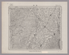
Image from the Map Collections courtesy Stanford University Libraries, licensed under a Creative Commons Attribution-Noncommercial 3.0 Unported License. © Stanford University. 【図幅名】 城端 【測量時期】 明治42年測図/昭和5年修正 【発行時期】 昭和8年12月発行 【記号】 金沢1号(共13面) 【測量機関】 大日本帝国陸地測量部 【備考】 ( 1枚のレイヤー)
リンク: 出所・参照情報
|
19日 前 | 4個の基準点 | |
|
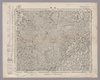
Image from the Map Collections courtesy Stanford University Libraries, licensed under a Creative Commons Attribution-Noncommercial 3.0 Unported License. © Stanford University. 【図幅名】 石動 【測量時期】 明治42年測圖/昭和5年修正測圖 【発行時期】 【記号】 七尾四号 【測量機関】 参謀本部 【備考】 祕 ( 1枚のレイヤー)
リンク: 出所・参照情報
|
19日 前 | 4個の基準点 | |
|
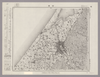
Image from the Map Collections courtesy Stanford University Libraries, licensed under a Creative Commons Attribution-Noncommercial 3.0 Unported License. © Stanford University. 【図幅名】 金沢 【測量時期】 明治42年測図/昭和6年修正 【発行時期】 【記号】 金沢5号 【測量機関】 参謀本部 【備考】 秘 ( 2枚のレイヤー)
リンク: 出所・参照情報
|
19日 前 | 4個の基準点 | |

|
|
2026 | 20日 前 | 7個の基準点 |

|
|
2026 | 20日 前 | 整形を解除する |

|
|
2026 | 20日 前 | 整形を解除する |

|
|
2026 | 20日 前 | 33個の基準点 |

|
|
2026 | 20日 前 | 21個の基準点 |

|
資源集団回収ルート図(最新現況)
|
2026 | 20日 前 | 15個の基準点 |

|
|
2026 | 20日 前 | 5個の基準点 |

|
|
2026 | 20日 前 | 8個の基準点 |
|
|
|
2026 | 20日 前 | 整形を解除する |
|
|
|
2026 | 22日 前 | 整形を解除する |

|
|
2026 | 30日 前 | 5個の基準点 |
|
Image from the Map Collections courtesy Stanford University Libraries, licensed under a Creative Commons Attribution-Noncommercial 3.0 Unported License. © Stanford University. 【図幅名】 黄尾嶼 【測量時期】 昭和5年測圖(海上寫眞測量) 【発行時期】 昭和11年発行 【記号】 先島群島二号 【測量機関】 陸地測量部・参謀本部 【備考】 軍事極祕(戦地ニ在りテハ軍事祕密トス) 假製版
リンク: 出所・参照情報
|
約1ヶ月 前 | 4個の基準点 | |
|
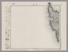
Image from the Map Collections courtesy Stanford University Libraries, licensed under a Creative Commons Attribution-Noncommercial 3.0 Unported License. © Stanford University. 【図幅名】 戸賀 【測量時期】 大正1年測図/昭和14年修正 【発行時期】 昭和16年1月発行 【記号】 男鹿島5号(共2面) 【測量機関】 大日本帝国陸地測量部 【備考】
リンク: 出所・参照情報
|
約1ヶ月 前 | 4個の基準点 | |
|
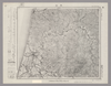
Image from the Map Collections courtesy Stanford University Libraries, licensed under a Creative Commons Attribution-Noncommercial 3.0 Unported License. © Stanford University. 【図幅名】 本荘 【測量時期】 大正2年測図/大正14年鉄道補入 【発行時期】 大正15年11月発行 【記号】 秋田16号(共16面) 【測量機関】 大日本帝国陸地測量部 【備考】
リンク: 出所・参照情報
|
約1ヶ月 前 | 4個の基準点 | |
|
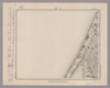
Image from the Map Collections courtesy Stanford University Libraries, licensed under a Creative Commons Attribution-Noncommercial 3.0 Unported License. © Stanford University. 【図幅名】 津幡 【測量時期】 明治42年測図/昭和5年修正 【発行時期】 昭和8年8月発行 【記号】 七尾8号(共7面) 【測量機関】 大日本帝国陸地測量部 【備考】 ( 1枚のレイヤー)
リンク: 出所・参照情報
|
約1ヶ月 前 | 4個の基準点 | |
|
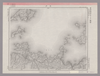
Image from the Map Collections courtesy Stanford University Libraries, licensed under a Creative Commons Attribution-Noncommercial 3.0 Unported License. © Stanford University. 【図幅名】 平戸 【測量時期】 大正12年測図の縮図/昭和10年修正、測図の縮図 【発行時期】 昭和21年11月発行 【記号】 唐津8号(共12面) 【測量機関】 地理調査所 【備考】
リンク: 出所・参照情報
|
約1ヶ月 前 | 4個の基準点 | |
|
Image from the Map Collections courtesy Stanford University Libraries, licensed under a Creative Commons Attribution-Noncommercial 3.0 Unported License. © Stanford University. 【図幅名】 生月 【測量時期】 大正12年測図の縮図/昭和10年修正、測図の縮図 【発行時期】 昭和21年11月発行 【記号】 唐津12号(共8面) 【測量機関】 地理調査所 【備考】
リンク: 出所・参照情報
|
約1ヶ月 前 | 4個の基準点 | |
|
Image from the Map Collections courtesy Stanford University Libraries, licensed under a Creative Commons Attribution-Noncommercial 3.0 Unported License. © Stanford University. 【図幅名】 二神島 【測量時期】 大正12年測図の縮図/昭和10年修正、測図の縮図 【発行時期】 昭和21年11月発行 【記号】 唐津7号(共8面) 【測量機関】 内務省地理調査所 【備考】
リンク: 出所・参照情報
|
約1ヶ月 前 | 4個の基準点 | |
|
Image from the Map Collections courtesy Stanford University Libraries, licensed under a Creative Commons Attribution-Noncommercial 3.0 Unported License. © Stanford University. 【図幅名】 盧辺 【測量時期】 大正12年測図の縮図/昭和10年修正、測図の縮図 【発行時期】 昭和21年11月発行 【記号】 唐津2号(共8面) 【測量機関】 内務省地理調査所 【備考】
リンク: 出所・参照情報
|
約1ヶ月 前 | 4個の基準点 | |
|
Image from the Map Collections courtesy Stanford University Libraries, licensed under a Creative Commons Attribution-Noncommercial 3.0 Unported License. © Stanford University. 【図幅名】 仁位 【測量時期】 大正1年測図/大正11年測図の縮図/昭和10年修正、第2回修正、測図の縮図 【発行時期】 昭和21年11月発行 【記号】 厳原10号(共7面) 【測量機関】 地理調査所 【備考】
リンク: 出所・参照情報
|
約1ヶ月 前 | 4個の基準点 | |
|
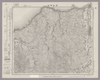
Image from the Map Collections courtesy Stanford University Libraries, licensed under a Creative Commons Attribution-Noncommercial 3.0 Unported License. © Stanford University. 【図幅名】 【測量時期】 【発行時期】 【記号】 【測量機関】 【備考】 ( 1枚のレイヤー)
リンク: 出所・参照情報
|
約1ヶ月 前 | 4個の基準点 | |
|
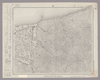
Image from the Map Collections courtesy Stanford University Libraries, licensed under a Creative Commons Attribution-Noncommercial 3.0 Unported License. © Stanford University. 【図幅名】 泊 【測量時期】 明治43年測図/昭和5年修正 【発行時期】 昭和9年5月発行 【記号】 富山7号(共11面) 【測量機関】 大日本帝国陸地測量部 【備考】 ( 1枚のレイヤー)
リンク: 出所・参照情報
|
約1ヶ月 前 | 4個の基準点 | |
|
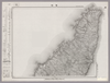
Image from the Map Collections courtesy Stanford University Libraries, licensed under a Creative Commons Attribution-Noncommercial 3.0 Unported License. © Stanford University. 【図幅名】 鷲崎 【測量時期】 大正2年測図/昭和9年修正 【発行時期】 【記号】 相川11号 【測量機関】 参謀本部 【備考】 秘
リンク: 出所・参照情報
|
約1ヶ月 前 | 4個の基準点 | |
|
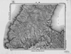
この地図の作成に当たっては、国土地理院長の承認を得て、同院発行の20万分の1地勢図及び5万分の1地形図を使用した。(承認番号 平30情使、 第1148号)
リンク: 出所・参照情報
|
1947 | 約1ヶ月 前 | 4個の基準点 |
|
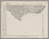
Image from the Map Collections courtesy Stanford University Libraries, licensed under a Creative Commons Attribution-Noncommercial 3.0 Unported License. © Stanford University. 【図幅名】 宇出津 【測量時期】 明治42年測図/昭和9年修正 【発行時期】 昭和11年11月発行 【記号】 富山13号(共11面) 【測量機関】 大日本帝国陸地測量部 【備考】
リンク: 出所・参照情報
|
約1ヶ月 前 | 4個の基準点 | |
|
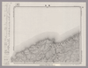
Image from the Map Collections courtesy Stanford University Libraries, licensed under a Creative Commons Attribution-Noncommercial 3.0 Unported License. © Stanford University. 【図幅名】 輪島 【測量時期】 明治43年測図/昭和4年修正 【発行時期】 昭和11年9月発行 【記号】 輪島4号(共3面) 【測量機関】 大日本帝国陸地測量部 【備考】
リンク: 出所・参照情報
|
約1ヶ月 前 | 4個の基準点 | |
|
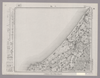
Image from the Map Collections courtesy Stanford University Libraries, licensed under a Creative Commons Attribution-Noncommercial 3.0 Unported License. © Stanford University. 【図幅名】 小松 【測量時期】 明治42年測図/昭和5年修正/昭和8年要部修正 【発行時期】 昭和8年9月発行 【記号】 金沢10号(共13面) 【測量機関】 大日本帝国陸地測量部 【備考】 ( 2枚のレイヤー)
リンク: 出所・参照情報
|
約1ヶ月 前 | 4個の基準点 | |
|
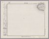
Image from the Map Collections courtesy Stanford University Libraries, licensed under a Creative Commons Attribution-Noncommercial 3.0 Unported License. © Stanford University. 【図幅名】 宿根木 【測量時期】 大正2年測図/昭和9年修正 【発行時期】 【記号】 長岡14号(共11面) 【測量機関】 参謀本部 【備考】 秘
リンク: 出所・参照情報
|
約1ヶ月 前 | 4個の基準点 | |
|
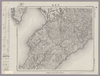
Image from the Map Collections courtesy Stanford University Libraries, licensed under a Creative Commons Attribution-Noncommercial 3.0 Unported License. © Stanford University. 【図幅名】 河原田 【測量時期】 大正2年測図/昭和9年修正 【発行時期】 【記号】 長岡9号 【測量機関】 参謀本部 【備考】 秘
リンク: 出所・参照情報
|
約1ヶ月 前 | 4個の基準点 | |
|
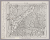
Image from the Map Collections courtesy Stanford University Libraries, licensed under a Creative Commons Attribution-Noncommercial 3.0 Unported License. © Stanford University. 【図幅名】 邑知潟 【測量時期】 明治42年測図/昭和5年修正 【発行時期】 昭和11年12月発行 【記号】 七尾3号(共7面) 【測量機関】 大日本帝国陸地測量部 【備考】 ( 1枚のレイヤー)
リンク: 出所・参照情報
|
約1ヶ月 前 | 4個の基準点 | |
|
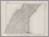
Image from the Map Collections courtesy Stanford University Libraries, licensed under a Creative Commons Attribution-Noncommercial 3.0 Unported License. © Stanford University. 【図幅名】 洲本 【測量時期】 明治29年測図/昭和3年修正/昭和33年要部修正 【発行時期】 昭和37年1月発行 【記号】 徳島2号(共14面) 【測量機関】 国土地理院 【備考】
リンク: 出所・参照情報
|
約1ヶ月 前 | 4個の基準点 | |

|
|
2026 | 約2ヶ月 前 | 8個の基準点 |

|
|
2026 | 約2ヶ月 前 | 整形を解除する |
|
|
|
2026 | 約2ヶ月 前 | 整形を解除する |

|
|
2026 | 約2ヶ月 前 | 5個の基準点 |

|
|
2026 | 約2ヶ月 前 | 整形を解除する |

|
|
2026 | 2ヶ月 前 | 9個の基準点 |
|
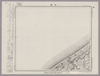
Image from the Map Collections courtesy Stanford University Libraries, licensed under a Creative Commons Attribution-Noncommercial 3.0 Unported License. © Stanford University. 【図幅名】 内野 【測量時期】 明治44年測図/昭和6年修正 【発行時期】 昭和8年1月発行 【記号】 長岡1号(共11面) 【測量機関】 大日本帝国陸地測量部 【備考】
リンク: 出所・参照情報
|
2ヶ月 前 | 4個の基準点 | |
|
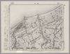
Image from the Map Collections courtesy Stanford University Libraries, licensed under a Creative Commons Attribution-Noncommercial 3.0 Unported License. © Stanford University. 【図幅名】 新潟 【測量時期】 明治44年測図/昭和6年要部修正 【発行時期】 昭和9年6月発行 【記号】 新潟13号(共16面) 【測量機関】 大日本帝国陸地測量部 【備考】
リンク: 出所・参照情報
|
2ヶ月 前 | 13個の基準点 | |
|
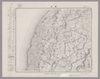
Image from the Map Collections courtesy Stanford University Libraries, licensed under a Creative Commons Attribution-Noncommercial 3.0 Unported License. © Stanford University. 【図幅名】 弥彦 【測量時期】 明治44年測図/昭和6年修正/昭和28年応急修正 【発行時期】 昭和33年6月発行 【記号】 長岡2号(共11面) 【測量機関】 国土地理院 【備考】 応急修正版
リンク: 出所・参照情報
|
2ヶ月 前 | 4個の基準点 | |
|
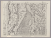
Image from the Map Collections courtesy Stanford University Libraries, licensed under a Creative Commons Attribution-Noncommercial 3.0 Unported License. © Stanford University. 【図幅名】 新津 【測量時期】 明治44年測図/昭和6年要部修正 【発行時期】 昭和9年6月発行 【記号】 新潟14号(共16面) 【測量機関】 大日本帝国陸地測量部 【備考】
リンク: 出所・参照情報
|
2ヶ月 前 | 4個の基準点 | |
|
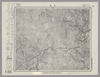
Image from the Map Collections courtesy Stanford University Libraries, licensed under a Creative Commons Attribution-Noncommercial 3.0 Unported License. © Stanford University. 【図幅名】 只見 【測量時期】 大正3年測図/昭和6年要部修正 【発行時期】 昭和8年11月発行 【記号】 新潟12号(共16面) 【測量機関】 大日本帝国陸地測量部 【備考】
リンク: 出所・参照情報
|
3ヶ月 前 | 4個の基準点 | |
|
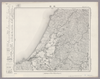
Image from the Map Collections courtesy Stanford University Libraries, licensed under a Creative Commons Attribution-Noncommercial 3.0 Unported License. © Stanford University. 【図幅名】 柏崎 【測量時期】 明治44年測図/昭和6年修正 【発行時期】 昭和9年4月発行 【記号】 長岡8号(共11面) 【測量機関】 大日本帝国陸地測量部 【備考】
リンク: 出所・参照情報
|
3ヶ月 前 | 4個の基準点 |