File Not Found. Perhaps the map has not been rectified yet?
Browse Maps
| map | Title | Year | Last Updated  |
Status |
|---|---|---|---|---|
|
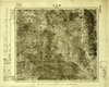
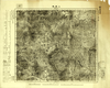
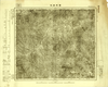
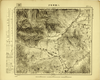
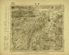
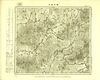
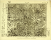
Image from the Map Collections courtesy Tohoku University. © 2023, the Committee for the Creation of the Gaihozu Digital Archives. 【図幅名】 獨石口 【測量時期】 明治44年測圖/昭和8年方眼描入 【発行時期】 昭和8年発行 【記号】 宣化17号 【測量機関】 臨時測圖部・陸地測量部・参謀本部
Links: Source / Biblio Ref
|
1933 | about 4 hours ago | 4 control points |
|
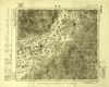
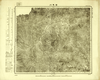
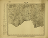
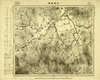
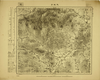
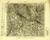
Image from the Map Collections courtesy Tohoku University. © 2023, the Committee for the Creation of the Gaihozu Digital Archives. 【図幅名】 張營子井コ 【測量時期】 明治44年測圖/昭和8年方眼描入 【発行時期】 昭和8年発行 【記号】 宣化16号 【測量機関】 臨時測圖部・陸地測量部・参謀本部
Links: Source / Biblio Ref
|
1933 | about 4 hours ago | 4 control points |
|
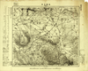
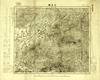
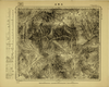
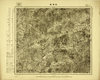
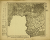
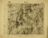
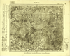
Image from the Map Collections courtesy Tohoku University. © 2023, the Committee for the Creation of the Gaihozu Digital Archives. 【図幅名】 延慶 【測量時期】 明治44年測圖/昭和8年方眼描入/昭和9年要部修正略測圖mネンソクズsネンヨウブシュウセイリャクソクズ 【発行時期】 昭和10年発行 【記号】 宣化14号 【測量機関】 支那駐屯軍司令部・陸地測量部・参謀本部
Links: Source / Biblio Ref
|
1935 | about 4 hours ago | 4 control points |

|
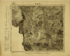
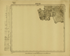
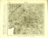
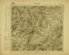
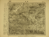
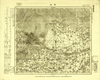
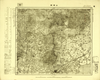
Image from the Map Collections courtesy Tohoku University. © 2023, the Committee for the Creation of the Gaihozu Digital Archives. 【図幅名】 上廟 【測量時期】 - 【発行時期】 昭和10年発行 【記号】 宣化14号 【測量機関】 大日本帝國陸地測量部
Links: Source / Biblio Ref
|
1935 | about 4 hours ago | 4 control points |

|
Image from the Map Collections courtesy Tohoku University. © 2023, the Committee for the Creation of the Gaihozu Digital Archives. 【図幅名】 赤城 【測量時期】 明治44年測圖/昭和8年方眼描入 【発行時期】 昭和8年発行 【記号】 宣化13号 【測量機関】 臨時測圖部・陸地測量部・参謀本部
Links: Source / Biblio Ref
|
1933 | about 4 hours ago | 4 control points |

|
Image from the Map Collections courtesy Tohoku University. © 2023, the Committee for the Creation of the Gaihozu Digital Archives. 【図幅名】 黒達營子 【測量時期】 - 【発行時期】 昭和10年発行 【記号】 宣化13号 【測量機関】 大日本帝國陸地測量部
Links: Source / Biblio Ref
|
1935 | about 4 hours ago | 4 control points |

|
Image from the Map Collections courtesy Tohoku University. © 2023, the Committee for the Creation of the Gaihozu Digital Archives. 【図幅名】 鎮安堡 【測量時期】 明治44年測圖/昭和8年方眼描入 【発行時期】 昭和8年発行 【記号】 宣化12号 【測量機関】 臨時測圖部・陸地測量部・参謀本部
Links: Source / Biblio Ref
|
1933 | about 4 hours ago | 4 control points |
|
Image from the Map Collections courtesy Tohoku University. © 2023, the Committee for the Creation of the Gaihozu Digital Archives. 【図幅名】 辛營子 【測量時期】 - 【発行時期】 昭和10年発行 【記号】 宣化12号 【測量機関】 大日本帝國陸地測量部
Links: Source / Biblio Ref
|
1935 | about 4 hours ago | 4 control points |

|
Image from the Map Collections courtesy Tohoku University. © 2023, the Committee for the Creation of the Gaihozu Digital Archives. 【図幅名】 海子溝口 【測量時期】 - 【発行時期】 昭和10年発行 【記号】 宣化9号 【測量機関】 大日本帝國陸地測量部
Links: Source / Biblio Ref
|
1935 | about 4 hours ago | 4 control points |

|
Image from the Map Collections courtesy Tohoku University. © 2023, the Committee for the Creation of the Gaihozu Digital Archives. 【図幅名】 湯河溝 【測量時期】 明治44年測圖/昭和8年方眼描入 【発行時期】 昭和8年発行 【記号】 宣化8号 【測量機関】 臨時測圖部・陸地測量部・参謀本部
Links: Source / Biblio Ref
|
1933 | about 4 hours ago | 4 control points |

|
Image from the Map Collections courtesy Tohoku University. © 2023, the Committee for the Creation of the Gaihozu Digital Archives. 【図幅名】 湯河溝 【測量時期】 - 【発行時期】 昭和10年発行 【記号】 宣化8号 【測量機関】 大日本帝國陸地測量部
Links: Source / Biblio Ref
|
1935 | about 4 hours ago | 4 control points |

|
Image from the Map Collections courtesy Tohoku University. © 2023, the Committee for the Creation of the Gaihozu Digital Archives. 【図幅名】 大閣鎮 【測量時期】 - 【発行時期】 昭和10年発行 【記号】 宣化7号 【測量機関】 大日本帝國陸地測量部
Links: Source / Biblio Ref
|
1935 | about 4 hours ago | 4 control points |
|
Image from the Map Collections courtesy Tohoku University. © 2023, the Committee for the Creation of the Gaihozu Digital Archives. 【図幅名】 上黄旗 【測量時期】 明治44年測圖/昭和8年方眼描入msネンホウガンエガイ 【発行時期】 昭和8年発行sネンハッコウ 【記号】 宣化6号 【測量機関】 臨時測圖部・陸地測量部・参謀本部リンジソクズブ
Links: Source / Biblio Ref
|
1933 | about 4 hours ago | 4 control points |
|
Image from the Map Collections courtesy Tohoku University. © 2023, the Committee for the Creation of the Gaihozu Digital Archives. 【図幅名】 羅家溝 【測量時期】 - 【発行時期】 昭和10年発行 【記号】 宣化5号 【測量機関】 大日本帝國陸地測量部
Links: Source / Biblio Ref
|
1935 | about 4 hours ago | 4 control points |

|
Image from the Map Collections courtesy Tohoku University. © 2023, the Committee for the Creation of the Gaihozu Digital Archives. 【図幅名】 南營寨 【測量時期】 - 【発行時期】 昭和10年発行 【記号】 宣化4号 【測量機関】 大日本帝國陸地測量部
Links: Source / Biblio Ref
|
1935 | about 4 hours ago | 4 control points |

|
Image from the Map Collections courtesy Tohoku University. © 2023, the Committee for the Creation of the Gaihozu Digital Archives. 【図幅名】 鞍匠屯 【測量時期】 - 【発行時期】 昭和10年発行 【記号】 宣化3号 【測量機関】 大日本帝國陸地測量部
Links: Source / Biblio Ref
|
1935 | about 4 hours ago | 4 control points |

|
Image from the Map Collections courtesy Tohoku University. © 2023, the Committee for the Creation of the Gaihozu Digital Archives. 【図幅名】 豊寧 【測量時期】 - 【発行時期】 昭和10年発行 【記号】 宣化2号 【測量機関】 大日本帝國陸地測量部
Links: Source / Biblio Ref
|
1935 | about 4 hours ago | 4 control points |

|
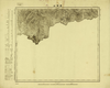
Image from the Map Collections courtesy Tohoku University. © 2023, the Committee for the Creation of the Gaihozu Digital Archives. 【図幅名】 郭家屯 【測量時期】 - 【発行時期】 - 【記号】 宣化1号 【測量機関】 -
Links: Source / Biblio Ref
|
about 4 hours ago | 4 control points | |

|
Image from the Map Collections courtesy Tohoku University. © 2023, the Committee for the Creation of the Gaihozu Digital Archives. 【図幅名】 薊州 【測量時期】 明治43年測圖/昭和8年方眼描入/昭和10年要部修正測圖メイジネンソクハカリsネンホウガンエガイsネンヨウブシュウセイソクズ 【発行時期】 昭和11年発行 【記号】 西八行北四段宣化5号 【測量機関】 支那駐屯軍司令部・陸地測量部・参謀本部ササトモチュウトングンシレイブ
Links: Source / Biblio Ref
|
1936 | about 4 hours ago | 4 control points |
|
Image from the Map Collections courtesy Tohoku University. © 2023, the Committee for the Creation of the Gaihozu Digital Archives. 【図幅名】 石匣鎮 【測量時期】 明治43年測圖/昭和8年方眼描入/昭和10年要部修正測圖メイジネンソクハカリsネンホウガンエガイsネンヨウブシュウセイソクズ 【発行時期】 昭和11年発行 【記号】 西八行北四段宣化4号ニシ8ギョウキタ 【測量機関】 支那駐屯軍司令部・陸地測量部・参謀本部ササトモチュウトングンシレイブ
Links: Source / Biblio Ref
|
1936 | about 4 hours ago | 4 control points |
|
Image from the Map Collections courtesy Tohoku University. © 2023, the Committee for the Creation of the Gaihozu Digital Archives. 【図幅名】 昌端山 【測量時期】 - 【発行時期】 昭和10年発行 【記号】 承徳25号 【測量機関】 大日本帝國陸地測量部
Links: Source / Biblio Ref
|
1935 | about 4 hours ago | 4 control points |
|
Image from the Map Collections courtesy Tohoku University. © 2023, the Committee for the Creation of the Gaihozu Digital Archives. 【図幅名】 曹家路城 【測量時期】 明治43年測圖/昭和8年方眼描入msネンホウガンエガイ 【発行時期】 昭和8年発行 【記号】 承徳24号 【測量機関】 臨時測圖部・陸地測量部・参謀本部リンジソクズブ
Links: Source / Biblio Ref
|
1933 | about 4 hours ago | 4 control points |
|
Image from the Map Collections courtesy Tohoku University. © 2023, the Committee for the Creation of the Gaihozu Digital Archives. 【図幅名】 白馬川 【測量時期】 - 【発行時期】 昭和10年発行 【記号】 承徳24号 【測量機関】 大日本帝國陸地測量部
Links: Source / Biblio Ref
|
1935 | about 4 hours ago | 4 control points |

|
Image from the Map Collections courtesy Tohoku University. © 2023, the Committee for the Creation of the Gaihozu Digital Archives. 【図幅名】 承徳 【測量時期】 - 【発行時期】 昭和10年発行 【記号】 承徳23号 【測量機関】 大日本帝國陸地測量部
Links: Source / Biblio Ref
|
1935 | about 4 hours ago | 4 control points |

|
Image from the Map Collections courtesy Tohoku University. © 2023, the Committee for the Creation of the Gaihozu Digital Archives. 【図幅名】 黄姑屯 【測量時期】 - 【発行時期】 - 【記号】 承徳22号 【測量機関】 -
Links: Source / Biblio Ref
|
about 4 hours ago | 4 control points | |

|
Image from the Map Collections courtesy Tohoku University. © 2023, the Committee for the Creation of the Gaihozu Digital Archives. 【図幅名】 張三營 【測量時期】 - 【発行時期】 昭和10年発行 【記号】 承徳21号 【測量機関】 大日本帝國陸地測量部
Links: Source / Biblio Ref
|
1935 | about 4 hours ago | 4 control points |

|
Image from the Map Collections courtesy Tohoku University. © 2023, the Committee for the Creation of the Gaihozu Digital Archives. 【図幅名】 氷窖 【測量時期】 - 【発行時期】 昭和10年発行 【記号】 承徳19号 【測量機関】 大日本帝國陸地測量部
Links: Source / Biblio Ref
|
1935 | about 4 hours ago | 4 control points |

|
Image from the Map Collections courtesy Tohoku University. © 2023, the Committee for the Creation of the Gaihozu Digital Archives. 【図幅名】 六溝 【測量時期】 - 【発行時期】 昭和10年発行 【記号】 承徳18号 【測量機関】 大日本帝國陸地測量部
Links: Source / Biblio Ref
|
1935 | about 4 hours ago | 4 control points |

|
Image from the Map Collections courtesy Tohoku University. © 2023, the Committee for the Creation of the Gaihozu Digital Archives. 【図幅名】 三溝 【測量時期】 - 【発行時期】 昭和10年発行 【記号】 承徳17号 【測量機関】 大日本帝國陸地測量部
Links: Source / Biblio Ref
|
1935 | about 4 hours ago | 4 control points |
|
Image from the Map Collections courtesy Tohoku University. © 2023, the Committee for the Creation of the Gaihozu Digital Archives. 【図幅名】 王家店 【測量時期】 - 【発行時期】 昭和10年発行 【記号】 承徳16号 【測量機関】 大日本帝國陸地測量部
Links: Source / Biblio Ref
|
1935 | about 4 hours ago | 4 control points |

|
Image from the Map Collections courtesy Tohoku University. © 2023, the Committee for the Creation of the Gaihozu Digital Archives. 【図幅名】 蕭家營子 【測量時期】 - 【発行時期】 昭和10年発行 【記号】 承徳15号 【測量機関】 大日本帝國陸地測量部
Links: Source / Biblio Ref
|
1935 | about 4 hours ago | 4 control points |
|
Image from the Map Collections courtesy Tohoku University. © 2023, the Committee for the Creation of the Gaihozu Digital Archives. 【図幅名】 寛城 【測量時期】 - 【発行時期】 昭和10年発行 【記号】 承徳14号 【測量機関】 大日本帝國陸地測量部
Links: Source / Biblio Ref
|
1935 | about 4 hours ago | 4 control points |

|
Image from the Map Collections courtesy Tohoku University. © 2023, the Committee for the Creation of the Gaihozu Digital Archives. 【図幅名】 平泉南部 【測量時期】 - 【発行時期】 昭和10年発行 【記号】 承徳13号 【測量機関】 大日本帝國陸地測量部
Links: Source / Biblio Ref
|
1935 | about 4 hours ago | 4 control points |

|
Image from the Map Collections courtesy Tohoku University. © 2023, the Committee for the Creation of the Gaihozu Digital Archives. 【図幅名】 平泉北部 【測量時期】 - 【発行時期】 昭和10年発行 【記号】 承徳12号 【測量機関】 大日本帝國陸地測量部
Links: Source / Biblio Ref
|
1935 | about 4 hours ago | 4 control points |
|
Image from the Map Collections courtesy Tohoku University. © 2023, the Committee for the Creation of the Gaihozu Digital Archives. 【図幅名】 八里罕甸子 【測量時期】 - 【発行時期】 昭和10年発行 【記号】 承徳11号 【測量機関】 大日本帝國陸地測量部
Links: Source / Biblio Ref
|
1935 | about 4 hours ago | 4 control points |
|
Image from the Map Collections courtesy Tohoku University. © 2023, the Committee for the Creation of the Gaihozu Digital Archives. 【図幅名】 界嶺口 【測量時期】 - 【発行時期】 昭和10年発行 【記号】 承徳10号 【測量機関】 大日本帝國陸地測量部
Links: Source / Biblio Ref
|
1935 | about 4 hours ago | 4 control points |
|
Image from the Map Collections courtesy Tohoku University. © 2023, the Committee for the Creation of the Gaihozu Digital Archives. 【図幅名】 乾溝鎮 【測量時期】 - 【発行時期】 昭和10年発行 【記号】 承徳9号 【測量機関】 大日本帝國陸地測量部
Links: Source / Biblio Ref
|
1935 | about 4 hours ago | 4 control points |
|
Image from the Map Collections courtesy Tohoku University. © 2023, the Committee for the Creation of the Gaihozu Digital Archives. 【図幅名】 叨?噔 【測量時期】 - 【発行時期】 昭和10年発行 【記号】 承徳8号 【測量機関】 大日本帝國陸地測量部
Links: Source / Biblio Ref
|
1935 | about 4 hours ago | 4 control points |
|
Image from the Map Collections courtesy Tohoku University. © 2023, the Committee for the Creation of the Gaihozu Digital Archives. 【図幅名】 建昌 【測量時期】 - 【発行時期】 昭和10年発行 【記号】 承徳7号 【測量機関】 大日本帝國陸地測量部
Links: Source / Biblio Ref
|
1935 | about 4 hours ago | 4 control points |
|
Image from the Map Collections courtesy Tohoku University. © 2023, the Committee for the Creation of the Gaihozu Digital Archives. 【図幅名】 杜家窩棚 【測量時期】 - 【発行時期】 昭和10年発行 【記号】 承徳6号 【測量機関】 大日本帝國陸地測量部
Links: Source / Biblio Ref
|
1935 | about 4 hours ago | 4 control points |
|
Image from the Map Collections courtesy Tohoku University. © 2023, the Committee for the Creation of the Gaihozu Digital Archives. 【図幅名】 山海關 【測量時期】 - 【発行時期】 昭和10年発行 【記号】 承徳5号 【測量機関】 大日本帝國陸地測量部
Links: Source / Biblio Ref
|
1935 | about 4 hours ago | 4 control points |
|
Image from the Map Collections courtesy Tohoku University. © 2023, the Committee for the Creation of the Gaihozu Digital Archives. 【図幅名】 腰溝 【測量時期】 - 【発行時期】 昭和10年発行 【記号】 承徳4号 【測量機関】 大日本帝國陸地測量部
Links: Source / Biblio Ref
|
1935 | about 4 hours ago | 4 control points |
|
Image from the Map Collections courtesy Tohoku University. © 2023, the Committee for the Creation of the Gaihozu Digital Archives. 【図幅名】 蟒牛營子 【測量時期】 - 【発行時期】 昭和10年発行 【記号】 承徳3号 【測量機関】 大日本帝國陸地測量部
Links: Source / Biblio Ref
|
1935 | about 4 hours ago | 4 control points |
|
Image from the Map Collections courtesy Tohoku University. © 2023, the Committee for the Creation of the Gaihozu Digital Archives. 【図幅名】 大城子 【測量時期】 - 【発行時期】 昭和10年発行 【記号】 承徳2号 【測量機関】 大日本帝國陸地測量部
Links: Source / Biblio Ref
|
1935 | about 4 hours ago | 4 control points |
|
Image from the Map Collections courtesy Tohoku University. © 2023, the Committee for the Creation of the Gaihozu Digital Archives. 【図幅名】 葉柏壽 【測量時期】 - 【発行時期】 昭和10年発行 【記号】 承徳1号 【測量機関】 大日本帝國陸地測量部
Links: Source / Biblio Ref
|
1935 | about 4 hours ago | 4 control points |
|
Image from the Map Collections courtesy Tohoku University. © 2023, the Committee for the Creation of the Gaihozu Digital Archives. 【図幅名】 新城 【測量時期】 明治43年測圖/昭和8年方眼描入/昭和10年要部修正測圖メイジネンソクハカリsネンホウガンエガイsネンヨウブシュウセイソクズ 【発行時期】 昭和11年発行 【記号】 西七行北四段承徳25号 【測量機関】 支那駐屯軍司令部・陸地測量部・参謀本部ササトモチュウトングンシレイブ
Links: Source / Biblio Ref
|
1936 | about 4 hours ago | 4 control points |
|
Image from the Map Collections courtesy Tohoku University. © 2023, the Committee for the Creation of the Gaihozu Digital Archives. 【図幅名】 遵化 【測量時期】 明治42年測圖/昭和8年方眼描入/昭和10年要部修正測圖メイジネンソクハカリsネンホウガンエガイsネンヨウブシュウセイソクズ 【発行時期】 昭和11年発行 【記号】 西七行北四段承徳20号 【測量機関】 支那駐屯軍司令部・陸地測量部・参謀本部ササトモチュウトングンシレイブ
Links: Source / Biblio Ref
|
1936 | about 4 hours ago | 4 control points |
|
Image from the Map Collections courtesy Tohoku University. © 2023, the Committee for the Creation of the Gaihozu Digital Archives. 【図幅名】 建昌營 【測量時期】 明治43年測圖/昭和8年方眼描入/昭和10年要部修正測圖メイジネンソクハカリsネンホウガンエガイsネンヨウブシュウセイソクズ 【発行時期】 昭和11年発行 【記号】 西七行北四段承徳15号 【測量機関】 支那駐屯軍司令部・陸地測量部・参謀本部ササトモチュウトングンシレイブ
Links: Source / Biblio Ref
|
1936 | about 4 hours ago | 4 control points |
|
Image from the Map Collections courtesy Tohoku University. © 2023, the Committee for the Creation of the Gaihozu Digital Archives. 【図幅名】 抬頭營 【測量時期】 明治43年測圖/昭和8年方眼描入/昭和10年要部修正測圖メイジネンソクハカリsネンホウガンエガイsネンヨウブシュウセイソクズ 【発行時期】 昭和11年発行 【記号】 西七行北四段承徳10号ニシ7ギョウキタ 【測量機関】 支那駐屯軍司令部・陸地測量部・参謀本部ササトモチュウトングンシレイブ
Links: Source / Biblio Ref
|
1936 | about 4 hours ago | 4 control points |
|
Image from the Map Collections courtesy Tohoku University. © 2023, the Committee for the Creation of the Gaihozu Digital Archives. 【図幅名】 山海關 【測量時期】 明治42年測圖/昭和8年方眼描入/昭和10年要部修正測圖メイジネンソクハカリsネンホウガンエガイsネンヨウブシュウセイソクズ 【発行時期】 昭和11年発行 【記号】 西七行北四段承徳5号 【測量機関】 支那駐屯軍司令部・陸地測量部・参謀本部ササトモチュウトングンシレイブ
Links: Source / Biblio Ref
|
1936 | about 4 hours ago | 4 control points |