Browse Maps
| map | Title | Year | Last Updated  |
Status |
|---|---|---|---|---|
|
|
2018 | almost 6 years ago | 4 control points |
|
|
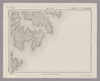
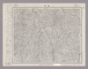
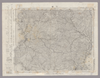
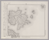
1864 | almost 6 years ago | 6 control points |
|
|
2018 | almost 6 years ago | 3 control points |
|
http://www.ritsumei.ac.jp/image.jsp?id=227610
Links: Source / Biblio Ref
|
2018 | almost 6 years ago | Unrectified |
|
|
2018 | almost 6 years ago | 3 control points |
|
|
2018 | almost 6 years ago | 3 control points |
|
|
2018 | almost 6 years ago | 3 control points |
|
|
2018 | almost 6 years ago | 3 control points |

|
|
2018 | almost 6 years ago | 3 control points |
|
|
2018 | almost 6 years ago | 3 control points |
|
|
2018 | almost 6 years ago | 3 control points |
|
Links: Source / Biblio Ref
|
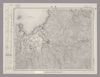
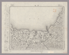
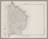
1851 | almost 6 years ago | 4 control points |
|
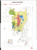
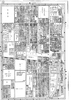
下京区地籍図
|
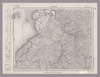
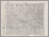
1884 | almost 6 years ago | 3 control points |
|
|
2018 | almost 6 years ago | 4 control points |
|
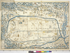
Owned by Sainsbury Institute for the Study of Japanese Arts and Cultures 【Atlas / Book Title】 【Engraver】 【Map Size】 105.5x2.0 cm 【Medium】 木版刷
Links: Source / Biblio Ref
|
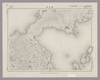
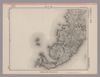
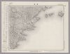
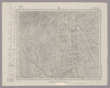
1834 | over 5 years ago | 4 control points |
|
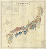
Owned by Sainsbury Institute for the Study of Japanese Arts and Cultures 【Atlas / Book Title】 【Engraver】 Yuki Masaaki 【Map Size】 161x150 cm 【Medium】 銅版画
Links: Source / Biblio Ref
|
1883 | over 5 years ago | 7 control points |
|
Image from the Map Collections courtesy Stanford University Libraries, licensed under a Creative Commons Attribution-Noncommercial 3.0 Unported License. © Stanford University.
Links: Source / Biblio Ref
|
over 5 years ago | 4 control points | |
|
|
2018 | over 5 years ago | 18 control points |
|
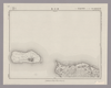
Image from the Map Collections courtesy Stanford University Libraries, licensed under a Creative Commons Attribution-Noncommercial 3.0 Unported License. © Stanford University. 【図幅名】 古場島 【測量時期】 大正10年測図 【発行時期】 昭和11年発行 【記号】 沖縄群島21号 【測量機関】 陸地測量部・参謀本部 【備考】 那覇15号
Links: Source / Biblio Ref
|
over 5 years ago | 4 control points | |
|
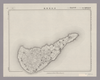
Image from the Map Collections courtesy Stanford University Libraries, licensed under a Creative Commons Attribution-Noncommercial 3.0 Unported License. © Stanford University. 【図幅名】 久米島西部 【測量時期】 大正10年測圖 【発行時期】 昭和11年発行 【記号】 沖縄郡島二十四号 【測量機関】 陸地測量部・参謀本部 【備考】 軍事極祕(戦地ニ在りテハ軍事祕密トス)
Links: Source / Biblio Ref
|
over 5 years ago | 4 control points | |
|
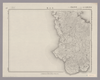
Image from the Map Collections courtesy Stanford University Libraries, licensed under a Creative Commons Attribution-Noncommercial 3.0 Unported License. © Stanford University. 【図幅名】 嘉手納 【測量時期】 大正10年測圖 【発行時期】 大正12年発行 【記号】 沖縄郡島十一号 【測量機関】 陸地測量部・参謀本部 【備考】 軍事極祕(戦地ニ在りテハ軍事祕密トス)
Links: Source / Biblio Ref
|
over 5 years ago | 4 control points | |
|
Image from the Map Collections courtesy Stanford University Libraries, licensed under a Creative Commons Attribution-Noncommercial 3.0 Unported License. © Stanford University. 【図幅名】 伊江島 【測量時期】 大正10年測圖 【発行時期】 大正12年発行 【記号】 沖縄郡島九号 【測量機関】 陸地測量部・参謀本部 【備考】 軍事極祕(戦地ニ在りテハ軍事祕密トス)
Links: Source / Biblio Ref
|
over 5 years ago | 4 control points | |
|
Image from the Map Collections courtesy Stanford University Libraries, licensed under a Creative Commons Attribution-Noncommercial 3.0 Unported License. © Stanford University. 【図幅名】 奥 【測量時期】 大正10年測圖 【発行時期】 大正12年発行 【記号】 沖縄郡島一号 【測量機関】 陸地測量部・参謀本部 【備考】 軍事極祕(戦地ニ在りテハ軍事祕密トス)
Links: Source / Biblio Ref
|
over 5 years ago | 4 control points | |
|
Image from the Map Collections courtesy Stanford University Libraries, licensed under a Creative Commons Attribution-Noncommercial 3.0 Unported License. © Stanford University. 【図幅名】 沖永良部島 【測量時期】 大正9年測圖 【発行時期】 昭和11年発行 【記号】 奄美大島要塞近傍十八号 【測量機関】 陸地測量部・参謀本部 【備考】 軍事極祕(戦地ニ在りテハ軍事祕密トス)
Links: Source / Biblio Ref
|
over 5 years ago | 4 control points | |
|
Image from the Map Collections courtesy Stanford University Libraries, licensed under a Creative Commons Attribution-Noncommercial 3.0 Unported License. © Stanford University. 【図幅名】 平土野 【測量時期】 大正9年測圖 【発行時期】 昭和11年発行 【記号】 奄美大島要塞近傍十七号 【測量機関】 陸地測量部・参謀本部 【備考】 軍事極祕(戦地ニ在りテハ軍事祕密トス)
Links: Source / Biblio Ref
|
over 5 years ago | 4 control points | |
|
Image from the Map Collections courtesy Stanford University Libraries, licensed under a Creative Commons Attribution-Noncommercial 3.0 Unported License. © Stanford University. 【図幅名】 古仁屋 【測量時期】 大正9年測圖 【発行時期】 大正11年発行 【記号】 奄美大島要塞近傍十二号 【測量機関】 陸地測量部・参謀本部 【備考】 軍事極祕(戦地ニ在りテハ軍事祕密トス)
Links: Source / Biblio Ref
|
over 5 years ago | 4 control points | |

|
Image from the Map Collections courtesy Stanford University Libraries, licensed under a Creative Commons Attribution-Noncommercial 3.0 Unported License. © Stanford University. 【図幅名】 岩川 【測量時期】 明治35年測圖/昭和7年第二回修正測圖及修正測圖之縮圖/昭和10年部分修正測圖 【発行時期】 【記号】 鹿児島三号 【測量機関】 参謀本部 【備考】 祕
Links: Source / Biblio Ref
|
over 5 years ago | 4 control points | |
|
Image from the Map Collections courtesy Stanford University Libraries, licensed under a Creative Commons Attribution-Noncommercial 3.0 Unported License. © Stanford University. 【図幅名】 出水 【測量時期】 明治34年測圖/昭和7年要部修正測圖/昭和10年部分修正測圖 【発行時期】 【記号】 八代十二号 【測量機関】 参謀本部 【備考】 祕
Links: Source / Biblio Ref
|
over 5 years ago | 4 control points | |
|
Image from the Map Collections courtesy Stanford University Libraries, licensed under a Creative Commons Attribution-Noncommercial 3.0 Unported License. © Stanford University. 【図幅名】 日奈久 【測量時期】 明治34年測圖/大正15年修正測圖/昭和7年部分修正測圖 【発行時期】 【記号】 八代六号 【測量機関】 参謀本部 【備考】 祕
Links: Source / Biblio Ref
|
over 5 years ago | 4 control points | |
|
Image from the Map Collections courtesy Stanford University Libraries, licensed under a Creative Commons Attribution-Noncommercial 3.0 Unported License. © Stanford University. 【図幅名】 志々伎 【測量時期】 明治33年測図/大正14年修正/昭和20年部分修正 【発行時期】 昭和23年2月発行 【記号】 長崎9号(共15面) 【測量機関】 地理調査所 【備考】
Links: Source / Biblio Ref
|
over 5 years ago | 4 control points | |
|
Image from the Map Collections courtesy Stanford University Libraries, licensed under a Creative Commons Attribution-Noncommercial 3.0 Unported License. © Stanford University. 【図幅名】 豊岡 【測量時期】 明治36年測圖/昭和2年要部修正測圖 【発行時期】 【記号】 中津十二号 【測量機関】 参謀本部 【備考】 祕
Links: Source / Biblio Ref
|
over 5 years ago | 4 control points | |
|
Image from the Map Collections courtesy Stanford University Libraries, licensed under a Creative Commons Attribution-Noncommercial 3.0 Unported License. © Stanford University. 【図幅名】 宇佐 【測量時期】 明治36年測圖/昭和2年修正測圖 【発行時期】 【記号】 中津十一号 【測量機関】 参謀本部 【備考】 祕
Links: Source / Biblio Ref
|
over 5 years ago | 4 control points | |
|
Image from the Map Collections courtesy Stanford University Libraries, licensed under a Creative Commons Attribution-Noncommercial 3.0 Unported License. © Stanford University. 【図幅名】 甲浦 【測量時期】 明治40年測圖/昭和8年修正測圖 【発行時期】 【記号】 剣山十一号 【測量機関】 参謀本部 【備考】 祕
Links: Source / Biblio Ref
|
over 5 years ago | 4 control points | |
|
Image from the Map Collections courtesy Stanford University Libraries, licensed under a Creative Commons Attribution-Noncommercial 3.0 Unported License. © Stanford University. 【図幅名】 盧辺 【測量時期】 大正12年測図の縮図/昭和10年修正、測図の縮図 【発行時期】 昭和21年11月発行 【記号】 唐津2号(共8面) 【測量機関】 内務省地理調査所 【備考】
Links: Source / Biblio Ref
|
over 5 years ago | 4 control points | |
|
Image from the Map Collections courtesy Stanford University Libraries, licensed under a Creative Commons Attribution-Noncommercial 3.0 Unported License. © Stanford University. 【図幅名】 日和佐 【測量時期】 明治40年測圖/昭和8年修正測圖 【発行時期】 【記号】 剣山六号 【測量機関】 参謀本部 【備考】 祕
Links: Source / Biblio Ref
|
over 5 years ago | 4 control points | |
|
Image from the Map Collections courtesy Stanford University Libraries, licensed under a Creative Commons Attribution-Noncommercial 3.0 Unported License. © Stanford University. 【図幅名】 伊島 【測量時期】 明治40年測図/昭和9年修正 【発行時期】 昭和11年6月発行 【記号】 由良要塞近傍8号(共10面) 【測量機関】 陸地測量部 【備考】 剣山1号(共12面) 軍事極秘
Links: Source / Biblio Ref
|
over 5 years ago | 4 control points | |
|
Image from the Map Collections courtesy Stanford University Libraries, licensed under a Creative Commons Attribution-Noncommercial 3.0 Unported License. © Stanford University. 【図幅名】 三津 【測量時期】 明治31年測図/昭和3年修正/昭和7年鉄道補入 【発行時期】 昭和13年4月発行 【記号】 広島3号(共16面) 【測量機関】 大日本帝国陸地測量部 【備考】
Links: Source / Biblio Ref
|
over 5 years ago | 4 control points | |
|
Image from the Map Collections courtesy Stanford University Libraries, licensed under a Creative Commons Attribution-Noncommercial 3.0 Unported License. © Stanford University. 【図幅名】 由良 【測量時期】 明治29年測図/昭和3年修正/昭和33年要部修正 【発行時期】 昭和36年6月発行 【記号】 徳島3号(共14面) 【測量機関】 国土地理院 【備考】
Links: Source / Biblio Ref
|
over 5 years ago | 4 control points | |
|
Image from the Map Collections courtesy Stanford University Libraries, licensed under a Creative Commons Attribution-Noncommercial 3.0 Unported License. © Stanford University. 【図幅名】 仁位 【測量時期】 大正1年測図/大正11年測図の縮図/昭和10年修正、第2回修正、測図の縮図 【発行時期】 昭和21年11月発行 【記号】 厳原10号(共7面) 【測量機関】 地理調査所 【備考】
Links: Source / Biblio Ref
|
over 5 years ago | 4 control points | |
|
Image from the Map Collections courtesy Stanford University Libraries, licensed under a Creative Commons Attribution-Noncommercial 3.0 Unported License. © Stanford University. 【図幅名】 御前崎 【測量時期】 明治22年測図/大正5年第2回修正/昭和2年鉄道補入 【発行時期】 昭和3年9月発行 【記号】 神子元島13号(共2面) 【測量機関】 大日本帝国陸地測量部 【備考】
Links: Source / Biblio Ref
|
over 5 years ago | 4 control points | |
|
Image from the Map Collections courtesy Stanford University Libraries, licensed under a Creative Commons Attribution-Noncommercial 3.0 Unported License. © Stanford University. 【図幅名】 益田 【測量時期】 明治32年測圖/昭和7年要部修正測圖 【発行時期】 【記号】 見嶋四号 【測量機関】 参謀本部 【備考】 祕
Links: Source / Biblio Ref
|
over 5 years ago | 4 control points | |
|
Image from the Map Collections courtesy Stanford University Libraries, licensed under a Creative Commons Attribution-Noncommercial 3.0 Unported License. © Stanford University. 【図幅名】 浜松 【測量時期】 明治23年測図/大正6年修正/昭和2年部分修正/昭和22年資料修正 【発行時期】 昭和22年2月発行 【記号】 豊橋8号(共16面) 【測量機関】 地理調査所 【備考】
Links: Source / Biblio Ref
|
over 5 years ago | 4 control points | |
|
Image from the Map Collections courtesy Stanford University Libraries, licensed under a Creative Commons Attribution-Noncommercial 3.0 Unported License. © Stanford University. 【図幅名】 下田 【測量時期】 明治20年測図/大正15年第2回修正 【発行時期】 【記号】 静岡4号(共15面) 【測量機関】 参謀本部 【備考】 秘
Links: Source / Biblio Ref
|
over 5 years ago | 4 control points | |
|
Image from the Map Collections courtesy Stanford University Libraries, licensed under a Creative Commons Attribution-Noncommercial 3.0 Unported License. © Stanford University. 【図幅名】 鳥取北部 【測量時期】 明治30年測図の縮図/昭和7年修正 【発行時期】 昭和9年1月発行 【記号】 鳥取15号(共9面) 【測量機関】 大日本帝国陸地測量部 【備考】
Links: Source / Biblio Ref
|
over 5 years ago | 4 control points | |
|
Image from the Map Collections courtesy Stanford University Libraries, licensed under a Creative Commons Attribution-Noncommercial 3.0 Unported License. © Stanford University. 【図幅名】 香住 【測量時期】 明治31年測圖/昭和7年要部修正測圖 【発行時期】 【記号】 鳥取七号 【測量機関】 参謀本部 【備考】 祕
Links: Source / Biblio Ref
|
over 5 years ago | 4 control points | |
|
Image from the Map Collections courtesy Stanford University Libraries, licensed under a Creative Commons Attribution-Noncommercial 3.0 Unported License. © Stanford University. 【図幅名】 谷村 【測量時期】 明治21年測図/昭和4年第3回修正 【発行時期】 【記号】 甲府3号(共16面) 【測量機関】 参謀本部 【備考】 秘
Links: Source / Biblio Ref
|
over 5 years ago | 4 control points | |
|
Image from the Map Collections courtesy Stanford University Libraries, licensed under a Creative Commons Attribution-Noncommercial 3.0 Unported License. © Stanford University. 【図幅名】 菱 【測量時期】 大正1年測図/昭和9年修正/昭和28年応急修正 【発行時期】 昭和34年8月発行 【記号】 西郷16号(共4面) 【測量機関】 国土地理院 【備考】 応急修正版
Links: Source / Biblio Ref
|
over 5 years ago | 4 control points | |
|
Image from the Map Collections courtesy Stanford University Libraries, licensed under a Creative Commons Attribution-Noncommercial 3.0 Unported License. © Stanford University. 【図幅名】 西郷 【測量時期】 大正元年測圖/昭和9年測圖 【発行時期】 【記号】 西郷十一号 【測量機関】 参謀本部 【備考】 祕
Links: Source / Biblio Ref
|
over 5 years ago | 4 control points | |
|
Image from the Map Collections courtesy Stanford University Libraries, licensed under a Creative Commons Attribution-Noncommercial 3.0 Unported License. © Stanford University. 【図幅名】 五百石 【測量時期】 明治44年測図/昭和5年修正 【発行時期】 昭和8年3月発行 【記号】 高山9号(共16面) 【測量機関】 大日本帝国陸地測量部 【備考】
Links: Source / Biblio Ref
|
over 5 years ago | 4 control points | |
|
Image from the Map Collections courtesy Stanford University Libraries, licensed under a Creative Commons Attribution-Noncommercial 3.0 Unported License. © Stanford University. 【図幅名】 塙 【測量時期】 明治42年測図/昭和8年要部修正 【発行時期】 【記号】 白河11号(共17面) 【測量機関】 参謀本部 【備考】 秘
Links: Source / Biblio Ref
|
over 5 years ago | 4 control points |