Browse Maps
| map | Title | Year | Last Updated | Status  |
|---|---|---|---|---|
|
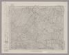
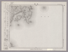
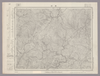
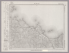
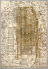
Image from the Map Collections courtesy Stanford University Libraries, licensed under a Creative Commons Attribution-Noncommercial 3.0 Unported License. © Stanford University. 【図幅名】 徳佐中 【測量時期】 明治32年測図/昭和7年要部修正 【発行時期】 昭和9年10月発行 【記号】 山口6号(共15面) 【測量機関】 大日本帝国陸地測量部 【備考】
Links: Source / Biblio Ref
|
over 2 years ago | 4 control points | |
|
|
2022 | about 2 years ago | 8 control points |
|
Links: Source / Biblio Ref
|
2021 | over 1 year ago | 14 control points |
|
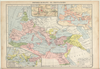
Image from the Map Collections courtesy Stanford University Libraries, licensed under a Creative Commons Attribution-Noncommercial 3.0 Unported License. © Stanford University.
Links: Source / Biblio Ref
|
over 6 years ago | 4 control points | |
|
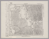
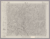
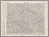
Image from the Map Collections courtesy Stanford University Libraries, licensed under a Creative Commons Attribution-Noncommercial 3.0 Unported License. © Stanford University. 【図幅名】 乃美 【測量時期】 明治31年測図/昭和7年修正 【発行時期】 昭和10年9月発行 【記号】 広島1号(共12面) 【測量機関】 大日本帝国陸地測量部 【備考】
Links: Source / Biblio Ref
|
over 2 years ago | 4 control points | |
|
Image from the Map Collections courtesy Stanford University Libraries, licensed under a Creative Commons Attribution-Noncommercial 3.0 Unported License. © Stanford University. 【図幅名】 尾崎 【測量時期】 明治43年測図の縮図/昭和9年第2回修正 【発行時期】 【記号】 和歌山14号 【測量機関】 参謀本部 【備考】 由良要塞近傍3号(共10面) 軍事極秘
Links: Source / Biblio Ref
|
about 2 months ago | 4 control points | |
|
Image from the Map Collections courtesy Stanford University Libraries, licensed under a Creative Commons Attribution-Noncommercial 3.0 Unported License. © Stanford University. 【図幅名】 雄信内 【測量時期】 大正12年測図 【発行時期】 昭和5年4月発行 【記号】 天塩3号(共9面) 【測量機関】 大日本帝国陸地測量部 【備考】 仮製版
Links: Source / Biblio Ref
|
about 2 months ago | 4 control points | |
|
Image from the Map Collections courtesy Stanford University Libraries, licensed under a Creative Commons Attribution-Noncommercial 3.0 Unported License. © Stanford University. 【図幅名】 名張 【測量時期】 明治25年測図の縮図/昭和12年第2回修正、測図の縮図 【発行時期】 昭和13年3月発行 【記号】 宇治山田13号(共14面) 【測量機関】 大日本帝国陸地測量部 【備考】
Links: Source / Biblio Ref
|
about 2 months ago | 4 control points | |
|
Image from the Map Collections courtesy Stanford University Libraries, licensed under a Creative Commons Attribution-Noncommercial 3.0 Unported License. © Stanford University. 【図幅名】 寒霞渓 【測量時期】 明治30年測圖/大正12年及昭和3年修正測圖 【発行時期】 【記号】 徳島九号 【測量機関】 参謀本部 【備考】 祕
Links: Source / Biblio Ref
|
about 1 month ago | 4 control points | |
|
|
1864 | over 6 years ago | 4 control points |
|
|
2020 | almost 4 years ago | 4 control points |
|
|
2022 | about 2 years ago | 6 control points |
|
Image from the Map Collections courtesy Stanford University Libraries, licensed under a Creative Commons Attribution-Noncommercial 3.0 Unported License. © Stanford University. 【図幅名】 上川口 【測量時期】 明治39年測図/昭和8年修正 【発行時期】 昭和11年4月発行 【記号】 窪川14号(共4面) 【測量機関】 大日本帝国陸地測量部 【備考】
Links: Source / Biblio Ref
|
2 days ago | 4 control points | |
|
|
2022 | about 2 years ago | 5 control points |
|
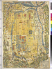
Owned by 立命館大学アート・リサーチセンター 【成立・出版年】 天保081837
Links: Source / Biblio Ref
|
1837 | almost 5 years ago | 79 control points |

|
|
2018 | over 6 years ago | 3 control points |
|
Image from the Map Collections courtesy Stanford University Libraries, licensed under a Creative Commons Attribution-Noncommercial 3.0 Unported License. © Stanford University. 【図幅名】 玉島 【測量時期】 明治37年測図/大正14年第2回修正 【発行時期】 昭和4年6月発行 【記号】 岡山及丸亀5号(共16面) 【測量機関】 大日本帝国陸地測量部 【備考】
Links: Source / Biblio Ref
|
about 2 months ago | 4 control points | |
|
Image from the Map Collections courtesy Stanford University Libraries, licensed under a Creative Commons Attribution-Noncommercial 3.0 Unported License. © Stanford University. 【図幅名】 津田 【測量時期】 明治32年測図/昭和2年修正 【発行時期】 【記号】 広島14号(共16面) 【測量機関】 参謀本部 【備考】 秘
Links: Source / Biblio Ref
|
about 1 month ago | 4 control points | |
|
Image from the Map Collections courtesy Stanford University Libraries, licensed under a Creative Commons Attribution-Noncommercial 3.0 Unported License. © Stanford University. 【図幅名】 上郡 【測量時期】 明治27年測図の縮図/明治29年測図/昭和7年要部修正、測図の縮図 【発行時期】 昭和9年8月発行 【記号】 姫路11号(共16面) 【測量機関】 大日本帝国陸地測量部 【備考】
Links: Source / Biblio Ref
|
over 2 years ago | 4 control points | |
|
|
2022 | about 2 years ago | 5 control points |
|
Image from the Map Collections courtesy Stanford University Libraries, licensed under a Creative Commons Attribution-Noncommercial 3.0 Unported License. © Stanford University. 【図幅名】 沖島 【測量時期】 明治33年測図/昭和11年修正 【発行時期】 昭和21年10月発行 【記号】 小串15号(共4面) 【測量機関】 内務省地理調査所 【備考】
Links: Source / Biblio Ref
|
about 1 month ago | 4 control points | |
|
Links: Source / Biblio Ref
|
2021 | over 3 years ago | 8 control points |
|
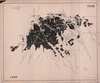
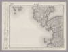
RIO SINU. CROQUIS DE LA DESEMBOCADURA DEL RIO EN LA BAHIA DE CISPATA. PARA ACOMPAÑAR AL INFORME DE SIR. A.GIBB G.B.C G.B. DEL 25 DE ABRIL-32. SIN ESCALA. CORONEL P.R.WARREN. TECNICO HIDRAULICO. DIBUJADO POR LUIS ACEVEDO.
|
1932 | 11 months ago | 8 control points |
|
|
2022 | about 2 years ago | 6 control points |
|
|
2024 | 12 days ago | 3 control points |

|
Image from the Map Collections courtesy Stanford University Libraries, licensed under a Creative Commons Attribution-Noncommercial 3.0 Unported License. © Stanford University. 【図幅名】 岩川 【測量時期】 明治35年測圖/昭和7年第二回修正測圖及修正測圖之縮圖/昭和10年部分修正測圖 【発行時期】 【記号】 鹿児島三号 【測量機関】 参謀本部 【備考】 祕
Links: Source / Biblio Ref
|
about 1 month ago | 4 control points | |
|
Image from the Map Collections courtesy Stanford University Libraries, licensed under a Creative Commons Attribution-Noncommercial 3.0 Unported License. © Stanford University. 【図幅名】 厳原 【測量時期】 大正1年測図の縮図/昭和10年第2回修正、測図の縮図 【発行時期】 昭和21年10月発行 【記号】 厳原11号(共7面) 【測量機関】 地理調査所 【備考】
Links: Source / Biblio Ref
|
about 1 month ago | 4 control points | |
|
Image from the Map Collections courtesy Stanford University Libraries, licensed under a Creative Commons Attribution-Noncommercial 3.0 Unported License. © Stanford University. 【図幅名】 下川 【測量時期】 大正11年測図 【発行時期】 大正13年5月発行 【記号】 名寄7号(共16面) 【測量機関】 大日本帝国陸地測量部 【備考】 仮製版 (In 1 layer)
Links: Source / Biblio Ref
|
almost 2 years ago | 4 control points | |
|
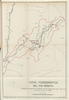
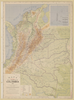
HOYA HIDROGRAFICA DEL RIO BOGOTA. PLANO PARA ACOMPAÑAR AL INFORME DE SIR. A.GIBB G.B.C G.B. DEL 25 DE JULIO DE 1931.
|
1931 | 10 months ago | 34 control points |
|
Links: Source / Biblio Ref
|
2021 | over 3 years ago | 17 control points |
|
Image from the Map Collections courtesy Stanford University Libraries, licensed under a Creative Commons Attribution-Noncommercial 3.0 Unported License. © Stanford University. 【図幅名】 長門峡 【測量時期】 明治32年測図/昭和2年修正 【発行時期】 昭和6年7月発行 【記号】 山口7号(共15面) 【測量機関】 大日本帝国陸地測量部 【備考】
Links: Source / Biblio Ref
|
over 2 years ago | 4 control points | |
|
Image from the Map Collections courtesy Stanford University Libraries, licensed under a Creative Commons Attribution-Noncommercial 3.0 Unported License. © Stanford University. 【図幅名】 鹿野 【測量時期】 明治32年測図/昭和2年要部修正 【発行時期】 昭和6年2月発行 【記号】 山口3号(共15面) 【測量機関】 大日本帝国陸地測量部 【備考】
Links: Source / Biblio Ref
|
over 2 years ago | 4 control points | |
|
Image from the Map Collections courtesy Stanford University Libraries, licensed under a Creative Commons Attribution-Noncommercial 3.0 Unported License. © Stanford University. 【図幅名】 瀬戸牛 【測量時期】 大正12年測図 【発行時期】 大正13年10月発行 【記号】 名寄3号(共16面) 【測量機関】 大日本帝国陸地測量部 【備考】 仮製版
Links: Source / Biblio Ref
|
almost 2 years ago | 4 control points | |
|
Image from the Map Collections courtesy Stanford University Libraries, licensed under a Creative Commons Attribution-Noncommercial 3.0 Unported License. © Stanford University. 【図幅名】 諏訪 【測量時期】 明治43年測図/昭和6年要部修正、測図の縮図 【発行時期】 【記号】 長野16号 【測量機関】 参謀本部 【備考】 秘
Links: Source / Biblio Ref
|
about 2 months ago | 4 control points | |
|
|
2022 | about 2 years ago | 9 control points |
|
Image from the Map Collections courtesy Stanford University Libraries, licensed under a Creative Commons Attribution-Noncommercial 3.0 Unported License. © Stanford University. 【図幅名】 土生 【測量時期】 明治31年測図/昭和3年修正/昭和7年鉄道補入 【発行時期】 昭和13年4月発行 【記号】 岡山及丸亀15号(共16面) 【測量機関】 大日本帝国陸地測量部 【備考】 (In 1 layer)
Links: Source / Biblio Ref
|
about 2 months ago | 4 control points | |
|
Image from the Map Collections courtesy Stanford University Libraries, licensed under a Creative Commons Attribution-Noncommercial 3.0 Unported License. © Stanford University. 【図幅名】 古田 【測量時期】 大正10年測圖 【発行時期】 昭和11年発行 【記号】 大隅列島二号 【測量機関】 陸地測量部・参謀本部 【備考】 軍事極祕(戦地ニ在りテハ軍事祕密トス)
Links: Source / Biblio Ref
|
about 2 months ago | 4 control points | |
|
Image from the Map Collections courtesy Stanford University Libraries, licensed under a Creative Commons Attribution-Noncommercial 3.0 Unported License. © Stanford University. 【図幅名】 日原 【測量時期】 明治32年測図/昭和7年要部修正 【発行時期】 昭和9年8月発行 【記号】 山口1号(共15面) 【測量機関】 大日本帝国陸地測量部 【備考】
Links: Source / Biblio Ref
|
over 2 years ago | 4 control points | |
|
Image from the Map Collections courtesy Stanford University Libraries, licensed under a Creative Commons Attribution-Noncommercial 3.0 Unported License. © Stanford University. 【図幅名】 三本松 【測量時期】 明治29年測図の縮図/昭和3年修正、測図の縮図/昭和9年鉄道補入、測図の縮図 【発行時期】 昭和12年3月発行 【記号】 徳島11号(共14面) 【測量機関】 大日本帝国陸地測量部 【備考】
Links: Source / Biblio Ref
|
over 2 years ago | 4 control points | |
|
Image from the Map Collections courtesy Stanford University Libraries, licensed under a Creative Commons Attribution-Noncommercial 3.0 Unported License. © Stanford University. 【図幅名】 竹原 【測量時期】 明治31年測図/大正18年修正/昭和7年鉄道補入 【発行時期】 昭和13年4月発行 【記号】 広島2号(共16面) 【測量機関】 大日本帝国陸地測量部 【備考】
Links: Source / Biblio Ref
|
about 2 months ago | 4 control points | |
|
Image from the Map Collections courtesy Stanford University Libraries, licensed under a Creative Commons Attribution-Noncommercial 3.0 Unported License. © Stanford University. 【図幅名】 二神島 【測量時期】 大正12年測図の縮図/昭和10年修正、測図の縮図 【発行時期】 昭和21年11月発行 【記号】 唐津7号(共8面) 【測量機関】 内務省地理調査所 【備考】
Links: Source / Biblio Ref
|
about 1 month ago | 4 control points | |
|
Image from the Map Collections courtesy Stanford University Libraries, licensed under a Creative Commons Attribution-Noncommercial 3.0 Unported License. © Stanford University. 【図幅名】 魚島 【測量時期】 明治31年測図 【発行時期】 明治36年12月発行 【記号】 岡山及丸亀11号(共16面) 【測量機関】 大日本帝国陸地測量部 【備考】
Links: Source / Biblio Ref
|
about 1 month ago | 4 control points | |
|
【Courtesy of the C. V. Starr East Asian Library University of California, Berkeley】 Japanese date Hōei 7 1710. In color. Folded. Wood block print. In Japanese. Relief shown pictorially. Includes distance chart and index.
Links: Source / Biblio Ref
|
1710 | almost 4 years ago | 4 control points |
|
Image from the Map Collections courtesy Stanford University Libraries, licensed under a Creative Commons Attribution-Noncommercial 3.0 Unported License. © Stanford University. 【図幅名】 阿久根 【測量時期】 明治34年測圖/昭和7年要部修正測圖/昭和10年部分修正測圖 【発行時期】 昭和12年発行 【記号】 八代十六号 【測量機関】 大日本帝國陸地測量部 【備考】
Links: Source / Biblio Ref
|
about 1 month ago | 4 control points | |
|
Links: Source / Biblio Ref
|
2021 | almost 2 years ago | 12 control points |
|
Image from the Map Collections courtesy Stanford University Libraries, licensed under a Creative Commons Attribution-Noncommercial 3.0 Unported License. © Stanford University.
Links: Source / Biblio Ref
|
over 6 years ago | 4 control points | |
|
Image from the Map Collections courtesy Stanford University Libraries, licensed under a Creative Commons Attribution-Noncommercial 3.0 Unported License. © Stanford University. 【図幅名】 答志 【測量時期】 明治23年測図/大正9年修正 【発行時期】 大正11年11月発行 【記号】 宇治山田1号(共14面) 【測量機関】 大日本帝国陸地測量部 【備考】
Links: Source / Biblio Ref
|
about 2 months ago | 4 control points | |
|
Image from the Map Collections courtesy Stanford University Libraries, licensed under a Creative Commons Attribution-Noncommercial 3.0 Unported License. © Stanford University. 【図幅名】 下梨 【測量時期】 明治42年測図/昭和5年修正 【発行時期】 【記号】 金沢2号(共13面) 【測量機関】 参謀本部 【備考】 秘
Links: Source / Biblio Ref
|
3 months ago | 4 control points | |
|
Image from the Map Collections courtesy Stanford University Libraries, licensed under a Creative Commons Attribution-Noncommercial 3.0 Unported License. © Stanford University. 【図幅名】 鳥羽 【測量時期】 明治23年測図/大正9年修正/昭和19年部分修正 【発行時期】 【記号】 宇治山田2号(共14面) 【測量機関】 参謀本部 【備考】 秘
Links: Source / Biblio Ref
|
about 2 months ago | 4 control points | |
|
|
2018 | over 6 years ago | 3 control points |