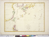
Owned by Sainsbury Institute for the Study of Japanese Arts and Cultures 【Atlas / Book Title】 【Engraver】 【Map Size】 50.0x8.5 cm 【Medium】 彩色銅板画 Uploaded by ima. Depicts: 1797 Last modified over 5 years ago. Unrectified.
Tags
Links: Source / Biblio Ref |
 WMS Capabilities URL
 Tiles (Google/OSM scheme)
 Download control points as CSV