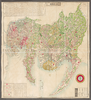
shelfmark: Maps 63100.4 License: Public Domain 明治10 *多色刷り。刊記に「明治六年八月官許/明治十年二月刻成」とあり。 Xylograph. Acquired 22 July 1868. Ex-Siebold. Uploaded by autobot. Depicts: 1877 Last modified over 4 years ago. 9 control points.
Tags
Links: Source / Biblio Ref | Download KML |
 WMS Capabilities URL
 Tiles (Google/OSM scheme)
 Download control points as CSV