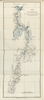
PLANO DEL RIO MAGDALENA QUE MUESTRA LA ZONA DE INUNDACION Y LOS LIMITES DEL CLIMA. JBK Uploaded by apicon. Depicts: 1928 Last modified over 2 years ago. 14 control points.
| Download KML |
|
|
fmapoteca_2571_fbnc_1062
PLANO DEL RIO MAGDALENA QUE MUESTRA LA ZONA DE INUNDACION Y LOS LIMITES DEL CLIMA. JBK Uploaded by apicon. Depicts: 1928 Last modified over 2 years ago. 14 control points. | Download KML | |
 WMS Capabilities URL
 Tiles (Google/OSM scheme)
 Download control points as CSV