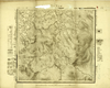
Image from the Map Collections courtesy Tohoku University. © 2023, the Committee for the Creation of the Gaihozu Digital Archives. 【図幅名】 イーマーヘー 【測量時期】 - 【発行時期】 大正10年発行 【記号】 西三行北七段三姓14号ニシ3ギョウキタ 【測量機関】 陸地測量部・参謀本部 アップロード者: autobot. 作成: 1921 最終更新日時 6ヶ月 前. 4個の基準点.
タグ
リンク: 出所・参照情報 | KMLをダウンロードする |
 エクスポート
 WMS CapabilitiesのURL
 タイル(Google・OSMのフォーマット)
 基準点をCSVでダウンロードする