タグ 中国満州
| 地図 | タイトル | 年 | 前回の更新  |
ステータス |
|---|---|---|---|---|
|
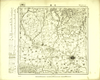
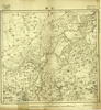
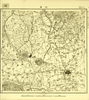
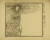
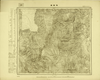
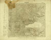
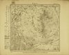
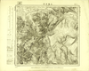
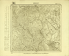
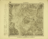
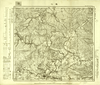
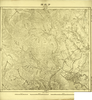
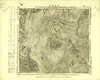
Image from the Map Collections courtesy Tohoku University. © 2023, the Committee for the Creation of the Gaihozu Digital Archives. 【図幅名】 巴彦 【測量時期】 - 【発行時期】 昭和7年発行 【記号】 哈爾賓2号 【測量機関】 大日本帝國陸地測量部
リンク: 出所・参照情報
|
1932 | 2ヶ月 前 | 4個の基準点 |
|
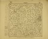
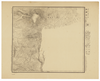
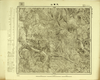
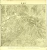
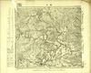
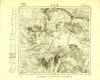
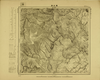
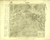
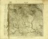
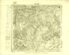
Image from the Map Collections courtesy Tohoku University. © 2023, the Committee for the Creation of the Gaihozu Digital Archives. 【図幅名】 興降鎮 【測量時期】 - 【発行時期】 昭和10年発行 【記号】 哈爾賓1号 【測量機関】 大日本帝國陸地測量部
リンク: 出所・参照情報
|
1935 | 2ヶ月 前 | 4個の基準点 |
|
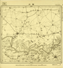
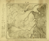
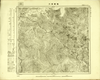
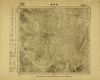
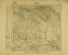
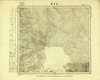
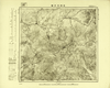
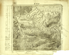
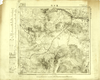
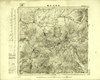
Image from the Map Collections courtesy Tohoku University. © 2023, the Committee for the Creation of the Gaihozu Digital Archives. 【図幅名】 肇州 【測量時期】 大正7年測圖t 【発行時期】 - 【記号】 西四行北七段哈爾賓24号 【測量機関】 陸地測量部r
リンク: 出所・参照情報
|
2ヶ月 前 | 4個の基準点 | |
|
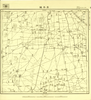
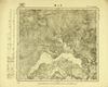
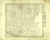
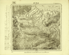
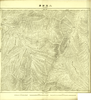
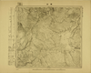
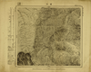
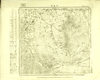
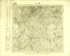
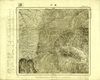
Image from the Map Collections courtesy Tohoku University. © 2023, the Committee for the Creation of the Gaihozu Digital Archives. 【図幅名】 昇平鎮 【測量時期】 - 【発行時期】 - 【記号】 西四行北七段哈爾賓22号 【測量機関】 支那駐屯軍司令部
リンク: 出所・参照情報
|
2ヶ月 前 | 4個の基準点 | |
|
Image from the Map Collections courtesy Tohoku University. © 2023, the Committee for the Creation of the Gaihozu Digital Archives. 【図幅名】 三站 【測量時期】 - 【発行時期】 - 【記号】 西四行北七段哈爾賓19号 【測量機関】 陸地測量部r
リンク: 出所・参照情報
|
2ヶ月 前 | 4個の基準点 | |
|
Image from the Map Collections courtesy Tohoku University. © 2023, the Committee for the Creation of the Gaihozu Digital Archives. 【図幅名】 安達 【測量時期】 - 【発行時期】 - 【記号】 西四行北七段哈爾賓16号 【測量機関】 -
リンク: 出所・参照情報
|
2ヶ月 前 | 4個の基準点 | |
|
Image from the Map Collections courtesy Tohoku University. © 2023, the Committee for the Creation of the Gaihozu Digital Archives. 【図幅名】 蘭西 【測量時期】 大正7年測圖/昭和3年修正測圖tsネンシュウセイソクズ 【発行時期】 昭和5年発行sネンハッコウ 【記号】 西四行北七段哈爾賓12号 【測量機関】 支那駐屯軍司令部・陸地測量部・参謀本部ササトモチュウトングンシレイブ
リンク: 出所・参照情報
|
1930 | 2ヶ月 前 | 4個の基準点 |
|
Image from the Map Collections courtesy Tohoku University. © 2023, the Committee for the Creation of the Gaihozu Digital Archives. 【図幅名】 二層頂子 【測量時期】 - 【発行時期】 - 【記号】 西四行北七段哈爾賓4号 【測量機関】 -
リンク: 出所・参照情報
|
2ヶ月 前 | 4個の基準点 | |

|
Image from the Map Collections courtesy Tohoku University. © 2023, the Committee for the Creation of the Gaihozu Digital Archives. 【図幅名】 賓州 【測量時期】 - 【発行時期】 - 【記号】 西四行北七段哈爾賓3号 【測量機関】 -
リンク: 出所・参照情報
|
2ヶ月 前 | 4個の基準点 | |
|
Image from the Map Collections courtesy Tohoku University. © 2023, the Committee for the Creation of the Gaihozu Digital Archives. 【図幅名】 巴彦 【測量時期】 大正7年測圖 【発行時期】 - 【記号】 西四行北七段哈爾賓2号ギョウ 【測量機関】 陸地測量部r
リンク: 出所・参照情報
|
2ヶ月 前 | 4個の基準点 | |
|
Image from the Map Collections courtesy Tohoku University. © 2023, the Committee for the Creation of the Gaihozu Digital Archives. 【図幅名】 佳林里 【測量時期】 昭和15年測量sネンソクリョウ 【発行時期】 昭和15年発行sネンハッコウ 【記号】 城津16号 【測量機関】 大日本帝國陸地測量部
リンク: 出所・参照情報
|
1940 | 2ヶ月 前 | 4個の基準点 |
|
Image from the Map Collections courtesy Tohoku University. © 2023, the Committee for the Creation of the Gaihozu Digital Archives. 【図幅名】 大浪柴河 【測量時期】 - 【発行時期】 昭和8年発行 【記号】 延吉22号エンキチ 【測量機関】 大日本帝國陸地測量部
リンク: 出所・参照情報
|
1933 | 2ヶ月 前 | 4個の基準点 |
|
Image from the Map Collections courtesy Tohoku University. © 2023, the Committee for the Creation of the Gaihozu Digital Archives. 【図幅名】 馬號 【測量時期】 - 【発行時期】 昭和8年発行 【記号】 延吉21号エンキチ 【測量機関】 大日本帝國陸地測量部
リンク: 出所・参照情報
|
1933 | 2ヶ月 前 | 4個の基準点 |
|
Image from the Map Collections courtesy Tohoku University. © 2023, the Committee for the Creation of the Gaihozu Digital Archives. 【図幅名】 白頭山 【測量時期】 昭和14年測量sネンソクリョウ 【発行時期】 昭和15年発行sネンハッコウ 【記号】 延吉20号エンキチ 【測量機関】 大日本帝國陸地測量部
リンク: 出所・参照情報
|
1940 | 2ヶ月 前 | 4個の基準点 |
|
Image from the Map Collections courtesy Tohoku University. © 2023, the Committee for the Creation of the Gaihozu Digital Archives. 【図幅名】 ?頭山 【測量時期】 @ 【発行時期】 @ 【記号】 延吉19号エンキチ 【測量機関】 @
リンク: 出所・参照情報
|
2ヶ月 前 | 4個の基準点 | |
|
Image from the Map Collections courtesy Tohoku University. © 2023, the Committee for the Creation of the Gaihozu Digital Archives. 【図幅名】 楡坪 【測量時期】 - 【発行時期】 昭和8年発行 【記号】 延吉15号エンキチ 【測量機関】 大日本帝國陸地測量部
リンク: 出所・参照情報
|
1933 | 2ヶ月 前 | 4個の基準点 |
|
Image from the Map Collections courtesy Tohoku University. © 2023, the Committee for the Creation of the Gaihozu Digital Archives. 【図幅名】 石人溝 【測量時期】 - 【発行時期】 昭和8年発行 【記号】 延吉14号エンキチ 【測量機関】 大日本帝國陸地測量部
リンク: 出所・参照情報
|
1933 | 2ヶ月 前 | 4個の基準点 |
|
Image from the Map Collections courtesy Tohoku University. © 2023, the Committee for the Creation of the Gaihozu Digital Archives. 【図幅名】 蜂蜜溝 【測量時期】 - 【発行時期】 昭和8年発行 【記号】 延吉13号エンキチ 【測量機関】 大日本帝國陸地測量部
リンク: 出所・参照情報
|
1933 | 2ヶ月 前 | 4個の基準点 |
|
Image from the Map Collections courtesy Tohoku University. © 2023, the Committee for the Creation of the Gaihozu Digital Archives. 【図幅名】 天寳山 【測量時期】 - 【発行時期】 昭和8年発行 【記号】 延吉12号エンキチ 【測量機関】 大日本帝國陸地測量部
リンク: 出所・参照情報
|
1933 | 2ヶ月 前 | 4個の基準点 |
|
Image from the Map Collections courtesy Tohoku University. © 2023, the Committee for the Creation of the Gaihozu Digital Archives. 【図幅名】 甕聲磖子 【測量時期】 - 【発行時期】 昭和8年発行 【記号】 延吉11号エンキチ 【測量機関】 大日本帝國陸地測量部
リンク: 出所・参照情報
|
1933 | 2ヶ月 前 | 4個の基準点 |
|
Image from the Map Collections courtesy Tohoku University. © 2023, the Committee for the Creation of the Gaihozu Digital Archives. 【図幅名】 二道江 【測量時期】 昭和14年測量sネンソクリョウ 【発行時期】 昭和15年発行sネンハッコウ 【記号】 西三行北五段延吉19号ニシサンギョウキタ 【測量機関】 大日本帝國陸地測量部
リンク: 出所・参照情報
|
1940 | 2ヶ月 前 | 4個の基準点 |
|
Image from the Map Collections courtesy Tohoku University. © 2023, the Committee for the Creation of the Gaihozu Digital Archives. 【図幅名】 新開嶺 【測量時期】 - 【発行時期】 昭和8年発行 【記号】 牡丹江25号 【測量機関】 大日本帝國陸地測量部
リンク: 出所・参照情報
|
1933 | 2ヶ月 前 | 4個の基準点 |
|
Image from the Map Collections courtesy Tohoku University. © 2023, the Committee for the Creation of the Gaihozu Digital Archives. 【図幅名】 額勒赫 【測量時期】 - 【発行時期】 昭和8年発行 【記号】 牡丹江24号 【測量機関】 大日本帝國陸地測量部
リンク: 出所・参照情報
|
1933 | 2ヶ月 前 | 4個の基準点 |
|
Image from the Map Collections courtesy Tohoku University. © 2023, the Committee for the Creation of the Gaihozu Digital Archives. 【図幅名】 楡樹溝 【測量時期】 - 【発行時期】 昭和8年発行 【記号】 牡丹江23号 【測量機関】 大日本帝國陸地測量部
リンク: 出所・参照情報
|
1933 | 2ヶ月 前 | 4個の基準点 |
|
Image from the Map Collections courtesy Tohoku University. © 2023, the Committee for the Creation of the Gaihozu Digital Archives. 【図幅名】 沙河子 【測量時期】 - 【発行時期】 昭和8年発行 【記号】 牡丹江22号 【測量機関】 大日本帝國陸地測量部
リンク: 出所・参照情報
|
1933 | 2ヶ月 前 | 4個の基準点 |
|
Image from the Map Collections courtesy Tohoku University. © 2023, the Committee for the Creation of the Gaihozu Digital Archives. 【図幅名】 小山子 【測量時期】 - 【発行時期】 昭和8年発行 【記号】 牡丹江21号 【測量機関】 大日本帝國陸地測量部
リンク: 出所・参照情報
|
1933 | 2ヶ月 前 | 4個の基準点 |
|
Image from the Map Collections courtesy Tohoku University. © 2023, the Committee for the Creation of the Gaihozu Digital Archives. 【図幅名】 敦化 【測量時期】 - 【発行時期】 昭和8年発行 【記号】 牡丹江20号 【測量機関】 大日本帝國陸地測量部
リンク: 出所・参照情報
|
1933 | 2ヶ月 前 | 4個の基準点 |
|
Image from the Map Collections courtesy Tohoku University. © 2023, the Committee for the Creation of the Gaihozu Digital Archives. 【図幅名】 額穆索 【測量時期】 - 【発行時期】 昭和8年発行 【記号】 牡丹江19号 【測量機関】 大日本帝國陸地測量部
リンク: 出所・参照情報
|
1933 | 2ヶ月 前 | 4個の基準点 |
|
Image from the Map Collections courtesy Tohoku University. © 2023, the Committee for the Creation of the Gaihozu Digital Archives. 【図幅名】 二張西溝 【測量時期】 - 【発行時期】 昭和8年発行 【記号】 牡丹江18号 【測量機関】 大日本帝國陸地測量部
リンク: 出所・参照情報
|
1933 | 2ヶ月 前 | 4個の基準点 |
|
Image from the Map Collections courtesy Tohoku University. © 2023, the Committee for the Creation of the Gaihozu Digital Archives. 【図幅名】 三道冲河 【測量時期】 - 【発行時期】 昭和11年発行 【記号】 牡丹江17号 【測量機関】 大日本帝國陸地測量部
リンク: 出所・参照情報
|
1936 | 2ヶ月 前 | 4個の基準点 |
|
Image from the Map Collections courtesy Tohoku University. © 2023, the Committee for the Creation of the Gaihozu Digital Archives. 【図幅名】 葦沙河 【測量時期】 - 【発行時期】 昭和8年発行 【記号】 牡丹江16号 【測量機関】 大日本帝國陸地測量部
リンク: 出所・参照情報
|
1933 | 2ヶ月 前 | 4個の基準点 |
|
Image from the Map Collections courtesy Tohoku University. © 2023, the Committee for the Creation of the Gaihozu Digital Archives. 【図幅名】 馬鹿溝 【測量時期】 - 【発行時期】 昭和8年発行 【記号】 牡丹江15号 【測量機関】 大日本帝國陸地測量部
リンク: 出所・参照情報
|
1933 | 2ヶ月 前 | 4個の基準点 |
|
Image from the Map Collections courtesy Tohoku University. © 2023, the Committee for the Creation of the Gaihozu Digital Archives. 【図幅名】 爾站 【測量時期】 - 【発行時期】 昭和8年発行 【記号】 牡丹江14号 【測量機関】 大日本帝國陸地測量部
リンク: 出所・参照情報
|
1933 | 2ヶ月 前 | 4個の基準点 |
|
Image from the Map Collections courtesy Tohoku University. © 2023, the Committee for the Creation of the Gaihozu Digital Archives. 【図幅名】 沙拉站 【測量時期】 - 【発行時期】 昭和8年発行 【記号】 牡丹江13号 【測量機関】 大日本帝國陸地測量部
リンク: 出所・参照情報
|
1933 | 2ヶ月 前 | 4個の基準点 |
|
Image from the Map Collections courtesy Tohoku University. © 2023, the Committee for the Creation of the Gaihozu Digital Archives. 【図幅名】 萬丈溝 【測量時期】 - 【発行時期】 昭和11年発行 【記号】 牡丹江12号 【測量機関】 大日本帝國陸地測量部
リンク: 出所・参照情報
|
1936 | 2ヶ月 前 | 4個の基準点 |
|
Image from the Map Collections courtesy Tohoku University. © 2023, the Committee for the Creation of the Gaihozu Digital Archives. 【図幅名】 石頭河子驛 【測量時期】 - 【発行時期】 昭和8年発行sネンハッコウ 【記号】 牡丹江11号 【測量機関】 大日本帝國陸地測量部
リンク: 出所・参照情報
|
1933 | 2ヶ月 前 | 4個の基準点 |
|
Image from the Map Collections courtesy Tohoku University. © 2023, the Committee for the Creation of the Gaihozu Digital Archives. 【図幅名】 磖門 【測量時期】 - 【発行時期】 昭和8年発行sネンハッコウ 【記号】 牡丹江10号 【測量機関】 大日本帝國陸地測量部
リンク: 出所・参照情報
|
1933 | 2ヶ月 前 | 4個の基準点 |
|
Image from the Map Collections courtesy Tohoku University. © 2023, the Committee for the Creation of the Gaihozu Digital Archives. 【図幅名】 王把街子 【測量時期】 - 【発行時期】 昭和8年発行sネンハッコウ 【記号】 牡丹江9号 【測量機関】 大日本帝國陸地測量部
リンク: 出所・参照情報
|
1933 | 2ヶ月 前 | 4個の基準点 |
|
Image from the Map Collections courtesy Tohoku University. © 2023, the Committee for the Creation of the Gaihozu Digital Archives. 【図幅名】 額勒赫 【測量時期】 - 【発行時期】 昭和8年発行sネンハッコウ 【記号】 寧古塔24号 【測量機関】 大日本帝國陸地測量部
リンク: 出所・参照情報
|
1933 | 2ヶ月 前 | 4個の基準点 |
|
Image from the Map Collections courtesy Tohoku University. © 2023, the Committee for the Creation of the Gaihozu Digital Archives. 【図幅名】 沙河子 【測量時期】 - 【発行時期】 昭和8年発行sネンハッコウ 【記号】 寧古塔22号 【測量機関】 大日本帝國陸地測量部
リンク: 出所・参照情報
|
1933 | 2ヶ月 前 | 4個の基準点 |
|
Image from the Map Collections courtesy Tohoku University. © 2023, the Committee for the Creation of the Gaihozu Digital Archives. 【図幅名】 小山子 【測量時期】 - 【発行時期】 昭和8年発行sネンハッコウ 【記号】 寧古塔21号 【測量機関】 大日本帝國陸地測量部
リンク: 出所・参照情報
|
1933 | 2ヶ月 前 | 4個の基準点 |
|
Image from the Map Collections courtesy Tohoku University. © 2023, the Committee for the Creation of the Gaihozu Digital Archives. 【図幅名】 敦化 【測量時期】 昭和13年複製同年鐡道補入sネンフクセイドウネンテツホ 【発行時期】 - 【記号】 寧古塔20号 【測量機関】 大日本帝國陸地測量部
リンク: 出所・参照情報
|
2ヶ月 前 | 4個の基準点 | |
|
Image from the Map Collections courtesy Tohoku University. © 2023, the Committee for the Creation of the Gaihozu Digital Archives. 【図幅名】 額稗索 【測量時期】 - 【発行時期】 - 【記号】 寧古塔19号 【測量機関】 大日本帝國陸地測量部
リンク: 出所・参照情報
|
2ヶ月 前 | 4個の基準点 | |
|
Image from the Map Collections courtesy Tohoku University. © 2023, the Committee for the Creation of the Gaihozu Digital Archives. 【図幅名】 葦沙河 【測量時期】 - 【発行時期】 昭和8年発行sネンハッコウ 【記号】 寧古塔16号 【測量機関】 大日本帝國陸地測量部
リンク: 出所・参照情報
|
1933 | 2ヶ月 前 | 4個の基準点 |
|
Image from the Map Collections courtesy Tohoku University. © 2023, the Committee for the Creation of the Gaihozu Digital Archives. 【図幅名】 爾站 【測量時期】 - 【発行時期】 昭和8年発行sネンハッコウ 【記号】 寧古塔14号 【測量機関】 大日本帝國陸地測量部
リンク: 出所・参照情報
|
1933 | 2ヶ月 前 | 4個の基準点 |
|
Image from the Map Collections courtesy Tohoku University. © 2023, the Committee for the Creation of the Gaihozu Digital Archives. 【図幅名】 沙拉站 【測量時期】 - 【発行時期】 昭和8年発行sネンハッコウ 【記号】 寧古塔13号 【測量機関】 大日本帝國陸地測量部
リンク: 出所・参照情報
|
1933 | 2ヶ月 前 | 4個の基準点 |
|
Image from the Map Collections courtesy Tohoku University. © 2023, the Committee for the Creation of the Gaihozu Digital Archives. 【図幅名】 萬丈溝 【測量時期】 - 【発行時期】 昭和11年発行sネンハッコウ 【記号】 寧古塔12号 【測量機関】 大日本帝國陸地測量部
リンク: 出所・参照情報
|
1936 | 2ヶ月 前 | 4個の基準点 |
|
Image from the Map Collections courtesy Tohoku University. © 2023, the Committee for the Creation of the Gaihozu Digital Archives. 【図幅名】 石頭河子驛 【測量時期】 - 【発行時期】 昭和8年発行sネンハッコウ 【記号】 寧古塔11号 【測量機関】 大日本帝國陸地測量部
リンク: 出所・参照情報
|
1933 | 2ヶ月 前 | 4個の基準点 |
|
Image from the Map Collections courtesy Tohoku University. © 2023, the Committee for the Creation of the Gaihozu Digital Archives. 【図幅名】 磖門 【測量時期】 - 【発行時期】 昭和8年発行sネンハッコウ 【記号】 寧古塔10号 【測量機関】 大日本帝國陸地測量部
リンク: 出所・参照情報
|
1933 | 2ヶ月 前 | 4個の基準点 |
|
Image from the Map Collections courtesy Tohoku University. © 2023, the Committee for the Creation of the Gaihozu Digital Archives. 【図幅名】 王把街子 【測量時期】 - 【発行時期】 昭和8年発行sネンハッコウ 【記号】 寧古塔9号 【測量機関】 大日本帝國陸地測量部
リンク: 出所・参照情報
|
1933 | 2ヶ月 前 | 4個の基準点 |