Tags for 満州
| Map | Title | Year | Last Updated  |
Status |
|---|---|---|---|---|
|
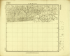
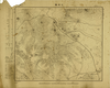
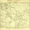
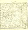
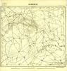
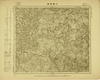
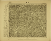
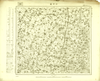
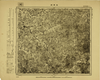
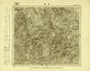
Image from the Map Collections courtesy Tohoku University. © 2023, the Committee for the Creation of the Gaihozu Digital Archives. 【図幅名】 ?倫 【測量時期】 - 【発行時期】 昭和8年発行 【記号】 黑山7号 【測量機関】 大日本帝國陸地測量部
Links: Source / Biblio Ref
|
1933 | 2 months ago | 4 control points |
|
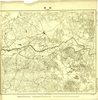
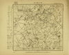
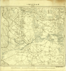
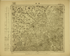
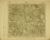
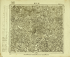
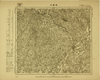
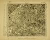
Image from the Map Collections courtesy Tohoku University. © 2023, the Committee for the Creation of the Gaihozu Digital Archives. 【図幅名】 周呢營子 【測量時期】 - 【発行時期】 昭和8年発行 【記号】 黑山6号 【測量機関】 大日本帝國陸地測量部
Links: Source / Biblio Ref
|
1933 | 2 months ago | 4 control points |
|
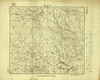
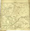
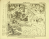
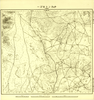
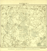
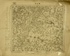
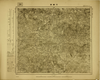
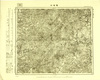
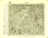
Image from the Map Collections courtesy Tohoku University. © 2023, the Committee for the Creation of the Gaihozu Digital Archives. 【図幅名】 東埧 【測量時期】 昭和15年撮影/昭和15年測量sネンサツエイsネンソクリョウ 【発行時期】 昭和15年発行sネンハッコウ 【記号】 蒙疆空中寫眞測量要圖五原7号 【測量機関】 陸地測量部・参謀本部
Links: Source / Biblio Ref
|
1940 | 2 months ago | 4 control points |
|
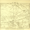
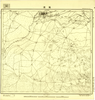
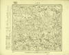
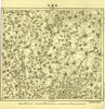
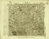
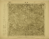
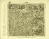
Image from the Map Collections courtesy Tohoku University. © 2023, the Committee for the Creation of the Gaihozu Digital Archives. 【図幅名】 烏拉特東公旗王府 【測量時期】 昭和15年撮影/昭和15年測量sネンサツエイsネンソクリョウ 【発行時期】 昭和15年発行sネンハッコウ 【記号】 蒙疆空中寫眞測量要圖五原6号 【測量機関】 陸地測量部・参謀本部
Links: Source / Biblio Ref
|
1940 | 2 months ago | 4 control points |
|
Image from the Map Collections courtesy Tohoku University. © 2023, the Committee for the Creation of the Gaihozu Digital Archives. 【図幅名】 烏藍桃拉亥 【測量時期】 昭和15年撮影/昭和15年測量sネンサツエイsネンソクリョウ 【発行時期】 昭和15年発行sネンハッコウ 【記号】 蒙疆空中寫眞測量要圖五原2号 【測量機関】 陸地測量部・参謀本部
Links: Source / Biblio Ref
|
1940 | 2 months ago | 4 control points |
|
Image from the Map Collections courtesy Tohoku University. © 2023, the Committee for the Creation of the Gaihozu Digital Archives. 【図幅名】 公合當 【測量時期】 昭和14年15年撮影/昭和15年測量sネンネンサツエイsネンソクリョウ 【発行時期】 - 【記号】 蒙疆空中寫眞測量要圖五原1号 【測量機関】 陸地測量部・参謀本部
Links: Source / Biblio Ref
|
2 months ago | 4 control points | |
|
Image from the Map Collections courtesy Tohoku University. © 2023, the Committee for the Creation of the Gaihozu Digital Archives. 【図幅名】 パーチルスーム 【測量時期】 - 【発行時期】 昭和10年発行 【記号】 開魯25号 【測量機関】 大日本帝國陸地測量部
Links: Source / Biblio Ref
|
1935 | 2 months ago | 4 control points |
|
Image from the Map Collections courtesy Tohoku University. © 2023, the Committee for the Creation of the Gaihozu Digital Archives. 【図幅名】 チャガステンスーム 【測量時期】 - 【発行時期】 昭和10年発行 【記号】 開魯24号 【測量機関】 大日本帝國陸地測量部
Links: Source / Biblio Ref
|
1935 | 2 months ago | 4 control points |
|
Image from the Map Collections courtesy Tohoku University. © 2023, the Committee for the Creation of the Gaihozu Digital Archives. 【図幅名】 三成隆 【測量時期】 - 【発行時期】 昭和10年発行 【記号】 開魯18号 【測量機関】 大日本帝國陸地測量部
Links: Source / Biblio Ref
|
1935 | 2 months ago | 4 control points |
|
Image from the Map Collections courtesy Tohoku University. © 2023, the Committee for the Creation of the Gaihozu Digital Archives. 【図幅名】 開魯 【測量時期】 - 【発行時期】 昭和8年発行 【記号】 開魯15号 【測量機関】 大日本帝國陸地測量部
Links: Source / Biblio Ref
|
1933 | 2 months ago | 4 control points |
|
Image from the Map Collections courtesy Tohoku University. © 2023, the Committee for the Creation of the Gaihozu Digital Archives. 【図幅名】 タラガン 【測量時期】 - 【発行時期】 昭和8年発行 【記号】 開魯14号 【測量機関】 大日本帝國陸地測量部
Links: Source / Biblio Ref
|
1933 | 2 months ago | 4 control points |
|
Image from the Map Collections courtesy Tohoku University. © 2023, the Committee for the Creation of the Gaihozu Digital Archives. 【図幅名】 ホンドルスーム 【測量時期】 - 【発行時期】 昭和8年発行 【記号】 開魯13号 【測量機関】 大日本帝國陸地測量部
Links: Source / Biblio Ref
|
1933 | 2 months ago | 4 control points |
|
Image from the Map Collections courtesy Tohoku University. © 2023, the Committee for the Creation of the Gaihozu Digital Archives. 【図幅名】 カシンスーム 【測量時期】 - 【発行時期】 昭和8年発行 【記号】 開魯12号 【測量機関】 大日本帝國陸地測量部
Links: Source / Biblio Ref
|
1933 | 2 months ago | 4 control points |
|
Image from the Map Collections courtesy Tohoku University. © 2023, the Committee for the Creation of the Gaihozu Digital Archives. 【図幅名】 オスンガッシヤ 【測量時期】 - 【発行時期】 昭和8年発行 【記号】 開魯11号 【測量機関】 大日本帝國陸地測量部
Links: Source / Biblio Ref
|
1933 | 2 months ago | 4 control points |
|
Image from the Map Collections courtesy Tohoku University. © 2023, the Committee for the Creation of the Gaihozu Digital Archives. 【図幅名】 チエールト王府 【測量時期】 - 【発行時期】 昭和8年発行 【記号】 開魯10号 【測量機関】 大日本帝國陸地測量部
Links: Source / Biblio Ref
|
1933 | 2 months ago | 4 control points |
|
Image from the Map Collections courtesy Tohoku University. © 2023, the Committee for the Creation of the Gaihozu Digital Archives. 【図幅名】 チャカントラガイ 【測量時期】 - 【発行時期】 昭和8年発行 【記号】 開魯9号 【測量機関】 大日本帝國陸地測量部
Links: Source / Biblio Ref
|
1933 | 2 months ago | 4 control points |
|
Image from the Map Collections courtesy Tohoku University. © 2023, the Committee for the Creation of the Gaihozu Digital Archives. 【図幅名】 ラムソルガー 【測量時期】 - 【発行時期】 昭和8年発行 【記号】 開魯8号 【測量機関】 大日本帝國陸地測量部
Links: Source / Biblio Ref
|
1933 | 2 months ago | 4 control points |
|
Image from the Map Collections courtesy Tohoku University. © 2023, the Committee for the Creation of the Gaihozu Digital Archives. 【図幅名】 クーシスーム 【測量時期】 - 【発行時期】 昭和8年発行 【記号】 開魯7号 【測量機関】 大日本帝國陸地測量部
Links: Source / Biblio Ref
|
1933 | 2 months ago | 4 control points |
|
Image from the Map Collections courtesy Tohoku University. © 2023, the Committee for the Creation of the Gaihozu Digital Archives. 【図幅名】 チャカントロゴー 【測量時期】 - 【発行時期】 昭和8年発行 【記号】 開魯6号 【測量機関】 大日本帝國陸地測量部
Links: Source / Biblio Ref
|
1933 | 2 months ago | 4 control points |
|
Image from the Map Collections courtesy Tohoku University. © 2023, the Committee for the Creation of the Gaihozu Digital Archives. 【図幅名】 通遼 【測量時期】 - 【発行時期】 昭和8年発行 【記号】 開魯5号 【測量機関】 大日本帝國陸地測量部
Links: Source / Biblio Ref
|
1933 | 2 months ago | 4 control points |
|
Image from the Map Collections courtesy Tohoku University. © 2023, the Committee for the Creation of the Gaihozu Digital Archives. 【図幅名】 達爾罕王府 【測量時期】 - 【発行時期】 昭和7年発行 【記号】 開魯4号 【測量機関】 大日本帝國陸地測量部
Links: Source / Biblio Ref
|
1932 | 2 months ago | 4 control points |
|
Image from the Map Collections courtesy Tohoku University. © 2023, the Committee for the Creation of the Gaihozu Digital Archives. 【図幅名】 ポロナスエモー 【測量時期】 - 【発行時期】 昭和8年発行 【記号】 開魯3号 【測量機関】 大日本帝國陸地測量部
Links: Source / Biblio Ref
|
1933 | 2 months ago | 4 control points |
|
Image from the Map Collections courtesy Tohoku University. © 2023, the Committee for the Creation of the Gaihozu Digital Archives. 【図幅名】 ハチクロアエラ 【測量時期】 - 【発行時期】 昭和8年発行 【記号】 開魯2号 【測量機関】 大日本帝國陸地測量部
Links: Source / Biblio Ref
|
1933 | 2 months ago | 4 control points |
|
Image from the Map Collections courtesy Tohoku University. © 2023, the Committee for the Creation of the Gaihozu Digital Archives. 【図幅名】 アボト 【測量時期】 - 【発行時期】 昭和8年発行 【記号】 開魯1号 【測量機関】 大日本帝國陸地測量部
Links: Source / Biblio Ref
|
1933 | 2 months ago | 4 control points |
|
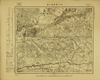
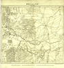
Image from the Map Collections courtesy Tohoku University. © 2023, the Committee for the Creation of the Gaihozu Digital Archives. 【図幅名】 圖什業圖王府 【測量時期】 - 【発行時期】 昭和8年発行 【記号】 王爺廟10号 【測量機関】 大日本帝國陸地測量部
Links: Source / Biblio Ref
|
1933 | 2 months ago | 4 control points |
|
Image from the Map Collections courtesy Tohoku University. © 2023, the Committee for the Creation of the Gaihozu Digital Archives. 【図幅名】 東太本站 【測量時期】 - 【発行時期】 昭和8年発行 【記号】 王爺廟5号 【測量機関】 大日本帝國陸地測量部
Links: Source / Biblio Ref
|
1933 | 2 months ago | 4 control points |
|
Image from the Map Collections courtesy Tohoku University. © 2023, the Committee for the Creation of the Gaihozu Digital Archives. 【図幅名】 床家窩棚 【測量時期】 - 【発行時期】 昭和10年発行 【記号】 王爺廟4号 【測量機関】 大日本帝國陸地測量部
Links: Source / Biblio Ref
|
1935 | 2 months ago | 4 control points |
|
Image from the Map Collections courtesy Tohoku University. © 2023, the Committee for the Creation of the Gaihozu Digital Archives. 【図幅名】 葛根廟 【測量時期】 - 【発行時期】 昭和10年発行 【記号】 王爺廟3号 【測量機関】 大日本帝國陸地測量部
Links: Source / Biblio Ref
|
1935 | 2 months ago | 4 control points |
|
Image from the Map Collections courtesy Tohoku University. © 2023, the Committee for the Creation of the Gaihozu Digital Archives. 【図幅名】 王爺廟 【測量時期】 - 【発行時期】 - 【記号】 王爺廟2号 【測量機関】 大日本帝國陸地測量部
Links: Source / Biblio Ref
|
2 months ago | 4 control points | |
|
Image from the Map Collections courtesy Tohoku University. © 2023, the Committee for the Creation of the Gaihozu Digital Archives. 【図幅名】 花園口 【測量時期】 - 【発行時期】 昭和8年発行 【記号】 大弧山22号 【測量機関】 大日本帝國陸地測量部
Links: Source / Biblio Ref
|
1933 | 2 months ago | 4 control points |
|
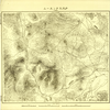
Image from the Map Collections courtesy Tohoku University. © 2023, the Committee for the Creation of the Gaihozu Digital Archives. 【図幅名】 龍巖浦 【測量時期】 - 【発行時期】 昭和7年発行 【記号】 大弧山6号 【測量機関】 大日本帝國陸地測量部
Links: Source / Biblio Ref
|
1932 | 2 months ago | 4 control points |
|
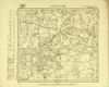
Image from the Map Collections courtesy Tohoku University. © 2023, the Committee for the Creation of the Gaihozu Digital Archives. 【図幅名】 萬福庄 【測量時期】 - 【発行時期】 昭和7年発行 【記号】 遼陽25号 【測量機関】 大日本帝國陸地測量部
Links: Source / Biblio Ref
|
1932 | 2 months ago | 4 control points |
|
Image from the Map Collections courtesy Tohoku University. © 2023, the Committee for the Creation of the Gaihozu Digital Archives. 【図幅名】 大牽馬嶺 【測量時期】 - 【発行時期】 昭和7年発行 【記号】 遼陽24号 【測量機関】 大日本帝國陸地測量部
Links: Source / Biblio Ref
|
1932 | 2 months ago | 4 control points |
|
Image from the Map Collections courtesy Tohoku University. © 2023, the Committee for the Creation of the Gaihozu Digital Archives. 【図幅名】 海城 【測量時期】 - 【発行時期】 昭和7年発行 【記号】 遼陽23号 【測量機関】 大日本帝國陸地測量部
Links: Source / Biblio Ref
|
1932 | 2 months ago | 4 control points |
|
Image from the Map Collections courtesy Tohoku University. © 2023, the Committee for the Creation of the Gaihozu Digital Archives. 【図幅名】 鞍山站 【測量時期】 - 【発行時期】 昭和7年発行 【記号】 遼陽22号 【測量機関】 大日本帝國陸地測量部
Links: Source / Biblio Ref
|
1932 | 2 months ago | 4 control points |
|
Image from the Map Collections courtesy Tohoku University. © 2023, the Committee for the Creation of the Gaihozu Digital Archives. 【図幅名】 黑溝台 【測量時期】 - 【発行時期】 昭和7年発行 【記号】 遼陽21号 【測量機関】 大日本帝國陸地測量部
Links: Source / Biblio Ref
|
1932 | 2 months ago | 4 control points |
|
Image from the Map Collections courtesy Tohoku University. © 2023, the Committee for the Creation of the Gaihozu Digital Archives. 【図幅名】 岫巖 【測量時期】 - 【発行時期】 昭和7年発行 【記号】 遼陽20号 【測量機関】 大日本帝國陸地測量部
Links: Source / Biblio Ref
|
1932 | 2 months ago | 4 control points |
|
Image from the Map Collections courtesy Tohoku University. © 2023, the Committee for the Creation of the Gaihozu Digital Archives. 【図幅名】 小偏嶺 【測量時期】 - 【発行時期】 昭和7年発行 【記号】 遼陽19号 【測量機関】 大日本帝國陸地測量部
Links: Source / Biblio Ref
|
1932 | 2 months ago | 4 control points |
|
Image from the Map Collections courtesy Tohoku University. © 2023, the Committee for the Creation of the Gaihozu Digital Archives. 【図幅名】 河欄溝 【測量時期】 - 【発行時期】 昭和7年発行 【記号】 遼陽18号 【測量機関】 大日本帝國陸地測量部
Links: Source / Biblio Ref
|
1932 | 2 months ago | 4 control points |
|
Image from the Map Collections courtesy Tohoku University. © 2023, the Committee for the Creation of the Gaihozu Digital Archives. 【図幅名】 遼陽 【測量時期】 - 【発行時期】 昭和7年発行 【記号】 遼陽17号 【測量機関】 大日本帝國陸地測量部
Links: Source / Biblio Ref
|
1932 | 2 months ago | 4 control points |
|
Image from the Map Collections courtesy Tohoku University. © 2023, the Committee for the Creation of the Gaihozu Digital Archives. 【図幅名】 沙河堡 【測量時期】 - 【発行時期】 昭和7年発行 【記号】 遼陽16号 【測量機関】 大日本帝國陸地測量部
Links: Source / Biblio Ref
|
1932 | 2 months ago | 4 control points |
|
Image from the Map Collections courtesy Tohoku University. © 2023, the Committee for the Creation of the Gaihozu Digital Archives. 【図幅名】 龍王廟 【測量時期】 - 【発行時期】 昭和7年発行 【記号】 遼陽15号 【測量機関】 大日本帝國陸地測量部
Links: Source / Biblio Ref
|
1932 | 2 months ago | 4 control points |
|
Image from the Map Collections courtesy Tohoku University. © 2023, the Committee for the Creation of the Gaihozu Digital Archives. 【図幅名】 雪裡站 【測量時期】 - 【発行時期】 - 【記号】 遼陽14号 【測量機関】 -
Links: Source / Biblio Ref
|
2 months ago | 4 control points | |
|
Image from the Map Collections courtesy Tohoku University. © 2023, the Committee for the Creation of the Gaihozu Digital Archives. 【図幅名】 橋頭 【測量時期】 - 【発行時期】 昭和7年発行 【記号】 遼陽12号 【測量機関】 大日本帝國陸地測量部
Links: Source / Biblio Ref
|
1932 | 2 months ago | 4 control points |
|
Image from the Map Collections courtesy Tohoku University. © 2023, the Committee for the Creation of the Gaihozu Digital Archives. 【図幅名】 本渓湖 【測量時期】 - 【発行時期】 昭和7年発行 【記号】 遼陽11号 【測量機関】 大日本帝國陸地測量部
Links: Source / Biblio Ref
|
1932 | 2 months ago | 4 control points |
|
Image from the Map Collections courtesy Tohoku University. © 2023, the Committee for the Creation of the Gaihozu Digital Archives. 【図幅名】 新義州 【測量時期】 - 【発行時期】 昭和7年発行 【記号】 遼陽10号 【測量機関】 大日本帝國陸地測量部
Links: Source / Biblio Ref
|
1932 | 2 months ago | 4 control points |
|
Image from the Map Collections courtesy Tohoku University. © 2023, the Committee for the Creation of the Gaihozu Digital Archives. 【図幅名】 鳳凰城 【測量時期】 - 【発行時期】 昭和7年発行 【記号】 遼陽9号 【測量機関】 大日本帝國陸地測量部
Links: Source / Biblio Ref
|
1932 | 2 months ago | 4 control points |
|
Image from the Map Collections courtesy Tohoku University. © 2023, the Committee for the Creation of the Gaihozu Digital Archives. 【図幅名】 賽馬集 【測量時期】 - 【発行時期】 昭和7年発行 【記号】 遼陽8号 【測量機関】 大日本帝國陸地測量部
Links: Source / Biblio Ref
|
1932 | 2 months ago | 4 control points |
|
Image from the Map Collections courtesy Tohoku University. © 2023, the Committee for the Creation of the Gaihozu Digital Archives. 【図幅名】 域廠 【測量時期】 - 【発行時期】 昭和7年発行 【記号】 遼陽7号 【測量機関】 大日本帝國陸地測量部
Links: Source / Biblio Ref
|
1932 | 2 months ago | 4 control points |
|
Image from the Map Collections courtesy Tohoku University. © 2023, the Committee for the Creation of the Gaihozu Digital Archives. 【図幅名】 義州 【測量時期】 - 【発行時期】 昭和7年発行 【記号】 遼陽5号 【測量機関】 大日本帝國陸地測量部
Links: Source / Biblio Ref
|
1932 | 2 months ago | 4 control points |