Tags for
 RSS Feed
| Map | Title | Year | Last Updated  |
Status |
|---|---|---|---|---|
|
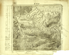
Image from the Map Collections courtesy Tohoku University. © 2023, the Committee for the Creation of the Gaihozu Digital Archives. 【図幅名】 沙河子 【測量時期】 - 【発行時期】 昭和8年発行sネンハッコウ 【記号】 寧古塔22号 【測量機関】 大日本帝國陸地測量部
Links: Source / Biblio Ref
|
1933 | 5 months ago | 4 control points |
|
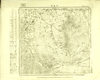
Image from the Map Collections courtesy Tohoku University. © 2023, the Committee for the Creation of the Gaihozu Digital Archives. 【図幅名】 小山子 【測量時期】 - 【発行時期】 昭和8年発行sネンハッコウ 【記号】 寧古塔21号 【測量機関】 大日本帝國陸地測量部
Links: Source / Biblio Ref
|
1933 | 5 months ago | 4 control points |
|
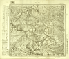
Image from the Map Collections courtesy Tohoku University. © 2023, the Committee for the Creation of the Gaihozu Digital Archives. 【図幅名】 敦化 【測量時期】 昭和13年複製同年鐡道補入sネンフクセイドウネンテツホ 【発行時期】 - 【記号】 寧古塔20号 【測量機関】 大日本帝國陸地測量部
Links: Source / Biblio Ref
|
5 months ago | 4 control points | |
|
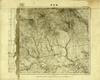
Image from the Map Collections courtesy Tohoku University. © 2023, the Committee for the Creation of the Gaihozu Digital Archives. 【図幅名】 額稗索 【測量時期】 - 【発行時期】 - 【記号】 寧古塔19号 【測量機関】 大日本帝國陸地測量部
Links: Source / Biblio Ref
|
5 months ago | 4 control points | |
|
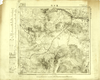
Image from the Map Collections courtesy Tohoku University. © 2023, the Committee for the Creation of the Gaihozu Digital Archives. 【図幅名】 葦沙河 【測量時期】 - 【発行時期】 昭和8年発行sネンハッコウ 【記号】 寧古塔16号 【測量機関】 大日本帝國陸地測量部
Links: Source / Biblio Ref
|
1933 | 5 months ago | 4 control points |
|
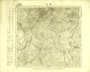
Image from the Map Collections courtesy Tohoku University. © 2023, the Committee for the Creation of the Gaihozu Digital Archives. 【図幅名】 爾站 【測量時期】 - 【発行時期】 昭和8年発行sネンハッコウ 【記号】 寧古塔14号 【測量機関】 大日本帝國陸地測量部
Links: Source / Biblio Ref
|
1933 | 5 months ago | 4 control points |
|
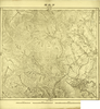
Image from the Map Collections courtesy Tohoku University. © 2023, the Committee for the Creation of the Gaihozu Digital Archives. 【図幅名】 沙拉站 【測量時期】 - 【発行時期】 昭和8年発行sネンハッコウ 【記号】 寧古塔13号 【測量機関】 大日本帝國陸地測量部
Links: Source / Biblio Ref
|
1933 | 5 months ago | 4 control points |
|
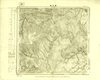
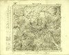
Image from the Map Collections courtesy Tohoku University. © 2023, the Committee for the Creation of the Gaihozu Digital Archives. 【図幅名】 萬丈溝 【測量時期】 - 【発行時期】 昭和11年発行sネンハッコウ 【記号】 寧古塔12号 【測量機関】 大日本帝國陸地測量部
Links: Source / Biblio Ref
|
1936 | 5 months ago | 4 control points |
|
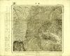
Image from the Map Collections courtesy Tohoku University. © 2023, the Committee for the Creation of the Gaihozu Digital Archives. 【図幅名】 石頭河子驛 【測量時期】 - 【発行時期】 昭和8年発行sネンハッコウ 【記号】 寧古塔11号 【測量機関】 大日本帝國陸地測量部
Links: Source / Biblio Ref
|
1933 | 5 months ago | 4 control points |
|
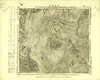
Image from the Map Collections courtesy Tohoku University. © 2023, the Committee for the Creation of the Gaihozu Digital Archives. 【図幅名】 磖門 【測量時期】 - 【発行時期】 昭和8年発行sネンハッコウ 【記号】 寧古塔10号 【測量機関】 大日本帝國陸地測量部
Links: Source / Biblio Ref
|
1933 | 5 months ago | 4 control points |
|
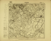
Image from the Map Collections courtesy Tohoku University. © 2023, the Committee for the Creation of the Gaihozu Digital Archives. 【図幅名】 王把街子 【測量時期】 - 【発行時期】 昭和8年発行sネンハッコウ 【記号】 寧古塔9号 【測量機関】 大日本帝國陸地測量部
Links: Source / Biblio Ref
|
1933 | 5 months ago | 4 control points |
|
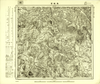
Image from the Map Collections courtesy Tohoku University. © 2023, the Committee for the Creation of the Gaihozu Digital Archives. 【図幅名】 烏吉密河 【測量時期】 - 【発行時期】 昭和7年発行sネンハッコウ 【記号】 依蘭25号 【測量機関】 大日本帝國陸地測量部
Links: Source / Biblio Ref
|
1932 | 5 months ago | 4 control points |
|
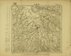
Image from the Map Collections courtesy Tohoku University. © 2023, the Committee for the Creation of the Gaihozu Digital Archives. 【図幅名】 黑龍宮 【測量時期】 - 【発行時期】 昭和7年発行sネンハッコウ 【記号】 依蘭24号 【測量機関】 大日本帝國陸地測量部
Links: Source / Biblio Ref
|
1932 | 5 months ago | 4 control points |
|
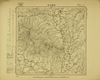
Image from the Map Collections courtesy Tohoku University. © 2023, the Committee for the Creation of the Gaihozu Digital Archives. 【図幅名】 枷板站 【測量時期】 - 【発行時期】 昭和7年発行sネンハッコウ 【記号】 依蘭23号 【測量機関】 大日本帝國陸地測量部
Links: Source / Biblio Ref
|
1932 | 5 months ago | 4 control points |
|
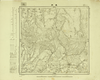
Image from the Map Collections courtesy Tohoku University. © 2023, the Committee for the Creation of the Gaihozu Digital Archives. 【図幅名】 石頭河子 【測量時期】 - 【発行時期】 昭和7年発行sネンハッコウ 【記号】 依蘭22号 【測量機関】 大日本帝國陸地測量部
Links: Source / Biblio Ref
|
1932 | 5 months ago | 4 control points |
|
Image from the Map Collections courtesy Tohoku University. © 2023, the Committee for the Creation of the Gaihozu Digital Archives. 【図幅名】 東興 【測量時期】 - 【発行時期】 昭和10年発行 【記号】 依蘭21号 【測量機関】 大日本帝國陸地測量部
Links: Source / Biblio Ref
|
1935 | 5 months ago | 4 control points |
|
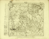
Image from the Map Collections courtesy Tohoku University. © 2023, the Committee for the Creation of the Gaihozu Digital Archives. 【図幅名】 一面坡 【測量時期】 - 【発行時期】 昭和7年発行sネンハッコウ 【記号】 依蘭20号 【測量機関】 大日本帝國陸地測量部
Links: Source / Biblio Ref
|
1932 | 5 months ago | 4 control points |
|
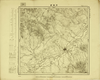
Image from the Map Collections courtesy Tohoku University. © 2023, the Committee for the Creation of the Gaihozu Digital Archives. 【図幅名】 同賓縣 【測量時期】 - 【発行時期】 昭和8年発行sネンハッコウ 【記号】 依蘭19号 【測量機関】 大日本帝國陸地測量部
Links: Source / Biblio Ref
|
1933 | 5 months ago | 4 control points |
|
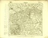
Image from the Map Collections courtesy Tohoku University. © 2023, the Committee for the Creation of the Gaihozu Digital Archives. 【図幅名】 木蘭縣 【測量時期】 - 【発行時期】 昭和7年発行sネンハッコウ 【記号】 依蘭18号 【測量機関】 大日本帝國陸地測量部
Links: Source / Biblio Ref
|
1932 | 5 months ago | 4 control points |
|
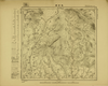
Image from the Map Collections courtesy Tohoku University. © 2023, the Committee for the Creation of the Gaihozu Digital Archives. 【図幅名】 老石房 【測量時期】 - 【発行時期】 昭和7年発行sネンハッコウ 【記号】 依蘭17号 【測量機関】 大日本帝國陸地測量部
Links: Source / Biblio Ref
|
1932 | 5 months ago | 4 control points |
|
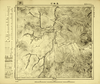
Image from the Map Collections courtesy Tohoku University. © 2023, the Committee for the Creation of the Gaihozu Digital Archives. 【図幅名】 亮珠河 【測量時期】 - 【発行時期】 昭和7年発行sネンハッコウ 【記号】 依蘭15号 【測量機関】 大日本帝國陸地測量部
Links: Source / Biblio Ref
|
1932 | 5 months ago | 4 control points |
|
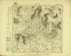
Image from the Map Collections courtesy Tohoku University. © 2023, the Committee for the Creation of the Gaihozu Digital Archives. 【図幅名】 三站 【測量時期】 - 【発行時期】 昭和7年発行sネンハッコウ 【記号】 依蘭12号 【測量機関】 大日本帝國陸地測量部
Links: Source / Biblio Ref
|
1932 | 5 months ago | 4 control points |
|
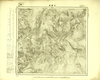
Image from the Map Collections courtesy Tohoku University. © 2023, the Committee for the Creation of the Gaihozu Digital Archives. 【図幅名】 芳家溝 【測量時期】 - 【発行時期】 昭和8年発行sネンハッコウ 【記号】 依蘭10号 【測量機関】 大日本帝國陸地測量部
Links: Source / Biblio Ref
|
1933 | 5 months ago | 4 control points |
|
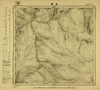
Image from the Map Collections courtesy Tohoku University. © 2023, the Committee for the Creation of the Gaihozu Digital Archives. 【図幅名】 老嶺 【測量時期】 - 【発行時期】 昭和8年発行sネンハッコウ 【記号】 依蘭9号 【測量機関】 大日本帝國陸地測量部
Links: Source / Biblio Ref
|
1933 | 5 months ago | 4 control points |
|
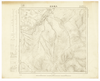
Image from the Map Collections courtesy Tohoku University. © 2023, the Committee for the Creation of the Gaihozu Digital Archives. 【図幅名】 大羅勒密 【測量時期】 - 【発行時期】 昭和7年発行sネンハッコウ 【記号】 依蘭8号 【測量機関】 大日本帝國陸地測量部
Links: Source / Biblio Ref
|
1932 | 5 months ago | 4 control points |
|
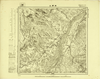
Image from the Map Collections courtesy Tohoku University. © 2023, the Committee for the Creation of the Gaihozu Digital Archives. 【図幅名】 祥順山 【測量時期】 - 【発行時期】 昭和7年発行sネンハッコウ 【記号】 依蘭7号 【測量機関】 大日本帝國陸地測量部
Links: Source / Biblio Ref
|
1932 | 5 months ago | 4 control points |
|
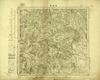
Image from the Map Collections courtesy Tohoku University. © 2023, the Committee for the Creation of the Gaihozu Digital Archives. 【図幅名】 黑龍宮 【測量時期】 - 【発行時期】 昭和7年発行sネンハッコウ 【記号】 三姓24号 【測量機関】 大日本帝國陸地測量部
Links: Source / Biblio Ref
|
1932 | 5 months ago | 4 control points |
|
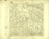
Image from the Map Collections courtesy Tohoku University. © 2023, the Committee for the Creation of the Gaihozu Digital Archives. 【図幅名】 枷板站 【測量時期】 - 【発行時期】 昭和7年発行sネンハッコウ 【記号】 三姓23号 【測量機関】 大日本帝國陸地測量部
Links: Source / Biblio Ref
|
1932 | 5 months ago | 4 control points |
|
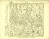
Image from the Map Collections courtesy Tohoku University. © 2023, the Committee for the Creation of the Gaihozu Digital Archives. 【図幅名】 東興 【測量時期】 - 【発行時期】 昭和10年発行 【記号】 三姓21号 【測量機関】 大日本帝國陸地測量部
Links: Source / Biblio Ref
|
1935 | 5 months ago | 4 control points |
|
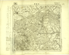
Image from the Map Collections courtesy Tohoku University. © 2023, the Committee for the Creation of the Gaihozu Digital Archives. 【図幅名】 木蘭縣 【測量時期】 - 【発行時期】 昭和7年発行sネンハッコウ 【記号】 三姓18号 【測量機関】 大日本帝國陸地測量部
Links: Source / Biblio Ref
|
1932 | 5 months ago | 4 control points |
|
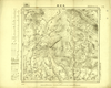
Image from the Map Collections courtesy Tohoku University. © 2023, the Committee for the Creation of the Gaihozu Digital Archives. 【図幅名】 老石房 【測量時期】 - 【発行時期】 昭和7年発行sネンハッコウ 【記号】 三姓17号 【測量機関】 大日本帝國陸地測量部
Links: Source / Biblio Ref
|
1932 | 5 months ago | 4 control points |
|
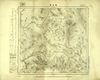
Image from the Map Collections courtesy Tohoku University. © 2023, the Committee for the Creation of the Gaihozu Digital Archives. 【図幅名】 鳳山縣 【測量時期】 - 【発行時期】 昭和10年発行 【記号】 三姓16号 【測量機関】 大日本帝國陸地測量部
Links: Source / Biblio Ref
|
1935 | 5 months ago | 4 control points |
|
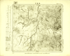
Image from the Map Collections courtesy Tohoku University. © 2023, the Committee for the Creation of the Gaihozu Digital Archives. 【図幅名】 亮珠河 【測量時期】 - 【発行時期】 昭和7年発行sネンハッコウ 【記号】 三姓15号 【測量機関】 大日本帝國陸地測量部
Links: Source / Biblio Ref
|
1932 | 5 months ago | 4 control points |
|
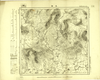
Image from the Map Collections courtesy Tohoku University. © 2023, the Committee for the Creation of the Gaihozu Digital Archives. 【図幅名】 三站 【測量時期】 - 【発行時期】 昭和7年発行sネンハッコウ 【記号】 三姓12号 【測量機関】 陸地測量部・参謀本部
Links: Source / Biblio Ref
|
1932 | 5 months ago | 4 control points |
|
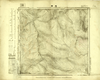
Image from the Map Collections courtesy Tohoku University. © 2023, the Committee for the Creation of the Gaihozu Digital Archives. 【図幅名】 老嶺 【測量時期】 - 【発行時期】 昭和8年発行sネンハッコウ 【記号】 三姓9号 【測量機関】 陸地測量部・参謀本部
Links: Source / Biblio Ref
|
1933 | 5 months ago | 4 control points |
|
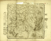
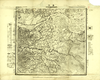
Image from the Map Collections courtesy Tohoku University. © 2023, the Committee for the Creation of the Gaihozu Digital Archives. 【図幅名】 イーマーヘー 【測量時期】 - 【発行時期】 大正10年発行 【記号】 西三行北七段三姓14号ニシ3ギョウキタ 【測量機関】 陸地測量部・参謀本部
Links: Source / Biblio Ref
|
1921 | 5 months ago | 4 control points |
|
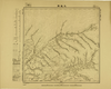
Image from the Map Collections courtesy Tohoku University. © 2023, the Committee for the Creation of the Gaihozu Digital Archives. 【図幅名】 通河 【測量時期】 - 【発行時期】 - 【記号】 西三行北七段三姓13号ニシ3ギョウキタ 【測量機関】 陸地測量部・参謀本部
Links: Source / Biblio Ref
|
5 months ago | 4 control points | |
|
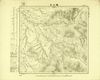
Image from the Map Collections courtesy Tohoku University. © 2023, the Committee for the Creation of the Gaihozu Digital Archives. 【図幅名】 五道崗 【測量時期】 - 【発行時期】 昭和10年発行 【記号】 鐵驪24号 【測量機関】 大日本帝國陸地測量部
Links: Source / Biblio Ref
|
1935 | 5 months ago | 4 control points |
|
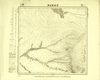
Image from the Map Collections courtesy Tohoku University. © 2023, the Committee for the Creation of the Gaihozu Digital Archives. 【図幅名】 鐵山包 【測量時期】 - 【発行時期】 昭和10年発行 【記号】 鐵驪20号 【測量機関】 大日本帝國陸地測量部
Links: Source / Biblio Ref
|
1935 | 5 months ago | 4 control points |
|
Image from the Map Collections courtesy Tohoku University. © 2023, the Committee for the Creation of the Gaihozu Digital Archives. 【図幅名】 伊吉密河原 【測量時期】 - 【発行時期】 昭和10年発行 【記号】 鐵驪19号 【測量機関】 大日本帝國陸地測量部
Links: Source / Biblio Ref
|
1935 | 5 months ago | 4 control points |
|
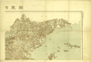
Image from the Map Collections courtesy Tohoku University. © 2023, the Committee for the Creation of the Gaihozu Digital Archives. 【図幅名】 【測量時期】 大正12年編纂 【発行時期】 大正13年発行 【記号】 関東州全図-右上 【測量機関】 關東廰・陸地測量部
Links: Source / Biblio Ref
|
1924 | 5 months ago | 4 control points |
|
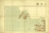
Image from the Map Collections courtesy Tohoku University. © 2023, the Committee for the Creation of the Gaihozu Digital Archives. 【図幅名】 【測量時期】 大正12年編纂 【発行時期】 大正13年発行 【記号】 関東州全図-左上 【測量機関】 關東廰・陸地測量部
Links: Source / Biblio Ref
|
1924 | 5 months ago | 4 control points |
|
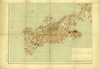
Image from the Map Collections courtesy Tohoku University. © 2023, the Committee for the Creation of the Gaihozu Digital Archives. 【図幅名】 【測量時期】 大正12年編纂 【発行時期】 大正13年発行 【記号】 関東州全図-左下 【測量機関】 關東廰・陸地測量部
Links: Source / Biblio Ref
|
1924 | 5 months ago | 4 control points |
|
【最初期発行】 この地図の作成に当たっては、国土地理院長の承認を得て、同院発行の20万分の1地勢図及び5万分の1地形図を使用した。(承認番号 平30情使、 第1148号) (In 1 layer)
Links: Source / Biblio Ref
|
1930 | 6 months ago | 4 control points |
|
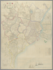
この地図の作成に当たっては、国土地理院長の承認を得て、同院発行の20万分の1地勢図及び5万分の1地形図を使用した。(承認番号 平30情使、 第1148号)
Links: Source / Biblio Ref
|
1923 | 6 months ago | 4 control points |
|
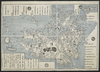
shelfmark: Maps 5.c.45
License: Public Domain
明治9 *銅板。多色刷り。朱印「定價金貳圓」。 Copperplate. Acquired 21 December 1878.
Links: Source / Biblio Ref
|
1876 | 6 months ago | 53 control points |
|
shelfmark: Maps 62987.8
License: Public Domain
文化10 *三色図。改装のため外題欠。山下和正『地図で読む江戸時代』58頁によれば、外題は大日本九州九ケ国之図」。 Xylograph. Acquired 21 December 1878. Beans 1.33; Yamashita 58; Mody, plate 38.
Links: Source / Biblio Ref
|
1813 | 7 months ago | 3 control points |
|
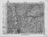
この地図の作成に当たっては、国土地理院長の承認を得て、同院発行の20万分の1地勢図及び5万分の1地形図を使用した。(承認番号 平30情使、 第1148号)
Links: Source / Biblio Ref
|
1946 | 8 months ago | 4 control points |
|
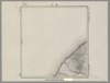
Image from the Map Collections courtesy Stanford University Libraries. This item is in the public domain. There are no restrictions on use.
【図幅名】 白川【測量時期】 大正2年測圖 【発行時期】大正13年 【記号】 千島列島七号 【測量機関】 参謀本部 【その他】千島列島 陸地測量部 (In 1 layer)
Links: Source / Biblio Ref
|
1924 | 8 months ago | 4 control points |
|
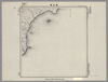
Image from the Map Collections courtesy Stanford University Libraries. This item is in the public domain. There are no restrictions on use.
【図幅名】 朝日灣【測量時期】 大正2年測圖 【発行時期】大正13年 【記号】 朝日灣十四号 【測量機関】 参謀本部 【その他】千島列島 陸地測量部 (In 1 layer)
Links: Source / Biblio Ref
|
1924 | 8 months ago | 4 control points |


