Browse Maps
| map | Title  |
Year | Last Updated | Status |
|---|---|---|---|---|
|
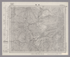
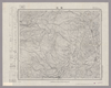
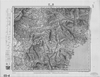
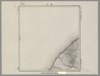
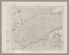
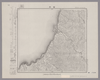
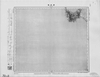
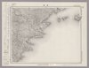
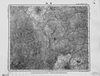
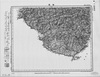
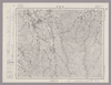
Image from the Map Collections courtesy Stanford University Libraries, licensed under a Creative Commons Attribution-Noncommercial 3.0 Unported License. © Stanford University. 【図幅名】 白鳥 【測量時期】 明治43年測図/昭和5年修正/昭和8年鉄道補入 【発行時期】 昭和10年3月発行 【記号】 岐阜1号(共16面) 【測量機関】 大日本帝国陸地測量部 【備考】
Links: Source / Biblio Ref
|
about 2 years ago | 4 control points | |
|
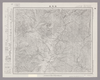
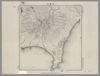
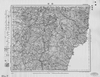
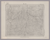
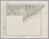
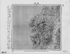
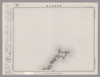
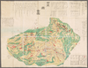
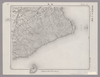
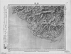
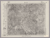
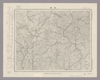
Image from the Map Collections courtesy Stanford University Libraries, licensed under a Creative Commons Attribution-Noncommercial 3.0 Unported License. © Stanford University. 【図幅名】 白馬岳 【測量時期】 大正1年測図/昭和5年測図、昭和6年修正 【発行時期】 昭和8年2月発行 【記号】 富山4号(共11面) 【測量機関】 大日本帝国陸地測量部 【備考】
Links: Source / Biblio Ref
|
about 2 years ago | 4 control points | |
|
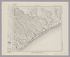
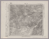
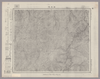
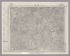
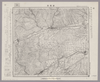
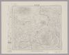
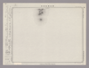
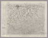
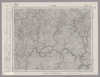
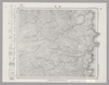
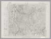
Image from the Map Collections courtesy Stanford University Libraries, licensed under a Creative Commons Attribution-Noncommercial 3.0 Unported License. © Stanford University. 【図幅名】 徳舜瞥 【測量時期】 大正6年測圖/昭和10年修正測圖 【発行時期】 【記号】 苫小牧十三号 【測量機関】 参謀本部 【備考】 祕 (In 1 layer)
Links: Source / Biblio Ref
|
about 2 years ago | 4 control points | |
|
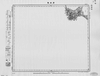
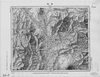
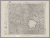
この地図の作成に当たっては、国土地理院長の承認を得て、同院発行の20万分の1地勢図及び5万分の1地形図を使用した。(承認番号 平30情使、 第1148号)
Links: Source / Biblio Ref
|
1946 | over 5 years ago | 4 control points |
|
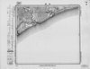
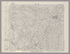
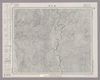
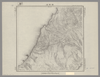
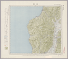
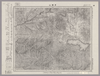
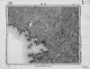
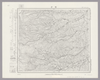
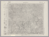
Image from the Map Collections courtesy Stanford University Libraries, licensed under a Creative Commons Attribution-Noncommercial 3.0 Unported License. © Stanford University. 【図幅名】 白石 【測量時期】 昭和8年測図 【発行時期】 【記号】 仙台8号(共16面) 【測量機関】 内務省地理調査所 【備考】
Links: Source / Biblio Ref
|
about 2 years ago | 4 control points | |
|
Image from the Map Collections courtesy Stanford University Libraries. This item is in the public domain. There are no restrictions on use.
【図幅名】 白煙山【測量時期】 大正3年測圖 【発行時期】大正13年 【記号】 幌筵島十二号 【測量機関】 参謀本部 【その他】千島列島 陸地測量部 (In 1 layer)
Links: Source / Biblio Ref
|
1924 | over 1 year ago | 4 control points |
|
Image from the Map Collections courtesy Stanford University Libraries, licensed under a Creative Commons Attribution-Noncommercial 3.0 Unported License. © Stanford University. 【図幅名】 白龍 【測量時期】 大正10年及大正12年測圖/昭和8年鐡道補入 【発行時期】 【記号】 陸別十三号 【測量機関】 参謀本部 【備考】 祕 假製版 (In 1 layer)
Links: Source / Biblio Ref
|
about 2 years ago | 4 control points | |
|
Image from the Map Collections courtesy Stanford University Libraries, licensed under a Creative Commons Attribution-Noncommercial 3.0 Unported License. © Stanford University. 【図幅名】 白河 【測量時期】 明治42年測図/昭和4年修正/昭和7年測図の縮図/昭和8年部分修正 【発行時期】 昭和22年4月発行 【記号】 白河14号(共17面) 【測量機関】 内務省地理調査所 【備考】
Links: Source / Biblio Ref
|
about 2 years ago | 4 control points | |
|
【最初期発行】 この地図の作成に当たっては、国土地理院長の承認を得て、同院発行の20万分の1地勢図及び5万分の1地形図を使用した。(承認番号 平30情使、 第1148号) (In 1 layer)
Links: Source / Biblio Ref
|
1922 | almost 4 years ago | 4 control points |
|
この地図の作成に当たっては、国土地理院長の承認を得て、同院発行の20万分の1地勢図及び5万分の1地形図を使用した。(承認番号 平30情使、 第1148号)
Links: Source / Biblio Ref
|
1947 | over 5 years ago | 4 control points |
|
Image from the Map Collections courtesy Stanford University Libraries, licensed under a Creative Commons Attribution-Noncommercial 3.0 Unported License. © Stanford University. 【図幅名】 白木峰 【測量時期】 大正1年測図/昭和5年要部修正 【発行時期】 【記号】 高山14号(共16面) 【測量機関】 参謀本部 【備考】 秘
Links: Source / Biblio Ref
|
about 2 years ago | 4 control points | |
|
Image from the Map Collections courtesy Stanford University Libraries, licensed under a Creative Commons Attribution-Noncommercial 3.0 Unported License. © Stanford University. 【図幅名】 白川村 【測量時期】 明治43年測図/昭和5年要部修正 【発行時期】 昭和21年10月発行 【記号】 金沢3号(共13面) 【測量機関】 地理調査所 【備考】
Links: Source / Biblio Ref
|
about 2 years ago | 4 control points | |
|
Image from the Map Collections courtesy Stanford University Libraries. This item is in the public domain. There are no restrictions on use.
【図幅名】 白川【測量時期】 大正2年測圖 【発行時期】大正13年 【記号】 千島列島七号 【測量機関】 参謀本部 【その他】千島列島 陸地測量部 (In 1 layer)
Links: Source / Biblio Ref
|
1924 | over 1 year ago | 4 control points |
|
Image from the Map Collections courtesy Stanford University Libraries, licensed under a Creative Commons Attribution-Noncommercial 3.0 Unported License. © Stanford University. 【図幅名】 白峰 【測量時期】 明治43年測図/昭和5年要部修正 【発行時期】 昭和8年1月発行 【記号】 金沢7号(共13面) 【測量機関】 大日本帝国陸地測量部 【備考】
Links: Source / Biblio Ref
|
about 2 years ago | 4 control points | |
|
Image from the Map Collections courtesy Stanford University Libraries, licensed under a Creative Commons Attribution-Noncommercial 3.0 Unported License. © Stanford University. 【図幅名】 白山 【測量時期】 明治43年測図/昭和5年要部修正 【発行時期】 昭和7年8月発行 【記号】 金沢4号(共13面) 【測量機関】 大日本帝国陸地測量部 【備考】
Links: Source / Biblio Ref
|
about 2 years ago | 4 control points | |
|
Image from the Map Collections courtesy Stanford University Libraries. This item is in the public domain. There are no restrictions on use.
【図幅名】 白妙山【測量時期】 大正4年測圖 【発行時期】昭和11年 【記号】 千島列島五十八号 【測量機関】 参謀本部 【その他】千島列島 陸地測量部 (In 1 layer)
Links: Source / Biblio Ref
|
1936 | over 1 year ago | 4 control points |
|
Image from the Map Collections courtesy Stanford University Libraries, licensed under a Creative Commons Attribution-Noncommercial 3.0 Unported License. © Stanford University. 【図幅名】 登米 【測量時期】 大正2年測図/昭和8年要部修正 【発行時期】 昭和11年4月発行 【記号】 石巻9号(共9面) 【測量機関】 大日本帝国陸地測量部 【備考】
Links: Source / Biblio Ref
|
about 2 years ago | 4 control points | |
|
Image from the Map Collections courtesy Stanford University Libraries, licensed under a Creative Commons Attribution-Noncommercial 3.0 Unported License. © Stanford University. 【図幅名】 登別温泉 【測量時期】 大正6年測図の縮図/昭和10年修正、測図の縮図 【発行時期】 昭和12年6月発行 【記号】 苫小牧14号(共5面) 【測量機関】 大日本帝国陸地測量部 【備考】 (In 1 layer)
Links: Source / Biblio Ref
|
over 5 years ago | 4 control points | |
|
Image from the Map Collections courtesy Stanford University Libraries, licensed under a Creative Commons Attribution-Noncommercial 3.0 Unported License. © Stanford University. 【図幅名】 小利別 【測量時期】 大正13年測図 【発行時期】 昭和14年7月発行 【記号】 淕別7号(共16面) 【測量機関】 大日本帝国陸地測量部 【備考】 仮製版 (In 1 layer)
Links: Source / Biblio Ref
|
about 2 years ago | 4 control points | |
|
Image from the Map Collections courtesy Stanford University Libraries, licensed under a Creative Commons Attribution-Noncommercial 3.0 Unported License. © Stanford University.
Links: Source / Biblio Ref
|
over 6 years ago | 4 control points | |
|
Image from the Map Collections courtesy Stanford University Libraries, licensed under a Creative Commons Attribution-Noncommercial 3.0 Unported License. © Stanford University. 【図幅名】 留萌 【測量時期】 大正8年測図/昭和6年鉄道補入 【発行時期】 昭和7年9月発行 【記号】 留萌5号(共11面) 【測量機関】 大日本帝国陸地測量部 【備考】 (In 1 layer)
Links: Source / Biblio Ref
|
about 2 years ago | 4 control points | |
|
【最初期発行】 この地図の作成に当たっては、国土地理院長の承認を得て、同院発行の20万分の1地勢図及び5万分の1地形図を使用した。(承認番号 平30情使、 第1148号) (In 1 layer)
Links: Source / Biblio Ref
|
1927 | over 5 years ago | 4 control points |
|
Image from the Map Collections courtesy Stanford University Libraries, licensed under a Creative Commons Attribution-Noncommercial 3.0 Unported License. © Stanford University. 【図幅名】 留寿都 【測量時期】 大正6年測圖/昭和6年鐡道補入 【発行時期】 【記号】 岩内四号 【測量機関】 参謀本部 【備考】 祕 (In 1 layer)
Links: Source / Biblio Ref
|
about 2 years ago | 4 control points | |
|
この地図の作成に当たっては、国土地理院長の承認を得て、同院発行の20万分の1地勢図及び5万分の1地形図を使用した。(承認番号 平30情使、 第1148号)
Links: Source / Biblio Ref
|
1947 | over 5 years ago | 4 control points |
|
【最初期発行】 この地図の作成に当たっては、国土地理院長の承認を得て、同院発行の20万分の1地勢図及び5万分の1地形図を使用した。(承認番号 平30情使、 第1148号) (In 1 layer)
Links: Source / Biblio Ref
|
1920 | about 4 years ago | 4 control points |
|
Image from the Map Collections courtesy Stanford University Libraries, licensed under a Creative Commons Attribution-Noncommercial 3.0 Unported License. © Stanford University. 【図幅名】 男女群島北部 【測量時期】 明治44年測圖/昭和11年要部修正測圖 【発行時期】 【記号】 富江十二号 【測量機関】 参謀本部 【備考】 祕
Links: Source / Biblio Ref
|
about 4 years ago | 4 control points | |
|
Image from the Map Collections courtesy Stanford University Libraries, licensed under a Creative Commons Attribution-Noncommercial 3.0 Unported License. © Stanford University. 【図幅名】 男女群島南部 【測量時期】 明治44年測圖/昭和11年要部修正測圖 【発行時期】 【記号】 富江十二号南部 【測量機関】 参謀本部 【備考】 祕
Links: Source / Biblio Ref
|
about 4 years ago | 4 control points | |
|
Image from the Map Collections courtesy Stanford University Libraries, licensed under a Creative Commons Attribution-Noncommercial 3.0 Unported License. © Stanford University. 【図幅名】 男体山 【測量時期】 大正1年測図/昭和4年要部修正 【発行時期】 【記号】 日光12号(共16面) 【測量機関】 参謀本部 【備考】 秘
Links: Source / Biblio Ref
|
about 2 years ago | 4 control points | |
|
Image from the Map Collections courtesy Stanford University Libraries, licensed under a Creative Commons Attribution-Noncommercial 3.0 Unported License. © Stanford University. 【図幅名】 甲浦 【測量時期】 明治40年測圖/昭和8年修正測圖 【発行時期】 【記号】 剣山十一号 【測量機関】 参謀本部 【備考】 祕
Links: Source / Biblio Ref
|
over 5 years ago | 4 control points | |
|
shelfmark: Maps 62987.4
License: Public Domain
慶応4 *改装のため外題欠。(刊記書肆)東都書林、出雲寺万次郎・和泉屋金右衛門・須原屋茂兵衛・小林新兵衛・山城屋佐兵衛・須原屋伊八・岡田屋嘉七・和泉屋吉兵衛/甲府書林、藤屋伝右衛門/ ・菊屋幸三郎(下線部は入れ木)。多色刷り。 Xylograph. Acquired 22 July 1868. Ex-Siebold.
Links: Source / Biblio Ref
|
1868 | about 1 year ago | 31 control points |
|
Image from the Map Collections courtesy Stanford University Libraries, licensed under a Creative Commons Attribution-Noncommercial 3.0 Unported License. © Stanford University. 【図幅名】 甲府 【測量時期】 明治21年測図/昭和4年第3回修正 【発行時期】 昭和21年10月発行 【記号】 甲府7号(共16面) 【測量機関】 内務省地理調査所 【備考】
Links: Source / Biblio Ref
|
about 2 years ago | 4 control points | |
|
【最初期発行】 この地図の作成に当たっては、国土地理院長の承認を得て、同院発行の20万分の1地勢図及び5万分の1地形図を使用した。(承認番号 平30情使、 第1148号) (In 1 layer)
Links: Source / Biblio Ref
|
1917 | about 4 years ago | 4 control points |
|
この地図の作成に当たっては、国土地理院長の承認を得て、同院発行の20万分の1地勢図及び5万分の1地形図を使用した。(承認番号 平30情使、 第1148号)
Links: Source / Biblio Ref
|
1947 | over 5 years ago | 4 control points |
|
Image from the Map Collections courtesy Stanford University Libraries, licensed under a Creative Commons Attribution-Noncommercial 3.0 Unported License. © Stanford University. 【図幅名】 由良 【測量時期】 明治29年測図/昭和3年修正/昭和33年要部修正 【発行時期】 昭和36年6月発行 【記号】 徳島3号(共14面) 【測量機関】 国土地理院 【備考】
Links: Source / Biblio Ref
|
over 5 years ago | 4 control points | |
|
Image from the Map Collections courtesy Stanford University Libraries, licensed under a Creative Commons Attribution-Noncommercial 3.0 Unported License. © Stanford University. 【図幅名】 田野々 【測量時期】 明治39年測図/昭和8年修正 【発行時期】 昭和11年5月発行 【記号】 宇和島1号(共13面) 【測量機関】 大日本帝国陸地測量部 【備考】
Links: Source / Biblio Ref
|
about 2 years ago | 4 control points | |
|
この地図の作成に当たっては、国土地理院長の承認を得て、同院発行の20万分の1地勢図及び5万分の1地形図を使用した。(承認番号 平30情使、 第1148号)
Links: Source / Biblio Ref
|
1947 | over 5 years ago | 4 control points |
|
この地図の作成に当たっては、国土地理院長の承認を得て、同院発行の20万分の1地勢図及び5万分の1地形図を使用した。(承認番号 平30情使、 第1148号)
Links: Source / Biblio Ref
|
1947 | over 5 years ago | 4 control points |
|
【最初期発行】 この地図の作成に当たっては、国土地理院長の承認を得て、同院発行の20万分の1地勢図及び5万分の1地形図を使用した。(承認番号 平30情使、 第1148号)
Links: Source / Biblio Ref
|
1918 | over 5 years ago | 4 control points |
|
Image from the Map Collections courtesy Stanford University Libraries, licensed under a Creative Commons Attribution-Noncommercial 3.0 Unported License. © Stanford University. 【図幅名】 田老 【測量時期】 大正5年測図 【発行時期】 大正7年7月発行 【記号】 盛岡2号(共18面) 【測量機関】 大日本帝国陸地測量部 【備考】
Links: Source / Biblio Ref
|
over 5 years ago | 4 control points | |
|
Image from the Map Collections courtesy Stanford University Libraries, licensed under a Creative Commons Attribution-Noncommercial 3.0 Unported License. © Stanford University. 【図幅名】 田沢湖 【測量時期】 大正5年測図 【発行時期】 昭和16年7月発行 【記号】 秋田6号 【測量機関】 大日本帝国陸地測量部 【備考】
Links: Source / Biblio Ref
|
about 2 years ago | 4 control points | |
|
Image from the Map Collections courtesy Stanford University Libraries, licensed under a Creative Commons Attribution-Noncommercial 3.0 Unported License. © Stanford University. 【図幅名】 後藤寺 【測量時期】 明治33年測図/昭和12年第2回修正 【発行時期】 【記号】 小倉3号 【測量機関】 参謀本部 【備考】 秘
Links: Source / Biblio Ref
|
about 4 years ago | 4 control points | |
|
Image from the Map Collections courtesy Stanford University Libraries, licensed under a Creative Commons Attribution-Noncommercial 3.0 Unported License. © Stanford University. 【図幅名】 田島 【測量時期】 大正2年測図/昭和8年要部修正 【発行時期】 【記号】 日光1号(共16面) 【測量機関】 参謀本部 【備考】 秘
Links: Source / Biblio Ref
|
about 2 years ago | 4 control points | |
|
Image from the Map Collections courtesy Stanford University Libraries, licensed under a Creative Commons Attribution-Noncommercial 3.0 Unported License. © Stanford University. 【図幅名】 田山 【測量時期】 大正5年測図/昭和14年修正 【発行時期】 【記号】 弘前4号 【測量機関】 参謀本部 【備考】 秘
Links: Source / Biblio Ref
|
about 2 years ago | 4 control points | |
|
Image from the Map Collections courtesy Stanford University Libraries, licensed under a Creative Commons Attribution-Noncommercial 3.0 Unported License. © Stanford University. 【図幅名】 田子 【測量時期】 大正3年測図/昭和8年修正 【発行時期】 昭和11年1月発行 【記号】 八戸14号(共15面) 【測量機関】 大日本帝国陸地測量部 【備考】
Links: Source / Biblio Ref
|
about 2 years ago | 4 control points | |
|
Image from the Map Collections courtesy Stanford University Libraries, licensed under a Creative Commons Attribution-Noncommercial 3.0 Unported License. © Stanford University. 【図幅名】 田名崎 【測量時期】 大正10年測圖 【発行時期】 昭和11年発行 【記号】 沖縄郡島四号 【測量機関】 陸地測量部・参謀本部 【備考】 軍事極祕(戦地ニ在りテハ軍事祕密トス)
Links: Source / Biblio Ref
|
3 months ago | 4 control points | |
|
Image from the Map Collections courtesy Stanford University Libraries, licensed under a Creative Commons Attribution-Noncommercial 3.0 Unported License. © Stanford University. 【図幅名】 田口 【測量時期】 明治41年測図/昭和8年要部修正 【発行時期】 昭和11年7月発行 【記号】 豊橋6号(共16面) 【測量機関】 大日本帝国陸地測量部 【備考】
Links: Source / Biblio Ref
|
about 2 years ago | 4 control points | |
|
Image from the Map Collections courtesy Stanford University Libraries, licensed under a Creative Commons Attribution-Noncommercial 3.0 Unported License. © Stanford University. 【図幅名】 田原 【測量時期】 明治23年測図/昭和15年第2回修正/昭和24年応急修正 【発行時期】 昭和32年5月発行 【記号】 伊良湖岬9号(共3面) 【測量機関】 国土地理院 【備考】 応急修正版
Links: Source / Biblio Ref
|
about 2 years ago | 4 control points | |
|
Image from the Map Collections courtesy Stanford University Libraries, licensed under a Creative Commons Attribution-Noncommercial 3.0 Unported License. © Stanford University. 【図幅名】 太良鉱山 【測量時期】 大正3年測図/昭和14年修正 【発行時期】 昭和16年1月発行 【記号】 弘前10号(共16面) 【測量機関】 大日本帝国陸地測量部 【備考】
Links: Source / Biblio Ref
|
about 2 years ago | 4 control points | |
|
この地図の作成に当たっては、国土地理院長の承認を得て、同院発行の20万分の1地勢図及び5万分の1地形図を使用した。(承認番号 平30情使、 第1148号)
Links: Source / Biblio Ref
|
1947 | over 5 years ago | 4 control points |
|
Image from the Map Collections courtesy Stanford University Libraries, licensed under a Creative Commons Attribution-Noncommercial 3.0 Unported License. © Stanford University. 【図幅名】 生野 【測量時期】 明治30年測図/昭和7年要部修正 【発行時期】 【記号】 姫路2号(共16面) 【測量機関】 参謀本部 【備考】 秘
Links: Source / Biblio Ref
|
about 2 years ago | 4 control points |