Browse Maps
| map | Title  |
Year | Last Updated | Status |
|---|---|---|---|---|

|
|
1864 | almost 5 years ago | 4 control points |

|
|
1864 | over 6 years ago | 3 control points |
|
|
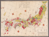
1864 | over 6 years ago | 3 control points |
|
この地図の作成に当たっては、国土地理院長の承認を得て、同院発行の20万分の1地勢図及び5万分の1地形図を使用した。(承認番号 平30情使、 第1148号)
Links: Source / Biblio Ref
|
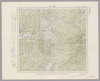
1946 | over 5 years ago | 4 control points |
|
Image from the Map Collections courtesy Stanford University Libraries, licensed under a Creative Commons Attribution-Noncommercial 3.0 Unported License. © Stanford University. 【図幅名】 本山 【測量時期】 明治39年測図/昭和8年修正 【発行時期】 昭和11年6月発行 【記号】 高知6号(共16面) 【測量機関】 大日本帝国陸地測量部 【備考】
Links: Source / Biblio Ref
|
about 2 years ago | 4 control points | |
|
Image from the Map Collections courtesy Stanford University Libraries, licensed under a Creative Commons Attribution-Noncommercial 3.0 Unported License. © Stanford University. 【図幅名】 本別 【測量時期】 大正9年測図 【発行時期】 大正11年8月発行 【記号】 帯広6号(共16面) 【測量機関】 大日本帝国陸地測量部 【備考】 (In 1 layer)
Links: Source / Biblio Ref
|
about 2 years ago | 4 control points | |
|
Image from the Map Collections courtesy Stanford University Libraries. This item is in the public domain. There are no restrictions on use.
【図幅名】 末廣嶽 【測量時期】 大正5年測圖 【発行時期】昭和11年 【記号】 新知島七号 【測量機関】 参謀本部 【その他】千島列島 陸地測量部 (In 1 layer)
Links: Source / Biblio Ref
|
1936 | over 1 year ago | 4 control points |
|
Image from the Map Collections courtesy Stanford University Libraries, licensed under a Creative Commons Attribution-Noncommercial 3.0 Unported License. © Stanford University. 【図幅名】 末吉 【測量時期】 明治34年測図/昭和7年第2回修正、測図の縮図/昭和10年部分修正 【発行時期】 昭和21年10月発行 【記号】 宮崎15号(共8面) 【測量機関】 内務省地理調査所 【備考】
Links: Source / Biblio Ref
|
about 4 years ago | 4 control points | |
|
Image from the Map Collections courtesy Stanford University Libraries, licensed under a Creative Commons Attribution-Noncommercial 3.0 Unported License. © Stanford University. 【図幅名】 木都賀 【測量時期】 明治32年測圖/昭和7年修正測圖 【発行時期】 【記号】 浜田十六号 【測量機関】 参謀本部 【備考】 祕
Links: Source / Biblio Ref
|
3 months ago | 4 control points | |
|
Image from the Map Collections courtesy Stanford University Libraries, licensed under a Creative Commons Attribution-Noncommercial 3.0 Unported License. © Stanford University. 【図幅名】 木次 【測量時期】 明治32年測図/昭和7年修正 【発行時期】 昭和10年6月発行 【記号】 浜田1号(共15面) 【測量機関】 大日本帝国陸地測量部 【備考】
Links: Source / Biblio Ref
|
about 2 years ago | 4 control points | |
|
この地図の作成に当たっては、国土地理院長の承認を得て、同院発行の20万分の1地勢図及び5万分の1地形図を使用した。(承認番号 平30情使、 第1148号)
Links: Source / Biblio Ref
|
1948 | about 2 years ago | 4 control points |
|
Image from the Map Collections courtesy Stanford University Libraries, licensed under a Creative Commons Attribution-Noncommercial 3.0 Unported License. © Stanford University. 【図幅名】 早田 【測量時期】 明治44年測図/昭和8年要部修正 【発行時期】 昭和11年5月発行 【記号】 木本9号(共3面) 【測量機関】 大日本帝国陸地測量部 【備考】
Links: Source / Biblio Ref
|
about 2 years ago | 4 control points | |
|
【最初期発行】 この地図の作成に当たっては、国土地理院長の承認を得て、同院発行の20万分の1地勢図及び5万分の1地形図を使用した。(承認番号 平30情使、 第1148号)
Links: Source / Biblio Ref
|
1915 | over 5 years ago | 4 control points |
|
この地図の作成に当たっては、国土地理院長の承認を得て、同院発行の20万分の1地勢図及び5万分の1地形図を使用した。(承認番号 平30情使、 第1148号)
Links: Source / Biblio Ref
|
1947 | over 5 years ago | 4 control points |
|
Image from the Map Collections courtesy Stanford University Libraries, licensed under a Creative Commons Attribution-Noncommercial 3.0 Unported License. © Stanford University. 【図幅名】 木曽福島 【測量時期】 明治44年測図/昭和6年修正 【発行時期】 【記号】 飯田5号(共16面) 【測量機関】 内務省地理調査所 【備考】 秘
Links: Source / Biblio Ref
|
about 2 years ago | 4 control points | |
|
この地図の作成に当たっては、国土地理院長の承認を得て、同院発行の20万分の1地勢図及び5万分の1地形図を使用した。(承認番号 平30情使、 第1148号) (In 2 layers)
Links: Source / Biblio Ref
|
1947 | about 2 years ago | 4 control points |
|
Image from the Map Collections courtesy Stanford University Libraries, licensed under a Creative Commons Attribution-Noncommercial 3.0 Unported License. © Stanford University. 【図幅名】 【測量時期】 【発行時期】 【記号】 【測量機関】 【備考】 (In 1 layer)
Links: Source / Biblio Ref
|
over 4 years ago | 4 control points | |
|
この地図の作成に当たっては、国土地理院長の承認を得て、同院発行の20万分の1地勢図及び5万分の1地形図を使用した。(承認番号 平30情使、 第1148号)
Links: Source / Biblio Ref
|
1946 | over 5 years ago | 4 control points |
|
Image from the Map Collections courtesy Stanford University Libraries. This item is in the public domain. There are no restrictions on use.
【図幅名】 朝日灣【測量時期】 大正2年測圖 【発行時期】大正13年 【記号】 朝日灣十四号 【測量機関】 参謀本部 【その他】千島列島 陸地測量部 (In 1 layer)
Links: Source / Biblio Ref
|
1924 | over 1 year ago | 4 control points |
|
Image from the Map Collections courtesy Stanford University Libraries, licensed under a Creative Commons Attribution-Noncommercial 3.0 Unported License. © Stanford University.
Links: Source / Biblio Ref
|
over 6 years ago | 4 control points | |
|
Image from the Map Collections courtesy Stanford University Libraries, licensed under a Creative Commons Attribution-Noncommercial 3.0 Unported License. © Stanford University. 【図幅名】 朝日岳 【測量時期】 大正2年測図/昭和6年部分修正 【発行時期】 昭和8年9月発行 【記号】 村上3号(共12面) 【測量機関】 大日本帝国陸地測量部 【備考】
Links: Source / Biblio Ref
|
about 2 years ago | 4 control points | |
|
Image from the Map Collections courtesy Stanford University Libraries, licensed under a Creative Commons Attribution-Noncommercial 3.0 Unported License. © Stanford University. 【図幅名】 有川 【測量時期】 明治33年測図/大正13年測図、昭和13年測図の縮図/昭和11年修正、測図の縮図 【発行時期】 昭和21年11月発行 【記号】 長崎15号(共15面) 【測量機関】 地理調査所 【備考】
Links: Source / Biblio Ref
|
about 4 years ago | 4 control points | |
|
Image from the Map Collections courtesy Stanford University Libraries, licensed under a Creative Commons Attribution-Noncommercial 3.0 Unported License. © Stanford University. 【図幅名】 東茂住 【測量時期】 大正1年測図/昭和5年部分修正 【発行時期】 昭和7年10月発行 【記号】 高山10号(共16面) 【測量機関】 大日本帝国陸地測量部 【備考】
Links: Source / Biblio Ref
|
about 2 years ago | 4 control points | |
|
Image from the Map Collections courtesy Stanford University Libraries, licensed under a Creative Commons Attribution-Noncommercial 3.0 Unported License. © Stanford University. 【図幅名】 月形 【測量時期】 大正5年測図/昭和10年鉄道補入 【発行時期】 昭和11年2月発行 【記号】 留萌8号(共11面) 【測量機関】 大日本帝国陸地測量部 【備考】 (In 1 layer)
Links: Source / Biblio Ref
|
about 2 years ago | 4 control points | |
|
Image from the Map Collections courtesy Stanford University Libraries, licensed under a Creative Commons Attribution-Noncommercial 3.0 Unported License. © Stanford University. 【図幅名】 月山 【測量時期】 明治43年測図/昭和6年要部修正 【発行時期】 昭和8年3月発行 【記号】 仙台13号(共16面) 【測量機関】 大日本帝国陸地測量部 【備考】
Links: Source / Biblio Ref
|
about 2 years ago | 4 control points | |
|
Image from the Map Collections courtesy Stanford University Libraries, licensed under a Creative Commons Attribution-Noncommercial 3.0 Unported License. © Stanford University. 【図幅名】 智頭 【測量時期】 明治31年測図/昭和7年要部修正 【発行時期】 昭和9年7月発行 【記号】 姫路13号 【測量機関】 大日本帝国陸地測量部 【備考】
Links: Source / Biblio Ref
|
3 months ago | 4 control points | |
|
この地図の作成に当たっては、国土地理院長の承認を得て、同院発行の20万分の1地勢図及び5万分の1地形図を使用した。(承認番号 平30情使、 第1148号)
Links: Source / Biblio Ref
|
1946 | over 5 years ago | 4 control points |
|
Image from the Map Collections courtesy Stanford University Libraries. This item is in the public domain. There are no restrictions on use.
【図幅名】 春牟古丹島西部【測量時期】 大正5年測圖 【発行時期】昭和11年 【記号】 捨子古丹島十号 【測量機関】 参謀本部 【その他】千島列島 陸地測量部
Links: Source / Biblio Ref
|
1936 | over 1 year ago | 4 control points |
|
Image from the Map Collections courtesy Stanford University Libraries. This item is in the public domain. There are no restrictions on use.
【図幅名】 春牟古丹島東部【測量時期】 大正5年測圖 【発行時期】昭和11年 【記号】 捨子古丹島六号 【測量機関】 参謀本部 【その他】千島列島 陸地測量部
Links: Source / Biblio Ref
|
1936 | over 1 year ago | 4 control points |
|
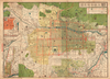
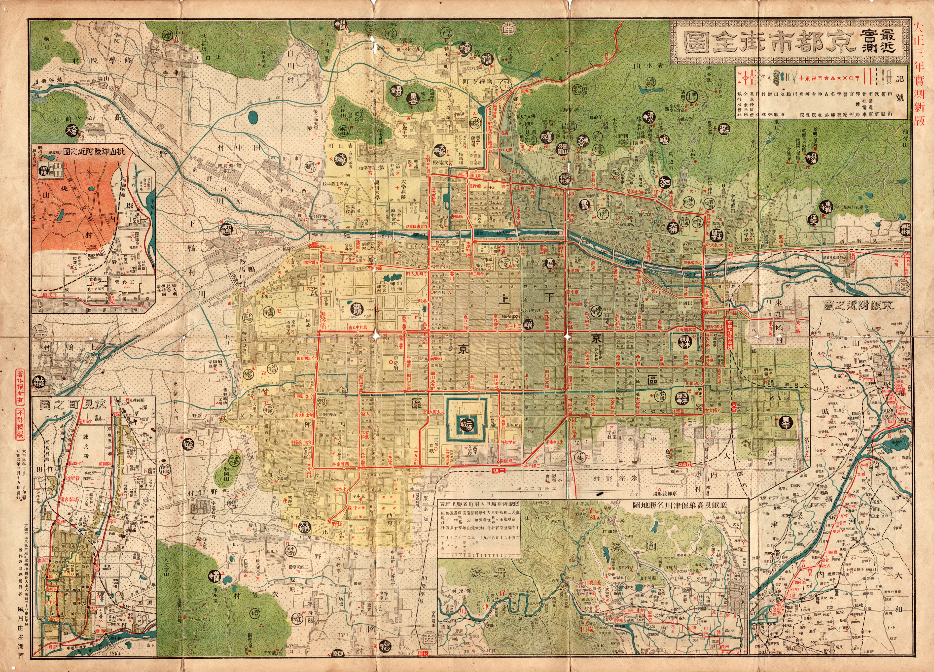
京都市の古地図
Links: Source / Biblio Ref
|
2017 | about 3 years ago | 5 control points |
|
この地図の作成に当たっては、国土地理院長の承認を得て、同院発行の20万分の1地勢図及び5万分の1地形図を使用した。(承認番号 平30情使、 第1148号)
Links: Source / Biblio Ref
|
1947 | over 5 years ago | 4 control points |
|
shelfmark: Maps 5.c.45
License: Public Domain
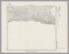
明治9 *銅板。多色刷り。朱印「定價金貳圓」。 Copperplate. Acquired 21 December 1878.
Links: Source / Biblio Ref
|
1876 | about 1 year ago | 53 control points |
|
「札幌沿革史」札幌史学会 明治30所載図を拡大印刷したもの。
Links: Source / Biblio Ref
|
1897 | almost 3 years ago | 4 control points |
|
Image from the Map Collections courtesy Stanford University Libraries, licensed under a Creative Commons Attribution-Noncommercial 3.0 Unported License. © Stanford University. 【図幅名】 明知 【測量時期】 明治24年測図/昭和3年要部修正 【発行時期】 昭和6年2月発行 【記号】 豊橋9号(共16面) 【測量機関】 大日本帝国陸地測量部 【備考】
Links: Source / Biblio Ref
|
about 2 years ago | 4 control points | |
|
Image from the Map Collections courtesy Stanford University Libraries, licensed under a Creative Commons Attribution-Noncommercial 3.0 Unported License. © Stanford University. 【図幅名】 昆布森 【測量時期】 大正11年測図/昭和19年部分修正 【発行時期】 昭和21年11月発行 【記号】 釧路7号(共12面) 【測量機関】 内務省地理調査所 【備考】 仮製版 (In 1 layer)
Links: Source / Biblio Ref
|
about 2 years ago | 4 control points | |
|
Image from the Map Collections courtesy Stanford University Libraries, licensed under a Creative Commons Attribution-Noncommercial 3.0 Unported License. © Stanford University.
Links: Source / Biblio Ref
|
over 6 years ago | 4 control points | |
|
Image from the Map Collections courtesy Stanford University Libraries, licensed under a Creative Commons Attribution-Noncommercial 3.0 Unported License. © Stanford University. 【図幅名】 旭川 【測量時期】 大正5年測図/昭和6年鉄道補入 【発行時期】 昭和7年8月発行 【記号】 旭川10号(共16面) 【測量機関】 大日本帝国陸地測量部 【備考】 (In 1 layer)
Links: Source / Biblio Ref
|
3 months ago | 4 control points | |
|
【最初期発行】 この地図の作成に当たっては、国土地理院長の承認を得て、同院発行の20万分の1地勢図及び5万分の1地形図を使用した。(承認番号 平30情使、 第1148号) (In 1 layer)
Links: Source / Biblio Ref
|
1927 | over 2 years ago | 4 control points |
|
Image from the Map Collections courtesy Stanford University Libraries, licensed under a Creative Commons Attribution-Noncommercial 3.0 Unported License. © Stanford University. 【図幅名】 旭岳 【測量時期】 大正10年測図 【発行時期】 大正13年3月発行 【記号】 旭川3号(共16面) 【測量機関】 大日本帝国陸地測量部 【備考】 (In 1 layer)
Links: Source / Biblio Ref
|
about 2 years ago | 4 control points | |
|
Image from the Map Collections courtesy Stanford University Libraries, licensed under a Creative Commons Attribution-Noncommercial 3.0 Unported License. © Stanford University. 【図幅名】 速池峰山 【測量時期】 大正5年測図/昭和6年鉄道補入 【発行時期】 昭和8年1月発行 【記号】 盛岡11号(共18面) 【測量機関】 大日本帝国陸地測量部 【備考】
Links: Source / Biblio Ref
|
about 2 years ago | 4 control points | |
|
Image from the Map Collections courtesy Stanford University Libraries, licensed under a Creative Commons Attribution-Noncommercial 3.0 Unported License. © Stanford University. 【図幅名】 早来 【測量時期】 大正8年測圖/昭和10年修正測圖 【発行時期】 【記号】 札幌四号 【測量機関】 参謀本部 【備考】 祕 (In 1 layer)
Links: Source / Biblio Ref
|
about 2 years ago | 4 control points | |
|
Image from the Map Collections courtesy Stanford University Libraries, licensed under a Creative Commons Attribution-Noncommercial 3.0 Unported License. © Stanford University. 【図幅名】 早岐 【測量時期】 明治34年測図の縮図/大正14年修正、測図の縮図/昭和7年部分修正、測図の縮図 【発行時期】 昭和21年10月発行 【記号】 長崎2号(共15面) 【測量機関】 内務省地理調査所 【備考】
Links: Source / Biblio Ref
|
about 4 years ago | 4 control points | |

|
旧川崎地区明細地図 川崎市 1958年度版 川崎市経済地図 P.33「小川町・南町」をもとに作図
|
1958 | about 4 years ago | 5 control points |
|
旧川崎地区明細地図 川崎市 1958年度版 川崎市経済地図P.33「小川町・南町」をもとに作図
|
1958 | about 4 years ago | 11 control points |
|
Image from the Map Collections courtesy Stanford University Libraries, licensed under a Creative Commons Attribution-Noncommercial 3.0 Unported License. © Stanford University. 【図幅名】 右左府 【測量時期】 大正8年測圖 【発行時期】 【記号】 夕張岳十一号 【測量機関】 参謀本部 【備考】 祕 (In 1 layer)
Links: Source / Biblio Ref
|
about 2 years ago | 4 control points | |
|
Image from the Map Collections courtesy Stanford University Libraries, licensed under a Creative Commons Attribution-Noncommercial 3.0 Unported License. © Stanford University. 【図幅名】 日詰 【測量時期】 大正1年測図 【発行時期】 大正5年3月発行 【記号】 盛岡15号(共18面) 【測量機関】 大日本帝国陸地測量部 【備考】
Links: Source / Biblio Ref
|
about 2 years ago | 4 control points | |
|
Image from the Map Collections courtesy Stanford University Libraries, licensed under a Creative Commons Attribution-Noncommercial 3.0 Unported License. © Stanford University. 【図幅名】 【測量時期】 【発行時期】 【記号】 【測量機関】 【備考】 (In 1 layer)
Links: Source / Biblio Ref
|
about 2 years ago | 10 control points | |
|
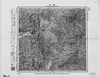
Image from the Map Collections courtesy Stanford University Libraries, licensed under a Creative Commons Attribution-Noncommercial 3.0 Unported License. © Stanford University. 【図幅名】 日田 【測量時期】 明治33年測圖/昭和2年要部修正測圖/昭和6年部分修正測圖/昭和7年鐡道補入 【発行時期】 【記号】 熊本一号 【測量機関】 参謀本部 【備考】 祕
Links: Source / Biblio Ref
|
about 4 years ago | 4 control points | |
|
Image from the Map Collections courtesy Stanford University Libraries, licensed under a Creative Commons Attribution-Noncommercial 3.0 Unported License. © Stanford University. 【図幅名】 日比原 【測量時期】 明治39年測図/昭和8年修正 【発行時期】 昭和11年6月発行 【記号】 高知10号(共16面) 【測量機関】 大日本帝国陸地測量部 【備考】
Links: Source / Biblio Ref
|
about 2 years ago | 4 control points | |
|
shelfmark: Maps 62980.20
License: Public Domain
文久2 *多色刷り。天保15序。(刊記書肆)文久二壬戌年十二月/発行書林/江戸、山城屋佐兵衛/京都、越後屋治兵衛/大阪、加賀屋善蔵・藤屋徳兵衛・伊丹屋善兵衛・河内屋太助・河内屋吉兵衛・河内屋喜兵衛。 Xylograph.
Links: Source / Biblio Ref
|
1862 | almost 4 years ago | 27 control points |