Browse Maps
| map | Title | Year  |
Last Updated | Status |
|---|---|---|---|---|
|
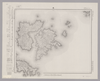
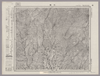
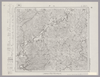
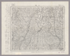
Image from the Map Collections courtesy Stanford University Libraries, licensed under a Creative Commons Attribution-Noncommercial 3.0 Unported License. © Stanford University. 【図幅名】 菱 【測量時期】 大正1年測図/昭和9年修正/昭和28年応急修正 【発行時期】 昭和34年8月発行 【記号】 西郷16号(共4面) 【測量機関】 国土地理院 【備考】 応急修正版
Links: Source / Biblio Ref
|
over 5 years ago | 4 control points | |
|
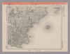
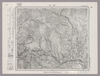
Image from the Map Collections courtesy Stanford University Libraries, licensed under a Creative Commons Attribution-Noncommercial 3.0 Unported License. © Stanford University. 【図幅名】 有川 【測量時期】 明治33年測図/大正13年測図、昭和13年測図の縮図/昭和11年修正、測図の縮図 【発行時期】 昭和21年11月発行 【記号】 長崎15号(共15面) 【測量機関】 地理調査所 【備考】
Links: Source / Biblio Ref
|
about 4 years ago | 4 control points | |
|
Image from the Map Collections courtesy Stanford University Libraries, licensed under a Creative Commons Attribution-Noncommercial 3.0 Unported License. © Stanford University. 【図幅名】 【測量時期】 【発行時期】 【記号】 【測量機関】 【備考】
Links: Source / Biblio Ref
|
about 2 years ago | 4 control points | |
|
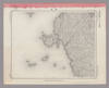
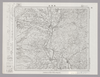
Image from the Map Collections courtesy Stanford University Libraries, licensed under a Creative Commons Attribution-Noncommercial 3.0 Unported License. © Stanford University. 【図幅名】 神浦 【測量時期】 明治34年測図/大正13年修正/昭和20年部分修正 【発行時期】 昭和23年4月発行 【記号】 長崎7号(共15面) 【測量機関】 地理調査所 【備考】
Links: Source / Biblio Ref
|
about 4 years ago | 4 control points | |
|
Image from the Map Collections courtesy Stanford University Libraries, licensed under a Creative Commons Attribution-Noncommercial 3.0 Unported License. © Stanford University. 【図幅名】 熱塩 【測量時期】 大正2年測図/昭和6年要部修正、測図の縮図 【発行時期】 昭和9年4月発行 【記号】 新潟2号 【測量機関】 大日本帝国陸地測量部 【備考】
Links: Source / Biblio Ref
|
about 2 years ago | 4 control points | |
|
Image from the Map Collections courtesy Stanford University Libraries, licensed under a Creative Commons Attribution-Noncommercial 3.0 Unported License. © Stanford University. 【図幅名】 鹿部 【測量時期】 大正4年測圖 【発行時期】 【記号】 室蘭四号 【測量機関】 参謀本部 【備考】 祕 (In 1 layer)
Links: Source / Biblio Ref
|
about 2 years ago | 4 control points | |
|
Image from the Map Collections courtesy Stanford University Libraries, licensed under a Creative Commons Attribution-Noncommercial 3.0 Unported License. © Stanford University. 【図幅名】 狩太 【測量時期】 大正6年測圖 【発行時期】 【記号】 岩内八号 【測量機関】 参謀本部 【備考】 祕 (In 1 layer)
Links: Source / Biblio Ref
|
about 2 years ago | 4 control points | |
|
Image from the Map Collections courtesy Stanford University Libraries, licensed under a Creative Commons Attribution-Noncommercial 3.0 Unported License. © Stanford University.
Links: Source / Biblio Ref
|
over 6 years ago | 4 control points | |
|
Image from the Map Collections courtesy Stanford University Libraries, licensed under a Creative Commons Attribution-Noncommercial 3.0 Unported License. © Stanford University. 【図幅名】 津幡 【測量時期】 明治42年測図/昭和5年修正 【発行時期】 昭和8年8月発行 【記号】 七尾8号(共7面) 【測量機関】 大日本帝国陸地測量部 【備考】 (In 1 layer)
Links: Source / Biblio Ref
|
about 2 years ago | 4 control points | |
|
Image from the Map Collections courtesy Stanford University Libraries, licensed under a Creative Commons Attribution-Noncommercial 3.0 Unported License. © Stanford University. 【図幅名】 原町 【測量時期】 明治41年測図/昭和8年修正 【発行時期】 昭和22年4月発行 【記号】 福島3号(共18面) 【測量機関】 内務省地理調査所 【備考】
Links: Source / Biblio Ref
|
about 2 years ago | 4 control points | |
|
Image from the Map Collections courtesy Stanford University Libraries, licensed under a Creative Commons Attribution-Noncommercial 3.0 Unported License. © Stanford University. 【図幅名】 戸隠 【測量時期】 大正1年測図/昭和6年修正 【発行時期】 【記号】 高田16号(共15面) 【測量機関】 参謀本部 【備考】 秘
Links: Source / Biblio Ref
|
about 2 years ago | 4 control points | |
|
Image from the Map Collections courtesy Stanford University Libraries, licensed under a Creative Commons Attribution-Noncommercial 3.0 Unported License. © Stanford University. 【図幅名】 新潟 【測量時期】 明治44年測図/昭和6年要部修正 【発行時期】 昭和9年6月発行 【記号】 新潟13号(共16面) 【測量機関】 大日本帝国陸地測量部 【備考】
Links: Source / Biblio Ref
|
almost 4 years ago | 13 control points | |
|
Image from the Map Collections courtesy Stanford University Libraries, licensed under a Creative Commons Attribution-Noncommercial 3.0 Unported License. © Stanford University. 【図幅名】 笹川 【測量時期】 大正2年測図/昭和9年修正 【発行時期】 昭和11年4月発行 【記号】 村上10号(共12面) 【測量機関】 大日本帝国陸地測量部 【備考】
Links: Source / Biblio Ref
|
about 2 years ago | 4 control points | |
|
Image from the Map Collections courtesy Stanford University Libraries, licensed under a Creative Commons Attribution-Noncommercial 3.0 Unported License. © Stanford University. 【図幅名】 勝木 【測量時期】 大正2年測図/昭和9年部分修正 【発行時期】 昭和11年9月発行 【記号】 村上6号(共12面) 【測量機関】 大日本帝国陸地測量部 【備考】
Links: Source / Biblio Ref
|
about 2 years ago | 4 control points | |
|
Image from the Map Collections courtesy Stanford University Libraries, licensed under a Creative Commons Attribution-Noncommercial 3.0 Unported License. © Stanford University. 【図幅名】 関山峠 【測量時期】 明治34年測図/昭和6年修正 【発行時期】 昭和7年2月発行 【記号】 仙台6号(共16面) 【測量機関】 大日本帝国陸地測量部 【備考】
Links: Source / Biblio Ref
|
about 2 years ago | 4 control points | |
|
Image from the Map Collections courtesy Stanford University Libraries, licensed under a Creative Commons Attribution-Noncommercial 3.0 Unported License. © Stanford University. 【図幅名】 古川 【測量時期】 明治34年測図/昭和3年修正/昭和5年鉄道補入 【発行時期】 昭和7年1月発行 【記号】 仙台1号(共16面) 【測量機関】 大日本帝国陸地測量部 【備考】
Links: Source / Biblio Ref
|
about 2 years ago | 4 control points | |
|
Image from the Map Collections courtesy Stanford University Libraries, licensed under a Creative Commons Attribution-Noncommercial 3.0 Unported License. © Stanford University. 【図幅名】 石巻 【測量時期】 大正2年測図/昭和8年要部修正 【発行時期】 昭和11年1月発行 【記号】 石巻10号(共9面) 【測量機関】 大日本帝国陸地測量部 【備考】
Links: Source / Biblio Ref
|
about 2 years ago | 4 control points | |
|
Image from the Map Collections courtesy Stanford University Libraries, licensed under a Creative Commons Attribution-Noncommercial 3.0 Unported License. © Stanford University. 【図幅名】 西郷 【測量時期】 大正元年測圖/昭和9年測圖 【発行時期】 【記号】 西郷十一号 【測量機関】 参謀本部 【備考】 祕
Links: Source / Biblio Ref
|
over 5 years ago | 4 control points | |
|
Image from the Map Collections courtesy Stanford University Libraries, licensed under a Creative Commons Attribution-Noncommercial 3.0 Unported License. © Stanford University. 【図幅名】 薬来山 【測量時期】 明治34年測図/昭和6年修正 【発行時期】 昭和8年1月発行 【記号】 仙台5号(共16面) 【測量機関】 大日本帝国陸地測量部 【備考】
Links: Source / Biblio Ref
|
about 2 years ago | 4 control points | |
|
Image from the Map Collections courtesy Stanford University Libraries, licensed under a Creative Commons Attribution-Noncommercial 3.0 Unported License. © Stanford University. 【図幅名】 草津 【測量時期】 大正1年測図/昭和12年修正 【発行時期】 【記号】 長野5号(共16面) 【測量機関】 参謀本部 【備考】 秘
Links: Source / Biblio Ref
|
about 2 years ago | 4 control points | |
|
Image from the Map Collections courtesy Stanford University Libraries, licensed under a Creative Commons Attribution-Noncommercial 3.0 Unported License. © Stanford University. 【図幅名】 気仙沼 【測量時期】 大正2年測圖/昭和8年部分修正測圖 【発行時期】 昭和11年発行 【記号】 一関七号 【測量機関】 大日本帝國陸地測量部 【備考】
Links: Source / Biblio Ref
|
about 2 years ago | 4 control points | |
|
Image from the Map Collections courtesy Stanford University Libraries, licensed under a Creative Commons Attribution-Noncommercial 3.0 Unported License. © Stanford University. 【図幅名】 佐賀関 【測量時期】 明治36年測図/昭和2年第2回修正 【発行時期】 昭和21年9月発行 【記号】 大分1号(共16面) 【測量機関】 内務省地理調査所 【備考】
Links: Source / Biblio Ref
|
about 4 years ago | 4 control points | |
|
Image from the Map Collections courtesy Stanford University Libraries, licensed under a Creative Commons Attribution-Noncommercial 3.0 Unported License. © Stanford University. 【図幅名】 軽井沢 【測量時期】 大正1年測図/昭和12年修正 【発行時期】 【記号】 長野6号 【測量機関】 参謀本部 【備考】 秘 (In 1 layer)
Links: Source / Biblio Ref
|
about 2 years ago | 4 control points | |
|
Image from the Map Collections courtesy Stanford University Libraries, licensed under a Creative Commons Attribution-Noncommercial 3.0 Unported License. © Stanford University. 【図幅名】 稲庭 【測量時期】 大正2年測図/昭和9年修正 【発行時期】 昭和11年6月発行 【記号】 新庄6号(共16面) 【測量機関】 大日本帝国陸地測量部 【備考】
Links: Source / Biblio Ref
|
about 2 years ago | 4 control points | |
|
Image from the Map Collections courtesy Stanford University Libraries, licensed under a Creative Commons Attribution-Noncommercial 3.0 Unported License. © Stanford University. 【図幅名】 足尾 【測量時期】 明治40年測図/昭和4年要部修正 【発行時期】 【記号】 宇都宮9号 【測量機関】 参謀本部 【備考】 秘
Links: Source / Biblio Ref
|
about 2 years ago | 4 control points | |
|
Image from the Map Collections courtesy Stanford University Libraries, licensed under a Creative Commons Attribution-Noncommercial 3.0 Unported License. © Stanford University. 【図幅名】 ?崎 【測量時期】 大正5年測図 【発行時期】 大正7年6月発行 【記号】 盛岡3号東部(共18面) 【測量機関】 大日本帝国陸地測量部 【備考】
Links: Source / Biblio Ref
|
about 2 years ago | 4 control points | |
|
Image from the Map Collections courtesy Stanford University Libraries, licensed under a Creative Commons Attribution-Noncommercial 3.0 Unported License. © Stanford University. 【図幅名】 若柳 【測量時期】 大正2年測図/昭和8年修正 【発行時期】 昭和11年1月発行 【記号】 一関16号(共14面) 【測量機関】 大日本帝国陸地測量部 【備考】
Links: Source / Biblio Ref
|
about 2 years ago | 4 control points | |
|
Image from the Map Collections courtesy Stanford University Libraries, licensed under a Creative Commons Attribution-Noncommercial 3.0 Unported License. © Stanford University. 【図幅名】 土淵 【測量時期】 大正5年測図 【発行時期】 大正7年7月発行 【記号】 盛岡8号(共18面) 【測量機関】 大日本帝国陸地測量部 【備考】
Links: Source / Biblio Ref
|
about 2 years ago | 4 control points | |
|
Image from the Map Collections courtesy Stanford University Libraries, licensed under a Creative Commons Attribution-Noncommercial 3.0 Unported License. © Stanford University. 【図幅名】 三本木 【測量時期】 大正3年測図/昭和8年修正 【発行時期】 昭和11年2月発行 【記号】 八戸13号(共15面) 【測量機関】 大日本帝国陸地測量部 【備考】
Links: Source / Biblio Ref
|
about 2 years ago | 4 control points | |
|
Image from the Map Collections courtesy Stanford University Libraries, licensed under a Creative Commons Attribution-Noncommercial 3.0 Unported License. © Stanford University. 【図幅名】 綾里 【測量時期】 大正2年測図/昭和8年修正 【発行時期】 昭和11年1月発行 【記号】 一関2号(共14面) 【測量機関】 大日本帝国陸地測量部 【備考】
Links: Source / Biblio Ref
|
about 2 years ago | 4 control points | |
|
Image from the Map Collections courtesy Stanford University Libraries, licensed under a Creative Commons Attribution-Noncommercial 3.0 Unported License. © Stanford University. 【図幅名】 森岳 【測量時期】 大正1年測図 【発行時期】 大正4年10月発行 【記号】 弘前16号(共16面) 【測量機関】 大日本帝国陸地測量部 【備考】
Links: Source / Biblio Ref
|
over 4 years ago | 4 control points | |
|
Image from the Map Collections courtesy Stanford University Libraries, licensed under a Creative Commons Attribution-Noncommercial 3.0 Unported License. © Stanford University. 【図幅名】 本荘 【測量時期】 大正2年測図/大正14年鉄道補入 【発行時期】 大正15年11月発行 【記号】 秋田16号(共16面) 【測量機関】 大日本帝国陸地測量部 【備考】
Links: Source / Biblio Ref
|
over 5 years ago | 4 control points | |
|
Image from the Map Collections courtesy Stanford University Libraries, licensed under a Creative Commons Attribution-Noncommercial 3.0 Unported License. © Stanford University. 【図幅名】 青瀬 【測量時期】 明治34年測図/昭和11年修正 【発行時期】 【記号】 甑島6号 【測量機関】 参謀本部 【備考】 秘
Links: Source / Biblio Ref
|
about 4 years ago | 4 control points | |
|
Image from the Map Collections courtesy Stanford University Libraries, licensed under a Creative Commons Attribution-Noncommercial 3.0 Unported License. © Stanford University. 【図幅名】 浅舞 【測量時期】 大正2年測図/昭和9年修正 【発行時期】 昭和11年11月発行 【記号】 新庄9号(共16面) 【測量機関】 大日本帝国陸地測量部 【備考】
Links: Source / Biblio Ref
|
about 2 years ago | 4 control points | |
|
Image from the Map Collections courtesy Stanford University Libraries, licensed under a Creative Commons Attribution-Noncommercial 3.0 Unported License. © Stanford University. 【図幅名】 金木 【測量時期】 大正1年測図の縮図/昭和14年修正、測図の縮図 【発行時期】 昭和17年5月発行 【記号】 青森11号 【測量機関】 大日本帝国陸地測量部 【備考】
Links: Source / Biblio Ref
|
about 2 years ago | 4 control points | |
|
Image from the Map Collections courtesy Stanford University Libraries, licensed under a Creative Commons Attribution-Noncommercial 3.0 Unported License. © Stanford University. 【図幅名】 大館 【測量時期】 大正3年測図/昭和14年鉄道補入 【発行時期】 昭和2年2月発行 【記号】 弘前7号(共16面) 【測量機関】 大日本帝国陸地測量部 【備考】
Links: Source / Biblio Ref
|
about 2 years ago | 4 control points | |
|
Image from the Map Collections courtesy Stanford University Libraries, licensed under a Creative Commons Attribution-Noncommercial 3.0 Unported License. © Stanford University. 【図幅名】 三戸 【測量時期】 大正3年測圖 【発行時期】 大正6年発行 【記号】 八戸十号 【測量機関】 大日本帝國陸地測量部 【備考】
Links: Source / Biblio Ref
|
about 2 years ago | 4 control points | |
|
Image from the Map Collections courtesy Stanford University Libraries, licensed under a Creative Commons Attribution-Noncommercial 3.0 Unported License. © Stanford University. 【図幅名】 雫石 【測量時期】 明治44年測図の縮図/大正1年測量/昭和14年修正、測図の縮図 【発行時期】 昭和16年5月発行 【記号】 秋田2号(共16面) 【測量機関】 大日本帝国陸地測量部 【備考】
Links: Source / Biblio Ref
|
about 2 years ago | 4 control points | |
|
Image from the Map Collections courtesy Stanford University Libraries, licensed under a Creative Commons Attribution-Noncommercial 3.0 Unported License. © Stanford University. 【図幅名】 追貝 【測量時期】 大正1年測図/昭和33年要部修正 【発行時期】 昭和35年4月発行 【記号】 日光16号 【測量機関】 国土地理院 【備考】
Links: Source / Biblio Ref
|
about 2 years ago | 4 control points | |
|
Image from the Map Collections courtesy Stanford University Libraries, licensed under a Creative Commons Attribution-Noncommercial 3.0 Unported License. © Stanford University. 【図幅名】 黒沢尻 【測量時期】 大正2年測図/昭和8年修正 【発行時期】 昭和11年2月発行 【記号】 一関13号(共14面) 【測量機関】 大日本帝国陸地測量部 【備考】
Links: Source / Biblio Ref
|
about 2 years ago | 4 control points | |
|
Image from the Map Collections courtesy Stanford University Libraries, licensed under a Creative Commons Attribution-Noncommercial 3.0 Unported License. © Stanford University. 【図幅名】 戸賀 【測量時期】 大正1年測図/昭和14年修正 【発行時期】 昭和16年1月発行 【記号】 男鹿島5号(共2面) 【測量機関】 大日本帝国陸地測量部 【備考】
Links: Source / Biblio Ref
|
over 5 years ago | 4 control points | |
|
Image from the Map Collections courtesy Stanford University Libraries, licensed under a Creative Commons Attribution-Noncommercial 3.0 Unported License. © Stanford University. 【図幅名】 青森西部 【測量時期】 大正1年測図の縮図/昭和14年修正、測図の縮図 【発行時期】 昭和21年11月発行 【記号】 青森8号 【測量機関】 内務省地理調査所 【備考】
Links: Source / Biblio Ref
|
about 2 years ago | 4 control points | |
|
Image from the Map Collections courtesy Stanford University Libraries, licensed under a Creative Commons Attribution-Noncommercial 3.0 Unported License. © Stanford University. 【図幅名】 外山 【測量時期】 大正5年測図/昭和4年鉄道補入 【発行時期】 昭和6年8月発行 【記号】 盛岡10号(共18面) 【測量機関】 大日本帝国陸地測量部 【備考】
Links: Source / Biblio Ref
|
about 2 years ago | 4 control points | |
|
Image from the Map Collections courtesy Stanford University Libraries, licensed under a Creative Commons Attribution-Noncommercial 3.0 Unported License. © Stanford University. 【図幅名】 相沼内 【測量時期】 大正6年測圖 【発行時期】 【記号】 室蘭十六号 【測量機関】 参謀本部 【備考】 祕
Links: Source / Biblio Ref
|
about 2 years ago | 4 control points | |
|
Image from the Map Collections courtesy Stanford University Libraries, licensed under a Creative Commons Attribution-Noncommercial 3.0 Unported License. © Stanford University. 【図幅名】 八尾 【測量時期】 明治44年測図/昭和5年修正/昭和28年応急修正 【発行時期】 昭和32年10月発行 【記号】 高山13号(共16面) 【測量機関】 国土地理院 【備考】 (In 1 layer)
Links: Source / Biblio Ref
|
about 2 years ago | 4 control points | |
|
Image from the Map Collections courtesy Stanford University Libraries, licensed under a Creative Commons Attribution-Noncommercial 3.0 Unported License. © Stanford University. 【図幅名】 【測量時期】 【発行時期】 【記号】 【測量機関】 【備考】
Links: Source / Biblio Ref
|
about 2 years ago | 4 control points | |
|
Image from the Map Collections courtesy Stanford University Libraries, licensed under a Creative Commons Attribution-Noncommercial 3.0 Unported License. © Stanford University. 【図幅名】 大朝 【測量時期】 明治32年測図/昭和7年修正 【発行時期】 昭和10年5月発行 【記号】 浜田12号(共15面) 【測量機関】 大日本帝国陸地測量部 【備考】
Links: Source / Biblio Ref
|
3 months ago | 4 control points | |
|
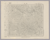
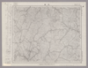
Owned by 立命館大学アート・リサーチセンター 【成立・出版年】
Links: Source / Biblio Ref
|
over 4 years ago | 9 control points | |
|
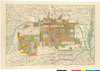
shelfmark: Maps 149.e.221
License: Public Domain
江戸後期写 *寛政6序刊図写。 Manuscript, early 19th century. Acquired 22 July 1868. Ex-Siebold. Copy of a map published in 1794.
Links: Source / Biblio Ref
|
about 3 years ago | 15 control points | |
|
Image from the Map Collections courtesy Stanford University Libraries, licensed under a Creative Commons Attribution-Noncommercial 3.0 Unported License. © Stanford University. 【図幅名】 桜谷 【測量時期】 明治40年測図/昭和8年修正 【発行時期】 昭和11年9月発行 【記号】 剣山10号(共11面) 【測量機関】 大日本帝国陸地測量部 【備考】
Links: Source / Biblio Ref
|
about 2 years ago | 4 control points |