Browse Maps
| map | Title  |
Year | Last Updated | Status |
|---|---|---|---|---|
|
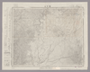
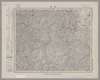
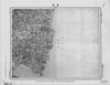
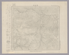
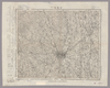
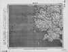
Image from the Map Collections courtesy Stanford University Libraries, licensed under a Creative Commons Attribution-Noncommercial 3.0 Unported License. © Stanford University. 【図幅名】 富士山 【測量時期】 明治21年測圖/昭和3年第二回修正測圖 【発行時期】 【記号】 甲府八号 【測量機関】 参謀本部 【備考】 祕
Links: Source / Biblio Ref
|
3 months ago | 4 control points | |
|
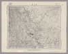
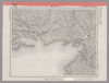
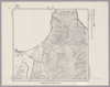
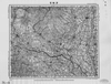
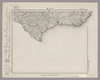
Image from the Map Collections courtesy Stanford University Libraries, licensed under a Creative Commons Attribution-Noncommercial 3.0 Unported License. © Stanford University. 【図幅名】 駿河大宮 【測量時期】 明治20年測図/昭和3年第2回修正 【発行時期】 昭和5年5月発行 【記号】 静岡5号(共15面) 【測量機関】 大日本帝国陸地測量部 【備考】
Links: Source / Biblio Ref
|
about 2 years ago | 4 control points | |
|
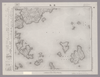
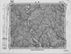
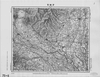
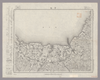
Image from the Map Collections courtesy Stanford University Libraries, licensed under a Creative Commons Attribution-Noncommercial 3.0 Unported License. © Stanford University. 【図幅名】 寄磯 【測量時期】 大正2年測図/昭和8年要部修正 【発行時期】 昭和10年10月発行 【記号】 石巻6号(共9面) 【測量機関】 大日本帝国陸地測量部 【備考】
Links: Source / Biblio Ref
|
about 2 years ago | 4 control points | |
|
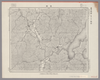
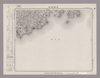
Image from the Map Collections courtesy Stanford University Libraries, licensed under a Creative Commons Attribution-Noncommercial 3.0 Unported License. © Stanford University. 【図幅名】 寄島 【測量時期】 明治34年測図/明治35年測図/大正14年測図/昭和3年第2回修正 【発行時期】 昭和5年8月発行 【記号】 岡山及丸亀6号(共16面) 【測量機関】 大日本帝国陸地測量部 【備考】
Links: Source / Biblio Ref
|
about 2 years ago | 4 control points | |
|
Image from the Map Collections courtesy Stanford University Libraries, licensed under a Creative Commons Attribution-Noncommercial 3.0 Unported License. © Stanford University. 【図幅名】 寄居 【測量時期】 明治40年測図/昭和4年修正/昭和9年要部修正/昭和14年部分修正 【発行時期】 昭和15年8月発行 【記号】 宇都宮16号 【測量機関】 大日本帝国陸地測量部 【備考】 (In 1 layer)
Links: Source / Biblio Ref
|
3 months ago | 4 control points | |
|
Image from the Map Collections courtesy Stanford University Libraries, licensed under a Creative Commons Attribution-Noncommercial 3.0 Unported License. © Stanford University. 【図幅名】 宿毛 【測量時期】 明治37年測図/昭和8年修正 【発行時期】 昭和17年12月発行 【記号】 宇和島7号 【測量機関】 大日本帝国陸地測量部 【備考】 (In 1 layer)
Links: Source / Biblio Ref
|
5 months ago | 4 control points | |
|
この地図の作成に当たっては、国土地理院長の承認を得て、同院発行の20万分の1地勢図及び5万分の1地形図を使用した。(承認番号 平30情使、 第1148号)
Links: Source / Biblio Ref
|
1946 | over 5 years ago | 4 control points |
|
Image from the Map Collections courtesy Stanford University Libraries, licensed under a Creative Commons Attribution-Noncommercial 3.0 Unported License. © Stanford University. 【図幅名】 宮津 【測量時期】 明治25年測図の縮図/昭和7年修正、測図の縮図/昭和25年応急修正 【発行時期】 昭和33年9月発行 【記号】 宮津15号(共12面) 【測量機関】 国土地理院 【備考】 応急修正版
Links: Source / Biblio Ref
|
about 2 years ago | 4 control points | |
|
【最初期発行】 この地図の作成に当たっては、国土地理院長の承認を得て、同院発行の20万分の1地勢図及び5万分の1地形図を使用した。(承認番号 平30情使、 第1148号) (In 1 layer)
Links: Source / Biblio Ref
|
1904 | about 4 years ago | 4 control points |
|
この地図の作成に当たっては、国土地理院長の承認を得て、同院発行の20万分の1地勢図及び5万分の1地形図を使用した。(承認番号 平30情使、 第1148号)
Links: Source / Biblio Ref
|
1947 | over 5 years ago | 4 control points |
|
Image from the Map Collections courtesy Stanford University Libraries, licensed under a Creative Commons Attribution-Noncommercial 3.0 Unported License. © Stanford University.
Links: Source / Biblio Ref
|
over 6 years ago | 4 control points | |
|
Image from the Map Collections courtesy Stanford University Libraries, licensed under a Creative Commons Attribution-Noncommercial 3.0 Unported License. © Stanford University. 【図幅名】 宮崎 【測量時期】 明治35年測圖/昭和7年修正測圖/昭和10年部分修正測圖 【発行時期】 【記号】 宮崎九号 【測量機関】 参謀本部 【備考】 祕
Links: Source / Biblio Ref
|
about 4 years ago | 4 control points | |
|
【最初期発行】 この地図の作成に当たっては、国土地理院長の承認を得て、同院発行の20万分の1地勢図及び5万分の1地形図を使用した。(承認番号 平30情使、 第1148号)
Links: Source / Biblio Ref
|
1913 | over 5 years ago | 4 control points |
|
Image from the Map Collections courtesy Stanford University Libraries, licensed under a Creative Commons Attribution-Noncommercial 3.0 Unported License. © Stanford University.
Links: Source / Biblio Ref
|
over 6 years ago | 4 control points | |

|
この地図の作成に当たっては、国土地理院長の承認を得て、同院発行の20万分の1地勢図及び5万分の1地形図を使用した。(承認番号 平30情使、 第1148号)
Links: Source / Biblio Ref
|
1946 | over 4 years ago | 4 control points |
|
Image from the Map Collections courtesy Stanford University Libraries, licensed under a Creative Commons Attribution-Noncommercial 3.0 Unported License. © Stanford University. 【図幅名】 宮原 【測量時期】 明治36年測圖/昭和2年要部修正測圖 【発行時期】 昭和4年発行 【記号】 大分十四号 【測量機関】 大日本帝國陸地測量部 【備考】
Links: Source / Biblio Ref
|
about 4 years ago | 4 control points | |
|
Image from the Map Collections courtesy Stanford University Libraries, licensed under a Creative Commons Attribution-Noncommercial 3.0 Unported License. © Stanford University. 【図幅名】 宮之城 【測量時期】 明治34年測圖/昭和7年要部修正測圖/昭和10年部分修正測圖 【発行時期】 【記号】 鹿児島九号 【測量機関】 参謀本部 【備考】 祕
Links: Source / Biblio Ref
|
about 4 years ago | 4 control points | |
|
Image from the Map Collections courtesy Stanford University Libraries, licensed under a Creative Commons Attribution-Noncommercial 3.0 Unported License. © Stanford University. 【図幅名】 宮下 【測量時期】 大正2年測図/昭和6年要部修正 【発行時期】 昭和8年10月発行 【記号】 新潟8号(共16面) 【測量機関】 大日本帝国陸地測量部 【備考】
Links: Source / Biblio Ref
|
about 2 years ago | 4 control points | |
|
Image from the Map Collections courtesy Stanford University Libraries, licensed under a Creative Commons Attribution-Noncommercial 3.0 Unported License. © Stanford University.
Links: Source / Biblio Ref
|
over 6 years ago | 4 control points | |
|
Image from the Map Collections courtesy Stanford University Libraries, licensed under a Creative Commons Attribution-Noncommercial 3.0 Unported License. © Stanford University. 【図幅名】 室蘭 【測量時期】 大正6年測図/昭和19年部分修正(空中写真測図) 【発行時期】 昭和21年11月発行 【記号】 室蘭3号(共14面) 【測量機関】 内務省地理調査所 【備考】 (In 1 layer)
Links: Source / Biblio Ref
|
over 5 years ago | 4 control points | |
|
【最初期発行】 この地図の作成に当たっては、国土地理院長の承認を得て、同院発行の20万分の1地勢図及び5万分の1地形図を使用した。(承認番号 平30情使、 第1148号) (In 1 layer)
Links: Source / Biblio Ref
|
1925 | over 2 years ago | 4 control points |
|
この地図の作成に当たっては、国土地理院長の承認を得て、同院発行の20万分の1地勢図及び5万分の1地形図を使用した。(承認番号 平30情使、 第1148号)
Links: Source / Biblio Ref
|
1947 | over 5 years ago | 4 control points |
|
Image from the Map Collections courtesy Stanford University Libraries, licensed under a Creative Commons Attribution-Noncommercial 3.0 Unported License. © Stanford University. 【図幅名】 室戸岬 【測量時期】 明治40年測圖/昭和8年修正測圖 【発行時期】 【記号】 剣山十六号南部 【測量機関】 参謀本部 【備考】 祕
Links: Source / Biblio Ref
|
about 2 years ago | 4 control points | |
|
Image from the Map Collections courtesy Stanford University Libraries, licensed under a Creative Commons Attribution-Noncommercial 3.0 Unported License. © Stanford University. 【図幅名】 宝立山 【測量時期】 明治43年測図/昭和9年修正 【発行時期】 昭和12年1月発行 【記号】 珠洲岬16号(共4面) 【測量機関】 大日本帝国陸地測量部 【備考】
Links: Source / Biblio Ref
|
about 2 years ago | 4 control points | |
|
shelfmark: Maps 38.c.211
License: Public Domain
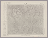
嘉永6 *多色刷り。存原外袋。(刊記)蔦屋吉蔵寿梓。刊年は外袋に「(安政改正)宝永御江戸絵図/地本草紙問屋東都紅英堂上梓」とあるによる。外袋に書名が「ほうえいおんえどゑず」と振ってある。 Xylograph. Edozu somokuroku, p.166.
Links: Source / Biblio Ref
|
1853 | almost 4 years ago | 12 control points |
|
Image from the Map Collections courtesy Stanford University Libraries, licensed under a Creative Commons Attribution-Noncommercial 3.0 Unported License. © Stanford University.
Links: Source / Biblio Ref
|
over 6 years ago | 4 control points | |
|
Image from the Map Collections courtesy Stanford University Libraries, licensed under a Creative Commons Attribution-Noncommercial 3.0 Unported License. © Stanford University. 【図幅名】 宝島 【測量時期】 昭和5年測圖(海上寫眞測量) 【発行時期】 昭和11年発行 【記号】 奄美大島要塞近傍四号 【測量機関】 陸地測量部・参謀本部 【備考】 軍事極祕(戦地ニ在りテハ軍事祕密トス) 假製版
Links: Source / Biblio Ref
|
3 months ago | 4 control points | |
|
Image from the Map Collections courtesy Stanford University Libraries, licensed under a Creative Commons Attribution-Noncommercial 3.0 Unported License. © Stanford University. 【図幅名】 小宝島 【測量時期】 昭和5年測圖(海上寫眞測量) 【発行時期】 昭和11年発行 【記号】 奄美大島要塞近傍三号 【測量機関】 陸地測量部・参謀本部 【備考】 軍事極祕(戦地ニ在りテハ軍事祕密トス) 假製版
Links: Source / Biblio Ref
|
3 months ago | 4 control points | |
|
この地図の作成に当たっては、国土地理院長の承認を得て、同院発行の20万分の1地勢図及び5万分の1地形図を使用した。(承認番号 平30情使、 第1148号)
Links: Source / Biblio Ref
|
1953 | over 5 years ago | 4 control points |
|
Image from the Map Collections courtesy Stanford University Libraries, licensed under a Creative Commons Attribution-Noncommercial 3.0 Unported License. © Stanford University. 【図幅名】 定山渓 【測量時期】 大正6年測圖/昭和10年修正測圖 【発行時期】 【記号】 札幌十五号 【測量機関】 参謀本部 【備考】 祕 (In 1 layer)
Links: Source / Biblio Ref
|
about 2 years ago | 4 control points | |
|
Image from the Map Collections courtesy Stanford University Libraries, licensed under a Creative Commons Attribution-Noncommercial 3.0 Unported License. © Stanford University. 【図幅名】 宗谷 【測量時期】 大正12年測図 【発行時期】 大正14年2月発行 【記号】 聲問近傍4号(共7面) 【測量機関】 陸地測量部・参謀本部 【備考】 宗谷4号(共7面) 仮製版 軍事極秘 (In 1 layer)
Links: Source / Biblio Ref
|
about 2 years ago | 4 control points | |
|
Image from the Map Collections courtesy Stanford University Libraries, licensed under a Creative Commons Attribution-Noncommercial 3.0 Unported License. © Stanford University. 【図幅名】 宗谷岬 【測量時期】 大正12年測図 【発行時期】 大正14年2月発行 【記号】 聲問近傍3号(共7面) 【測量機関】 陸地測量部・参謀本部 【備考】 宗谷3号(共7面) 仮製版 軍事極秘 (In 2 layers)
Links: Source / Biblio Ref
|
about 2 years ago | 4 control points | |
|
Image from the Map Collections courtesy Stanford University Libraries, licensed under a Creative Commons Attribution-Noncommercial 3.0 Unported License. © Stanford University. 【図幅名】 安芸 【測量時期】 明治40年測図/昭和8年修正 【発行時期】 昭和11年1月発行 【記号】 高知4号(共16面) 【測量機関】 大日本帝国陸地測量部 【備考】
Links: Source / Biblio Ref
|
about 2 years ago | 4 control points | |
|
Image from the Map Collections courtesy Stanford University Libraries, licensed under a Creative Commons Attribution-Noncommercial 3.0 Unported License. © Stanford University.
Links: Source / Biblio Ref
|
over 6 years ago | 4 control points | |
|
Image from the Map Collections courtesy Stanford University Libraries, licensed under a Creative Commons Attribution-Noncommercial 3.0 Unported License. © Stanford University. 【図幅名】 安波 【測量時期】 大正10年測圖 【発行時期】 大正12年発行 【記号】 沖縄郡島二号 【測量機関】 陸地測量部・参謀本部 【備考】 軍事極祕(戦地ニ在りテハ軍事祕密トス)
Links: Source / Biblio Ref
|
3 months ago | 4 control points | |
|
この地図の作成に当たっては、国土地理院長の承認を得て、同院発行の20万分の1地勢図及び5万分の1地形図を使用した。(承認番号 平30情使、 第1148号)
Links: Source / Biblio Ref
|
1946 | over 5 years ago | 4 control points |
|
Image from the Map Collections courtesy Stanford University Libraries, licensed under a Creative Commons Attribution-Noncommercial 3.0 Unported License. © Stanford University. 【図幅名】 守門岳 【測量時期】 明治44年測図/昭和6年要部修正、測図の縮図 【発行時期】 昭和9年3月発行 【記号】 新潟16号(共16面) 【測量機関】 大日本帝国陸地測量部 【備考】
Links: Source / Biblio Ref
|
almost 2 years ago | 4 control points | |
|
Image from the Map Collections courtesy Stanford University Libraries, licensed under a Creative Commons Attribution-Noncommercial 3.0 Unported License. © Stanford University. 【図幅名】 宇都宮 【測量時期】 明治40年測図/昭和4年第2回修正/昭和8年鉄道補入、測図の縮図 【発行時期】 昭和22年6月発行 【記号】 宇都宮1号(共16面) 【測量機関】 参謀本部 【備考】 (In 1 layer)
Links: Source / Biblio Ref
|
about 2 years ago | 4 control points | |
|
この地図の作成に当たっては、国土地理院長の承認を得て、同院発行の20万分の1地勢図及び5万分の1地形図を使用した。(承認番号 平30情使、 第1148号)
Links: Source / Biblio Ref
|
1945 | over 5 years ago | 4 control points |
|
【最初期発行】 この地図の作成に当たっては、国土地理院長の承認を得て、同院発行の20万分の1地勢図及び5万分の1地形図を使用した。(承認番号 平30情使、 第1148号) (In 1 layer)
Links: Source / Biblio Ref
|
1916 | about 4 years ago | 4 control points |
|
Image from the Map Collections courtesy Stanford University Libraries, licensed under a Creative Commons Attribution-Noncommercial 3.0 Unported License. © Stanford University. 【図幅名】 宇部東部 【測量時期】 明治32年測圖/昭和2年修正測圖 【発行時期】 【記号】 中津九号 【測量機関】 参謀本部 【備考】 祕
Links: Source / Biblio Ref
|
about 2 years ago | 4 control points | |
|
この地図の作成に当たっては、国土地理院長の承認を得て、同院発行の20万分の1地勢図及び5万分の1地形図を使用した。(承認番号 平30情使、 第1148号)
Links: Source / Biblio Ref
|
1946 | over 5 years ago | 4 control points |
|
Image from the Map Collections courtesy Stanford University Libraries, licensed under a Creative Commons Attribution-Noncommercial 3.0 Unported License. © Stanford University. 【図幅名】 ウトロ 【測量時期】 大正13年測圖/昭和11年部分修正測圖 【発行時期】 【記号】 網走四号 【測量機関】 参謀本部 【備考】 祕
Links: Source / Biblio Ref
|
about 2 years ago | 4 control points | |
|
Image from the Map Collections courtesy Stanford University Libraries. This item is in the public domain. There are no restrictions on use.
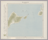
【図幅名】 宇志知島【測量時期】 大正6年測圖 【発行時期】昭和11年 【記号】 羅処和島三号 【測量機関】 参謀本部 【その他】千島列島 陸地測量部 (In 1 layer)
Links: Source / Biblio Ref
|
1936 | over 1 year ago | 4 control points |
|
Image from the Map Collections courtesy Stanford University Libraries, licensed under a Creative Commons Attribution-Noncommercial 3.0 Unported License. © Stanford University. 【図幅名】 宇和島 【測量時期】 明治37年測図/昭和8年修正 【発行時期】 昭和11年8月発行 【記号】 宇和島5号(共13面) 【測量機関】 大日本帝国陸地測量部 【備考】 (In 1 layer)
Links: Source / Biblio Ref
|
about 2 years ago | 4 control points | |
|
この地図の作成に当たっては、国土地理院長の承認を得て、同院発行の20万分の1地勢図及び5万分の1地形図を使用した。(承認番号 平30情使、 第1148号)
Links: Source / Biblio Ref
|
1947 | over 5 years ago | 4 control points |
|
【最初期発行】 この地図の作成に当たっては、国土地理院長の承認を得て、同院発行の20万分の1地勢図及び5万分の1地形図を使用した。(承認番号 平30情使、 第1148号)
Links: Source / Biblio Ref
|
1916 | over 5 years ago | 4 control points |
|
Image from the Map Collections courtesy Stanford University Libraries, licensed under a Creative Commons Attribution-Noncommercial 3.0 Unported License. © Stanford University. 【図幅名】 宇出津 【測量時期】 明治42年測図/昭和9年修正 【発行時期】 昭和11年11月発行 【記号】 富山13号(共11面) 【測量機関】 大日本帝国陸地測量部 【備考】
Links: Source / Biblio Ref
|
about 2 years ago | 4 control points | |
|
Image from the Map Collections courtesy Stanford University Libraries, licensed under a Creative Commons Attribution-Noncommercial 3.0 Unported License. © Stanford University. 【図幅名】 宇佐 【測量時期】 明治36年測圖/昭和2年修正測圖 【発行時期】 【記号】 中津十一号 【測量機関】 参謀本部 【備考】 祕
Links: Source / Biblio Ref
|
over 5 years ago | 4 control points | |
|
【最初期発行】 この地図の作成に当たっては、国土地理院長の承認を得て、同院発行の20万分の1地勢図及び5万分の1地形図を使用した。(承認番号 平30情使、 第1148号)
Links: Source / Biblio Ref
|
1935 | over 5 years ago | 4 control points |