Browse Maps
| map | Title  |
Year | Last Updated | Status |
|---|---|---|---|---|
|
Image from the Map Collections courtesy Stanford University Libraries, licensed under a Creative Commons Attribution-Noncommercial 3.0 Unported License. © Stanford University. 【図幅名】 大葛 【測量時期】 大正5年測図/昭和14年修正 【発行時期】 昭和22年2月発行 【記号】 弘前8号 【測量機関】 地理調査所 【備考】
Links: Source / Biblio Ref
|
about 2 years ago | 4 control points | |
|
Image from the Map Collections courtesy Stanford University Libraries, licensed under a Creative Commons Attribution-Noncommercial 3.0 Unported License. © Stanford University. 【図幅名】 大聖寺 【測量時期】 【発行時期】 【記号】 金沢11号(共13面) 【測量機関】 参謀本部 【備考】 秘 (In 1 layer)
Links: Source / Biblio Ref
|
about 2 years ago | 4 control points | |
|
Image from the Map Collections courtesy Stanford University Libraries, licensed under a Creative Commons Attribution-Noncommercial 3.0 Unported License. © Stanford University. 【図幅名】 津田 【測量時期】 明治32年測圖/昭和2年修正測圖 【発行時期】 【記号】 広島十四号 【測量機関】 参謀本部 【備考】 祕
Links: Source / Biblio Ref
|
3 months ago | 4 control points | |
|
Image from the Map Collections courtesy Stanford University Libraries, licensed under a Creative Commons Attribution-Noncommercial 3.0 Unported License. © Stanford University. 【図幅名】 大社 【測量時期】 明治32年測図/昭和9年第2回修正、測図の縮図 【発行時期】 【記号】 大社8号(共3面) 【測量機関】 参謀本部 【備考】 秘
Links: Source / Biblio Ref
|
about 2 years ago | 4 control points | |
|
【最初期発行】 この地図の作成に当たっては、国土地理院長の承認を得て、同院発行の20万分の1地勢図及び5万分の1地形図を使用した。(承認番号 平30情使、 第1148号)
Links: Source / Biblio Ref
|
1904 | over 5 years ago | 4 control points |
|
この地図の作成に当たっては、国土地理院長の承認を得て、同院発行の20万分の1地勢図及び5万分の1地形図を使用した。(承認番号 平30情使、 第1148号)
Links: Source / Biblio Ref
|
1947 | over 5 years ago | 4 control points |
|
Image from the Map Collections courtesy Stanford University Libraries, licensed under a Creative Commons Attribution-Noncommercial 3.0 Unported License. © Stanford University. 【図幅名】 大畑 【測量時期】 大正3年測図/昭和4年修正/昭和19年部分修正 【発行時期】 【記号】 尻屋崎16号(共4面) 【測量機関】 内務省地理調査所 【備考】
Links: Source / Biblio Ref
|
about 2 years ago | 4 control points | |
|
Image from the Map Collections courtesy Stanford University Libraries, licensed under a Creative Commons Attribution-Noncommercial 3.0 Unported License. © Stanford University. 【図幅名】 大町 【測量時期】 大正1年測図/昭和5年測図/昭和6年修正 【発行時期】 昭和8年7月発行 【記号】 高山1号(共16面) 【測量機関】 大日本帝国陸地測量部 【備考】
Links: Source / Biblio Ref
|
about 2 years ago | 4 control points | |
|
Image from the Map Collections courtesy Stanford University Libraries, licensed under a Creative Commons Attribution-Noncommercial 3.0 Unported License. © Stanford University. 【図幅名】 大田原 【測量時期】 明治42年測図/昭和4年修正 【発行時期】 昭和8年4月発行 【記号】 白河15号(共17面) 【測量機関】 大日本帝国陸地測量部 【備考】
Links: Source / Biblio Ref
|
about 2 years ago | 4 control points | |
|
この地図の作成に当たっては、国土地理院長の承認を得て、同院発行の20万分の1地勢図及び5万分の1地形図を使用した。(承認番号 平30情使、 第1148号)
Links: Source / Biblio Ref
|
1946 | over 5 years ago | 4 control points |
|
Image from the Map Collections courtesy Stanford University Libraries, licensed under a Creative Commons Attribution-Noncommercial 3.0 Unported License. © Stanford University. 【図幅名】 大甕 【測量時期】 明治41年測図/昭和8年修正 【発行時期】 昭和10年12月発行 【記号】 福島3号東部(共18面) 【測量機関】 大日本帝国陸地測量部 【備考】
Links: Source / Biblio Ref
|
3 months ago | 4 control points | |
|
Image from the Map Collections courtesy Stanford University Libraries, licensed under a Creative Commons Attribution-Noncommercial 3.0 Unported License. © Stanford University. 【図幅名】 大牟田 【測量時期】 明治34年測圖/大正15年第二回修正測圖/昭和6年鐡道補入 【発行時期】 【記号】 熊本十号 【測量機関】 参謀本部 【備考】 祕
Links: Source / Biblio Ref
|
about 4 years ago | 4 control points | |
|
この地図の作成に当たっては、国土地理院長の承認を得て、同院発行の20万分の1地勢図及び5万分の1地形図を使用した。(承認番号 平30情使、 第1148号)
Links: Source / Biblio Ref
|
1947 | about 1 year ago | 4 control points |
|
Image from the Map Collections courtesy Stanford University Libraries, licensed under a Creative Commons Attribution-Noncommercial 3.0 Unported License. © Stanford University. 【図幅名】 大洲 【測量時期】 明治37年測図/昭和8年修正 【発行時期】 昭和11年7月発行 【記号】 松山7号(共15面) 【測量機関】 大日本帝国陸地測量部 【備考】 (In 1 layer)
Links: Source / Biblio Ref
|
5 months ago | 4 control points | |
|
この地図の作成に当たっては、国土地理院長の承認を得て、同院発行の20万分の1地勢図及び5万分の1地形図を使用した。(承認番号 平30情使、 第1148号)
Links: Source / Biblio Ref
|
1947 | over 5 years ago | 4 control points |
|
この地図の作成に当たっては、国土地理院長の承認を得て、同院発行の20万分の1地勢図及び5万分の1地形図を使用した。(承認番号 平30情使、 第1148号)
Links: Source / Biblio Ref
|
1946 | over 5 years ago | 4 control points |
|
Image from the Map Collections courtesy Stanford University Libraries, licensed under a Creative Commons Attribution-Noncommercial 3.0 Unported License. © Stanford University. 【図幅名】 大河原 【測量時期】 明治43年測図/昭和5年修正 【発行時期】 【記号】 甲府15号(共16面) 【測量機関】 参謀本部 【備考】 秘
Links: Source / Biblio Ref
|
about 2 years ago | 4 control points | |
|
この地図の作成に当たっては、国土地理院長の承認を得て、同院発行の20万分の1地勢図及び5万分の1地形図を使用した。(承認番号 平30情使、 第1148号)
Links: Source / Biblio Ref
|
1946 | over 5 years ago | 4 control points |
|
Image from the Map Collections courtesy Stanford University Libraries, licensed under a Creative Commons Attribution-Noncommercial 3.0 Unported License. © Stanford University. 【図幅名】 大江山 【測量時期】 明治26年測図/大正9年修正/昭和2年鉄道補入 【発行時期】 【記号】 宮津16号 【測量機関】 参謀本部 【備考】 舞鶴要塞近傍9号(共10面) 軍事極秘
Links: Source / Biblio Ref
|
about 2 years ago | 4 control points | |
|
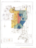
「新撰鯖江誌」より
出展:越前鯖江5万石 ふるさと史跡紹介(2002年 鯖江地区まちづくり推進協議会 発行)
Links: Source / Biblio Ref
|
1914 | about 4 years ago | 12 control points |
|
Image from the Map Collections courtesy Stanford University Libraries, licensed under a Creative Commons Attribution-Noncommercial 3.0 Unported License. © Stanford University. 【図幅名】 幸震 【測量時期】 大正9年測図/昭和5年部分修正 【発行時期】 昭和7年12月発行 【記号】 帯広16号(共16面) 【測量機関】 大日本帝国陸地測量部 【備考】 (In 1 layer)
Links: Source / Biblio Ref
|
about 2 years ago | 4 control points | |
|
Image from the Map Collections courtesy Stanford University Libraries, licensed under a Creative Commons Attribution-Noncommercial 3.0 Unported License. © Stanford University. 【図幅名】 大樹 【測量時期】 大正9年測圖/昭和8年鐡道補入 【発行時期】 【記号】 広尾十号 【測量機関】 参謀本部 【備考】 祕
Links: Source / Biblio Ref
|
about 2 years ago | 4 control points | |
|
Image from the Map Collections courtesy Stanford University Libraries, licensed under a Creative Commons Attribution-Noncommercial 3.0 Unported License. © Stanford University. 【図幅名】 【測量時期】 【発行時期】 【記号】 【測量機関】 【備考】
Links: Source / Biblio Ref
|
about 2 years ago | 4 control points | |
|
Image from the Map Collections courtesy Stanford University Libraries, licensed under a Creative Commons Attribution-Noncommercial 3.0 Unported License. © Stanford University. 【図幅名】 大楽毛 【測量時期】 大正11年測図/昭和3年鉄道補入 【発行時期】 昭和5年4月発行 【記号】 釧路10号(共12面) 【測量機関】 大日本帝国陸地測量部 【備考】 仮製版 (In 1 layer)
Links: Source / Biblio Ref
|
about 2 years ago | 4 control points | |
|
Image from the Map Collections courtesy Stanford University Libraries, licensed under a Creative Commons Attribution-Noncommercial 3.0 Unported License. © Stanford University. 【図幅名】 大根占 【測量時期】 明治34年測図/昭和7年要部修正/昭和10年部分修正/昭和20年部分修正/昭和24年資料修正 【発行時期】 昭和24年11月発行 【記号】 開聞岳1号(共7面) 【測量機関】 地理調査所 【備考】
Links: Source / Biblio Ref
|
about 4 years ago | 4 control points | |
|
Image from the Map Collections courtesy Stanford University Libraries, licensed under a Creative Commons Attribution-Noncommercial 3.0 Unported License. © Stanford University. 【図幅名】 大栃 【測量時期】 明治40年測図/昭和8年修正 【発行時期】 昭和11年6月発行 【記号】 高知2号(共16面) 【測量機関】 大日本帝国陸地測量部 【備考】
Links: Source / Biblio Ref
|
about 2 years ago | 4 control points | |
|
Image from the Map Collections courtesy Stanford University Libraries, licensed under a Creative Commons Attribution-Noncommercial 3.0 Unported License. © Stanford University.
Links: Source / Biblio Ref
|
over 6 years ago | 4 control points | |
|
Image from the Map Collections courtesy Stanford University Libraries, licensed under a Creative Commons Attribution-Noncommercial 3.0 Unported License. © Stanford University. 【図幅名】 大村 【測量時期】 明治34年測図/大正13年修正 【発行時期】 昭和21年11月発行 【記号】 長崎3号(共15面) 【測量機関】 内務省地理調査所 【備考】
Links: Source / Biblio Ref
|
about 4 years ago | 4 control points | |
|
Image from the Map Collections courtesy Stanford University Libraries, licensed under a Creative Commons Attribution-Noncommercial 3.0 Unported License. © Stanford University. 【図幅名】 大朝 【測量時期】 明治32年測図/昭和7年修正 【発行時期】 昭和10年5月発行 【記号】 浜田12号(共15面) 【測量機関】 大日本帝国陸地測量部 【備考】
Links: Source / Biblio Ref
|
3 months ago | 4 control points | |
|
Image from the Map Collections courtesy Stanford University Libraries, licensed under a Creative Commons Attribution-Noncommercial 3.0 Unported License. © Stanford University. 【図幅名】 大曲 【測量時期】 大正2年測図/昭和9年修正 【発行時期】 昭和11年12月発行 【記号】 秋田12号(共16面) 【測量機関】 大日本帝国陸地測量部 【備考】
Links: Source / Biblio Ref
|
4 months ago | 4 control points | |
|
shelfmark: Maps 62980.14
License: Public Domain
文化5 *多色刷り。刊記「浪華書籍師/藤屋弥兵衛・吉文字屋市左衛門」。外題「大日本細見指全図(改正増選)」。 Xylograph.
Links: Source / Biblio Ref
|
1808 | over 3 years ago | 25 control points |
|
shelfmark: Maps 62980.42
License: Public Domain
嘉永7 *多色刷り。「整軒玄魚図書」。外袋に「安政年製/。。。/文溪堂.文昇堂合梓」 Xylograph. Acquired 13 July 1903.
Links: Source / Biblio Ref
|
1854 | over 3 years ago | 23 control points |
|
shelfmark: Maps 38.b.164
License: Public Domain
明治5 *銅板。多色刷り。外題「(銅刻)大日本改正輿地全図」。北海道・樺太・千島列島等を含む。(刊記)免許文化八辛未年七月/再刻天保八丁酉年九月/三刻天保十四癸卯年九月/四刻慶応三丁卯八月/五刻明治五壬申年十一月銅刻/東京書肆玉養堂若林喜兵衛蔵板。(枠外)木村楊堂縮写並銅鐫。 Copperplate.
Links: Source / Biblio Ref
|
1872 | almost 4 years ago | 16 control points |
|
Owned by Sainsbury Institute for the Study of Japanese Arts and Cultures 【Atlas / Book Title】 【Engraver】 Yuki Masaaki 【Map Size】 161x150 cm 【Medium】 銅版画
Links: Source / Biblio Ref
|
1883 | almost 6 years ago | 7 control points |
|
shelfmark: Maps 38.b.166
License: Public Domain
明治10 *銅版。多色刷り。外題「(森琴石編輯)大日本九州一覧之図」。刊記「出版人/大阪、中川勘兵衛」。 Copperplate.
Links: Source / Biblio Ref
|
1877 | about 3 years ago | 17 control points |
|
Image from the Map Collections courtesy Stanford University Libraries, licensed under a Creative Commons Attribution-Noncommercial 3.0 Unported License. © Stanford University. 【図幅名】 大日岳 【測量時期】 大正2年測図/昭和6年要部修正 【発行時期】 【記号】 新潟6号 【測量機関】 参謀本部 【備考】 秘
Links: Source / Biblio Ref
|
about 2 years ago | 4 control points | |
|
Image from the Map Collections courtesy Stanford University Libraries, licensed under a Creative Commons Attribution-Noncommercial 3.0 Unported License. © Stanford University. 【図幅名】 大平山 【測量時期】 大正6年測図 【発行時期】 大正8年7月発行 【記号】 室蘭13号(共14面) 【測量機関】 大日本帝国陸地測量部 【備考】 (In 1 layer)
Links: Source / Biblio Ref
|
about 2 years ago | 4 control points | |
|
この地図の作成に当たっては、国土地理院長の承認を得て、同院発行の20万分の1地勢図及び5万分の1地形図を使用した。(承認番号 平30情使、 第1148号)
Links: Source / Biblio Ref
|
1947 | over 5 years ago | 4 control points |
|
Image from the Map Collections courtesy Stanford University Libraries, licensed under a Creative Commons Attribution-Noncommercial 3.0 Unported License. © Stanford University.
Links: Source / Biblio Ref
|
over 6 years ago | 4 control points | |
|
この地図の作成に当たっては、国土地理院長の承認を得て、同院発行の20万分の1地勢図及び5万分の1地形図を使用した。(承認番号 平30情使、 第1148号)
Links: Source / Biblio Ref
|
1946 | over 5 years ago | 4 control points |
|
Image from the Map Collections courtesy Stanford University Libraries, licensed under a Creative Commons Attribution-Noncommercial 3.0 Unported License. © Stanford University. 【図幅名】 大山 【測量時期】 明治31年測図/昭和7年修正 【発行時期】 【記号】 松江8号(共8面) 【測量機関】 参謀本部 【備考】
Links: Source / Biblio Ref
|
about 2 years ago | 4 control points | |
|
Image from the Map Collections courtesy Stanford University Libraries, licensed under a Creative Commons Attribution-Noncommercial 3.0 Unported License. © Stanford University. 【図幅名】 大屋市場 【測量時期】 明治31年測圖/昭和7年要部修正測圖 【発行時期】 【記号】 姫路五号 【測量機関】 参謀本部 【備考】 祕
Links: Source / Biblio Ref
|
3 months ago | 4 control points | |
|
Image from the Map Collections courtesy Stanford University Libraries, licensed under a Creative Commons Attribution-Noncommercial 3.0 Unported License. © Stanford University. 【図幅名】 大宮 【測量時期】 明治39年測図/大正13年修正/昭和4年鉄道補入 【発行時期】 昭和21年8月発行 【記号】 東京5号(共16面) 【測量機関】 地理調査所 【備考】 (In 1 layer)
Links: Source / Biblio Ref
|
about 2 years ago | 4 control points | |
|
Image from the Map Collections courtesy Stanford University Libraries, licensed under a Creative Commons Attribution-Noncommercial 3.0 Unported License. © Stanford University. 【図幅名】 大子 【測量時期】 明治42年測図/昭和8年要部修正 【発行時期】 昭和11年1月発行 【記号】 白河12号(共17面) 【測量機関】 大日本帝国陸地測量部 【備考】 (In 1 layer)
Links: Source / Biblio Ref
|
about 2 years ago | 4 control points | |
|
Image from the Map Collections courtesy Stanford University Libraries, licensed under a Creative Commons Attribution-Noncommercial 3.0 Unported License. © Stanford University.
Links: Source / Biblio Ref
|
over 6 years ago | 4 control points | |
|
Image from the Map Collections courtesy Stanford University Libraries, licensed under a Creative Commons Attribution-Noncommercial 3.0 Unported License. © Stanford University. 【図幅名】 大多喜 【測量時期】 明治36年測図/昭和6年修正/昭和19年部分修正 【発行時期】 昭和22年5月発行 【記号】 大多喜13号(共4面) 【測量機関】 内務省地理調査所 【備考】 (In 1 layer)
Links: Source / Biblio Ref
|
about 2 years ago | 4 control points | |
|
【最初期発行】 この地図の作成に当たっては、国土地理院長の承認を得て、同院発行の20万分の1地勢図及び5万分の1地形図を使用した。(承認番号 平30情使、 第1148号) (In 1 layer)
Links: Source / Biblio Ref
|
1910 | about 2 years ago | 4 control points |
|
Image from the Map Collections courtesy Stanford University Libraries, licensed under a Creative Commons Attribution-Noncommercial 3.0 Unported License. © Stanford University. 【図幅名】 大垣 【測量時期】 明治24年測図の縮図/明治39年測図/昭和7年第2回修正、測図の縮図 【発行時期】 昭和9年12月発行 【記号】 岐阜8号(共16面) 【測量機関】 大日本帝国陸地測量部 【備考】
Links: Source / Biblio Ref
|
3 months ago | 4 control points | |
|
|
2018 | about 6 years ago | 3 control points |
|
Image from the Map Collections courtesy Stanford University Libraries, licensed under a Creative Commons Attribution-Noncommercial 3.0 Unported License. © Stanford University. 【図幅名】 北見富士 【測量時期】 大正13年測図 【発行時期】 昭和4年6月発行 【記号】 淕別10号(共16面) 【測量機関】 大日本帝国陸地測量部 【備考】 (In 1 layer)
Links: Source / Biblio Ref
|
about 2 years ago | 4 control points |