Browse Maps
| map | Title | Year  |
Last Updated | Status |
|---|---|---|---|---|
|
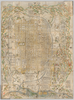
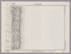
shelfmark: Or.75.f.9
License: Public Domain
元禄1 *ケンペル旧蔵。 Xylograph. Ex-Kaempfer. Gardner, #570.
Links: Source / Biblio Ref
|
1688 | over 1 year ago | 3 control points |
|
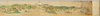
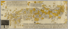
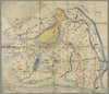
【Courtesy of the C. V. Starr East Asian Library University of California, Berkeley】 First of 4 scanned sections. Title from MS. label mounted on scroll. Hand scroll. Hand drawn col. panoramic map. In Japanese. Orientation varies. East Asian Library call number: MJ02.
Links: Source / Biblio Ref
|
1687 | over 3 years ago | 3 control points |
|
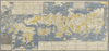
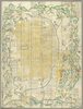
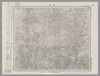
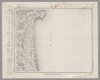
shelfmark: Or.75.f.11
License: Public Domain
貞享4 *ケンペル旧蔵。 Xylograph. Ex-Kaempfer. Gardner #563. Kurita 17.
Links: Source / Biblio Ref
|
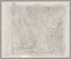
1687 | over 3 years ago | 22 control points |
|
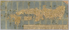
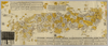
【Courtesy of the C. V. Starr East Asian Library University of California, Berkeley】 Japanese date Jokyo 4 1687 estimated. In color. Folded. Wood block print. In Japanese. Title added by hand. Relief shown pictorially. Includes distance chart and index
Links: Source / Biblio Ref
|
1687 | over 3 years ago | 4 control points |
|
GIS day 2019
|
1686 | over 5 years ago | 4 control points |
|
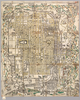
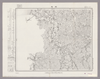
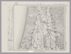
shelfmark: Or.75.f.16
License: Public Domain
貞享3 *ケンペル自筆書入あり。 Xylograph. Ex-Kaempfer. Gardner #564; Kyotozu somokuroku, p.13, #26.
Links: Source / Biblio Ref
|
1686 | over 3 years ago | 4 control points |
|
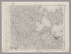
【Courtesy of the C. V. Starr East Asian Library University of California, Berkeley】 1 map: hand col.; on sheet 71 x 163 cm., folded in cover 24 x 14 cm. Mounted cover title. Wood block print. In Japanese. Covers Matsumae to Tsushima and Ryukyu. Includes text and legend. Shows the distance of sea routes. Alternate Title: Nihonkoku oezu. East Asian Library call number Ca 43.
Links: Source / Biblio Ref
|
1685 | over 3 years ago | 5 control points |
|
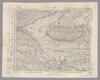
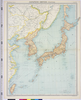
岡山大学附属図書館所蔵
池田家文庫絵図T6-5〔岡山古図〕
|
1632 | about 3 years ago | 3 control points |
|
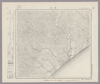
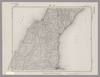
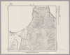
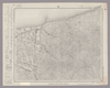
This geotiff map focused on south part of KyushuSatsuma and Osumi.
Type Pocket Map
Obj Height cm 68
Obj Width cm 166
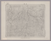
Mounted cover title. Wood block print. In Japanese. Covers Matsumae to Tsushima and Ryukyu. Shows Ezo east from Kanto region. Shows distance of sea routes and main roads and kokudaka of daimyo. Includes legend. East Asian Library call number Ca 11.
Links: Source / Biblio Ref
|
1630 | almost 3 years ago | 16 control points |
|
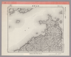
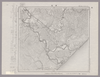
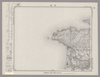
【Courtesy of the C. V. Starr East Asian Library University of California, Berkeley】 Description 1 map: hand col.; 68 x 166 cm., folded to 24 x 18 cm. Mounted cover title. Wood block print. In Japanese. Covers Matsumae to Tsushima and Ryukyu. Shows Ezo east from Kanto region. Shows distance of sea routes and main roads and kokudaka of daimyo. Includes legend. East Asian Library call number Ca 11.
Links: Source / Biblio Ref
|
1630 | over 3 years ago | 5 control points |
|
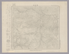
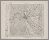
Image from the Map Collections courtesy Stanford University Libraries, licensed under a Creative Commons Attribution-Noncommercial 3.0 Unported License. © Stanford University. 【図幅名】 七尾 【測量時期】 明治43年測図/昭和4年修正 【発行時期】 【記号】 七尾2号(共7面) 【測量機関】 参謀本部 【備考】 秘
Links: Source / Biblio Ref
|
about 2 years ago | 4 control points | |
|
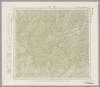
Image from the Map Collections courtesy Stanford University Libraries, licensed under a Creative Commons Attribution-Noncommercial 3.0 Unported License. © Stanford University. 【図幅名】 今治西部 【測量時期】 明治31年測図/昭和3年修正 【発行時期】 昭和6年6月発行 【記号】 広島4号(共16面) 【測量機関】 大日本帝国陸地測量部 【備考】 (In 1 layer)
Links: Source / Biblio Ref
|
about 2 years ago | 4 control points | |
|
Image from the Map Collections courtesy Stanford University Libraries, licensed under a Creative Commons Attribution-Noncommercial 3.0 Unported License. © Stanford University. 【図幅名】 登別温泉 【測量時期】 大正6年測図の縮図/昭和10年修正、測図の縮図 【発行時期】 昭和12年6月発行 【記号】 苫小牧14号(共5面) 【測量機関】 大日本帝国陸地測量部 【備考】 (In 1 layer)
Links: Source / Biblio Ref
|
over 5 years ago | 4 control points | |
|
Image from the Map Collections courtesy Stanford University Libraries, licensed under a Creative Commons Attribution-Noncommercial 3.0 Unported License. © Stanford University. 【図幅名】 青森 【測量時期】 明治39年測図/大正10年測図/大正12年測図の縮図/昭和12年修正、測図の縮図/昭和34年部分修正 【発行時期】 昭和36年10月発行 【記号】 東京10号(共16面) 【測量機関】 国土地理院 【備考】 (In 1 layer)
Links: Source / Biblio Ref
|
about 2 years ago | 8 control points | |
|
Image from the Map Collections courtesy Stanford University Libraries, licensed under a Creative Commons Attribution-Noncommercial 3.0 Unported License. © Stanford University. 【図幅名】 音別 【測量時期】 大正9年測図 【発行時期】 大正11年3月発行 【記号】 帯広3号(共16面) 【測量機関】 大日本帝国陸地測量部 【備考】 (In 1 layer)
Links: Source / Biblio Ref
|
about 2 years ago | 4 control points | |

|
Image from the Map Collections courtesy Stanford University Libraries, licensed under a Creative Commons Attribution-Noncommercial 3.0 Unported License. © Stanford University. 【図幅名】 添牛内 【測量時期】 大正11年測図/昭和8年鉄道補入 【発行時期】 昭和9年8月発行 【記号】 名寄15号(共16面) 【測量機関】 大日本帝国陸地測量部 【備考】 仮製版
Links: Source / Biblio Ref
|
about 2 years ago | 4 control points | |
|
Image from the Map Collections courtesy Stanford University Libraries, licensed under a Creative Commons Attribution-Noncommercial 3.0 Unported License. © Stanford University. 【図幅名】 浦幌 【測量時期】 大正9年測圖 【発行時期】 【記号】 帯広八号 【測量機関】 参謀本部 【備考】 祕
Links: Source / Biblio Ref
|
over 5 years ago | 4 control points | |
|
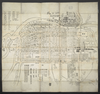
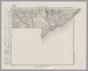
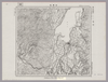
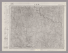
shelfmark: Maps 24.b.212
License: Public Domain
江戸後期写 *浜松助郷村名等を明記す。藩政用の図力。 Manuscript, early 19th century.
Links: Source / Biblio Ref
|
over 3 years ago | 14 control points | |
|
Image from the Map Collections courtesy Stanford University Libraries, licensed under a Creative Commons Attribution-Noncommercial 3.0 Unported License. © Stanford University. 【図幅名】 白山 【測量時期】 明治43年測図/昭和5年要部修正 【発行時期】 昭和7年8月発行 【記号】 金沢4号(共13面) 【測量機関】 大日本帝国陸地測量部 【備考】
Links: Source / Biblio Ref
|
about 2 years ago | 4 control points | |
|
Image from the Map Collections courtesy Stanford University Libraries, licensed under a Creative Commons Attribution-Noncommercial 3.0 Unported License. © Stanford University. 【図幅名】 東京東北部 【測量時期】 明治42年測図/大正10年第2回修正/昭和4年測図/昭和7年要部修正 【発行時期】 昭和7年12月発行 【記号】 東京2号 【測量機関】 大日本帝国陸地測量部 【備考】 (In 1 layer)
Links: Source / Biblio Ref
|
about 2 years ago | 4 control points | |
|
Image from the Map Collections courtesy Stanford University Libraries, licensed under a Creative Commons Attribution-Noncommercial 3.0 Unported License. © Stanford University. 【図幅名】 【測量時期】 【発行時期】 【記号】 【測量機関】 【備考】
Links: Source / Biblio Ref
|
about 2 years ago | 4 control points | |
|
Image from the Map Collections courtesy Stanford University Libraries, licensed under a Creative Commons Attribution-Noncommercial 3.0 Unported License. © Stanford University. 【図幅名】 女満別 【測量時期】 大正13年測圖 【発行時期】 【記号】 斜里十三号 【測量機関】 参謀本部 【備考】 祕 假製版 (In 1 layer)
Links: Source / Biblio Ref
|
about 2 years ago | 4 control points | |
|
Image from the Map Collections courtesy Stanford University Libraries, licensed under a Creative Commons Attribution-Noncommercial 3.0 Unported License. © Stanford University. 【図幅名】 足尾 【測量時期】 明治40年測図/昭和4年要部修正 【発行時期】 【記号】 宇都宮9号 【測量機関】 参謀本部 【備考】 秘
Links: Source / Biblio Ref
|
about 2 years ago | 4 control points | |
|
Image from the Map Collections courtesy Stanford University Libraries, licensed under a Creative Commons Attribution-Noncommercial 3.0 Unported License. © Stanford University. 【図幅名】 姉崎 【測量時期】 明治36年測図/昭和6年修正 【発行時期】 昭和16年10月発行 【記号】 佐倉16号(共12面) 【測量機関】 大日本帝国陸地測量部 【備考】 (In 1 layer)
Links: Source / Biblio Ref
|
about 2 years ago | 4 control points | |
|
Image from the Map Collections courtesy Stanford University Libraries, licensed under a Creative Commons Attribution-Noncommercial 3.0 Unported License. © Stanford University. 【図幅名】 洲本 【測量時期】 明治29年測図/昭和3年修正/昭和33年要部修正 【発行時期】 昭和37年1月発行 【記号】 徳島2号(共14面) 【測量機関】 国土地理院 【備考】
Links: Source / Biblio Ref
|
over 4 years ago | 7 control points | |
|
Image from the Map Collections courtesy Stanford University Libraries, licensed under a Creative Commons Attribution-Noncommercial 3.0 Unported License. © Stanford University. 【図幅名】 宗谷 【測量時期】 大正12年測図 【発行時期】 大正14年2月発行 【記号】 聲問近傍4号(共7面) 【測量機関】 陸地測量部・参謀本部 【備考】 宗谷4号(共7面) 仮製版 軍事極秘 (In 1 layer)
Links: Source / Biblio Ref
|
about 2 years ago | 4 control points | |
|
Image from the Map Collections courtesy Stanford University Libraries, licensed under a Creative Commons Attribution-Noncommercial 3.0 Unported License. © Stanford University. 【図幅名】 白峰 【測量時期】 明治43年測図/昭和5年要部修正 【発行時期】 昭和8年1月発行 【記号】 金沢7号(共13面) 【測量機関】 大日本帝国陸地測量部 【備考】
Links: Source / Biblio Ref
|
about 2 years ago | 4 control points | |
|
Image from the Map Collections courtesy Stanford University Libraries, licensed under a Creative Commons Attribution-Noncommercial 3.0 Unported License. © Stanford University. 【図幅名】 大社 【測量時期】 明治32年測図/昭和9年第2回修正、測図の縮図 【発行時期】 【記号】 大社8号(共3面) 【測量機関】 参謀本部 【備考】 秘
Links: Source / Biblio Ref
|
about 2 years ago | 4 control points | |
|
Image from the Map Collections courtesy Stanford University Libraries, licensed under a Creative Commons Attribution-Noncommercial 3.0 Unported License. © Stanford University. 【図幅名】 八幡平 【測量時期】 大正5年測図/昭和4年鉄道補入 【発行時期】 昭和6年6月発行 【記号】 秋田1号(共16面) 【測量機関】 大日本帝国陸地測量部 【備考】
Links: Source / Biblio Ref
|
about 2 years ago | 4 control points | |
|
Image from the Map Collections courtesy Stanford University Libraries, licensed under a Creative Commons Attribution-Noncommercial 3.0 Unported License. © Stanford University. 【図幅名】 新川 【測量時期】 大正10年測圖 【発行時期】 大正12年発行 【記号】 沖縄郡島三号 【測量機関】 陸地測量部・参謀本部 【備考】 軍事極祕(戦地ニ在りテハ軍事祕密トス)
Links: Source / Biblio Ref
|
3 months ago | 4 control points | |
|
Image from the Map Collections courtesy Stanford University Libraries, licensed under a Creative Commons Attribution-Noncommercial 3.0 Unported License. © Stanford University. 【図幅名】 相沼内 【測量時期】 大正6年測圖 【発行時期】 【記号】 室蘭十六号 【測量機関】 参謀本部 【備考】 祕
Links: Source / Biblio Ref
|
about 2 years ago | 4 control points | |
|
Image from the Map Collections courtesy Stanford University Libraries, licensed under a Creative Commons Attribution-Noncommercial 3.0 Unported License. © Stanford University. 【図幅名】 川治 【測量時期】 大正1年測図/昭和8年要部修正 【発行時期】 【記号】 日光7号(共16面) 【測量機関】 参謀本部 【備考】 秘
Links: Source / Biblio Ref
|
about 2 years ago | 4 control points | |
|
Image from the Map Collections courtesy Stanford University Libraries, licensed under a Creative Commons Attribution-Noncommercial 3.0 Unported License. © Stanford University.
Links: Source / Biblio Ref
|
over 6 years ago | 4 control points | |
|
Image from the Map Collections courtesy Stanford University Libraries, licensed under a Creative Commons Attribution-Noncommercial 3.0 Unported License. © Stanford University. 【図幅名】 志文内 【測量時期】 大正12年測図 【発行時期】 大正13年7月発行 【記号】 名寄13号(共16面) 【測量機関】 大日本帝国陸地測量部 【備考】 仮製版 (In 1 layer)
Links: Source / Biblio Ref
|
about 2 years ago | 4 control points | |
|
Image from the Map Collections courtesy Stanford University Libraries, licensed under a Creative Commons Attribution-Noncommercial 3.0 Unported License. © Stanford University. 【図幅名】 乗鞍岳 【測量時期】 大正1年測図/昭和5年修正/昭和6年部分修正 【発行時期】 昭和8年3月発行 【記号】 高山8号(共16面) 【測量機関】 大日本帝国陸地測量部 【備考】
Links: Source / Biblio Ref
|
about 2 years ago | 4 control points | |
|
Image from the Map Collections courtesy Stanford University Libraries, licensed under a Creative Commons Attribution-Noncommercial 3.0 Unported License. © Stanford University. 【図幅名】 福島 【測量時期】 明治41年測図/大正14年鉄道補入/昭和6年要部修正 【発行時期】 昭和21年11月発行 【記号】 福島10号(共18面) 【測量機関】 内務省地理調査所 【備考】
Links: Source / Biblio Ref
|
4 months ago | 4 control points | |
|
Image from the Map Collections courtesy Stanford University Libraries, licensed under a Creative Commons Attribution-Noncommercial 3.0 Unported License. © Stanford University. 【図幅名】 荒島岳 【測量時期】 明治43年測圖/昭和5年要部修正測圖 【発行時期】 【記号】 岐阜五号 【測量機関】 参謀本部 【備考】 祕
Links: Source / Biblio Ref
|
about 2 years ago | 4 control points | |
|
Image from the Map Collections courtesy Stanford University Libraries, licensed under a Creative Commons Attribution-Noncommercial 3.0 Unported License. © Stanford University. 【図幅名】 定山渓 【測量時期】 大正6年測圖/昭和10年修正測圖 【発行時期】 【記号】 札幌十五号 【測量機関】 参謀本部 【備考】 祕 (In 1 layer)
Links: Source / Biblio Ref
|
about 2 years ago | 4 control points | |
|
Owned by 立命館大学アート・リサーチセンター 【成立・出版年】
Links: Source / Biblio Ref
|
over 5 years ago | 10 control points | |
|
Image from the Map Collections courtesy Stanford University Libraries, licensed under a Creative Commons Attribution-Noncommercial 3.0 Unported License. © Stanford University. 【図幅名】 泊 【測量時期】 明治43年測図/昭和5年修正 【発行時期】 昭和9年5月発行 【記号】 富山7号(共11面) 【測量機関】 大日本帝国陸地測量部 【備考】 (In 1 layer)
Links: Source / Biblio Ref
|
about 2 years ago | 4 control points | |
|
Image from the Map Collections courtesy Stanford University Libraries, licensed under a Creative Commons Attribution-Noncommercial 3.0 Unported License. © Stanford University. 【図幅名】 諸塚山 【測量時期】 明治35年測圖/昭和7年要部修正測圖 【発行時期】 【記号】 延岡九号 【測量機関】 参謀本部 【備考】 祕
Links: Source / Biblio Ref
|
about 4 years ago | 4 control points | |
|
Image from the Map Collections courtesy Stanford University Libraries, licensed under a Creative Commons Attribution-Noncommercial 3.0 Unported License. © Stanford University. 【図幅名】 鬼鹿 【測量時期】 大正11年測図/昭和8年鉄道補入 【発行時期】 昭和7年9月発行 【記号】 羽幌8号(共8面) 【測量機関】 大日本帝国陸地測量部 【備考】 仮製版
Links: Source / Biblio Ref
|
about 2 years ago | 4 control points | |
|
Image from the Map Collections courtesy Stanford University Libraries, licensed under a Creative Commons Attribution-Noncommercial 3.0 Unported License. © Stanford University. 【図幅名】 追貝 【測量時期】 大正1年測図/昭和33年要部修正 【発行時期】 昭和35年4月発行 【記号】 日光16号 【測量機関】 国土地理院 【備考】
Links: Source / Biblio Ref
|
about 2 years ago | 4 control points | |
|
Image from the Map Collections courtesy Stanford University Libraries, licensed under a Creative Commons Attribution-Noncommercial 3.0 Unported License. © Stanford University. 【図幅名】 旭川 【測量時期】 大正5年測図/昭和6年鉄道補入 【発行時期】 昭和7年8月発行 【記号】 旭川10号(共16面) 【測量機関】 大日本帝国陸地測量部 【備考】 (In 1 layer)
Links: Source / Biblio Ref
|
3 months ago | 4 control points | |
|
Image from the Map Collections courtesy Stanford University Libraries, licensed under a Creative Commons Attribution-Noncommercial 3.0 Unported License. © Stanford University.
Links: Source / Biblio Ref
|
over 6 years ago | 4 control points | |
|
Image from the Map Collections courtesy Stanford University Libraries, licensed under a Creative Commons Attribution-Noncommercial 3.0 Unported License. © Stanford University. 【図幅名】 磐城富岡 【測量時期】 明治41年測図/昭和8年修正 【発行時期】 昭和10年10月発行 【記号】 福島4号東部(共18面) 【測量機関】 大日本帝国陸地測量部 【備考】
Links: Source / Biblio Ref
|
3 months ago | 4 control points | |
|
Image from the Map Collections courtesy Stanford University Libraries, licensed under a Creative Commons Attribution-Noncommercial 3.0 Unported License. © Stanford University. 【図幅名】 【測量時期】 【発行時期】 【記号】 【測量機関】 【備考】 (In 1 layer)
Links: Source / Biblio Ref
|
about 2 years ago | 4 control points | |
|
Image from the Map Collections courtesy Stanford University Libraries, licensed under a Creative Commons Attribution-Noncommercial 3.0 Unported License. © Stanford University. 【図幅名】 上津別 【測量時期】 大正13年測図/昭和3年鉄道補入 【発行時期】 昭和5年4月発行 【記号】 斜里15号(共16面) 【測量機関】 大日本帝国陸地測量部 【備考】 仮製版 (In 1 layer)
Links: Source / Biblio Ref
|
about 2 years ago | 4 control points | |
|
Image from the Map Collections courtesy Stanford University Libraries, licensed under a Creative Commons Attribution-Noncommercial 3.0 Unported License. © Stanford University. 【図幅名】 金木 【測量時期】 大正1年測図の縮図/昭和14年修正、測図の縮図 【発行時期】 昭和17年5月発行 【記号】 青森11号 【測量機関】 大日本帝国陸地測量部 【備考】
Links: Source / Biblio Ref
|
about 2 years ago | 4 control points | |
|
Image from the Map Collections courtesy Stanford University Libraries, licensed under a Creative Commons Attribution-Noncommercial 3.0 Unported License. © Stanford University. 【図幅名】 敏音知 【測量時期】 大正12年測図/昭和3年鉄道補入 【発行時期】 昭和5年3月発行 【記号】 枝幸15号(共12面) 【測量機関】 大日本帝国陸地測量部 【備考】 仮製版
Links: Source / Biblio Ref
|
about 2 years ago | 4 control points |