Browse Maps
| map | Title | Year | Last Updated | Status  |
|---|---|---|---|---|
|
|
2022 | over 1 year ago | 9 control points |
|
|
2019 | over 4 years ago | 4 control points |
|
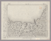
Image from the Map Collections courtesy Stanford University Libraries, licensed under a Creative Commons Attribution-Noncommercial 3.0 Unported License. © Stanford University. 【図幅名】 仲尾次 【測量時期】 大正10年測圖 【発行時期】 大正12年発行 【記号】 沖縄郡島六号 【測量機関】 陸地測量部・参謀本部 【備考】 軍事極祕(戦地ニ在りテハ軍事祕密トス)
Links: Source / Biblio Ref
|
about 1 month ago | 4 control points | |
|
|
2022 | over 1 year ago | 7 control points |
|
Image from the Map Collections courtesy Stanford University Libraries, licensed under a Creative Commons Attribution-Noncommercial 3.0 Unported License. © Stanford University. 【図幅名】 経ヶ岳 【測量時期】 明治43年測図/昭和5年要部修正 【発行時期】 昭和7年11月発行 【記号】 金沢8号(共13面) 【測量機関】 大日本帝国陸地測量部 【備考】
Links: Source / Biblio Ref
|
about 2 years ago | 4 control points | |
|
|
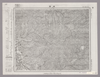
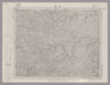
1931 | 5 months ago | 9 control points |
|
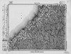
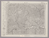
Image from the Map Collections courtesy Stanford University Libraries, licensed under a Creative Commons Attribution-Noncommercial 3.0 Unported License. © Stanford University. 【図幅名】 【測量時期】 【発行時期】 【記号】 【測量機関】 【備考】
Links: Source / Biblio Ref
|
about 4 years ago | 4 control points | |
|
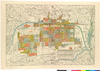
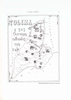
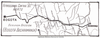
京都府立京都学・歴彩館所蔵
下京地籍図
Links: Source / Biblio Ref
|
1884 | about 6 years ago | 3 control points |
|
Image from the Map Collections courtesy Stanford University Libraries, licensed under a Creative Commons Attribution-Noncommercial 3.0 Unported License. © Stanford University.
Links: Source / Biblio Ref
|
about 6 years ago | 4 control points | |
|
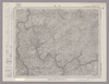
Image from the Map Collections courtesy Stanford University Libraries, licensed under a Creative Commons Attribution-Noncommercial 3.0 Unported License. © Stanford University. 【図幅名】 高瀬 【測量時期】 明治33年測圖/大正15年第二回修正測圖/昭和6年部分修正測圖 【発行時期】 【記号】 熊本七号 【測量機関】 参謀本部 【備考】 祕
Links: Source / Biblio Ref
|
almost 4 years ago | 4 control points | |
|
|
2019 | over 4 years ago | 4 control points |
|
Image from the Map Collections courtesy Stanford University Libraries, licensed under a Creative Commons Attribution-Noncommercial 3.0 Unported License. © Stanford University. 【図幅名】 三重町 【測量時期】 明治35年測圖/昭和7年要部修正測圖 【発行時期】 昭和10年発行 【記号】 大分七号 【測量機関】 大日本帝國陸地測量部 【備考】
Links: Source / Biblio Ref
|
about 4 years ago | 4 control points | |
|
|
2022 | over 1 year ago | 6 control points |
|
|
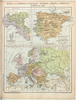
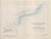
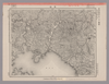
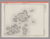
1863 | almost 3 years ago | 34 control points |
|
|
2022 | over 1 year ago | 9 control points |
|
Links: Source / Biblio Ref
|
2020 | about 1 year ago | 4 control points |
|
|
2023 | 5 months ago | 12 control points |
|
Image from the Map Collections courtesy Stanford University Libraries, licensed under a Creative Commons Attribution-Noncommercial 3.0 Unported License. © Stanford University. 【図幅名】 桂島 【測量時期】 明治32年測図/大正14年修正 【発行時期】 昭和23年12月発行 【記号】 広島12号(共16面) 【測量機関】 地理調査所 【備考】
Links: Source / Biblio Ref
|
about 2 years ago | 4 control points | |
|
Image from the Map Collections courtesy Stanford University Libraries, licensed under a Creative Commons Attribution-Noncommercial 3.0 Unported License. © Stanford University. 【図幅名】 三日町 【測量時期】 大正元年測圖/昭和5年要部修正測圖 【発行時期】 【記号】 高山十六号 【測量機関】 参謀本部 【備考】 祕
Links: Source / Biblio Ref
|
about 2 years ago | 4 control points | |
|
Image from the Map Collections courtesy Stanford University Libraries, licensed under a Creative Commons Attribution-Noncommercial 3.0 Unported License. © Stanford University. 【図幅名】 蠣ノ浦 【測量時期】 明治34年測図/大正13年修正/昭和20年部分修正 【発行時期】 昭和23年3月発行 【記号】 長崎6号(共15面) 【測量機関】 地理調査所 【備考】
Links: Source / Biblio Ref
|
almost 4 years ago | 4 control points | |
|
Image from the Map Collections courtesy Stanford University Libraries, licensed under a Creative Commons Attribution-Noncommercial 3.0 Unported License. © Stanford University. 【図幅名】 早岐 【測量時期】 明治34年測図の縮図/大正14年修正、測図の縮図/昭和7年部分修正、測図の縮図 【発行時期】 昭和21年10月発行 【記号】 長崎2号(共15面) 【測量機関】 内務省地理調査所 【備考】
Links: Source / Biblio Ref
|
almost 4 years ago | 4 control points | |
|
Links: Source / Biblio Ref
|
2020 | over 1 year ago | 12 control points |
|
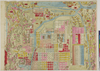
老松
|
over 4 years ago | 4 control points | |
|
Image from the Map Collections courtesy Stanford University Libraries, licensed under a Creative Commons Attribution-Noncommercial 3.0 Unported License. © Stanford University. 【図幅名】 中津 【測量時期】 明治35年測圖/昭和16年第二回修正測圖 【発行時期】 【記号】 中津十五号 【測量機関】 参謀本部 【備考】 祕
Links: Source / Biblio Ref
|
almost 4 years ago | 4 control points | |
|
この地図の作成に当たっては、国土地理院長の承認を得て、同院発行の20万分の1地勢図及び5万分の1地形図を使用した。(承認番号 平30情使、 第1148号)
Links: Source / Biblio Ref
|
1946 | about 1 month ago | 4 control points |
|
Links: Source / Biblio Ref
|
2020 | about 1 year ago | 4 control points |
|
|
2018 | about 6 years ago | 3 control points |
|
Image from the Map Collections courtesy Stanford University Libraries, licensed under a Creative Commons Attribution-Noncommercial 3.0 Unported License. © Stanford University. 【図幅名】 川口 【測量時期】 明治40年測図/昭和8年修正 【発行時期】 昭和11年5月発行 【記号】 高知1号(共16面) 【測量機関】 大日本帝国陸地測量部 【備考】
Links: Source / Biblio Ref
|
about 2 years ago | 4 control points | |
|
Image from the Map Collections courtesy Stanford University Libraries, licensed under a Creative Commons Attribution-Noncommercial 3.0 Unported License. © Stanford University. 【図幅名】 宇佐 【測量時期】 明治36年測圖/昭和2年修正測圖 【発行時期】 【記号】 中津十一号 【測量機関】 参謀本部 【備考】 祕
Links: Source / Biblio Ref
|
over 5 years ago | 4 control points | |
|
|
2018 | about 6 years ago | 4 control points |
|
Image from the Map Collections courtesy Stanford University Libraries, licensed under a Creative Commons Attribution-Noncommercial 3.0 Unported License. © Stanford University. 【図幅名】 池田 【測量時期】 明治39年測図の縮図/昭和3年修正、測図の縮図/昭和7年鉄道補入 【発行時期】 昭和8年12月発行 【記号】 岡山及丸亀4号(共16面) 【測量機関】 大日本帝国陸地測量部 【備考】
Links: Source / Biblio Ref
|
about 2 years ago | 4 control points | |
|
Image from the Map Collections courtesy Stanford University Libraries, licensed under a Creative Commons Attribution-Noncommercial 3.0 Unported License. © Stanford University. 【図幅名】 服島 【測量時期】 明治39年測図 【発行時期】 【記号】 岡山及丸亀12号(共13面) 【測量機関】 参謀本部 【備考】 秘
Links: Source / Biblio Ref
|
about 2 years ago | 4 control points | |
|
|
2022 | over 1 year ago | 7 control points |
|
|
2022 | over 1 year ago | 5 control points |
|
(In 1 layer)
|
2020 | over 3 years ago | 7 control points |
|
(In 1 layer)
|
2020 | over 3 years ago | 10 control points |
|
(In 1 layer)
|
2020 | over 3 years ago | 5 control points |
|
Image from the Map Collections courtesy Stanford University Libraries, licensed under a Creative Commons Attribution-Noncommercial 3.0 Unported License. © Stanford University. 【図幅名】 仁位 【測量時期】 大正1年測図/大正11年測図の縮図/昭和10年修正、第2回修正、測図の縮図 【発行時期】 昭和21年11月発行 【記号】 厳原10号(共7面) 【測量機関】 地理調査所 【備考】
Links: Source / Biblio Ref
|
over 5 years ago | 4 control points | |
|
Image from the Map Collections courtesy Stanford University Libraries, licensed under a Creative Commons Attribution-Noncommercial 3.0 Unported License. © Stanford University. 【図幅名】 阿波富岡 【測量時期】 明治40年測図/昭和9年第2回修正、測図の縮図 【発行時期】 【記号】 剣山5号(共11面) 【測量機関】 陸地測量部 【備考】 秘
Links: Source / Biblio Ref
|
about 2 years ago | 4 control points | |
|
Image from the Map Collections courtesy Stanford University Libraries, licensed under a Creative Commons Attribution-Noncommercial 3.0 Unported License. © Stanford University. 【図幅名】 保戸島 【測量時期】 明治38年測図/昭和2年修正/昭和20年部分修正 【発行時期】 昭和21年5月発行 【記号】 宇和島14号(共13面) 【測量機関】 地理調査所 【備考】
Links: Source / Biblio Ref
|
almost 4 years ago | 4 control points | |
|
Image from the Map Collections courtesy Stanford University Libraries, licensed under a Creative Commons Attribution-Noncommercial 3.0 Unported License. © Stanford University. 【図幅名】 和食 【測量時期】 明治40年測圖/昭和8年修正測圖 【発行時期】 【記号】 剣山九号 【測量機関】 参謀本部 【備考】 祕
Links: Source / Biblio Ref
|
about 2 years ago | 4 control points | |
|
Image from the Map Collections courtesy Stanford University Libraries, licensed under a Creative Commons Attribution-Noncommercial 3.0 Unported License. © Stanford University. 【図幅名】 小値賀島 【測量時期】 明治36年測図/昭和11年修正/昭和13年測図の縮図 【発行時期】 昭和21年11月発行 【記号】 長崎13号(共15面) 【測量機関】 地理調査所 【備考】
Links: Source / Biblio Ref
|
almost 4 years ago | 4 control points | |
|
Image from the Map Collections courtesy Stanford University Libraries, licensed under a Creative Commons Attribution-Noncommercial 3.0 Unported License. © Stanford University. 【図幅名】 【測量時期】 【発行時期】 【記号】 【測量機関】 【備考】
Links: Source / Biblio Ref
|
about 2 years ago | 4 control points | |
|
Links: Source / Biblio Ref
|
2020 | over 1 year ago | 9 control points |
|
|
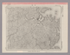
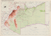
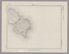
1931 | 5 months ago | 3 control points |
|
(In 1 layer)
|
2020 | over 3 years ago | 5 control points |
|
Image from the Map Collections courtesy Stanford University Libraries, licensed under a Creative Commons Attribution-Noncommercial 3.0 Unported License. © Stanford University. 【図幅名】 志々伎 【測量時期】 明治33年測図/大正14年修正/昭和20年部分修正 【発行時期】 昭和23年2月発行 【記号】 長崎9号(共15面) 【測量機関】 地理調査所 【備考】
Links: Source / Biblio Ref
|
over 5 years ago | 4 control points | |
|
Image from the Map Collections courtesy Stanford University Libraries, licensed under a Creative Commons Attribution-Noncommercial 3.0 Unported License. © Stanford University. 【図幅名】 大栃 【測量時期】 明治40年測図/昭和8年修正 【発行時期】 昭和11年6月発行 【記号】 高知2号(共16面) 【測量機関】 大日本帝国陸地測量部 【備考】
Links: Source / Biblio Ref
|
about 2 years ago | 4 control points | |
|
Image from the Map Collections courtesy Stanford University Libraries, licensed under a Creative Commons Attribution-Noncommercial 3.0 Unported License. © Stanford University. 【図幅名】 剣山 【測量時期】 明治40年測圖/昭和8年修正測圖 【発行時期】 【記号】 剣山十三号 【測量機関】 参謀本部 【備考】 祕
Links: Source / Biblio Ref
|
about 2 years ago | 4 control points | |
|
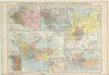
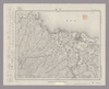
|
1854 | over 6 years ago | 4 control points |