Browse Maps
| map | Title | Year | Last Updated | Status  |
|---|---|---|---|---|
|
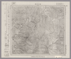
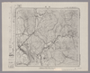
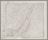
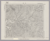
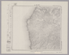
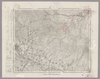
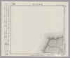
Image from the Map Collections courtesy Stanford University Libraries, licensed under a Creative Commons Attribution-Noncommercial 3.0 Unported License. © Stanford University. 【図幅名】 右左府 【測量時期】 大正8年測圖 【発行時期】 【記号】 夕張岳十一号 【測量機関】 参謀本部 【備考】 祕 (In 1 layer)
Links: Source / Biblio Ref
|
about 2 years ago | 4 control points | |
|
|
2022 | almost 2 years ago | 4 control points |
|
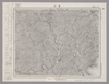
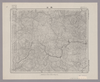
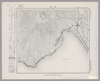
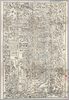
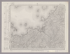
Image from the Map Collections courtesy Stanford University Libraries, licensed under a Creative Commons Attribution-Noncommercial 3.0 Unported License. © Stanford University. 【図幅名】 窪川 【測量時期】 明治39年測図/昭和8年修正 【発行時期】 昭和11年6月発行 【記号】 窪川13号(共4面) 【測量機関】 大日本帝国陸地測量部 【備考】
Links: Source / Biblio Ref
|
about 2 years ago | 4 control points | |
|
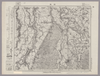
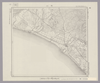
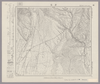
Image from the Map Collections courtesy Stanford University Libraries, licensed under a Creative Commons Attribution-Noncommercial 3.0 Unported License. © Stanford University. 【図幅名】 新津 【測量時期】 明治44年測図/昭和6年要部修正 【発行時期】 昭和9年6月発行 【記号】 新潟14号(共16面) 【測量機関】 大日本帝国陸地測量部 【備考】
Links: Source / Biblio Ref
|
about 2 years ago | 4 control points | |
|
|
2019 | over 4 years ago | 3 control points |
|
|
1918 | over 3 years ago | 3 control points |
|
Image from the Map Collections courtesy Stanford University Libraries. This item is in the public domain. There are no restrictions on use.
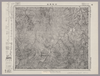
【図幅名】 黑嶽【測量時期】 大正5年測圖 【発行時期】昭和11年 【記号】 捨子古丹島十五号 【測量機関】 参謀本部 【その他】千島列島 陸地測量部 (In 1 layer)
Links: Source / Biblio Ref
|
1936 | over 1 year ago | 4 control points |
|
Image from the Map Collections courtesy Stanford University Libraries, licensed under a Creative Commons Attribution-Noncommercial 3.0 Unported License. © Stanford University. 【図幅名】 船川 【測量時期】 大正1年測図/大正14年鉄道補入 【発行時期】 昭和2年2月発行 【記号】 男鹿島1号(共2面) 【測量機関】 大日本帝国陸地測量部 【備考】
Links: Source / Biblio Ref
|
about 2 years ago | 4 control points | |
|
Image from the Map Collections courtesy Stanford University Libraries, licensed under a Creative Commons Attribution-Noncommercial 3.0 Unported License. © Stanford University. 【図幅名】 早来 【測量時期】 大正8年測圖/昭和10年修正測圖 【発行時期】 【記号】 札幌四号 【測量機関】 参謀本部 【備考】 祕 (In 1 layer)
Links: Source / Biblio Ref
|
about 2 years ago | 4 control points | |
|
Image from the Map Collections courtesy Stanford University Libraries, licensed under a Creative Commons Attribution-Noncommercial 3.0 Unported License. © Stanford University. 【図幅名】 勝山 【測量時期】 明治32年測圖/昭和7年要部修正測圖 【発行時期】 昭和9年発行 【記号】 高梁六号 【測量機関】 大日本帝國陸地測量部 【備考】
Links: Source / Biblio Ref
|
about 2 years ago | 4 control points | |
|
Image from the Map Collections courtesy Stanford University Libraries, licensed under a Creative Commons Attribution-Noncommercial 3.0 Unported License. © Stanford University. 【図幅名】 原歌 【測量時期】 大正6年測図 【発行時期】 大正7年12月発行 【記号】 久遠1号北部(共9面) 【測量機関】 大日本帝国陸地測量部 【備考】 (In 1 layer)
Links: Source / Biblio Ref
|
about 2 years ago | 4 control points | |
|
|
1813 | over 6 years ago | 4 control points |
|
Image from the Map Collections courtesy Stanford University Libraries, licensed under a Creative Commons Attribution-Noncommercial 3.0 Unported License. © Stanford University. 【図幅名】 幸震 【測量時期】 大正9年測図/昭和5年部分修正 【発行時期】 昭和7年12月発行 【記号】 帯広16号(共16面) 【測量機関】 大日本帝国陸地測量部 【備考】 (In 1 layer)
Links: Source / Biblio Ref
|
about 2 years ago | 4 control points | |
|
Image from the Map Collections courtesy Stanford University Libraries, licensed under a Creative Commons Attribution-Noncommercial 3.0 Unported License. © Stanford University. 【図幅名】 大湊 【測量時期】 大正3年測図/昭和4年修正/昭和19年部分修正 【発行時期】 【記号】 辺地13号(共7面) 【測量機関】 内務省地理調査所 【備考】
Links: Source / Biblio Ref
|
about 2 years ago | 4 control points | |
|
Image from the Map Collections courtesy Stanford University Libraries, licensed under a Creative Commons Attribution-Noncommercial 3.0 Unported License. © Stanford University. 【図幅名】 鵡川 【測量時期】 大正8年測圖/昭和10年修正測圖 【発行時期】 【記号】 苫小牧一号 【測量機関】 参謀本部 【備考】 祕 (In 1 layer)
Links: Source / Biblio Ref
|
about 2 years ago | 4 control points | |
|
Links: Source / Biblio Ref
|
2020 | almost 2 years ago | 15 control points |
|
|
2022 | almost 2 years ago | 5 control points |
|
Image from the Map Collections courtesy Stanford University Libraries, licensed under a Creative Commons Attribution-Noncommercial 3.0 Unported License. © Stanford University. 【図幅名】 青海川 【測量時期】 明治43年測図/昭和5年修正 【発行時期】 昭和8年10月発行 【記号】 長岡12号(共11面) 【測量機関】 大日本帝国陸地測量部 【備考】
Links: Source / Biblio Ref
|
about 2 years ago | 4 control points | |
|
Image from the Map Collections courtesy Stanford University Libraries, licensed under a Creative Commons Attribution-Noncommercial 3.0 Unported License. © Stanford University. 【図幅名】 糠内 【測量時期】 大正9年測図 【発行時期】 大正11年1月発行 【記号】 帯広12号(共16面) 【測量機関】 大日本帝国陸地測量部 【備考】 (In 1 layer)
Links: Source / Biblio Ref
|
about 2 years ago | 4 control points | |
|
Image from the Map Collections courtesy Stanford University Libraries, licensed under a Creative Commons Attribution-Noncommercial 3.0 Unported License. © Stanford University. 【図幅名】 田島 【測量時期】 大正2年測図/昭和8年要部修正 【発行時期】 【記号】 日光1号(共16面) 【測量機関】 参謀本部 【備考】 秘
Links: Source / Biblio Ref
|
about 2 years ago | 4 control points | |
|
Image from the Map Collections courtesy Stanford University Libraries, licensed under a Creative Commons Attribution-Noncommercial 3.0 Unported License. © Stanford University. 【図幅名】 令金 【測量時期】 大正6年測図/昭和8年鉄道補入 【発行時期】 昭和10年3月発行 【記号】 室蘭14号(共14面) 【測量機関】 大日本帝国陸地測量部 【備考】 (In 1 layer)
Links: Source / Biblio Ref
|
about 2 years ago | 4 control points | |
|
|
over 6 years ago | 5 control points | |
|
(In 1 layer)
Links: Source / Biblio Ref
|
1924 | about 1 year ago | 4 control points |
|
|
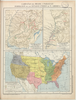
1863 | over 6 years ago | 5 control points |
|
Image from the Map Collections courtesy Stanford University Libraries, licensed under a Creative Commons Attribution-Noncommercial 3.0 Unported License. © Stanford University. 【図幅名】 狩場山 【測量時期】 大正6年測図 【発行時期】 大正9年2月発行 【記号】 久遠1号(共9面) 【測量機関】 大日本帝国陸地測量部 【備考】 (In 1 layer)
Links: Source / Biblio Ref
|
about 2 years ago | 4 control points | |
|
Image from the Map Collections courtesy Stanford University Libraries, licensed under a Creative Commons Attribution-Noncommercial 3.0 Unported License. © Stanford University. 【図幅名】 【測量時期】 【発行時期】 【記号】 【測量機関】 【備考】
Links: Source / Biblio Ref
|
about 2 years ago | 4 control points | |
|
|
2019 | almost 5 years ago | 3 control points |
|
この地図の作成に当たっては、国土地理院長の承認を得て、同院発行の20万分の1地勢図及び5万分の1地形図を使用した。(承認番号 平30情使、 第1148号)
Links: Source / Biblio Ref
|
1950 | over 5 years ago | 4 control points |
|
50%に縮小
|
1944 | almost 5 years ago | 13 control points |
|
【Courtesy of the C. V. Starr East Asian Library University of California, Berkeley】 Colored manuscript map. Relief shown pictorially. East Asian Library call number: MJ11.
Links: Source / Biblio Ref
|
1874 | over 2 years ago | 16 control points |
|
Links: Source / Biblio Ref
|
2019 | almost 5 years ago | 6 control points |
|
Image from the Map Collections courtesy Stanford University Libraries, licensed under a Creative Commons Attribution-Noncommercial 3.0 Unported License. © Stanford University. 【図幅名】 小宝島 【測量時期】 昭和5年測圖(海上寫眞測量) 【発行時期】 昭和11年発行 【記号】 奄美大島要塞近傍三号 【測量機関】 陸地測量部・参謀本部 【備考】 軍事極祕(戦地ニ在りテハ軍事祕密トス) 假製版
Links: Source / Biblio Ref
|
3 months ago | 4 control points | |
|
|
8 months ago | 30 control points | |
|
立命館大学ARC古地図データベースより引用
|
2022 | over 1 year ago | 153 control points |
|
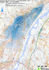
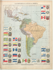
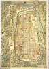
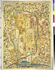
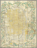
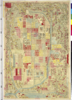
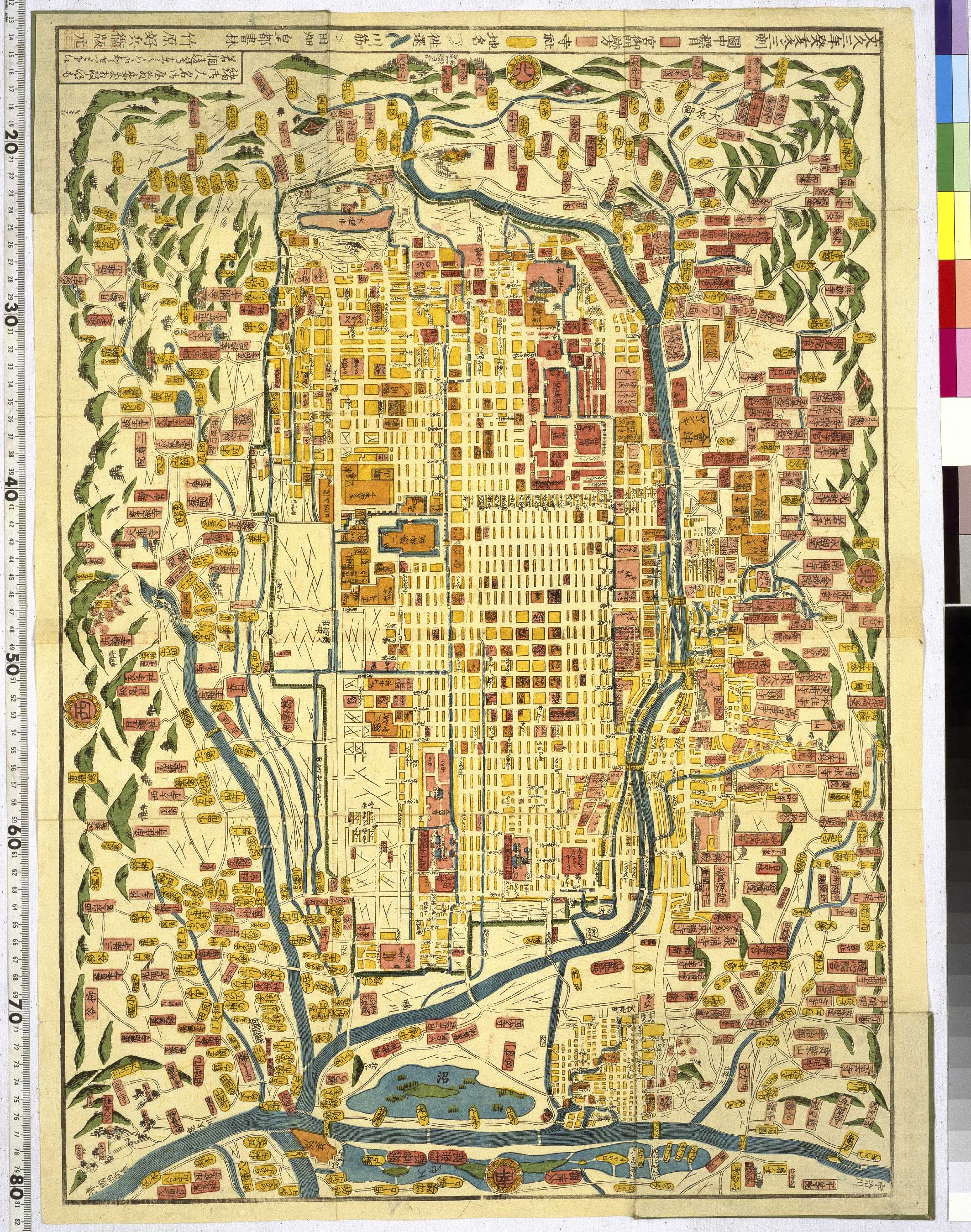
<대경성정도大京城精圖>는 1936년에 경성지성당至誠堂에서 경성부의 교열을 거쳐 발행한 서울지도로서 전체 17장補 4장 포함으로 구성된 지번도이다. 이 지도는 대경성정도 답게 관할 구역이 확장된 후 구획과 지번을 넣어 만든 자세한 지도다. 맨 앞장인 <대경성정도일람도>의 축척은 1:25,000이며, 다른 분도分圖는 1:6,000이다. 지도 순서는 동쪽에서 서쪽으로 편집되어 있으며, 도성내부는 5번 지도에 수록되어 있다.
판권자와 발행인은 반미경평飯米耕平이며, 제도자는 삼전선당森田仙堂이고, 인쇄소는 야진집문당野津集文堂이다.
이 지도가 제작된 1936년은 경성시가지계획과 경성토지구획정리지구가 발표된 해이다. 그러므로 이 지도는 관할 구역이 확장되고 도시계획이 확정되어 근대도시로서 경성의 계획된 면모를 보여주는 자료라고 할 수 있다. 당시 경성은 50만명 정도의 인구가 살도록 계획되었고, 이를 위해 도로가 확장되고, 구불구불한 도로를 직선화하였으며, 새로운 길을 내고, 청계천의 일부를 복개하는 등 도시화가 가속화되었다. 그러나 경복궁과 경희궁의 전각이 다 헐려나가고 창덕궁과 종묘를 잇는 축을 도로를 내기 위해 자르는 등 조선왕실의 전통과 문화를 파괴한 흔적 또한 자세히 볼 수 있다.
이렇게 지번地番을 넣은 서울지도는 이후에도 여러 차례1958 · 1969 · 1986 · 1988 · 1993 등 제작 · 간행되었는데, 모두 이 지도를 모본으로 하여 제작되었다.
Links: Source / Biblio Ref
|
1936 | almost 5 years ago | 3 control points |
|
Image from the Map Collections courtesy Stanford University Libraries, licensed under a Creative Commons Attribution-Noncommercial 3.0 Unported License. © Stanford University. 【図幅名】 宿根木 【測量時期】 大正2年測図/昭和9年修正 【発行時期】 【記号】 長岡14号(共11面) 【測量機関】 参謀本部 【備考】 秘
Links: Source / Biblio Ref
|
over 5 years ago | 4 control points | |
|
Image from the Map Collections courtesy Stanford University Libraries, licensed under a Creative Commons Attribution-Noncommercial 3.0 Unported License. © Stanford University. 【図幅名】 上田 【測量時期】 大正1年測図/昭和12年第2回修正 【発行時期】 【記号】 長野10号(共16面) 【測量機関】 参謀本部 【備考】 秘 (In 1 layer)
Links: Source / Biblio Ref
|
about 2 years ago | 4 control points | |
|
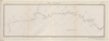
【Courtesy of the C. V. Starr East Asian Library University of California, Berkeley】 Japanese date Hōei 7 1710. In color. Folded. Wood block print. In Japanese. Relief shown pictorially. Includes distance chart and index.
Links: Source / Biblio Ref
|
1710 | over 3 years ago | 4 control points |
|
|
2019 | over 2 years ago | 10 control points |
|
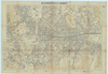
【Courtesy of the C. V. Starr East Asian Library University of California, Berkeley】 Japanese date Genji 1 1864. Folded. Mounted cover title. Wood block print. In Japanese. Relief shown pictorially. Includes distance chart. Shows land tenures of daimyo.
Links: Source / Biblio Ref
|
1864 | over 3 years ago | 4 control points |
|
Image from the Map Collections courtesy Stanford University Libraries, licensed under a Creative Commons Attribution-Noncommercial 3.0 Unported License. © Stanford University. 【図幅名】 奥尻西北部 【測量時期】 大正6年測圖 【発行時期】 【記号】 久遠十一号 【測量機関】 参謀本部 【備考】 祕 (In 1 layer)
Links: Source / Biblio Ref
|
about 2 years ago | 4 control points | |
|
Image from the Map Collections courtesy Stanford University Libraries, licensed under a Creative Commons Attribution-Noncommercial 3.0 Unported License. © Stanford University. 【図幅名】 萩 【測量時期】 明治32年測圖/昭和2年要部修正測圖/昭和7年鐡道補入/昭和15年部分修正測圖 【発行時期】 【記号】 山口十号 【測量機関】 参謀本部 【備考】 祕
Links: Source / Biblio Ref
|
about 2 years ago | 4 control points | |
|
ImagefromtheMapCollectionscourtesyStanfordUniversityLibraries.Ifyouhavequestions,pleasecontacttheBrannerEarthScienceLibrary&MapCollectionsatbrannerlibrary@stanford.edu.
|
over 4 years ago | 4 control points | |
|
Image from the Map Collections courtesy Stanford University Libraries, licensed under a Creative Commons Attribution-Noncommercial 3.0 Unported License. © Stanford University. 【図幅名】 御神楽岳 【測量時期】 明治44年測図/昭和6年要部修正 【発行時期】 昭和8年10月発行 【記号】 新潟11号(共16面) 【測量機関】 大日本帝国陸地測量部 【備考】
Links: Source / Biblio Ref
|
about 2 years ago | 4 control points | |
|
|
2019 | almost 5 years ago | 6 control points |
|
Image from the Map Collections courtesy Stanford University Libraries, licensed under a Creative Commons Attribution-Noncommercial 3.0 Unported License. © Stanford University. 【図幅名】 喜多方 【測量時期】 明治43年測図/昭和6年修正 【発行時期】 昭和9年6月発行 【記号】 新潟3号(共16面) 【測量機関】 大日本帝国陸地測量部 【備考】
Links: Source / Biblio Ref
|
about 2 years ago | 4 control points | |
|
JADH
|
2019 | almost 5 years ago | 5 control points |
|
Links: Source / Biblio Ref
|
2020 | about 1 year ago | 4 control points |
|
|
2022 | almost 2 years ago | 7 control points |
|
Image from the Map Collections courtesy Stanford University Libraries, licensed under a Creative Commons Attribution-Noncommercial 3.0 Unported License. © Stanford University. 【図幅名】 蓼科山 【測量時期】 大正元年測圖/昭和4年要部修正測圖 【発行時期】 【記号】 長野十二号 【測量機関】 参謀本部 【備考】 祕
Links: Source / Biblio Ref
|
about 2 years ago | 4 control points |