Browse Maps
| map | Title | Year | Last Updated | Status  |
|---|---|---|---|---|
|
(In 1 layer)
Links: Source / Biblio Ref
|
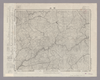
2020 | over 3 years ago | 18 control points |
|
この地図の作成に当たっては、国土地理院長の承認を得て、同院発行の20万分の1地勢図及び5万分の1地形図を使用した。(承認番号 平30情使、 第1148号)
Links: Source / Biblio Ref
|
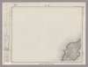
1945 | over 5 years ago | 4 control points |
|
Image from the Map Collections courtesy Stanford University Libraries, licensed under a Creative Commons Attribution-Noncommercial 3.0 Unported License. © Stanford University. 【図幅名】 苗場山 【測量時期】 大正1年測図/昭和6年要部修正 【発行時期】 【記号】 高田7号 【測量機関】 参謀本部 【備考】 秘
Links: Source / Biblio Ref
|
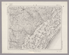
about 2 years ago | 4 control points | |
|
この地図の作成に当たっては、国土地理院長の承認を得て、同院発行の20万分の1地勢図及び5万分の1地形図を使用した。(承認番号 平30情使、 第1148号)
Links: Source / Biblio Ref
|
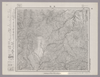
1947 | over 5 years ago | 4 control points |
|
|
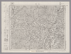
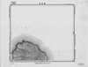
1863 | about 7 years ago | 8 control points |
|
この地図の作成に当たっては、国土地理院長の承認を得て、同院発行の20万分の1地勢図及び5万分の1地形図を使用した。(承認番号 平30情使、 第1148号)
Links: Source / Biblio Ref
|
1946 | over 2 years ago | 4 control points |
|
Links: Source / Biblio Ref
|
2020 | over 1 year ago | 5 control points |
|
|
2019 | over 5 years ago | 5 control points |
|
Image from the Map Collections courtesy Stanford University Libraries, licensed under a Creative Commons Attribution-Noncommercial 3.0 Unported License. © Stanford University. 【図幅名】 大日岳 【測量時期】 大正2年測図/昭和6年要部修正 【発行時期】 【記号】 新潟6号 【測量機関】 参謀本部 【備考】 秘
Links: Source / Biblio Ref
|
about 2 years ago | 4 control points | |
|
この地図の作成に当たっては、国土地理院長の承認を得て、同院発行の20万分の1地勢図及び5万分の1地形図を使用した。(承認番号 平30情使、 第1148号)
Links: Source / Biblio Ref
|
1953 | over 5 years ago | 4 control points |
|
Image from the Map Collections courtesy Stanford University Libraries, licensed under a Creative Commons Attribution-Noncommercial 3.0 Unported License. © Stanford University. 【図幅名】 酒田 【測量時期】 大正2年測図/昭和9年修正 【発行時期】 【記号】 酒田3号(共6面) 【測量機関】 参謀本部 【備考】 秘
Links: Source / Biblio Ref
|
about 2 years ago | 4 control points | |
|
Links: Source / Biblio Ref
|
2020 | over 1 year ago | 13 control points |
|
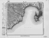
Image from the Map Collections courtesy Stanford University Libraries, licensed under a Creative Commons Attribution-Noncommercial 3.0 Unported License. © Stanford University. 【図幅名】 古場島 【測量時期】 大正10年測図 【発行時期】 昭和11年発行 【記号】 沖縄群島21号 【測量機関】 陸地測量部・参謀本部 【備考】 那覇15号
Links: Source / Biblio Ref
|
over 5 years ago | 4 control points | |
|
この地図の作成に当たっては、国土地理院長の承認を得て、同院発行の20万分の1地勢図及び5万分の1地形図を使用した。(承認番号 平30情使、 第1148号)
Links: Source / Biblio Ref
|
1946 | over 5 years ago | 4 control points |
|
Image from the Map Collections courtesy Stanford University Libraries, licensed under a Creative Commons Attribution-Noncommercial 3.0 Unported License. © Stanford University.
Links: Source / Biblio Ref
|
over 6 years ago | 4 control points | |
|
この地図の作成に当たっては、国土地理院長の承認を得て、同院発行の20万分の1地勢図及び5万分の1地形図を使用した。(承認番号 平30情使、 第1148号)
Links: Source / Biblio Ref
|
1946 | over 5 years ago | 4 control points |
|
Links: Source / Biblio Ref
|
2020 | over 1 year ago | 9 control points |
|
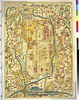
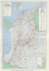
岡山大学附属図書館所蔵
池田家文庫絵図T6-32備前岡山地理家宅一枚図
|
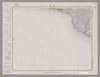
1861 | about 3 years ago | 3 control points |
|
|
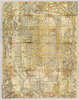
2022 | over 1 year ago | 7 control points |
|
この地図の作成に当たっては、国土地理院長の承認を得て、同院発行の20万分の1地勢図及び5万分の1地形図を使用した。(承認番号 平30情使、 第1148号)
Links: Source / Biblio Ref
|
1947 | over 5 years ago | 4 control points |
|
Image from the Map Collections courtesy Stanford University Libraries, licensed under a Creative Commons Attribution-Noncommercial 3.0 Unported License. © Stanford University.
Links: Source / Biblio Ref
|
over 6 years ago | 4 control points | |
|
この地図の作成に当たっては、国土地理院長の承認を得て、同院発行の20万分の1地勢図及び5万分の1地形図を使用した。(承認番号 平30情使、 第1148号)
Links: Source / Biblio Ref
|
1947 | over 5 years ago | 4 control points |
|
Image from the Map Collections courtesy Stanford University Libraries, licensed under a Creative Commons Attribution-Noncommercial 3.0 Unported License. © Stanford University. 【図幅名】 鬼首 【測量時期】 大正2年測図/昭和9年修正 【発行時期】 昭和11年1月発行 【記号】 新庄7号(共16面) 【測量機関】 大日本帝国陸地測量部 【備考】
Links: Source / Biblio Ref
|
about 2 years ago | 4 control points | |
|
この地図の作成に当たっては、国土地理院長の承認を得て、同院発行の20万分の1地勢図及び5万分の1地形図を使用した。(承認番号 平30情使、 第1148号)
Links: Source / Biblio Ref
|
1946 | over 5 years ago | 4 control points |
|
(In 4 layers)
|
over 4 years ago | 4 control points | |
|
この地図の作成に当たっては、国土地理院長の承認を得て、同院発行の20万分の1地勢図及び5万分の1地形図を使用した。(承認番号 平30情使、 第1148号)
Links: Source / Biblio Ref
|
1946 | over 5 years ago | 4 control points |
|
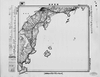
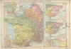
【Courtesy of the C. V. Starr East Asian Library University of California, Berkeley】 Mounted cover title. Hand col. wood block print. In Japanese. Relief shown pictorially. Includes distance chart and index. Folded in cover 23 x 16 cm. East Asian Library call number: F6.
Links: Source / Biblio Ref
|
1717 | over 3 years ago | 4 control points |
|
|
2022 | almost 2 years ago | 3 control points |
|
|
2022 | almost 2 years ago | 7 control points |
|
この地図の作成に当たっては、国土地理院長の承認を得て、同院発行の20万分の1地勢図及び5万分の1地形図を使用した。(承認番号 平30情使、 第1148号)
Links: Source / Biblio Ref
|
1949 | over 5 years ago | 4 control points |
|
Links: Source / Biblio Ref
|
2020 | over 1 year ago | 3 control points |

|
|
2022 | almost 2 years ago | 6 control points |
|
Image from the Map Collections courtesy Stanford University Libraries, licensed under a Creative Commons Attribution-Noncommercial 3.0 Unported License. © Stanford University. 【図幅名】 涌谷 【測量時期】 大正1年測図/昭和8年修正 【発行時期】 昭和10年9月発行 【記号】 石巻13号(共9面) 【測量機関】 大日本帝国陸地測量部 【備考】
Links: Source / Biblio Ref
|
about 2 years ago | 4 control points | |
|
この地図の作成に当たっては、国土地理院長の承認を得て、同院発行の20万分の1地勢図及び5万分の1地形図を使用した。(承認番号 平30情使、 第1148号)
Links: Source / Biblio Ref
|
1947 | over 5 years ago | 4 control points |
|
Image from the Map Collections courtesy Stanford University Libraries, licensed under a Creative Commons Attribution-Noncommercial 3.0 Unported License. © Stanford University. 【図幅名】 安芸 【測量時期】 明治40年測図/昭和8年修正 【発行時期】 昭和11年1月発行 【記号】 高知4号(共16面) 【測量機関】 大日本帝国陸地測量部 【備考】
Links: Source / Biblio Ref
|
about 2 years ago | 4 control points | |
|
この地図の作成に当たっては、国土地理院長の承認を得て、同院発行の20万分の1地勢図及び5万分の1地形図を使用した。(承認番号 平30情使、 第1148号)
Links: Source / Biblio Ref
|
1946 | over 5 years ago | 4 control points |
|
Image from the Map Collections courtesy Stanford University Libraries, licensed under a Creative Commons Attribution-Noncommercial 3.0 Unported License. © Stanford University. 【図幅名】 舳倉島 【測量時期】 明治43年測図/昭和4年修正 【発行時期】 昭和11年6月発行 【記号】 輪島1号(共3面) 【測量機関】 大日本帝国陸地測量部 【備考】
Links: Source / Biblio Ref
|
about 2 years ago | 4 control points | |
|
この地図の作成に当たっては、国土地理院長の承認を得て、同院発行の20万分の1地勢図及び5万分の1地形図を使用した。(承認番号 平30情使、 第1148号)
Links: Source / Biblio Ref
|
1946 | over 5 years ago | 4 control points |
|
Image from the Map Collections courtesy Stanford University Libraries, licensed under a Creative Commons Attribution-Noncommercial 3.0 Unported License. © Stanford University.
Links: Source / Biblio Ref
|
over 6 years ago | 4 control points | |
|
Links: Source / Biblio Ref
|
2020 | over 1 year ago | 4 control points |
|
|
2018 | over 6 years ago | 4 control points |
|
Image from the Map Collections courtesy Stanford University Libraries, licensed under a Creative Commons Attribution-Noncommercial 3.0 Unported License. © Stanford University. 【図幅名】 明知 【測量時期】 明治24年測図/昭和3年要部修正 【発行時期】 昭和6年2月発行 【記号】 豊橋9号(共16面) 【測量機関】 大日本帝国陸地測量部 【備考】
Links: Source / Biblio Ref
|
about 2 years ago | 4 control points | |
|
Image from the Map Collections courtesy Stanford University Libraries, licensed under a Creative Commons Attribution-Noncommercial 3.0 Unported License. © Stanford University. 【図幅名】 青瀬 【測量時期】 明治34年測図/昭和11年修正 【発行時期】 【記号】 甑島6号 【測量機関】 参謀本部 【備考】 秘
Links: Source / Biblio Ref
|
about 4 years ago | 4 control points | |
|
Image from the Map Collections courtesy Stanford University Libraries, licensed under a Creative Commons Attribution-Noncommercial 3.0 Unported License. © Stanford University. 【図幅名】 東金 【測量時期】 明治36年測量、測図の縮図/昭和9年第2回修正/昭和19年部分修正 【発行時期】 昭和21年11月発行 【記号】 佐倉11号(共12面) 【測量機関】 内務省地理調査所 【備考】 (In 1 layer)
Links: Source / Biblio Ref
|
about 2 years ago | 4 control points | |
|
Image from the Map Collections courtesy Stanford University Libraries, licensed under a Creative Commons Attribution-Noncommercial 3.0 Unported License. © Stanford University. 【図幅名】 鶯宿 【測量時期】 大正5年測図/昭和14年修正 【発行時期】 昭和16年5月発行 【記号】 秋田3号(共16面) 【測量機関】 大日本帝国陸地測量部 【備考】
Links: Source / Biblio Ref
|
about 2 years ago | 4 control points | |
|
Image from the Map Collections courtesy Stanford University Libraries, licensed under a Creative Commons Attribution-Noncommercial 3.0 Unported License. © Stanford University. 【図幅名】 茂原 【測量時期】 明治36年測図/昭和6年修正 【発行時期】 昭和8年9月発行 【記号】 佐倉12号(共12面) 【測量機関】 大日本帝国陸地測量部 【備考】 (In 1 layer)
Links: Source / Biblio Ref
|
about 2 years ago | 4 control points | |
|
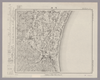
【Courtesy of the C. V. Starr East Asian Library University of California, Berkeley】 Title on map: Chosen zenzu. Cover title. In Japanese. Relief shown by hachures. Includes legend. Shows distance of sea routes. Col. map folded in cover 15 x 8 cm. East Asian Library call number Bc25.
Links: Source / Biblio Ref
|
1911 | over 3 years ago | 4 control points |
|
|
2022 | almost 2 years ago | 4 control points |
|
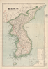
【Courtesy of the C. V. Starr East Asian Library University of California, Berkeley】 Mounted cover title. Wood block print. In Japanese. Relief shown pictorially. Includes distance chart and index. Folded in cover 24 x 16 cm. East Asian Library call number: F7.5.
Links: Source / Biblio Ref
|
1728 | over 3 years ago | 4 control points |
|
この地図の作成に当たっては、国土地理院長の承認を得て、同院発行の20万分の1地勢図及び5万分の1地形図を使用した。(承認番号 平30情使、 第1148号)
Links: Source / Biblio Ref
|
1946 | over 5 years ago | 4 control points |