Browse Maps
| map | Title | Year | Last Updated | Status  |
|---|---|---|---|---|
|
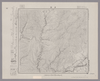
Image from the Map Collections courtesy Stanford University Libraries, licensed under a Creative Commons Attribution-Noncommercial 3.0 Unported License. © Stanford University. 【図幅名】 【測量時期】 【発行時期】 【記号】 【測量機関】 【備考】
Links: Source / Biblio Ref
|
over 2 years ago | 4 control points | |
|
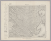
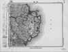
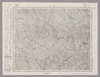
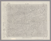
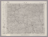
Image from the Map Collections courtesy Stanford University Libraries, licensed under a Creative Commons Attribution-Noncommercial 3.0 Unported License. © Stanford University. 【図幅名】 大屋市場 【測量時期】 明治31年測圖/昭和7年要部修正測圖 【発行時期】 【記号】 姫路五号 【測量機関】 参謀本部 【備考】 祕
Links: Source / Biblio Ref
|
6 months ago | 4 control points | |
|
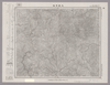
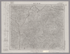
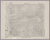
Image from the Map Collections courtesy Stanford University Libraries, licensed under a Creative Commons Attribution-Noncommercial 3.0 Unported License. © Stanford University. 【図幅名】 寄磯 【測量時期】 大正2年測図/昭和8年要部修正 【発行時期】 昭和10年10月発行 【記号】 石巻6号(共9面) 【測量機関】 大日本帝国陸地測量部 【備考】
Links: Source / Biblio Ref
|
2 months ago | 4 control points | |
|
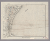
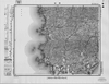
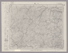
Image from the Map Collections courtesy Stanford University Libraries, licensed under a Creative Commons Attribution-Noncommercial 3.0 Unported License. © Stanford University. 【図幅名】 津東部 【測量時期】 明治23年測図の縮図/昭和12年第2回修正、測図の縮図 【発行時期】 昭和12年10月発行 【記号】 名古屋8号(共16面) 【測量機関】 大日本帝国陸地測量部 【備考】
Links: Source / Biblio Ref
|
2 months ago | 4 control points | |
|
この地図の作成に当たっては、国土地理院長の承認を得て、同院発行の20万分の1地勢図及び5万分の1地形図を使用した。(承認番号 平30情使、 第1148号)
Links: Source / Biblio Ref
|
1946 | about 2 months ago | 4 control points |
|
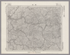
Image from the Map Collections courtesy Stanford University Libraries, licensed under a Creative Commons Attribution-Noncommercial 3.0 Unported License. © Stanford University. 【図幅名】 但馬竹田 【測量時期】 明治31年測図/昭和7年要部修正 【発行時期】 【記号】 姫路1号(共16面) 【測量機関】 参謀本部 【備考】 秘
Links: Source / Biblio Ref
|
about 1 month ago | 4 control points | |
|
この地図の作成に当たっては、国土地理院長の承認を得て、同院発行の20万分の1地勢図及び5万分の1地形図を使用した。(承認番号 平30情使、 第1148号) (In 1 layer)
Links: Source / Biblio Ref
|
1947 | about 2 months ago | 4 control points |
|
Image from the Map Collections courtesy Stanford University Libraries, licensed under a Creative Commons Attribution-Noncommercial 3.0 Unported License. © Stanford University. 【図幅名】 綾部 【測量時期】 明治26年測図/大正9年修正 【発行時期】 大正14年6月発行 【記号】 舞鶴要塞近傍6号(共10面) 【測量機関】 参謀本部 【備考】 京都及大阪9号(共16面)軍事極秘
Links: Source / Biblio Ref
|
2 months ago | 4 control points | |
|
|
1863 | over 6 years ago | 4 control points |
|
(In 1 layer)
Links: Source / Biblio Ref
|
1924 | over 1 year ago | 4 control points |
|
Image from the Map Collections courtesy Stanford University Libraries, licensed under a Creative Commons Attribution-Noncommercial 3.0 Unported License. © Stanford University. 【図幅名】 屋久島東北部 【測量時期】 大正10年測図/昭和28年応急修正 【発行時期】 昭和37年4月 【記号】 屋久島6号(共8面) 【測量機関】 国土地理院 【備考】 応急修正版
Links: Source / Biblio Ref
|
2 months ago | 4 control points | |
|
Image from the Map Collections courtesy Stanford University Libraries, licensed under a Creative Commons Attribution-Noncommercial 3.0 Unported License. © Stanford University. 【図幅名】 和気 【測量時期】 明治28年測図/大正14年第2回修正 【発行時期】 昭和2年12月発行 【記号】 姫路16号(共16面) 【測量機関】 大日本帝国陸地測量部 【備考】
Links: Source / Biblio Ref
|
about 1 month ago | 4 control points | |
|
Image from the Map Collections courtesy Stanford University Libraries, licensed under a Creative Commons Attribution-Noncommercial 3.0 Unported License. © Stanford University. 【図幅名】 沖島 【測量時期】 明治33年測図/昭和11年修正 【発行時期】 昭和21年10月発行 【記号】 小串15号(共4面) 【測量機関】 内務省地理調査所 【備考】
Links: Source / Biblio Ref
|
about 1 month ago | 4 control points | |
|
Image from the Map Collections courtesy Stanford University Libraries, licensed under a Creative Commons Attribution-Noncommercial 3.0 Unported License. © Stanford University. 【図幅名】 駒越 【測量時期】 明治19年測図の縮図/昭和15年第2回修正、測図の縮図 【発行時期】 昭和16年7月発行 【記号】 静岡7号 【測量機関】 大日本帝国陸地測量部 【備考】
Links: Source / Biblio Ref
|
about 2 months ago | 4 control points | |
|
Image from the Map Collections courtesy Stanford University Libraries, licensed under a Creative Commons Attribution-Noncommercial 3.0 Unported License. © Stanford University. 【図幅名】 鷹巣 【測量時期】 大正3年測図 【発行時期】 大正6年4月発行 【記号】 弘前11号(共16面) 【測量機関】 大日本帝国陸地測量部 【備考】
Links: Source / Biblio Ref
|
2 months ago | 4 control points | |
|
|
2019 | over 5 years ago | 6 control points |
|
Image from the Map Collections courtesy Stanford University Libraries, licensed under a Creative Commons Attribution-Noncommercial 3.0 Unported License. © Stanford University. 【図幅名】 月形 【測量時期】 大正5年測図/昭和10年鉄道補入 【発行時期】 昭和11年2月発行 【記号】 留萌8号(共11面) 【測量機関】 大日本帝国陸地測量部 【備考】 (In 1 layer)
Links: Source / Biblio Ref
|
over 2 years ago | 4 control points | |
|
Image from the Map Collections courtesy Stanford University Libraries, licensed under a Creative Commons Attribution-Noncommercial 3.0 Unported License. © Stanford University. 【図幅名】 府中 【測量時期】 明治30年測図の縮図/明治31年測量/昭和7年修正、測図の縮図 【発行時期】 昭和10年8月発行 【記号】 岡山及丸亀13号(共16面) 【測量機関】 大日本帝国陸地測量部 【備考】
Links: Source / Biblio Ref
|
2 months ago | 4 control points | |
|
Links: Source / Biblio Ref
|
2021 | over 3 years ago | 8 control points |
|
|
2022 | about 2 years ago | 3 control points |
|
|
2018 | over 6 years ago | 6 control points |
|
Image from the Map Collections courtesy Stanford University Libraries, licensed under a Creative Commons Attribution-Noncommercial 3.0 Unported License. © Stanford University. 【図幅名】 丹生 【測量時期】 明治25年測図の縮図/昭和12年第2回修正、測図の縮図 【発行時期】 昭和15年6月発行 【記号】 宇治山田10号(共14面) 【測量機関】 大日本帝国陸地測量部 【備考】
Links: Source / Biblio Ref
|
2 months ago | 4 control points | |
|
Image from the Map Collections courtesy Stanford University Libraries, licensed under a Creative Commons Attribution-Noncommercial 3.0 Unported License. © Stanford University. 【図幅名】 士居常呂 【測量時期】 大正13年測図 【発行時期】 昭和4年6月発行 【記号】 淕別11号(共16面) 【測量機関】 大日本帝国陸地測量部 【備考】 (In 1 layer)
Links: Source / Biblio Ref
|
over 2 years ago | 4 control points | |
|
Image from the Map Collections courtesy Stanford University Libraries, licensed under a Creative Commons Attribution-Noncommercial 3.0 Unported License. © Stanford University. 【図幅名】 八重 【測量時期】 明治32年測図/昭和7年修正 【発行時期】 昭和10年6月発行 【記号】 浜田8号(共15面) 【測量機関】 大日本帝国陸地測量部 【備考】
Links: Source / Biblio Ref
|
over 2 years ago | 4 control points | |
|
Image from the Map Collections courtesy Stanford University Libraries, licensed under a Creative Commons Attribution-Noncommercial 3.0 Unported License. © Stanford University. 【図幅名】 下梨 【測量時期】 明治42年測図/昭和5年修正 【発行時期】 【記号】 金沢2号(共13面) 【測量機関】 参謀本部 【備考】 秘
Links: Source / Biblio Ref
|
3 months ago | 4 control points | |
|
Image from the Map Collections courtesy Stanford University Libraries, licensed under a Creative Commons Attribution-Noncommercial 3.0 Unported License. © Stanford University. 【図幅名】 泉 【測量時期】 大正11年測図の縮図/昭和10年修正、測図の縮図 【発行時期】 昭和21年11月発行 【記号】 厳原9号北部(共7面) 【測量機関】 地理調査所 【備考】
Links: Source / Biblio Ref
|
about 1 month ago | 4 control points | |
|
Image from the Map Collections courtesy Stanford University Libraries, licensed under a Creative Commons Attribution-Noncommercial 3.0 Unported License. © Stanford University. 【図幅名】 旭岳 【測量時期】 大正10年測図 【発行時期】 大正13年3月発行 【記号】 旭川3号(共16面) 【測量機関】 大日本帝国陸地測量部 【備考】 (In 1 layer)
Links: Source / Biblio Ref
|
over 2 years ago | 4 control points | |
|
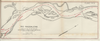
RIO MAGDALENA. PLANO Nº2 DEL KM 586 HASTA 604 PARA ACOMPAÑAR AL INFORME DE SIR. A.GIBB G.B.E G.B. 14 DE JULIO DE 1930
|
2023 | 11 months ago | 37 control points |
|
Image from the Map Collections courtesy Stanford University Libraries, licensed under a Creative Commons Attribution-Noncommercial 3.0 Unported License. © Stanford University. 【図幅名】 滝川 【測量時期】 大正5年測図/昭和10年鉄道補入 【発行時期】 昭和11年8月発行 【記号】 留萌3号(共11面) 【測量機関】 大日本帝国陸地測量部 【備考】 (In 1 layer)
Links: Source / Biblio Ref
|
over 2 years ago | 4 control points | |
|
Image from the Map Collections courtesy Stanford University Libraries, licensed under a Creative Commons Attribution-Noncommercial 3.0 Unported License. © Stanford University. 【図幅名】 柿崎 【測量時期】 明治44年測図/昭和5年修正 【発行時期】 昭和8年8月発行 【記号】 高田9号(共15面) 【測量機関】 大日本帝国陸地測量部 【備考】 (In 1 layer)
Links: Source / Biblio Ref
|
2 months ago | 4 control points | |
|
Image from the Map Collections courtesy Stanford University Libraries, licensed under a Creative Commons Attribution-Noncommercial 3.0 Unported License. © Stanford University. 【図幅名】 【測量時期】 【発行時期】 【記号】 【測量機関】 【備考】
Links: Source / Biblio Ref
|
30 days ago | 4 control points | |
|
Image from the Map Collections courtesy Stanford University Libraries, licensed under a Creative Commons Attribution-Noncommercial 3.0 Unported License. © Stanford University. 【図幅名】 丸亀 【測量時期】 明治39年測図の縮図/昭和3年修正、測図の縮図/昭和7年鉄道補入 【発行時期】 昭和9年1月発行 【記号】 岡山及丸亀3号(共16面) 【測量機関】 大日本帝国陸地測量部 【備考】
Links: Source / Biblio Ref
|
about 1 month ago | 4 control points | |
|
RIO SINU. CROQUIS DE LA DESEMBOCADURA DEL RIO EN LA BAHIA DE CISPATA. PARA ACOMPAÑAR AL INFORME DE SIR. A.GIBB G.B.C G.B. DEL 25 DE ABRIL-32. SIN ESCALA. CORONEL P.R.WARREN. TECNICO HIDRAULICO. DIBUJADO POR LUIS ACEVEDO.
|
1932 | 11 months ago | 8 control points |
|
Image from the Map Collections courtesy Stanford University Libraries, licensed under a Creative Commons Attribution-Noncommercial 3.0 Unported License. © Stanford University. 【図幅名】 島勝 【測量時期】 明治44年測図/昭和8年要部修正 【発行時期】 昭和10年10月発行 【記号】 宇治山田12号 【測量機関】 大日本帝国陸地測量部 【備考】
Links: Source / Biblio Ref
|
over 2 years ago | 4 control points | |
|
Image from the Map Collections courtesy Stanford University Libraries, licensed under a Creative Commons Attribution-Noncommercial 3.0 Unported License. © Stanford University. 【図幅名】 【測量時期】 【発行時期】 【記号】 【測量機関】 【備考】
Links: Source / Biblio Ref
|
2 months ago | 4 control points | |
|
Image from the Map Collections courtesy Stanford University Libraries, licensed under a Creative Commons Attribution-Noncommercial 3.0 Unported License. © Stanford University. 【図幅名】 広島 【測量時期】 明治27年測図の縮図/明治31年測量/大正14年修正、測図の縮図/昭和7年部分修正、測図の縮図 【発行時期】 昭和8年10月発行 【記号】 広島10号(共16面) 【測量機関】 大日本帝国陸地測量部 【備考】
Links: Source / Biblio Ref
|
about 2 months ago | 4 control points | |
|
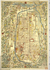
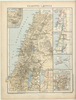
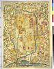
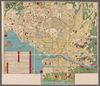
【Courtesy of the C. V. Starr East Asian Library University of California, Berkeley】 Folded in cover 22 x 16 cm. Includes list of shrines, and legend. East Asian Library call number Hb107.2.
Links: Source / Biblio Ref
|
1907 | over 5 years ago | 12 control points |
|
Image from the Map Collections courtesy Stanford University Libraries, licensed under a Creative Commons Attribution-Noncommercial 3.0 Unported License. © Stanford University. 【図幅名】 神湊 【測量時期】 明治33年測図/昭和11年第2回修正 【発行時期】 昭和21年11月発行 【記号】 小倉9号(共16面) 【測量機関】 地理調査所 【備考】
Links: Source / Biblio Ref
|
about 1 month ago | 4 control points | |
|
|
2022 | about 2 years ago | 6 control points |
|
|
2022 | about 2 years ago | 5 control points |
|
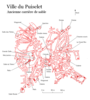
講義の課題で作成したものです。
Links: Source / Biblio Ref
|
2024 | 2 months ago | 3 control points |
|
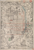
【Courtesy of the C. V. Starr East Asian Library University of California, Berkeley】 Wood block print. In Japanese. Relief shown pictorially.
Links: Source / Biblio Ref
|
1831 | over 3 years ago | 4 control points |
|
Image from the Map Collections courtesy Stanford University Libraries, licensed under a Creative Commons Attribution-Noncommercial 3.0 Unported License. © Stanford University. 【図幅名】 久慈 【測量時期】 大正3年測図/大正5年鉄道補入 【発行時期】 昭和7年3月発行 【記号】 八戸3号(共15面) 【測量機関】 大日本帝国陸地測量部 【備考】
Links: Source / Biblio Ref
|
over 2 years ago | 4 control points | |
|
Image from the Map Collections courtesy Stanford University Libraries, licensed under a Creative Commons Attribution-Noncommercial 3.0 Unported License. © Stanford University. 【図幅名】 益田 【測量時期】 明治32年測圖/昭和7年要部修正測圖 【発行時期】 【記号】 見嶋四号 【測量機関】 参謀本部 【備考】 祕
Links: Source / Biblio Ref
|
almost 6 years ago | 4 control points | |
|
Image from the Map Collections courtesy Stanford University Libraries, licensed under a Creative Commons Attribution-Noncommercial 3.0 Unported License. © Stanford University. 【図幅名】 【測量時期】 【発行時期】 【記号】 【測量機関】 【備考】
Links: Source / Biblio Ref
|
over 2 years ago | 4 control points | |
|
Image from the Map Collections courtesy Stanford University Libraries, licensed under a Creative Commons Attribution-Noncommercial 3.0 Unported License. © Stanford University. 【図幅名】 日比原 【測量時期】 明治39年測図/昭和8年修正 【発行時期】 昭和11年6月発行 【記号】 高知10号(共16面) 【測量機関】 大日本帝国陸地測量部 【備考】
Links: Source / Biblio Ref
|
3 days ago | 4 control points | |
|
|
2024 | 13 days ago | 3 control points |
|
Image from the Map Collections courtesy Stanford University Libraries, licensed under a Creative Commons Attribution-Noncommercial 3.0 Unported License. © Stanford University. 【図幅名】 今治東部 【測量時期】 明治31年測図/昭和3年修正 【発行時期】 昭和6年6月発行 【記号】 岡山及丸亀16号(共16面) 【測量機関】 大日本帝国陸地測量部 【備考】 (In 1 layer)
Links: Source / Biblio Ref
|
2 months ago | 4 control points | |
|
Image from the Map Collections courtesy Stanford University Libraries, licensed under a Creative Commons Attribution-Noncommercial 3.0 Unported License. © Stanford University.
Links: Source / Biblio Ref
|
over 6 years ago | 4 control points | |
|
Image from the Map Collections courtesy Stanford University Libraries, licensed under a Creative Commons Attribution-Noncommercial 3.0 Unported License. © Stanford University. 【図幅名】 須崎 【測量時期】 明治39年測図の縮図/昭和8年修正、測図の縮図 【発行時期】 【記号】 高知12号(共16面) 【測量機関】 参謀本部 【備考】 秘
Links: Source / Biblio Ref
|
22 days ago | 4 control points |