Browse Maps
| map | Title | Year | Last Updated | Status  |
|---|---|---|---|---|
|
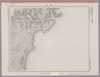
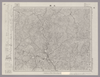
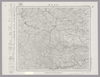
この地図の作成に当たっては、国土地理院長の承認を得て、同院発行の20万分の1地勢図及び5万分の1地形図を使用した。(承認番号 平30情使、 第1148号)
Links: Source / Biblio Ref
|
1946 | over 5 years ago | 4 control points |
|
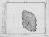
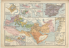
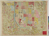
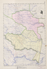
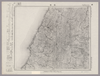
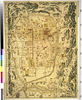
【Courtesy of the C. V. Starr East Asian Library University of California, Berkeley】 Wood block print. In Japanese. Covers Ezo to a part of Ryūkyū. Includes distance chart and legend. Engraved by Nakazawa Hachibē. Folded to 19 x 9 cm.
Links: Source / Biblio Ref
|
1863 | over 3 years ago | 4 control points |
|
|
2023 | over 1 year ago | 15 control points |
|
shelfmark: Maps 149.e.221
License: Public Domain
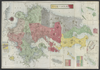
江戸後期写 *寛政6序刊図写。 Manuscript, early 19th century. Acquired 22 July 1868. Ex-Siebold. Copy of a map published in 1794.
Links: Source / Biblio Ref
|
almost 3 years ago | 15 control points | |
|
|
7 months ago | 4 control points | |
|
|
2023 | about 1 year ago | 10 control points |
|
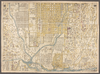
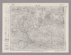
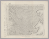
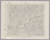
Image from the Map Collections courtesy Stanford University Libraries, licensed under a Creative Commons Attribution-Noncommercial 3.0 Unported License. © Stanford University. 【図幅名】 海田市 【測量時期】 明治32年測図/大正14年修正 【発行時期】 昭和21年11月発行 【記号】 広島6号(共16面) 【測量機関】 内務省地理調査所 【備考】
Links: Source / Biblio Ref
|
about 2 years ago | 4 control points | |
|
国立国会図書館デジタルコレクション
インターネット公開(保護期間満了) (In 4 layers)
Links: Source / Biblio Ref
|
1849 | about 2 years ago | 62 control points |
|
|
2022 | over 1 year ago | 9 control points |
|
|
2022 | over 1 year ago | 5 control points |
|
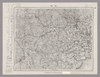
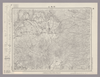
Image from the Map Collections courtesy Stanford University Libraries, licensed under a Creative Commons Attribution-Noncommercial 3.0 Unported License. © Stanford University. 【図幅名】 浜津脇 【測量時期】 大正10年測図/昭和29年応急修正 【発行時期】 昭和37年10月 【記号】 屋久島1号(共8面) 【測量機関】 国土地理院 【備考】 応急修正版
Links: Source / Biblio Ref
|
about 4 years ago | 4 control points | |
|
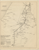
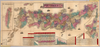
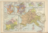
【Courtesy of the C. V. Starr East Asian Library University of California, Berkeley】 Japanese date Meiji 31 1898. In color. Folded. Title on map: Dai Nihon meisai ryokō annai. Mounted cover title. Copperplate print. In Japanese. Oriented with north to the upper right. Includes 3 insets: Hokkaidō zenzu ; Dai Nihon Shinryōchi Taiwan no zu ; Tokyo fuzoku Ogasawarajima. Includes list of district names, charts of mountains and rivers, distance chart of railroads, and legend. Shows sea routes with distances.
Links: Source / Biblio Ref
|
1898 | over 3 years ago | 5 control points |
|
|
over 5 years ago | 6 control points | |
|
立命館大学古地図データベースより引用
|
over 1 year ago | 156 control points | |
|
1
|
2022 | over 1 year ago | 5 control points |
|
|
2022 | over 1 year ago | 3 control points |
|
Image from the Map Collections courtesy Stanford University Libraries, licensed under a Creative Commons Attribution-Noncommercial 3.0 Unported License. © Stanford University. 【図幅名】 厳原 【測量時期】 大正1年測図の縮図/昭和10年第2回修正、測図の縮図 【発行時期】 昭和21年10月発行 【記号】 厳原11号(共7面) 【測量機関】 地理調査所 【備考】
Links: Source / Biblio Ref
|
about 4 years ago | 4 control points | |
|
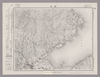
Image from the Map Collections courtesy Stanford University Libraries, licensed under a Creative Commons Attribution-Noncommercial 3.0 Unported License. © Stanford University. 【図幅名】 粟島 【測量時期】 大正2年測図/昭和9年修正 【発行時期】 昭和11年8月発行 【記号】 村上14号(共12面) 【測量機関】 大日本帝国陸地測量部 【備考】
Links: Source / Biblio Ref
|
about 2 years ago | 4 control points | |
|
Image from the Map Collections courtesy Stanford University Libraries, licensed under a Creative Commons Attribution-Noncommercial 3.0 Unported License. © Stanford University. 【図幅名】 玉島 【測量時期】 明治37年測図/大正14年第2回修正 【発行時期】 昭和4年6月発行 【記号】 岡山及丸亀5号(共16面) 【測量機関】 大日本帝国陸地測量部 【備考】
Links: Source / Biblio Ref
|
about 2 years ago | 4 control points | |
|
Image from the Map Collections courtesy Stanford University Libraries, licensed under a Creative Commons Attribution-Noncommercial 3.0 Unported License. © Stanford University. 【図幅名】 玉造 【測量時期】 明治36年測図/昭和4年修正 【発行時期】 【記号】 水戸12号 【測量機関】 参謀本部 【備考】 秘 (In 1 layer)
Links: Source / Biblio Ref
|
about 2 years ago | 4 control points | |
|
Links: Source / Biblio Ref
|
2020 | over 1 year ago | 3 control points |
|
|
2023 | about 1 year ago | 8 control points |
|
Image from the Map Collections courtesy Stanford University Libraries, licensed under a Creative Commons Attribution-Noncommercial 3.0 Unported License. © Stanford University. 【図幅名】 屋久島東北部 【測量時期】 大正10年測図/昭和28年応急修正 【発行時期】 昭和37年4月 【記号】 屋久島6号(共8面) 【測量機関】 国土地理院 【備考】 応急修正版
Links: Source / Biblio Ref
|
about 4 years ago | 4 control points | |
|
Image from the Map Collections courtesy Stanford University Libraries, licensed under a Creative Commons Attribution-Noncommercial 3.0 Unported License. © Stanford University. 【図幅名】 桜谷 【測量時期】 明治40年測図/昭和8年修正 【発行時期】 昭和11年9月発行 【記号】 剣山10号(共11面) 【測量機関】 大日本帝国陸地測量部 【備考】
Links: Source / Biblio Ref
|
about 2 years ago | 4 control points | |
|
Image from the Map Collections courtesy Stanford University Libraries, licensed under a Creative Commons Attribution-Noncommercial 3.0 Unported License. © Stanford University. 【図幅名】 上郡 【測量時期】 明治27年測図の縮図/明治29年測図/昭和7年要部修正、測図の縮図 【発行時期】 昭和9年8月発行 【記号】 姫路11号(共16面) 【測量機関】 大日本帝国陸地測量部 【備考】
Links: Source / Biblio Ref
|
about 2 years ago | 4 control points | |
|
|
2022 | almost 2 years ago | 5 control points |
|
Image from the Map Collections courtesy Stanford University Libraries, licensed under a Creative Commons Attribution-Noncommercial 3.0 Unported License. © Stanford University.
Links: Source / Biblio Ref
|
over 6 years ago | 4 control points | |
|
|
2023 | about 1 year ago | 7 control points |
|
Image from the Map Collections courtesy Stanford University Libraries, licensed under a Creative Commons Attribution-Noncommercial 3.0 Unported License. © Stanford University. 【図幅名】 温海 【測量時期】 大正2年測図/昭和9年部分修正 【発行時期】 昭和11年7月発行 【記号】 村上5号(共12面) 【測量機関】 大日本帝国陸地測量部 【備考】
Links: Source / Biblio Ref
|
about 2 years ago | 4 control points | |
|
Image from the Map Collections courtesy Stanford University Libraries, licensed under a Creative Commons Attribution-Noncommercial 3.0 Unported License. © Stanford University. 【図幅名】 室戸岬 【測量時期】 明治40年測圖/昭和8年修正測圖 【発行時期】 【記号】 剣山十六号南部 【測量機関】 参謀本部 【備考】 祕
Links: Source / Biblio Ref
|
about 2 years ago | 4 control points | |
|
|
2022 | over 1 year ago | 5 control points |
|
Image from the Map Collections courtesy Stanford University Libraries, licensed under a Creative Commons Attribution-Noncommercial 3.0 Unported License. © Stanford University. 【図幅名】 久留米 【測量時期】 明治33年測圖/大正15年第二回修正測圖 【発行時期】 昭和6年発行 【記号】 熊本五号 【測量機関】 陸地測量部・参謀本部 【備考】
Links: Source / Biblio Ref
|
about 4 years ago | 4 control points | |
|
Image from the Map Collections courtesy Stanford University Libraries, licensed under a Creative Commons Attribution-Noncommercial 3.0 Unported License. © Stanford University. 【図幅名】 階上岳 【測量時期】 大正3年測図/大正14年鉄道補入 【発行時期】 昭和2年1月発行 【記号】 八戸6号(共15面) 【測量機関】 大日本帝国陸地測量部 【備考】
Links: Source / Biblio Ref
|
about 2 years ago | 4 control points | |
|
shelfmark: Maps 38.b.166
License: Public Domain
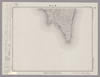
明治10 *銅版。多色刷り。外題「(森琴石編輯)大日本九州一覧之図」。刊記「出版人/大阪、中川勘兵衛」。 Copperplate.
Links: Source / Biblio Ref
|
1877 | about 3 years ago | 17 control points |
|
|
2022 | over 1 year ago | 6 control points |
|
Image from the Map Collections courtesy Stanford University Libraries, licensed under a Creative Commons Attribution-Noncommercial 3.0 Unported License. © Stanford University. 【図幅名】 別府 【測量時期】 明治36年測圖/昭和2年修正測圖 【発行時期】 【記号】 大分九号 【測量機関】 参謀本部 【備考】 祕
Links: Source / Biblio Ref
|
about 4 years ago | 4 control points | |
|
Image from the Map Collections courtesy Stanford University Libraries, licensed under a Creative Commons Attribution-Noncommercial 3.0 Unported License. © Stanford University. 【図幅名】 【測量時期】 【発行時期】 【記号】 【測量機関】 【備考】
Links: Source / Biblio Ref
|
about 2 years ago | 4 control points | |
|
Image from the Map Collections courtesy Stanford University Libraries, licensed under a Creative Commons Attribution-Noncommercial 3.0 Unported License. © Stanford University. 【図幅名】 宮原 【測量時期】 明治36年測圖/昭和2年要部修正測圖 【発行時期】 昭和4年発行 【記号】 大分十四号 【測量機関】 大日本帝國陸地測量部 【備考】
Links: Source / Biblio Ref
|
about 4 years ago | 4 control points | |
|
|
over 6 years ago | 4 control points | |
|
Image from the Map Collections courtesy Stanford University Libraries, licensed under a Creative Commons Attribution-Noncommercial 3.0 Unported License. © Stanford University. 【図幅名】 武雄 【測量時期】 明治33年及大正3年測圖之縮圖/大正6年修正測圖/昭和6年鐡道補入/昭和7年部分修正測圖 【発行時期】 昭和9年発行 【記号】 熊本十三号 【測量機関】 大日本帝國陸地測量部 【備考】
Links: Source / Biblio Ref
|
about 4 years ago | 4 control points | |
|
Image from the Map Collections courtesy Stanford University Libraries, licensed under a Creative Commons Attribution-Noncommercial 3.0 Unported License. © Stanford University. 【図幅名】 長崎 【測量時期】 明治34年測図/大正13年修正/昭和7年鉄道補入、測図の縮図 【発行時期】 昭和21年10月発行 【記号】 長崎4号(共15面) 【測量機関】 内務省地理調査所 【備考】
Links: Source / Biblio Ref
|
about 4 years ago | 4 control points | |
|
Image from the Map Collections courtesy Stanford University Libraries, licensed under a Creative Commons Attribution-Noncommercial 3.0 Unported License. © Stanford University. 【図幅名】 肥前江ノ島 【測量時期】 大正13年測図の縮図/大正13年修正/昭和11年部分修正、測図の縮図 【発行時期】 昭和21年10月発行 【記号】 長崎10号(共15面) 【測量機関】 内務省地理調査所 【備考】
Links: Source / Biblio Ref
|
about 4 years ago | 4 control points | |
|
Image from the Map Collections courtesy Stanford University Libraries, licensed under a Creative Commons Attribution-Noncommercial 3.0 Unported License. © Stanford University. 【図幅名】 角館 【測量時期】 大正5年測図/昭和14年修正 【発行時期】 昭和2年2月発行 【記号】 秋田7号(共16面) 【測量機関】 大日本帝国陸地測量部 【備考】
Links: Source / Biblio Ref
|
about 2 years ago | 4 control points | |
|
Image from the Map Collections courtesy Stanford University Libraries, licensed under a Creative Commons Attribution-Noncommercial 3.0 Unported License. © Stanford University. 【図幅名】 立串 【測量時期】 明治33年測図/大正13年測図/昭和13年測図の縮図/昭和11年修正、測図の縮図 【発行時期】 昭和21年11月発行 【記号】 長崎14号(共15面) 【測量機関】 地理調査所 【備考】
Links: Source / Biblio Ref
|
about 4 years ago | 4 control points | |
|
Image from the Map Collections courtesy Stanford University Libraries, licensed under a Creative Commons Attribution-Noncommercial 3.0 Unported License. © Stanford University. 【図幅名】 鷹巣 【測量時期】 大正3年測図 【発行時期】 大正6年4月発行 【記号】 弘前11号(共16面) 【測量機関】 大日本帝国陸地測量部 【備考】
Links: Source / Biblio Ref
|
about 2 years ago | 4 control points | |
|
Image from the Map Collections courtesy Stanford University Libraries, licensed under a Creative Commons Attribution-Noncommercial 3.0 Unported License. © Stanford University. 【図幅名】 阿蘇山 【測量時期】 明治35年測圖/昭和7年第二回修正測圖 【発行時期】 【記号】 大分十五号 【測量機関】 参謀本部 【備考】 祕
Links: Source / Biblio Ref
|
about 4 years ago | 4 control points | |
|
Image from the Map Collections courtesy Stanford University Libraries, licensed under a Creative Commons Attribution-Noncommercial 3.0 Unported License. © Stanford University. 【図幅名】 沖島 【測量時期】 明治33年測図/昭和11年修正 【発行時期】 昭和21年10月発行 【記号】 小串15号(共4面) 【測量機関】 内務省地理調査所 【備考】
Links: Source / Biblio Ref
|
about 4 years ago | 4 control points | |
|
Image from the Map Collections courtesy Stanford University Libraries, licensed under a Creative Commons Attribution-Noncommercial 3.0 Unported License. © Stanford University. 【図幅名】 諌早 【測量時期】 明治33年測圖及測圖之縮圖/大正15年修正測圖及修正測圖之縮圖 【発行時期】 【記号】 熊本十五号 【測量機関】 参謀本部 【備考】 祕
Links: Source / Biblio Ref
|
about 4 years ago | 4 control points | |
|
Links: Source / Biblio Ref
|
2021 | about 3 years ago | 8 control points |
|
Image from the Map Collections courtesy Stanford University Libraries, licensed under a Creative Commons Attribution-Noncommercial 3.0 Unported License. © Stanford University. 【図幅名】 長州 【測量時期】 明治33年測圖/大正15年第二回修正測圖/昭和7年部分修正測圖 【発行時期】 昭和9年発行 【記号】 熊本十一号 【測量機関】 大日本帝國陸地測量部 【備考】
Links: Source / Biblio Ref
|
about 4 years ago | 4 control points |