Browse Maps
| map | Title  |
Year | Last Updated | Status |
|---|---|---|---|---|
|
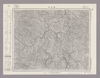
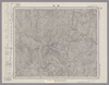
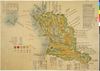
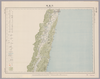
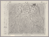
Image from the Map Collections courtesy Stanford University Libraries, licensed under a Creative Commons Attribution-Noncommercial 3.0 Unported License. © Stanford University. 【図幅名】 耶馬溪 【測量時期】 明治36年測圖/昭和7年要部修正測圖 【発行時期】 【記号】 中津十六号 【測量機関】 参謀本部 【備考】 祕
Links: Source / Biblio Ref
|
about 4 years ago | 4 control points | |
|
【最初期発行】 この地図の作成に当たっては、国土地理院長の承認を得て、同院発行の20万分の1地勢図及び5万分の1地形図を使用した。(承認番号 平30情使、 第1148号)
Links: Source / Biblio Ref
|
1934 | over 5 years ago | 4 control points |
|
この地図の作成に当たっては、国土地理院長の承認を得て、同院発行の20万分の1地勢図及び5万分の1地形図を使用した。(承認番号 平30情使、 第1148号)
Links: Source / Biblio Ref
|
1936 | over 5 years ago | 4 control points |
|
Image from the Map Collections courtesy Stanford University Libraries, licensed under a Creative Commons Attribution-Noncommercial 3.0 Unported License. © Stanford University. 【図幅名】 【測量時期】 【発行時期】 【記号】 【測量機関】 【備考】
Links: Source / Biblio Ref
|
about 2 years ago | 4 control points | |
|
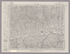
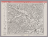
Image from the Map Collections courtesy Stanford University Libraries, licensed under a Creative Commons Attribution-Noncommercial 3.0 Unported License. © Stanford University. 【図幅名】 服島 【測量時期】 明治39年測図 【発行時期】 【記号】 岡山及丸亀12号(共13面) 【測量機関】 参謀本部 【備考】 秘
Links: Source / Biblio Ref
|
about 2 years ago | 4 control points | |
|
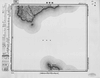
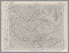
Image from the Map Collections courtesy Stanford University Libraries, licensed under a Creative Commons Attribution-Noncommercial 3.0 Unported License. © Stanford University. 【図幅名】 肥前小浜 【測量時期】 明治33年測図の縮図/大正15年測図の縮図/昭和7年部分修正 【発行時期】 【記号】 熊本16号 【測量機関】 参謀本部 【備考】 秘
Links: Source / Biblio Ref
|
about 4 years ago | 4 control points | |
|
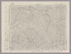
Image from the Map Collections courtesy Stanford University Libraries, licensed under a Creative Commons Attribution-Noncommercial 3.0 Unported License. © Stanford University. 【図幅名】 肥前平島 【測量時期】 明治36年測図/昭和11年修正 【発行時期】 昭和21年11月発行 【記号】 福江2号(共5面) 【測量機関】 地理調査所 【備考】
Links: Source / Biblio Ref
|
about 4 years ago | 4 control points | |
|
Image from the Map Collections courtesy Stanford University Libraries, licensed under a Creative Commons Attribution-Noncommercial 3.0 Unported License. © Stanford University. 【図幅名】 肥前江ノ島 【測量時期】 大正13年測図の縮図/大正13年修正/昭和11年部分修正、測図の縮図 【発行時期】 昭和21年10月発行 【記号】 長崎10号(共15面) 【測量機関】 内務省地理調査所 【備考】
Links: Source / Biblio Ref
|
about 4 years ago | 4 control points | |
|
Image from the Map Collections courtesy Stanford University Libraries, licensed under a Creative Commons Attribution-Noncommercial 3.0 Unported License. © Stanford University. 【図幅名】 【測量時期】 【発行時期】 【記号】 【測量機関】 【備考】
Links: Source / Biblio Ref
|
about 4 years ago | 4 control points | |
|
shelfmark: Maps *63035.1
License: Public Domain
寛政4 *手彩色。図題左方に「寛永十五年二月二十八日落城備図」とあり。奥書「黒田家士斉藤五六郎定備ヨリ借写/天明五乙巳歳三月大屋/寛政四壬子歳二月写瀬名貞雄[幕臣、奥右筆組頭。寛政8<1796>歿]」。蔵書印「柳峰□蔵書記」。 Xylograph. Acquired 22 July 1868. Ex-Siebold.
Links: Source / Biblio Ref
|
1792 | over 4 years ago | Unrectified |
|
Image from the Map Collections courtesy Stanford University Libraries, licensed under a Creative Commons Attribution-Noncommercial 3.0 Unported License. © Stanford University. 【図幅名】 肥前鳥ノ島 【測量時期】 明治44年測図/昭和11年修正 【発行時期】 【記号】 富江15号(共5面) 【測量機関】 参謀本部 【備考】 秘
Links: Source / Biblio Ref
|
about 4 years ago | 4 control points | |
|
shelfmark: 16084.d.9
License: Public Domain
安永7 *三色刷り。題箋に「Chart or plan of Nangasaki」との書入れあり Xylograph.
Links: Source / Biblio Ref
|
1778 | over 4 years ago | Unrectified |
|
shelfmark: Maps 149.e.217
License: Public Domain
江戸後期写 Manuscript, early 19th century. Acquired 22 July 1868. Ex-Siebold.
Links: Source / Biblio Ref
|
over 4 years ago | Unrectified | |
|
Image from the Map Collections courtesy Stanford University Libraries, licensed under a Creative Commons Attribution-Noncommercial 3.0 Unported License. © Stanford University. 【図幅名】 能代 【測量時期】 大正1年測図/昭和14年修正 【発行時期】 昭和16年12月発行 【記号】 弘前15号 【測量機関】 大日本帝国陸地測量部 【備考】 仮製版
Links: Source / Biblio Ref
|
over 5 years ago | 4 control points | |
|
shelfmark: Maps 149.e.250
License: Public Domain
江戸後期写 Manuscript, early 19th century. Acquired 22 July 1868. Ex-Siebold.
Links: Source / Biblio Ref
|
over 4 years ago | Unrectified | |
|
Image from the Map Collections courtesy Stanford University Libraries, licensed under a Creative Commons Attribution-Noncommercial 3.0 Unported License. © Stanford University. 【図幅名】 能登飯田 【測量時期】 明治43年測図/昭和9年修正 【発行時期】 昭和12年2月発行 【記号】 珠洲岬12号(共4面) 【測量機関】 大日本帝国陸地測量部 【備考】
Links: Source / Biblio Ref
|
about 2 years ago | 4 control points | |
|
Image from the Map Collections courtesy Stanford University Libraries, licensed under a Creative Commons Attribution-Noncommercial 3.0 Unported License. © Stanford University. 【図幅名】 根尾 【測量時期】 明治42年測図/昭和8年要部修正 【発行時期】 昭和11年1月発行 【記号】 岐阜6号(共16面) 【測量機関】 大日本帝国陸地測量部 【備考】
Links: Source / Biblio Ref
|
about 2 years ago | 4 control points | |
|
Image from the Map Collections courtesy Stanford University Libraries, licensed under a Creative Commons Attribution-Noncommercial 3.0 Unported License. © Stanford University. 【図幅名】 脇町 【測量時期】 明治29年測図/昭和9年第2回修正、測図の縮図 【発行時期】 【記号】 徳島16号(共14面) 【測量機関】 参謀本部 【備考】 秘
Links: Source / Biblio Ref
|
about 2 years ago | 4 control points | |
|
この地図の作成に当たっては、国土地理院長の承認を得て、同院発行の20万分の1地勢図及び5万分の1地形図を使用した。(承認番号 平30情使、 第1148号)
Links: Source / Biblio Ref
|
1946 | over 5 years ago | 4 control points |
|
Image from the Map Collections courtesy Stanford University Libraries, licensed under a Creative Commons Attribution-Noncommercial 3.0 Unported License. © Stanford University. 【図幅名】 背振山 【測量時期】 明治33年測圖之縮圖/昭和11年第三回修正測圖及修正測圖之縮圖/昭和13年測圖之縮圖 【発行時期】 【記号】 小倉十二号 【測量機関】 参謀本部 【備考】 祕
Links: Source / Biblio Ref
|
about 4 years ago | 4 control points | |
|
この地図の作成に当たっては、国土地理院長の承認を得て、同院発行の20万分の1地勢図及び5万分の1地形図を使用した。(承認番号 平30情使、 第1148号)
Links: Source / Biblio Ref
|
1946 | over 5 years ago | 4 control points |
|
この地図の作成に当たっては、国土地理院長の承認を得て、同院発行の20万分の1地勢図及び5万分の1地形図を使用した。(承認番号 平30情使、 第1148号)
Links: Source / Biblio Ref
|
1948 | over 5 years ago | 4 control points |
|
Image from the Map Collections courtesy Stanford University Libraries, licensed under a Creative Commons Attribution-Noncommercial 3.0 Unported License. © Stanford University. 【図幅名】 興部 【測量時期】 大正12年測図 【発行時期】 大正13年11月発行 【記号】 紋別14号(共11面) 【測量機関】 大日本帝国陸地測量部 【備考】 仮製版 (In 1 layer)
Links: Source / Biblio Ref
|
about 2 years ago | 4 control points | |
|
Image from the Map Collections courtesy Stanford University Libraries, licensed under a Creative Commons Attribution-Noncommercial 3.0 Unported License. © Stanford University. 【図幅名】 舞鶴 【測量時期】 明治26年測図/大正10年修正/昭和2年鉄道補入 【発行時期】 【記号】 舞鶴要塞近傍5号(共10面) 【測量機関】 参謀本部 【備考】 宮津12号(共12面) 軍事極秘
Links: Source / Biblio Ref
|
about 2 years ago | 4 control points | |

|
gisday 2019
|
about 5 years ago | 5 control points | |
|
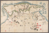
Owned by 舞鶴市糸井文庫 【成立・出版年】 明治 初1868
Links: Source / Biblio Ref
|
1868 | over 5 years ago | Unrectified |

|
|
2019 | about 5 years ago | Unrectified |
|
Image from the Map Collections courtesy Stanford University Libraries, licensed under a Creative Commons Attribution-Noncommercial 3.0 Unported License. © Stanford University. 【図幅名】 舳倉島 【測量時期】 明治43年測図/昭和4年修正 【発行時期】 昭和11年6月発行 【記号】 輪島1号(共3面) 【測量機関】 大日本帝国陸地測量部 【備考】
Links: Source / Biblio Ref
|
about 2 years ago | 4 control points | |
|
Image from the Map Collections courtesy Stanford University Libraries, licensed under a Creative Commons Attribution-Noncommercial 3.0 Unported License. © Stanford University. 【図幅名】 船川 【測量時期】 大正1年測図/大正14年鉄道補入 【発行時期】 昭和2年2月発行 【記号】 男鹿島1号(共2面) 【測量機関】 大日本帝国陸地測量部 【備考】
Links: Source / Biblio Ref
|
about 2 years ago | 4 control points | |
|
Image from the Map Collections courtesy Stanford University Libraries, licensed under a Creative Commons Attribution-Noncommercial 3.0 Unported License. © Stanford University. 【図幅名】 船津 【測量時期】 大正1年測図/昭和5年部分修正 【発行時期】 昭和8年1月発行 【記号】 高山11号(共16面) 【測量機関】 大日本帝国陸地測量部 【備考】
Links: Source / Biblio Ref
|
about 2 years ago | 4 control points | |
|
Image from the Map Collections courtesy Stanford University Libraries, licensed under a Creative Commons Attribution-Noncommercial 3.0 Unported License. © Stanford University.
Links: Source / Biblio Ref
|
over 6 years ago | 4 control points | |
|
Owned by Sainsbury Institute for the Study of Japanese Arts and Cultures 【Atlas / Book Title】 【Engraver】 【Map Size】 34.5x9.0 cm 【Medium】 木版刷
Links: Source / Biblio Ref
|
1857 | over 5 years ago | Unrectified |
|
shelfmark: Maps 145.d.2727
License: Public Domain
嘉永3 *多色刷り。『江戸切絵図集成』第四巻所収の安政4訂・図に該当。外題「芝高輪辺絵図」。(刊記)安政四丁巳歳改正/麹町六丁目/尾張屋清七板。英字・片仮名書き入れ多し。 Xylograph. Acquired 22 July 1868. Ex-Siebold. Edo kiriezu shusei 4: 94-99
Links: Source / Biblio Ref
|
1850 | over 4 years ago | Unrectified |
|
この地図の作成に当たっては、国土地理院長の承認を得て、同院発行の20万分の1地勢図及び5万分の1地形図を使用した。(承認番号 平30情使、 第1148号)
Links: Source / Biblio Ref
|
1947 | over 5 years ago | 4 control points |
|
Image from the Map Collections courtesy Stanford University Libraries, licensed under a Creative Commons Attribution-Noncommercial 3.0 Unported License. © Stanford University.
Links: Source / Biblio Ref
|
over 6 years ago | 4 control points | |
|
この地図の作成に当たっては、国土地理院長の承認を得て、同院発行の20万分の1地勢図及び5万分の1地形図を使用した。(承認番号 平30情使、 第1148号)
Links: Source / Biblio Ref
|
1947 | over 5 years ago | 4 control points |
|
Image from the Map Collections courtesy Stanford University Libraries, licensed under a Creative Commons Attribution-Noncommercial 3.0 Unported License. © Stanford University. 【図幅名】 茅登温泉 【測量時期】 大正9年測図 【発行時期】 大正11年5月発行 【記号】 淕別12号(共16面) 【測量機関】 大日本帝国陸地測量部 【備考】 (In 1 layer)
Links: Source / Biblio Ref
|
about 2 years ago | 4 control points | |
|
Image from the Map Collections courtesy Stanford University Libraries, licensed under a Creative Commons Attribution-Noncommercial 3.0 Unported License. © Stanford University. 【図幅名】 苗場山 【測量時期】 大正1年測図/昭和6年要部修正 【発行時期】 【記号】 高田7号 【測量機関】 参謀本部 【備考】 秘
Links: Source / Biblio Ref
|
about 2 years ago | 4 control points | |
|
Image from the Map Collections courtesy Stanford University Libraries, licensed under a Creative Commons Attribution-Noncommercial 3.0 Unported License. © Stanford University. 【図幅名】 若松 【測量時期】 大正2年測図/昭和6年修正/昭和8年鉄道補入 【発行時期】 昭和9年5月発行 【記号】 新潟4号(共16面) 【測量機関】 大日本帝国陸地測量部 【備考】
Links: Source / Biblio Ref
|
about 2 years ago | 4 control points | |
|
Image from the Map Collections courtesy Stanford University Libraries, licensed under a Creative Commons Attribution-Noncommercial 3.0 Unported License. © Stanford University. 【図幅名】 若柳 【測量時期】 大正2年測図/昭和8年修正 【発行時期】 昭和11年1月発行 【記号】 一関16号(共14面) 【測量機関】 大日本帝国陸地測量部 【備考】
Links: Source / Biblio Ref
|
about 2 years ago | 4 control points | |
|
Image from the Map Collections courtesy Stanford University Libraries, licensed under a Creative Commons Attribution-Noncommercial 3.0 Unported License. © Stanford University. 【図幅名】 若桜 【測量時期】 明治30年測図の縮図/明治31年測図/昭和7年修正 【発行時期】 昭和9年8月発行 【記号】 鳥取12号(共9面) 【測量機関】 大日本帝国陸地測量部 【備考】
Links: Source / Biblio Ref
|
about 2 years ago | 4 control points | |
|
shelfmark: Maps 149.e.273
License: Public Domain
江戸後期写 Manuscript, early 19th century. Acquired 22 July 1868. Ex-Siebold.
Links: Source / Biblio Ref
|
over 4 years ago | Unrectified | |
|
Image from the Map Collections courtesy Stanford University Libraries, licensed under a Creative Commons Attribution-Noncommercial 3.0 Unported License. © Stanford University. 【図幅名】 苫前 【測量時期】 大正11年測図/昭和8年鉄道補入 【発行時期】 昭和10年5月発行 【記号】 羽幌7号(共8面) 【測量機関】 大日本帝国陸地測量部 【備考】 仮製版
Links: Source / Biblio Ref
|
over 5 years ago | 4 control points | |

|
【最初期発行】 この地図の作成に当たっては、国土地理院長の承認を得て、同院発行の20万分の1地勢図及び5万分の1地形図を使用した。(承認番号 平30情使、 第1148号) (In 1 layer)
Links: Source / Biblio Ref
|
1923 | about 2 years ago | 3 control points |
|
Image from the Map Collections courtesy Stanford University Libraries, licensed under a Creative Commons Attribution-Noncommercial 3.0 Unported License. © Stanford University. 【図幅名】 苫小牧 【測量時期】 大正8年測圖/昭和10年修正測圖 【発行時期】 【記号】 苫小牧五号 【測量機関】 参謀本部 【備考】 祕 (In 1 layer)
Links: Source / Biblio Ref
|
about 2 years ago | 4 control points | |
|
Image from the Map Collections courtesy Stanford University Libraries, licensed under a Creative Commons Attribution-Noncommercial 3.0 Unported License. © Stanford University.
Links: Source / Biblio Ref
|
over 6 years ago | 4 control points | |
|
Image from the Map Collections courtesy Stanford University Libraries, licensed under a Creative Commons Attribution-Noncommercial 3.0 Unported License. © Stanford University. 【図幅名】 茂原 【測量時期】 明治36年測図/昭和6年修正 【発行時期】 昭和8年9月発行 【記号】 佐倉12号(共12面) 【測量機関】 大日本帝国陸地測量部 【備考】 (In 1 layer)
Links: Source / Biblio Ref
|
about 2 years ago | 4 control points | |
|
|
|
2022 | almost 2 years ago | Unrectified |
|
|
2022 | almost 2 years ago | 3 control points |
|
|
|
2022 | almost 2 years ago | Unrectified |