Browse Maps
| map | Title | Year | Last Updated | Status  |
|---|---|---|---|---|
|
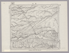
Image from the Map Collections courtesy Stanford University Libraries, licensed under a Creative Commons Attribution-Noncommercial 3.0 Unported License. © Stanford University. 【図幅名】 坂根 【測量時期】 明治31年測圖/昭和7年要部修正測圖 【発行時期】 【記号】 姫路九号 【測量機関】 参謀本部 【備考】 祕
Links: Source / Biblio Ref
|
about 2 years ago | 4 control points | |
|
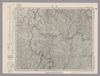
Image from the Map Collections courtesy Stanford University Libraries, licensed under a Creative Commons Attribution-Noncommercial 3.0 Unported License. © Stanford University. 【図幅名】 三里番屋 【測量時期】 大正13年測圖 【発行時期】 【記号】 紋別三号 【測量機関】 参謀本部 【備考】 祕 假製版 (In 1 layer)
Links: Source / Biblio Ref
|
about 2 years ago | 4 control points | |
|
Image from the Map Collections courtesy Stanford University Libraries, licensed under a Creative Commons Attribution-Noncommercial 3.0 Unported License. © Stanford University.
Links: Source / Biblio Ref
|
over 6 years ago | 4 control points | |
|
|
2023 | about 1 year ago | 7 control points |
|
|
over 6 years ago | 5 control points | |
|
Image from the Map Collections courtesy Stanford University Libraries, licensed under a Creative Commons Attribution-Noncommercial 3.0 Unported License. © Stanford University. 【図幅名】 丸瀬布 【測量時期】 大正13年測図/昭和3年鉄道補入 【発行時期】 昭和21年10月発行 【記号】 淕別9号(共16面) 【測量機関】 内務省地理調査所 【備考】 (In 1 layer)
Links: Source / Biblio Ref
|
about 2 years ago | 4 control points | |

|
Image from the Map Collections courtesy Stanford University Libraries, licensed under a Creative Commons Attribution-Noncommercial 3.0 Unported License. © Stanford University. 【図幅名】 片島 【測量時期】 明治34年測圖 【発行時期】 【記号】 野母崎四号 【測量機関】 参謀本部 【備考】 祕
Links: Source / Biblio Ref
|
about 4 years ago | 4 control points | |
|
Image from the Map Collections courtesy Stanford University Libraries, licensed under a Creative Commons Attribution-Noncommercial 3.0 Unported License. © Stanford University. 【図幅名】 豊富 【測量時期】 大正12年測図/昭和3年鉄道補入 【発行時期】 昭和5年3月発行 【記号】 天塩2号(共9面) 【測量機関】 大日本帝国陸地測量部 【備考】 仮製版 (In 1 layer)
Links: Source / Biblio Ref
|
about 2 years ago | 4 control points | |
|
Image from the Map Collections courtesy Stanford University Libraries, licensed under a Creative Commons Attribution-Noncommercial 3.0 Unported License. © Stanford University. 【図幅名】 古田 【測量時期】 大正10年測圖 【発行時期】 昭和11年発行 【記号】 大隅列島二号 【測量機関】 陸地測量部・参謀本部 【備考】 軍事極祕(戦地ニ在りテハ軍事祕密トス)
Links: Source / Biblio Ref
|
about 4 years ago | 4 control points | |
|
Image from the Map Collections courtesy Stanford University Libraries, licensed under a Creative Commons Attribution-Noncommercial 3.0 Unported License. © Stanford University. 【図幅名】 目梨泊 【測量時期】 大正12年測図 【発行時期】 大正13年6月発行 【記号】 枝幸6号(共12面) 【測量機関】 大日本帝国陸地測量部 【備考】 仮製版 (In 1 layer)
Links: Source / Biblio Ref
|
about 2 years ago | 4 control points | |
|
【Courtesy of the C. V. Starr East Asian Library University of California, Berkeley】 Col. map.
Links: Source / Biblio Ref
|
1895 | over 3 years ago | 4 control points |
|
Image from the Map Collections courtesy Stanford University Libraries, licensed under a Creative Commons Attribution-Noncommercial 3.0 Unported License. © Stanford University. 【図幅名】 手結 【測量時期】 明治40年測図の縮図/昭和8年修正、測図の縮図 【発行時期】 昭和11年5月発行 【記号】 高知3号(共16面) 【測量機関】 大日本帝国陸地測量部 【備考】
Links: Source / Biblio Ref
|
about 2 years ago | 4 control points | |
|
【Courtesy of the C. V. Starr East Asian Library University of California, Berkeley】 Col. map.
Links: Source / Biblio Ref
|
1895 | over 3 years ago | 4 control points |
|
Image from the Map Collections courtesy Stanford University Libraries, licensed under a Creative Commons Attribution-Noncommercial 3.0 Unported License. © Stanford University. 【図幅名】 西別 【測量時期】 大正11年測圖 【発行時期】 【記号】 標津十六号 【測量機関】 参謀本部 【備考】 祕 (In 1 layer)
Links: Source / Biblio Ref
|
about 2 years ago | 4 control points | |
|
Image from the Map Collections courtesy Stanford University Libraries, licensed under a Creative Commons Attribution-Noncommercial 3.0 Unported License. © Stanford University. 【図幅名】 日原 【測量時期】 明治32年測図/昭和7年要部修正 【発行時期】 昭和9年8月発行 【記号】 山口1号(共15面) 【測量機関】 大日本帝国陸地測量部 【備考】
Links: Source / Biblio Ref
|
about 2 years ago | 4 control points | |
|
Image from the Map Collections courtesy Stanford University Libraries, licensed under a Creative Commons Attribution-Noncommercial 3.0 Unported License. © Stanford University. 【図幅名】 茅登温泉 【測量時期】 大正9年測図 【発行時期】 大正11年5月発行 【記号】 淕別12号(共16面) 【測量機関】 大日本帝国陸地測量部 【備考】 (In 1 layer)
Links: Source / Biblio Ref
|
about 2 years ago | 4 control points | |
|
Image from the Map Collections courtesy Stanford University Libraries, licensed under a Creative Commons Attribution-Noncommercial 3.0 Unported License. © Stanford University. 【図幅名】 魚島 【測量時期】 明治31年測図 【発行時期】 明治36年12月発行 【記号】 岡山及丸亀11号(共16面) 【測量機関】 大日本帝国陸地測量部 【備考】
Links: Source / Biblio Ref
|
about 2 years ago | 4 control points | |
|
|
2022 | almost 2 years ago | 4 control points |
|
Image from the Map Collections courtesy Stanford University Libraries, licensed under a Creative Commons Attribution-Noncommercial 3.0 Unported License. © Stanford University. 【図幅名】 虻田 【測量時期】 大正6年測図/昭和6年鉄道補入 【発行時期】 昭和7年9月発行 【記号】 室蘭1号(共14面) 【測量機関】 大日本帝国陸地測量部 【備考】 (In 1 layer)
Links: Source / Biblio Ref
|
about 2 years ago | 4 control points | |
|
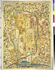
【Courtesy of the C. V. Starr East Asian Library University of California, Berkeley】 Japanese date Meiji 11 1878. In color. Folded. Mounted cover title. Wood block print. In Japanese. Relief shown pictorially. Shows distance of roads and sea routes. Includes list of kokudaka and legend.
Links: Source / Biblio Ref
|
1878 | over 3 years ago | 5 control points |
|
Image from the Map Collections courtesy Stanford University Libraries, licensed under a Creative Commons Attribution-Noncommercial 3.0 Unported License. © Stanford University. 【図幅名】 雄冬 【測量時期】 大正8年測圖 【発行時期】 【記号】 留萌十号 【測量機関】 参謀本部 【備考】 祕 (In 1 layer)
Links: Source / Biblio Ref
|
over 5 years ago | 4 control points | |
|
Image from the Map Collections courtesy Stanford University Libraries, licensed under a Creative Commons Attribution-Noncommercial 3.0 Unported License. © Stanford University. 【図幅名】 西達布 【測量時期】 大正8年測図 【発行時期】 大正9年12月発行 【記号】 夕張獄5号(共16面) 【測量機関】 大日本帝国陸地測量部 【備考】 (In 1 layer)
Links: Source / Biblio Ref
|
about 2 years ago | 4 control points | |
|
Image from the Map Collections courtesy Stanford University Libraries, licensed under a Creative Commons Attribution-Noncommercial 3.0 Unported License. © Stanford University. 【図幅名】 阿久根 【測量時期】 明治34年測圖/昭和7年要部修正測圖/昭和10年部分修正測圖 【発行時期】 昭和12年発行 【記号】 八代十六号 【測量機関】 大日本帝國陸地測量部 【備考】
Links: Source / Biblio Ref
|
about 4 years ago | 4 control points | |
|
Image from the Map Collections courtesy Stanford University Libraries, licensed under a Creative Commons Attribution-Noncommercial 3.0 Unported License. © Stanford University. 【図幅名】 落合 【測量時期】 大正8年測圖 【発行時期】 【記号】 夕張岳六号 【測量機関】 参謀本部 【備考】 祕 (In 1 layer)
Links: Source / Biblio Ref
|
about 2 years ago | 4 control points | |
|
Image from the Map Collections courtesy Stanford University Libraries, licensed under a Creative Commons Attribution-Noncommercial 3.0 Unported License. © Stanford University. 【図幅名】 三本松 【測量時期】 明治29年測図の縮図/昭和3年修正、測図の縮図/昭和9年鉄道補入、測図の縮図 【発行時期】 昭和12年3月発行 【記号】 徳島11号(共14面) 【測量機関】 大日本帝国陸地測量部 【備考】
Links: Source / Biblio Ref
|
about 2 years ago | 4 control points | |
|
Image from the Map Collections courtesy Stanford University Libraries, licensed under a Creative Commons Attribution-Noncommercial 3.0 Unported License. © Stanford University. 【図幅名】 札幌 【測量時期】 大正5年測図の縮図/昭和10年修正、測図の縮図 【発行時期】 【記号】 札幌10号 【測量機関】 参謀本部 【備考】 秘 (In 1 layer)
Links: Source / Biblio Ref
|
about 2 years ago | 4 control points | |
|
Links: Source / Biblio Ref
|
2020 | over 3 years ago | 20 control points |
|
Links: Source / Biblio Ref
|
2020 | almost 4 years ago | 15 control points |
|
Image from the Map Collections courtesy Stanford University Libraries, licensed under a Creative Commons Attribution-Noncommercial 3.0 Unported License. © Stanford University. 【図幅名】 土生 【測量時期】 明治31年測図/昭和3年修正/昭和7年鉄道補入 【発行時期】 昭和13年4月発行 【記号】 岡山及丸亀15号(共16面) 【測量機関】 大日本帝国陸地測量部 【備考】 (In 1 layer)
Links: Source / Biblio Ref
|
about 2 years ago | 4 control points | |
|
Image from the Map Collections courtesy Stanford University Libraries, licensed under a Creative Commons Attribution-Noncommercial 3.0 Unported License. © Stanford University. 【図幅名】 追分 【測量時期】 大正8年測図/昭和10年修正改版 【発行時期】 昭和11年7月発行 【記号】 札幌3号(共16面) 【測量機関】 大日本帝国陸地測量部 【備考】 (In 1 layer)
Links: Source / Biblio Ref
|
about 2 years ago | 4 control points | |
|
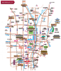
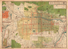
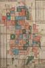
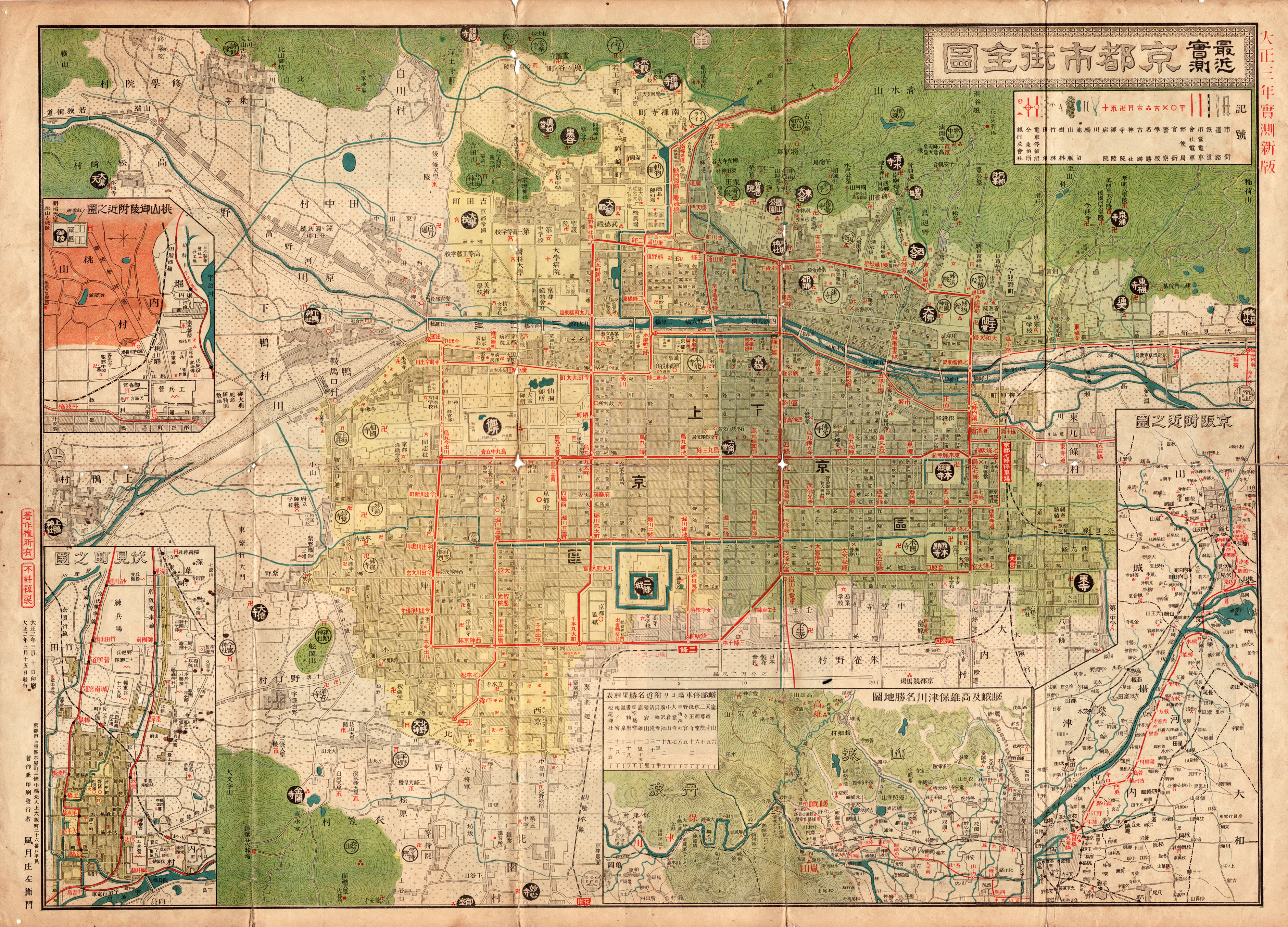
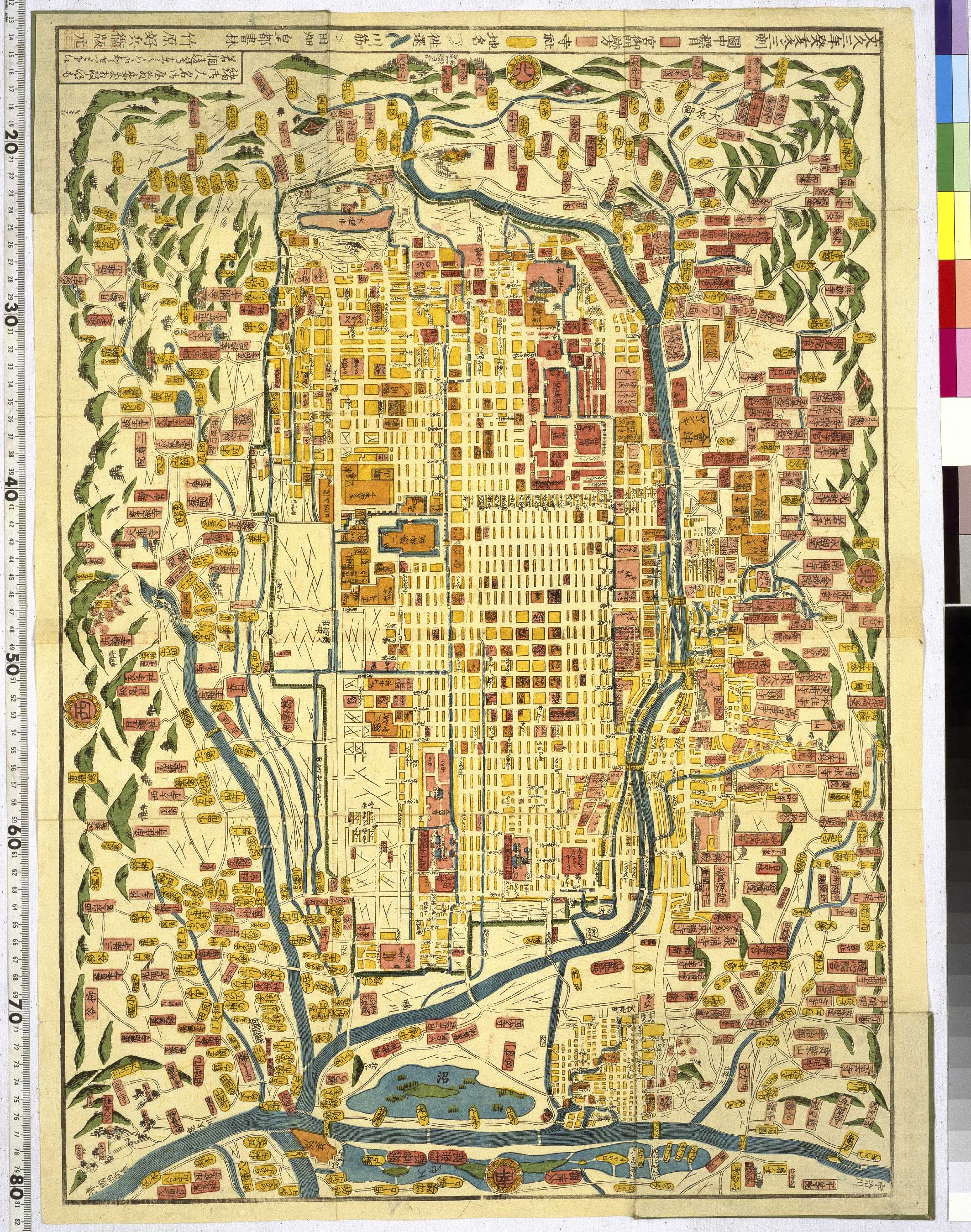
京都市の古地図
Links: Source / Biblio Ref
|
2017 | about 3 years ago | 5 control points |
|
|
7 months ago | 17 control points | |
|
Image from the Map Collections courtesy Stanford University Libraries, licensed under a Creative Commons Attribution-Noncommercial 3.0 Unported License. © Stanford University. 【図幅名】 国上 【測量時期】 大正10年測図/昭和28年応急修正 【発行時期】 昭和37年12月 【記号】 開聞岳4号東部(共11面) 【測量機関】 国土地理院 【備考】 応急修正版
Links: Source / Biblio Ref
|
about 4 years ago | 4 control points | |
|
Image from the Map Collections courtesy Stanford University Libraries, licensed under a Creative Commons Attribution-Noncommercial 3.0 Unported License. © Stanford University. 【図幅名】 韮崎 【測量時期】 明治43年測圖/昭和4年第二回修正測圖 【発行時期】 【記号】 甲府十号 【測量機関】 参謀本部 【備考】 祕
Links: Source / Biblio Ref
|
about 2 years ago | 4 control points | |
|
【Courtesy of the C. V. Starr East Asian Library University of California, Berkeley】 1 map : col. ; 116 x 73 cm., folded in cover 21 x 21 cm. In Japanese. Relief shown by contours and spot heights. Includes 1 inset and legend. East Asian Library call number: Cb132.2.
Links: Source / Biblio Ref
|
1890 | over 3 years ago | 4 control points |
|
Image from the Map Collections courtesy Stanford University Libraries, licensed under a Creative Commons Attribution-Noncommercial 3.0 Unported License. © Stanford University. 【図幅名】 島古丹 【測量時期】 大正6年測圖 【発行時期】 【記号】 岩内十一号 【測量機関】 参謀本部 【備考】 祕 (In 1 layer)
Links: Source / Biblio Ref
|
about 2 years ago | 4 control points | |
|
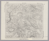
この地図の作成に当たっては、国土地理院長の承認を得て、同院発行の20万分の1地勢図及び5万分の1地形図を使用した。(承認番号 平30情使、 第1148号)
Links: Source / Biblio Ref
|
1946 | over 5 years ago | 4 control points |
|
Image from the Map Collections courtesy Stanford University Libraries, licensed under a Creative Commons Attribution-Noncommercial 3.0 Unported License. © Stanford University. 【図幅名】 江別 【測量時期】 大正5年測図の縮図/昭和10年修正改版、測図の縮図 【発行時期】 昭和12年4月発行 【記号】 札幌6号(共16面) 【測量機関】 大日本帝国陸地測量部 【備考】 (In 1 layer)
Links: Source / Biblio Ref
|
about 2 years ago | 4 control points | |
|
Image from the Map Collections courtesy Stanford University Libraries, licensed under a Creative Commons Attribution-Noncommercial 3.0 Unported License. © Stanford University. 【図幅名】 竹原 【測量時期】 明治31年測図/大正18年修正/昭和7年鉄道補入 【発行時期】 昭和13年4月発行 【記号】 広島2号(共16面) 【測量機関】 大日本帝国陸地測量部 【備考】
Links: Source / Biblio Ref
|
about 2 years ago | 4 control points | |
|
|
2019 | over 4 years ago | 4 control points |
|
Image from the Map Collections courtesy Stanford University Libraries, licensed under a Creative Commons Attribution-Noncommercial 3.0 Unported License. © Stanford University. 【図幅名】 大夕張 【測量時期】 大正8年測図 【発行時期】 大正10年6月発行 【記号】 夕張獄14号(共16面) 【測量機関】 大日本帝国陸地測量部 【備考】 (In 1 layer)
Links: Source / Biblio Ref
|
about 2 years ago | 4 control points | |
|
Image from the Map Collections courtesy Stanford University Libraries, licensed under a Creative Commons Attribution-Noncommercial 3.0 Unported License. © Stanford University. 【図幅名】 上豊似 【測量時期】 大正9年測圖 【発行時期】 【記号】 広尾十四号 【測量機関】 参謀本部 【備考】 祕 (In 1 layer)
Links: Source / Biblio Ref
|
about 2 years ago | 4 control points | |
|
Image from the Map Collections courtesy Stanford University Libraries, licensed under a Creative Commons Attribution-Noncommercial 3.0 Unported License. © Stanford University. 【図幅名】 大楽毛 【測量時期】 大正11年測図/昭和3年鉄道補入 【発行時期】 昭和5年4月発行 【記号】 釧路10号(共12面) 【測量機関】 大日本帝国陸地測量部 【備考】 仮製版 (In 1 layer)
Links: Source / Biblio Ref
|
about 2 years ago | 4 control points | |
|
|
2019 | over 4 years ago | 4 control points |
|
Image from the Map Collections courtesy Stanford University Libraries, licensed under a Creative Commons Attribution-Noncommercial 3.0 Unported License. © Stanford University. 【図幅名】 吉井 【測量時期】 明治33年測圖/昭和11年修正測圖 【発行時期】 昭和13年発行 【記号】 小倉四号 【測量機関】 大日本帝國陸地測量部 【備考】
Links: Source / Biblio Ref
|
about 4 years ago | 4 control points | |
|
Links: Source / Biblio Ref
|
2019 | almost 5 years ago | 6 control points |
|
Image from the Map Collections courtesy Stanford University Libraries, licensed under a Creative Commons Attribution-Noncommercial 3.0 Unported License. © Stanford University. 【図幅名】 徳舜暼 【測量時期】 大正6年測図の縮図/昭和10年修正、測図の縮図 【発行時期】 昭和12年4月発行 【記号】 苫小牧13号(共5面) 【測量機関】 大日本帝国陸地測量部 【備考】
Links: Source / Biblio Ref
|
about 2 years ago | 4 control points | |
|
|
7 months ago | 30 control points | |
|
Image from the Map Collections courtesy Stanford University Libraries, licensed under a Creative Commons Attribution-Noncommercial 3.0 Unported License. © Stanford University. 【図幅名】 長万部 【測量時期】 大正6年測図/昭和3年鉄道補入 【発行時期】 昭和5年9月発行 【記号】 室蘭9号(共14面) 【測量機関】 大日本帝国陸地測量部 【備考】 (In 1 layer)
Links: Source / Biblio Ref
|
about 2 years ago | 4 control points | |
|
Gomanbun no ichi chikeizu
ALTERNATIVE TITLE
五万分一地形圖
TYPE OF RESOURCE
Cartographic
FORM
cartographic materialmapmap
EXTENT
maps : some col. ; 39 x 46 cm. or smaller.
IMPRINT
Yatabe-machi : Kokudo Chiriin, Meiji 21?- 1888?-, 1888-
ISSUANCE
monographic
IMPRINT
谷田部町 : 國土地理院, 明治 21?- 1888?-
LANGUAGE
Japanese
MAP DATA
Scale 1:50,000.
Creators/Contributors (In 1 layer)
Links: Source / Biblio Ref
|
1888 | over 4 years ago | 4 control points |