Browse Maps
| map | Title  |
Year | Last Updated | Status |
|---|---|---|---|---|
|
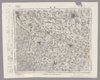
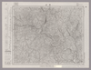
Image from the Map Collections courtesy Stanford University Libraries, licensed under a Creative Commons Attribution-Noncommercial 3.0 Unported License. © Stanford University. 【図幅名】 香住 【測量時期】 明治31年測圖/昭和7年要部修正測圖 【発行時期】 【記号】 鳥取七号 【測量機関】 参謀本部 【備考】 祕
Links: Source / Biblio Ref
|
over 5 years ago | 4 control points | |
|
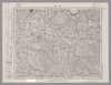
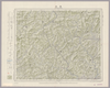
Image from the Map Collections courtesy Stanford University Libraries, licensed under a Creative Commons Attribution-Noncommercial 3.0 Unported License. © Stanford University. 【図幅名】 馬緤 【測量時期】 明治43年測図/昭和9年修正 【発行時期】 昭和22年3月発行 【記号】 珠洲岬15号(共4面) 【測量機関】 内務省地理調査所 【備考】
Links: Source / Biblio Ref
|
about 2 years ago | 4 control points | |
|
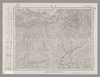
Image from the Map Collections courtesy Stanford University Libraries, licensed under a Creative Commons Attribution-Noncommercial 3.0 Unported License. © Stanford University. 【図幅名】 馬路 【測量時期】 明治40年測圖/昭和8年修正測圖 【発行時期】 【記号】 剣山十五号 【測量機関】 参謀本部 【備考】 祕
Links: Source / Biblio Ref
|
about 2 years ago | 4 control points | |
|
Image from the Map Collections courtesy Stanford University Libraries, licensed under a Creative Commons Attribution-Noncommercial 3.0 Unported License. © Stanford University. 【図幅名】 上濁川 【測量時期】 大正6年測圖 【発行時期】 【記号】 室蘭十二号 【測量機関】 参謀本部 【備考】 祕
Links: Source / Biblio Ref
|
about 2 years ago | 4 control points | |
|
Image from the Map Collections courtesy Stanford University Libraries, licensed under a Creative Commons Attribution-Noncommercial 3.0 Unported License. © Stanford University. 【図幅名】 駒越 【測量時期】 明治19年測図の縮図/昭和15年第2回修正、測図の縮図 【発行時期】 昭和16年7月発行 【記号】 静岡7号 【測量機関】 大日本帝国陸地測量部 【備考】
Links: Source / Biblio Ref
|
about 2 years ago | 4 control points | |
|
shelfmark: Maps 149.e.268
License: Public Domain
江戸後期写 *多色図。外題「駿河国」は流用。
Links: Source / Biblio Ref
|
about 3 years ago | 1 control point | |
|
shelfmark: Maps 149.e.267
License: Public Domain
江戸後期写 Manuscript, early 19th century. Acquired 22 July 1868. Ex-Siebold.
Links: Source / Biblio Ref
|
over 4 years ago | Unrectified | |
|
Image from the Map Collections courtesy Stanford University Libraries, licensed under a Creative Commons Attribution-Noncommercial 3.0 Unported License. © Stanford University. 【図幅名】 驫木 【測量時期】 大正3年測図/昭和14年修正 【発行時期】 昭和15年11月発行 【記号】 青森16号西部(共14面) 【測量機関】 大日本帝国陸地測量部 【備考】
Links: Source / Biblio Ref
|
about 2 years ago | 4 control points | |
|
【最初期発行】 この地図の作成に当たっては、国土地理院長の承認を得て、同院発行の20万分の1地勢図及び5万分の1地形図を使用した。(承認番号 平30情使、 第1148号) (In 1 layer)
Links: Source / Biblio Ref
|
1921 | about 2 years ago | 4 control points |
|
Image from the Map Collections courtesy Stanford University Libraries, licensed under a Creative Commons Attribution-Noncommercial 3.0 Unported License. © Stanford University. 【図幅名】 高山 【測量時期】 大正元年測圖/昭和5年要部修正測圖 【発行時期】 昭和7年発行 【記号】 高山十二号 【測量機関】 大日本帝國陸地測量部 【備考】
Links: Source / Biblio Ref
|
about 2 years ago | 4 control points | |
|
Image from the Map Collections courtesy Stanford University Libraries, licensed under a Creative Commons Attribution-Noncommercial 3.0 Unported License. © Stanford University.
Links: Source / Biblio Ref
|
about 6 years ago | 4 control points | |
|
この地図の作成に当たっては、国土地理院長の承認を得て、同院発行の20万分の1地勢図及び5万分の1地形図を使用した。(承認番号 平30情使、 第1148号)
Links: Source / Biblio Ref
|
1946 | over 5 years ago | 4 control points |
|
Image from the Map Collections courtesy Stanford University Libraries, licensed under a Creative Commons Attribution-Noncommercial 3.0 Unported License. © Stanford University. 【図幅名】 高崎 【測量時期】 明治40年測図/昭和4年修正/昭和9年要部修正 【発行時期】 昭和21年12月発行 【記号】 宇都宮15号(共16面) 【測量機関】 内務省地理調査所 【備考】 (In 1 layer)
Links: Source / Biblio Ref
|
about 2 years ago | 4 control points | |
|
Image from the Map Collections courtesy Stanford University Libraries, licensed under a Creative Commons Attribution-Noncommercial 3.0 Unported License. © Stanford University. 【図幅名】 高松 【測量時期】 明治30年測図の縮図/昭和3年修正、測図の縮図/昭和7年鉄道補入、測図の縮図 【発行時期】 【記号】 徳島14号(共14面) 【測量機関】 参謀本部 【備考】 秘
Links: Source / Biblio Ref
|
about 1 month ago | 4 control points | |
|
Image from the Map Collections courtesy Stanford University Libraries, licensed under a Creative Commons Attribution-Noncommercial 3.0 Unported License. © Stanford University. 【図幅名】 志度 【測量時期】 明治29年測図/明治30年測図の縮図/昭和3年修正、測図の縮図/昭和7年鉄道補入、測図の縮図 【発行時期】 【記号】 徳島15号(共14面) 【測量機関】 参謀本部 【備考】 秘
Links: Source / Biblio Ref
|
about 2 years ago | 4 control points | |
|
【最初期発行】 この地図の作成に当たっては、国土地理院長の承認を得て、同院発行の20万分の1地勢図及び5万分の1地形図を使用した。(承認番号 平30情使、 第1148号)
Links: Source / Biblio Ref
|
1908 | over 2 years ago | 4 control points |
|
Image from the Map Collections courtesy Stanford University Libraries, licensed under a Creative Commons Attribution-Noncommercial 3.0 Unported License. © Stanford University. 【図幅名】 高梁 【測量時期】 明治29年測圖之縮圖/明治31年測圖/昭和7年要部修正測圖及修正測圖 【発行時期】 【記号】 高梁八号 【測量機関】 参謀本部 【備考】 祕
Links: Source / Biblio Ref
|
about 2 years ago | 4 control points | |
|
Image from the Map Collections courtesy Stanford University Libraries, licensed under a Creative Commons Attribution-Noncommercial 3.0 Unported License. © Stanford University.
Links: Source / Biblio Ref
|
about 6 years ago | 4 control points | |
|
Image from the Map Collections courtesy Stanford University Libraries, licensed under a Creative Commons Attribution-Noncommercial 3.0 Unported License. © Stanford University. 【図幅名】 高森 【測量時期】 明治35年測圖/昭和7年要部修正測圖 【発行時期】 【記号】 大分十六号 【測量機関】 参謀本部 【備考】 祕
Links: Source / Biblio Ref
|
about 4 years ago | 4 control points | |
|
Image from the Map Collections courtesy Stanford University Libraries, licensed under a Creative Commons Attribution-Noncommercial 3.0 Unported License. © Stanford University. 【図幅名】 高浜 【測量時期】 明治34年測圖/昭和7年要部修正測圖 【発行時期】 【記号】 野母崎二号 【測量機関】 参謀本部 【備考】 祕
Links: Source / Biblio Ref
|
almost 4 years ago | 4 control points | |
|
【最初期発行】 この地図の作成に当たっては、国土地理院長の承認を得て、同院発行の20万分の1地勢図及び5万分の1地形図を使用した。(承認番号 平30情使、 第1148号) (In 1 layer)
Links: Source / Biblio Ref
|
1921 | 12 days ago | 4 control points |
|
Image from the Map Collections courtesy Stanford University Libraries, licensed under a Creative Commons Attribution-Noncommercial 3.0 Unported License. © Stanford University.
Links: Source / Biblio Ref
|
about 6 years ago | 4 control points | |
|
Image from the Map Collections courtesy Stanford University Libraries, licensed under a Creative Commons Attribution-Noncommercial 3.0 Unported License. © Stanford University. 【図幅名】 高田東部 【測量時期】 明治44年測図/昭和5年修正 【発行時期】 【記号】 高田10号(共15面) 【測量機関】 参謀本部 【備考】 秘 (In 1 layer)
Links: Source / Biblio Ref
|
about 2 years ago | 4 control points | |
|
Image from the Map Collections courtesy Stanford University Libraries, licensed under a Creative Commons Attribution-Noncommercial 3.0 Unported License. © Stanford University. 【図幅名】 【測量時期】 【発行時期】 【記号】 【測量機関】 【備考】 (In 1 layer)
Links: Source / Biblio Ref
|
about 2 years ago | 4 control points | |
|
この地図の作成に当たっては、国土地理院長の承認を得て、同院発行の20万分の1地勢図及び5万分の1地形図を使用した。(承認番号 平30情使、 第1148号)
Links: Source / Biblio Ref
|
1947 | about 4 years ago | 4 control points |
|
【最初期発行】 この地図の作成に当たっては、国土地理院長の承認を得て、同院発行の20万分の1地勢図及び5万分の1地形図を使用した。(承認番号 平30情使、 第1148号)
Links: Source / Biblio Ref
|
1915 | about 5 years ago | 4 control points |
|
Image from the Map Collections courtesy Stanford University Libraries, licensed under a Creative Commons Attribution-Noncommercial 3.0 Unported License. © Stanford University. 【図幅名】 高知 【測量時期】 明治40年測図の縮図/昭和8年修正、測図の縮図 【発行時期】 昭和11年4月発行 【記号】 高知7号(共16面) 【測量機関】 大日本帝国陸地測量部 【備考】
Links: Source / Biblio Ref
|
about 2 years ago | 4 control points | |
|
Image from the Map Collections courtesy Stanford University Libraries, licensed under a Creative Commons Attribution-Noncommercial 3.0 Unported License. © Stanford University.
Links: Source / Biblio Ref
|
about 6 years ago | 4 control points | |
|
(In 4 layers)
|
over 4 years ago | 4 control points | |
|
Image from the Map Collections courtesy Stanford University Libraries, licensed under a Creative Commons Attribution-Noncommercial 3.0 Unported License. © Stanford University. 【図幅名】 高砂 【測量時期】 明治29年測図/大正2年第2回修正 【発行時期】 【記号】 姫路4号(共16面) 【測量機関】 参謀本部 【備考】 秘
Links: Source / Biblio Ref
|
about 1 month ago | 4 control points | |
|
|
2022 | almost 2 years ago | 3 control points |
|
Image from the Map Collections courtesy Stanford University Libraries, licensed under a Creative Commons Attribution-Noncommercial 3.0 Unported License. © Stanford University. 【図幅名】 高萩 【測量時期】 明治42年測図/昭和8年要部修正 【発行時期】 昭和11年1月発行 【記号】 白河8号(共17面) 【測量機関】 大日本帝国陸地測量部 【備考】 (In 1 layer)
Links: Source / Biblio Ref
|
about 2 years ago | 4 control points | |
|
Image from the Map Collections courtesy Stanford University Libraries, licensed under a Creative Commons Attribution-Noncommercial 3.0 Unported License. © Stanford University. 【図幅名】 高見山 【測量時期】 明治25年測圖/昭和3年要部修正測圖/昭和6年部分修正測圖 【発行時期】 【記号】 宇治山田十四号 【測量機関】 参謀本部 【備考】 祕
Links: Source / Biblio Ref
|
about 2 years ago | 4 control points | |
|
Image from the Map Collections courtesy Stanford University Libraries, licensed under a Creative Commons Attribution-Noncommercial 3.0 Unported License. © Stanford University. 【図幅名】 高遠 【測量時期】 明治43年測図/昭和6年要部修正 【発行時期】 【記号】 甲府13号(共16面) 【測量機関】 参謀本部 【備考】 秘
Links: Source / Biblio Ref
|
about 2 years ago | 4 control points | |
|
この地図の作成に当たっては、国土地理院長の承認を得て、同院発行の20万分の1地勢図及び5万分の1地形図を使用した。(承認番号 平30情使、 第1148号)
Links: Source / Biblio Ref
|
1947 | over 5 years ago | 4 control points |
|
shelfmark: Maps C.22.b.10
License: Public Domain
文化10 *(刊記)板元/高野山、山本兵六/同,経師屋八左衛門/大坂白銀町、奥屋又兵衛。手彩色。 Xylograph.
Links: Source / Biblio Ref
|
1813 | over 4 years ago | Unrectified |
|
Image from the Map Collections courtesy Stanford University Libraries, licensed under a Creative Commons Attribution-Noncommercial 3.0 Unported License. © Stanford University. 【図幅名】 高鍋 【測量時期】 明治35年測図/昭和7年要部修正/昭和10年部分修正 【発行時期】 【記号】 延岡8号(共13面) 【測量機関】 参謀本部 【備考】 秘
Links: Source / Biblio Ref
|
almost 4 years ago | 4 control points | |
|
Image from the Map Collections courtesy Stanford University Libraries, licensed under a Creative Commons Attribution-Noncommercial 3.0 Unported License. © Stanford University.
Links: Source / Biblio Ref
|
about 6 years ago | 4 control points | |
|
Links: Source / Biblio Ref
|
1936 | about 3 years ago | 5 control points |
|
Image from the Map Collections courtesy Stanford University Libraries, licensed under a Creative Commons Attribution-Noncommercial 3.0 Unported License. © Stanford University. 【図幅名】 浅芽野台地 【測量時期】 大正12年測図 【発行時期】 大正13年6月発行 【記号】 枝幸9号(共12面) 【測量機関】 大日本帝国陸地測量部 【備考】 仮製版
Links: Source / Biblio Ref
|
over 5 years ago | 4 control points | |
|
Image from the Map Collections courtesy Stanford University Libraries, licensed under a Creative Commons Attribution-Noncommercial 3.0 Unported License. © Stanford University. 【図幅名】 魚島 【測量時期】 明治31年測図 【発行時期】 明治36年12月発行 【記号】 岡山及丸亀11号(共16面) 【測量機関】 大日本帝国陸地測量部 【備考】
Links: Source / Biblio Ref
|
about 2 years ago | 4 control points | |
|
Image from the Map Collections courtesy Stanford University Libraries, licensed under a Creative Commons Attribution-Noncommercial 3.0 Unported License. © Stanford University. 【図幅名】 魚津 【測量時期】 明治44年測図/昭和5年修正 【発行時期】 昭和8年11月発行 【記号】 富山12号(共11面) 【測量機関】 大日本帝国陸地測量部 【備考】 (In 1 layer)
Links: Source / Biblio Ref
|
about 2 years ago | 4 control points | |
|
Image from the Map Collections courtesy Stanford University Libraries, licensed under a Creative Commons Attribution-Noncommercial 3.0 Unported License. © Stanford University. 【図幅名】 魚神山 【測量時期】 昭和8年測図の縮図/昭和20年部分修正 【発行時期】 昭和23年2月発行 【記号】 宇和島10号(共13面) 【測量機関】 地理調査所 【備考】 (In 1 layer)
Links: Source / Biblio Ref
|
about 2 years ago | 4 control points | |
|
Image from the Map Collections courtesy Stanford University Libraries, licensed under a Creative Commons Attribution-Noncommercial 3.0 Unported License. © Stanford University. 【図幅名】 魚貫崎 【測量時期】 明治34年測圖/昭和7年要部修正測圖 【発行時期】 【記号】 野母崎三号 【測量機関】 参謀本部 【備考】 祕
Links: Source / Biblio Ref
|
almost 4 years ago | 4 control points | |
|
Image from the Map Collections courtesy Stanford University Libraries, licensed under a Creative Commons Attribution-Noncommercial 3.0 Unported License. © Stanford University. 【図幅名】 魚釣島 【測量時期】 昭和5年測圖(海上寫眞測量) 【発行時期】 昭和11年発行 【記号】 先島群島三号 【測量機関】 陸地測量部・参謀本部 【備考】 軍事極祕(戦地ニ在りテハ軍事祕密トス) 假製版
Links: Source / Biblio Ref
|
over 4 years ago | 4 control points | |
|
Image from the Map Collections courtesy Stanford University Libraries, licensed under a Creative Commons Attribution-Noncommercial 3.0 Unported License. © Stanford University.
Links: Source / Biblio Ref
|
about 6 years ago | 4 control points | |
|
Image from the Map Collections courtesy Stanford University Libraries, licensed under a Creative Commons Attribution-Noncommercial 3.0 Unported License. © Stanford University. 【図幅名】 ?崎 【測量時期】 大正5年測図 【発行時期】 大正7年6月発行 【記号】 盛岡3号東部(共18面) 【測量機関】 大日本帝国陸地測量部 【備考】
Links: Source / Biblio Ref
|
about 2 years ago | 4 control points | |
|
Image from the Map Collections courtesy Stanford University Libraries, licensed under a Creative Commons Attribution-Noncommercial 3.0 Unported License. © Stanford University. 【図幅名】 鯖江 【測量時期】 明治42年測図/昭和5年修正/昭和8年要部修正 【発行時期】 昭和8年7月発行 【記号】 岐阜13号(共16面) 【測量機関】 大日本帝国陸地測量部 【備考】 (In 1 layer)
Links: Source / Biblio Ref
|
about 2 years ago | 4 control points | |
|
|
over 1 year ago | 31 control points | |
|
Image from the Map Collections courtesy Stanford University Libraries, licensed under a Creative Commons Attribution-Noncommercial 3.0 Unported License. © Stanford University. 【図幅名】 鰍沢 【測量時期】 明治43年測図/昭和4年修正 【発行時期】 昭和22年2月発行 【記号】 甲府11号(共16面) 【測量機関】 内務省地理調査所 【備考】
Links: Source / Biblio Ref
|
about 2 years ago | 4 control points |