地図を見る
| 地図 | タイトル  |
年 | 前回の更新 | ステータス |
|---|---|---|---|---|
|
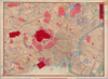
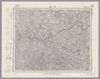
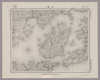
【Courtesy of the C. V. Starr East Asian Library University of California, Berkeley】 Mounted cover title. Copperplate print. In Japanese. Oriented with north to the upper right. Includes address chart pasted on the bottom of map. Includes legend.
リンク: 出所・参照情報
|
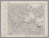
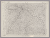
1880 | 3年以上 前 | 4個の基準点 |
|
Map from Suikeichuzu
|
3年以上 前 | 5個の基準点 | |
|
|
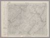
2020 | 4年弱 前 | 3個の基準点 |
|
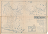
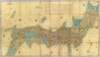
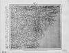
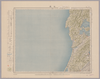
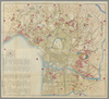
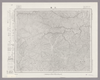
【Courtesy of the C. V. Starr East Asian Library University of California, Berkeley】 Japanese date Meiji 31 1898. In color. Folded. In Japanese. Oriented with north to the upper right. Shows distances of roads and sea routes. Includes 4 insets: Taiwan zenzu.--Hokkaidō.--Ogasawarajima Guntō ... et al. Includes legend.
リンク: 出所・参照情報
|
1898 | 3年以上 前 | 4個の基準点 |
|
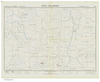
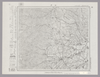
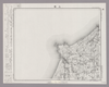
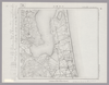
【Courtesy of the C. V. Starr East Asian Library University of California, Berkeley】 Folded in cover 22 x 16 cm. Includes list of shrines, and legend. East Asian Library call number Hb107.2.
リンク: 出所・参照情報
|
1907 | 5年以上 前 | 12個の基準点 |
|
|
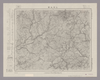
2020 | 4年弱 前 | 5個の基準点 |
|
【Courtesy of the C. V. Starr East Asian Library University of California, Berkeley】 Col. wood block print. In Japanese. East Asian Library call number: Ca 24.5 Rare-Map.
リンク: 出所・参照情報
|
1834 | 3年以上 前 | 4個の基準点 |
|
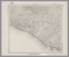
【Courtesy of the C. V. Starr East Asian Library University of California, Berkeley】 Mounted cover title. Copperplate print, col. In Japanese. Relief shown by hachures. Includes distance chart, points of interest, products in Osaka and legend. Folded 19 x 13 cm. East Asian Library call number: G51.
リンク: 出所・参照情報
|
1877 | 5年以上 前 | 13個の基準点 |
|
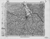
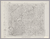
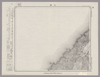
【Courtesy of the C. V. Starr East Asian Library University of California, Berkeley】 1 map : col. ; 101 x 183 cm., folded to 27 x 19 cm. Title added by hand. Wood block print. In Japanese. Oriented with north to the upper right. Covers Matsumae to Okinoerabujima, Tsushima and Ogasawara. Shows the distance of sea routes and Kuroshio. Includes legend. Alternate Title: Dai Nihon kokugun yochi rotei zenzu. East Asian Library call number Ca 34.
リンク: 出所・参照情報
|
1852 | 3年以上 前 | 5個の基準点 |
|
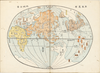
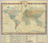
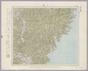
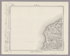
【Courtesy of the C. V. Starr East Asian Library University of California, Berkeley】 Title added by hand. Title in Kobe Shiritsu Hakubutsukan kanzobin mokuroku p.11 : Zotei yochi kokai zenzu. Wood block print. In Japanese. Relief shown by hachures. Shows sea routes and views of capital cities. Includes distance chart of sea routes, charts of mountains, and rivers, and national flags. Includes preface and legend. Col., folded in cover 32 x 20 cm. East Asian Library call number: A27.
リンク: 出所・参照情報
|
1875 | 3年以上 前 | 4個の基準点 |
|
Image from the Map Collections courtesy Stanford University Libraries, licensed under a Creative Commons Attribution-Noncommercial 3.0 Unported License. © Stanford University. 【図幅名】 石碆 【測量時期】 明治39年測図/昭和8年修正 【発行時期】 昭和11年4月発行 【記号】 窪川9号(共4面) 【測量機関】 大日本帝国陸地測量部 【備考】
リンク: 出所・参照情報
|
約2年 前 | 4個の基準点 | |
|
Image from the Map Collections courtesy Stanford University Libraries, licensed under a Creative Commons Attribution-Noncommercial 3.0 Unported License. © Stanford University. 【図幅名】 一戸 【測量時期】 大正3年測圖/大正14年部分修正測圖 【発行時期】 【記号】 八戸十一号 【測量機関】 参謀本部 【備考】 祕
リンク: 出所・参照情報
|
約2年 前 | 4個の基準点 | |
|
【最初期発行】 この地図の作成に当たっては、国土地理院長の承認を得て、同院発行の20万分の1地勢図及び5万分の1地形図を使用した。(承認番号 平30情使、 第1148号) ( 1枚のレイヤー)
リンク: 出所・参照情報
|
1924 | 約2年 前 | 4個の基準点 |
|
この地図の作成に当たっては、国土地理院長の承認を得て、同院発行の20万分の1地勢図及び5万分の1地形図を使用した。(承認番号 平30情使、 第1148号)
リンク: 出所・参照情報
|
1947 | 5年以上 前 | 4個の基準点 |
|
Image from the Map Collections courtesy Stanford University Libraries, licensed under a Creative Commons Attribution-Noncommercial 3.0 Unported License. © Stanford University.
リンク: 出所・参照情報
|
6年以上 前 | 4個の基準点 | |
|
【最初期発行】 この地図の作成に当たっては、国土地理院長の承認を得て、同院発行の20万分の1地勢図及び5万分の1地形図を使用した。(承認番号 平30情使、 第1148号) ( 1枚のレイヤー)
リンク: 出所・参照情報
|
1919 | 約2年 前 | 4個の基準点 |
|
Image from the Map Collections courtesy Stanford University Libraries, licensed under a Creative Commons Attribution-Noncommercial 3.0 Unported License. © Stanford University. 【図幅名】 七尾 【測量時期】 明治43年測図/昭和4年修正 【発行時期】 【記号】 七尾2号(共7面) 【測量機関】 参謀本部 【備考】 秘
リンク: 出所・参照情報
|
約2年 前 | 4個の基準点 | |
|
Image from the Map Collections courtesy Stanford University Libraries, licensed under a Creative Commons Attribution-Noncommercial 3.0 Unported License. © Stanford University.
リンク: 出所・参照情報
|
6年以上 前 | 4個の基準点 | |
|
Image from the Map Collections courtesy Stanford University Libraries, licensed under a Creative Commons Attribution-Noncommercial 3.0 Unported License. © Stanford University. 【図幅名】 七ッ島 【測量時期】 明治43年測図/昭和4年修正 【発行時期】 昭和11年10月発行 【記号】 輪島3号(共3面) 【測量機関】 大日本帝国陸地測量部 【備考】
リンク: 出所・参照情報
|
約2年 前 | 4個の基準点 | |
|
Image from the Map Collections courtesy Stanford University Libraries, licensed under a Creative Commons Attribution-Noncommercial 3.0 Unported License. © Stanford University. 【図幅名】 七戸 【測量時期】 大正3年測図/昭和19年部分修正 【発行時期】 【記号】 辺地16号(共7面) 【測量機関】 内務省地理調査所 【備考】
リンク: 出所・参照情報
|
約2年 前 | 4個の基準点 | |
|
Image from the Map Collections courtesy Stanford University Libraries, licensed under a Creative Commons Attribution-Noncommercial 3.0 Unported License. © Stanford University. 【図幅名】 万場 【測量時期】 大正1年測図/昭和9年要部修正 【発行時期】 昭和15年7月発行 【記号】 長野4号(共16面) 【測量機関】 大日本帝国陸地測量部 【備考】
リンク: 出所・参照情報
|
約2年 前 | 4個の基準点 | |
|
shelfmark: 16084.c.29
License: Public Domain
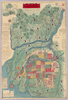
天保14 *多色刷り。附「江戸年中行事」。(刊記)元禄九年丙子旧板/文政五年壬午年補改/天保十四年癸卯再板/御書物師、出雲寺万次郎/書林、岡田屋嘉七/ (襴外)万延元年庚申改正。修訂の箇所あり。 Xylograph. Kawase p. 208.
リンク: 出所・参照情報
|
1843 | 3年以上 前 | 3個の基準点 |
|
この地図の作成に当たっては、国土地理院長の承認を得て、同院発行の20万分の1地勢図及び5万分の1地形図を使用した。(承認番号 平30情使、 第1148号)
リンク: 出所・参照情報
|
1946 | 5年以上 前 | 4個の基準点 |
|
Image from the Map Collections courtesy Stanford University Libraries, licensed under a Creative Commons Attribution-Noncommercial 3.0 Unported License. © Stanford University. 【図幅名】 三国 【測量時期】 【発行時期】 昭和8年8月発行 【記号】 金沢15号(共13面) 【測量機関】 大日本帝国陸地測量部 【備考】 ( 1枚のレイヤー)
リンク: 出所・参照情報
|
約2年 前 | 4個の基準点 | |

|
Image from the Map Collections courtesy Stanford University Libraries. This item is in the public domain. There are no restrictions on use.
【図幅名】 三子山【測量時期】 大正2年測圖 【発行時期】大正13年 【記号】 千島列島五号 【測量機関】 参謀本部 【その他】千島列島 陸地測量部 ( 1枚のレイヤー)
リンク: 出所・参照情報
|
1924 | 1年以上 前 | 4個の基準点 |
|
【最初期発行】 この地図の作成に当たっては、国土地理院長の承認を得て、同院発行の20万分の1地勢図及び5万分の1地形図を使用した。(承認番号 平30情使、 第1148号)
リンク: 出所・参照情報
|
1927 | 5年以上 前 | 4個の基準点 |
|
この地図の作成に当たっては、国土地理院長の承認を得て、同院発行の20万分の1地勢図及び5万分の1地形図を使用した。(承認番号 平30情使、 第1148号)
リンク: 出所・参照情報
|
1936 | 5年以上 前 | 4個の基準点 |
|
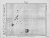
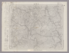
Image from the Map Collections courtesy Stanford University Libraries, licensed under a Creative Commons Attribution-Noncommercial 3.0 Unported License. © Stanford University. 【図幅名】 【測量時期】 【発行時期】 【記号】 【測量機関】 【備考】
リンク: 出所・参照情報
|
約2年 前 | 4個の基準点 | |
|
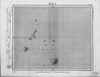
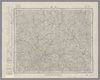
Image from the Map Collections courtesy Stanford University Libraries, licensed under a Creative Commons Attribution-Noncommercial 3.0 Unported License. © Stanford University. 【図幅名】 【測量時期】 【発行時期】 【記号】 【測量機関】 【備考】
リンク: 出所・参照情報
|
約2年 前 | 4個の基準点 | |
|
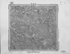
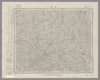
Image from the Map Collections courtesy Stanford University Libraries, licensed under a Creative Commons Attribution-Noncommercial 3.0 Unported License. © Stanford University. 【図幅名】 三峰 【測量時期】 明治43年測図/昭和4年要部修正 【発行時期】 昭和7年3月発行 【記号】 甲府1号(共16面) 【測量機関】 大日本帝国陸地測量部 【備考】 ( 1枚のレイヤー)
リンク: 出所・参照情報
|
約2年 前 | 4個の基準点 | |
|
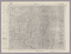
この地図の作成に当たっては、国土地理院長の承認を得て、同院発行の20万分の1地勢図及び5万分の1地形図を使用した。(承認番号 平30情使、 第1148号) ( 1枚のレイヤー)
リンク: 出所・参照情報
|
1947 | 5年以上 前 | 4個の基準点 |
|
Image from the Map Collections courtesy Stanford University Libraries, licensed under a Creative Commons Attribution-Noncommercial 3.0 Unported License. © Stanford University. 【図幅名】 三戸 【測量時期】 大正3年測圖 【発行時期】 大正6年発行 【記号】 八戸十号 【測量機関】 大日本帝國陸地測量部 【備考】
リンク: 出所・参照情報
|
約2年 前 | 4個の基準点 | |
|
Image from the Map Collections courtesy Stanford University Libraries, licensed under a Creative Commons Attribution-Noncommercial 3.0 Unported License. © Stanford University. 【図幅名】 三日市 【測量時期】 明治43年測図/昭和5年修正 【発行時期】 昭和9年4月発行 【記号】 富山11号(共11面) 【測量機関】 大日本帝国陸地測量部 【備考】 ( 1枚のレイヤー)
リンク: 出所・参照情報
|
約2年 前 | 4個の基準点 | |
|
Image from the Map Collections courtesy Stanford University Libraries, licensed under a Creative Commons Attribution-Noncommercial 3.0 Unported License. © Stanford University. 【図幅名】 三日町 【測量時期】 大正元年測圖/昭和5年要部修正測圖 【発行時期】 【記号】 高山十六号 【測量機関】 参謀本部 【備考】 祕
リンク: 出所・参照情報
|
約2年 前 | 4個の基準点 | |
|
Image from the Map Collections courtesy Stanford University Libraries, licensed under a Creative Commons Attribution-Noncommercial 3.0 Unported License. © Stanford University. 【図幅名】 三本松 【測量時期】 明治29年測図の縮図/昭和3年修正、測図の縮図/昭和9年鉄道補入、測図の縮図 【発行時期】 昭和12年3月発行 【記号】 徳島11号(共14面) 【測量機関】 大日本帝国陸地測量部 【備考】
リンク: 出所・参照情報
|
約2年 前 | 4個の基準点 | |
|
Image from the Map Collections courtesy Stanford University Libraries, licensed under a Creative Commons Attribution-Noncommercial 3.0 Unported License. © Stanford University. 【図幅名】 三条 【測量時期】 明治44年測図/昭和6年修正 【発行時期】 【記号】 長岡3号(共11面) 【測量機関】 参謀本部 【備考】 秘
リンク: 出所・参照情報
|
約2年 前 | 4個の基準点 | |
|
Image from the Map Collections courtesy Stanford University Libraries, licensed under a Creative Commons Attribution-Noncommercial 3.0 Unported License. © Stanford University. 【図幅名】 仁位 【測量時期】 大正1年測図/大正11年測図の縮図/昭和10年修正、第2回修正、測図の縮図 【発行時期】 昭和21年11月発行 【記号】 厳原10号(共7面) 【測量機関】 地理調査所 【備考】
リンク: 出所・参照情報
|
5年以上 前 | 4個の基準点 | |
|
Image from the Map Collections courtesy Stanford University Libraries, licensed under a Creative Commons Attribution-Noncommercial 3.0 Unported License. © Stanford University. 【図幅名】 三次 【測量時期】 明治31年測図/昭和7年修正 【発行時期】 昭和10年6月発行 【記号】 浜田4号(共15面) 【測量機関】 大日本帝国陸地測量部 【備考】
リンク: 出所・参照情報
|
約2年 前 | 4個の基準点 | |
|
Image from the Map Collections courtesy Stanford University Libraries, licensed under a Creative Commons Attribution-Noncommercial 3.0 Unported License. © Stanford University. 【図幅名】 三段峡 【測量時期】 明治32年測図/昭和7年修正 【発行時期】 昭和10年7月発行 【記号】 広島13号(共10面) 【測量機関】 大日本帝国陸地測量部 【備考】
リンク: 出所・参照情報
|
約2年 前 | 4個の基準点 | |
|
Image from the Map Collections courtesy Stanford University Libraries, licensed under a Creative Commons Attribution-Noncommercial 3.0 Unported License. © Stanford University. 【図幅名】 小川原沼 【測量時期】 大正3年測図 【発行時期】 【記号】 辺地12号(共7面) 【測量機関】 参謀本部 【備考】 秘
リンク: 出所・参照情報
|
約2年 前 | 4個の基準点 | |
|
Image from the Map Collections courtesy Stanford University Libraries, licensed under a Creative Commons Attribution-Noncommercial 3.0 Unported License. © Stanford University. 【図幅名】 三河大野 【測量時期】 明治22年測図の縮図/昭和15年第2回修正、測図の縮図 【発行時期】 昭和22年2月発行 【記号】 豊橋7号 【測量機関】 内務省地理調査所 【備考】 仮製版
リンク: 出所・参照情報
|
約2年 前 | 4個の基準点 | |
|
Image from the Map Collections courtesy Stanford University Libraries, licensed under a Creative Commons Attribution-Noncommercial 3.0 Unported License. © Stanford University. 【図幅名】 三津 【測量時期】 明治31年測図/昭和3年修正/昭和7年鉄道補入 【発行時期】 昭和13年4月発行 【記号】 広島3号(共16面) 【測量機関】 大日本帝国陸地測量部 【備考】
リンク: 出所・参照情報
|
5年以上 前 | 4個の基準点 | |
|
この地図の作成に当たっては、国土地理院長の承認を得て、同院発行の20万分の1地勢図及び5万分の1地形図を使用した。(承認番号 平30情使、 第1148号)
リンク: 出所・参照情報
|
1931 | 4ヶ月 前 | 4個の基準点 |
|
この地図の作成に当たっては、国土地理院長の承認を得て、同院発行の20万分の1地勢図及び5万分の1地形図を使用した。(承認番号 平30情使、 第1148号)
リンク: 出所・参照情報
|
1947 | 5年以上 前 | 4個の基準点 |
|
Image from the Map Collections courtesy Stanford University Libraries, licensed under a Creative Commons Attribution-Noncommercial 3.0 Unported License. © Stanford University. 【図幅名】 三瀬 【測量時期】 大正2年測図/昭和9年修正 【発行時期】 【記号】 酒田8号(共6面) 【測量機関】 参謀本部 【備考】 秘
リンク: 出所・参照情報
|
約2年 前 | 4個の基準点 | |
|
Image from the Map Collections courtesy Stanford University Libraries, licensed under a Creative Commons Attribution-Noncommercial 3.0 Unported License. © Stanford University. 【図幅名】 三瓶山 【測量時期】 明治32年測図/昭和7年修正 【発行時期】 昭和10年5月発行 【記号】 浜田6号(共15面) 【測量機関】 大日本帝国陸地測量部 【備考】
リンク: 出所・参照情報
|
約1年 前 | 4個の基準点 | |
|
( 3枚のレイヤー)
|
6年以上 前 | 4個の基準点 | |
|
Image from the Map Collections courtesy Stanford University Libraries, licensed under a Creative Commons Attribution-Noncommercial 3.0 Unported License. © Stanford University. 【図幅名】 三田 【測量時期】 明治43年測図/大正12年修正/昭和4年鉄道補入 【発行時期】 【記号】 京都及大阪15号(共16面) 【測量機関】 参謀本部 【備考】 秘
リンク: 出所・参照情報
|
約2年 前 | 4個の基準点 | |
|
Image from the Map Collections courtesy Stanford University Libraries, licensed under a Creative Commons Attribution-Noncommercial 3.0 Unported License. © Stanford University. 【図幅名】 三田井 【測量時期】 明治35年測圖/昭和7年要部修正測圖 【発行時期】 昭和10年発行 【記号】 大分十二号 【測量機関】 大日本帝國陸地測量部 【備考】
リンク: 出所・参照情報
|
約4年 前 | 4個の基準点 | |
|
Image from the Map Collections courtesy Stanford University Libraries, licensed under a Creative Commons Attribution-Noncommercial 3.0 Unported License. © Stanford University. 【図幅名】 三石 【測量時期】 大正9年測圖 【発行時期】 【記号】 浦河七号 【測量機関】 参謀本部 【備考】 祕 ( 1枚のレイヤー)
リンク: 出所・参照情報
|
約2年 前 | 4個の基準点 |