地図を見る
| 地図 | タイトル  |
年 | 前回の更新 | ステータス |
|---|---|---|---|---|
|
Image from the Map Collections courtesy Stanford University Libraries, licensed under a Creative Commons Attribution-Noncommercial 3.0 Unported License. © Stanford University.
リンク: 出所・参照情報
|
6年以上 前 | 4個の基準点 | |
|
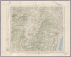
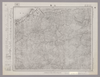
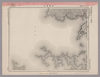
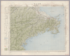
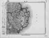
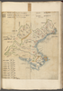
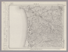
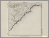
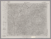
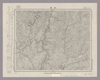
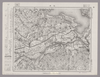
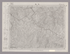
Image from the Map Collections courtesy Stanford University Libraries, licensed under a Creative Commons Attribution-Noncommercial 3.0 Unported License. © Stanford University. 【図幅名】 仙崎 【測量時期】 明治30年測図/昭和2年要部修正/昭和7年鉄道補入 【発行時期】 昭和17年12月発行 【記号】 山口14号 【測量機関】 大日本帝国陸地測量部 【備考】
リンク: 出所・参照情報
|
約2年 前 | 4個の基準点 | |
|
Image from the Map Collections courtesy Stanford University Libraries. This item is in the public domain. There are no restrictions on use.
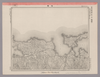
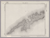
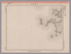
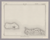
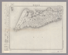
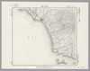
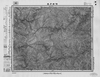
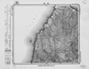
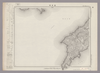
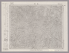
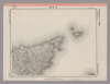
【図幅名】 仙波崎【測量時期】 大正3年測圖 【発行時期】大正13年 【記号】 幌筵島十号其一 【測量機関】 参謀本部 【その他】千島列島 陸地測量部 ( 1枚のレイヤー)
リンク: 出所・参照情報
|
1924 | 1年以上 前 | 4個の基準点 |
|
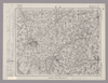
この地図の作成に当たっては、国土地理院長の承認を得て、同院発行の20万分の1地勢図及び5万分の1地形図を使用した。(承認番号 平30情使、 第1148号)
リンク: 出所・参照情報
|
1948 | 5年以上 前 | 4個の基準点 |
|
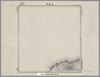
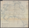
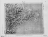
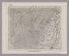
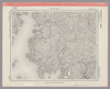
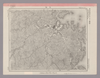
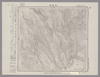
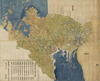
Image from the Map Collections courtesy Stanford University Libraries, licensed under a Creative Commons Attribution-Noncommercial 3.0 Unported License. © Stanford University. 【図幅名】 三島 【測量時期】 明治39年測図/昭和3年修正 【発行時期】 昭和7年1月発行 【記号】 高知5号(共16面) 【測量機関】 大日本帝国陸地測量部 【備考】 ( 1枚のレイヤー)
リンク: 出所・参照情報
|
約2年 前 | 4個の基準点 | |
|
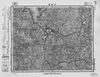
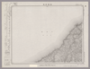
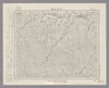
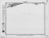
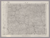
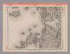
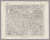
Image from the Map Collections courtesy Stanford University Libraries, licensed under a Creative Commons Attribution-Noncommercial 3.0 Unported License. © Stanford University. 【図幅名】 伊予三崎 【測量時期】 明治37年測図/昭和9年第2回修正、測図の縮図/昭和28年応急修正 【発行時期】 昭和36年8月発行 【記号】 松山16号(共15面) 【測量機関】 国土地理院 【備考】 応急修正版 ( 1枚のレイヤー)
リンク: 出所・参照情報
|
約2年 前 | 4個の基準点 | |
|
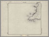
shelfmark: Maps 149.e.230
License: Public Domain
江戸後期写 Manuscript, early 19th century. Acquired 22 July 1868. Ex-Siebold.
リンク: 出所・参照情報
|
約1年 前 | 4個の基準点 | |
|
Image from the Map Collections courtesy Stanford University Libraries, licensed under a Creative Commons Attribution-Noncommercial 3.0 Unported License. © Stanford University. 【図幅名】 伊予長浜 【測量時期】 明治37年測図/昭和8年修正 【発行時期】 昭和11年5月発行 【記号】 松山11号(共15面) 【測量機関】 大日本帝国陸地測量部 【備考】 ( 1枚のレイヤー)
リンク: 出所・参照情報
|
約2年 前 | 4個の基準点 | |
|
Image from the Map Collections courtesy Stanford University Libraries, licensed under a Creative Commons Attribution-Noncommercial 3.0 Unported License. © Stanford University. 【図幅名】 伊予高山 【測量時期】 明治37年測図/昭和8年修正/昭和20年部分修正 【発行時期】 昭和23年2月発行 【記号】 宇和島9号(共13面) 【測量機関】 地理調査所 【備考】 ( 1枚のレイヤー)
リンク: 出所・参照情報
|
約2年 前 | 4個の基準点 | |
|
Image from the Map Collections courtesy Stanford University Libraries, licensed under a Creative Commons Attribution-Noncommercial 3.0 Unported License. © Stanford University. 【図幅名】 伊予鹿島 【測量時期】 明治37年測図/昭和8年修正/昭和20年部分修正 【発行時期】 昭和23年2月発行 【記号】 宇和島11号(共13面) 【測量機関】 地理調査所 【備考】 ( 1枚のレイヤー)
リンク: 出所・参照情報
|
4ヶ月 前 | 4個の基準点 | |
|
【最初期発行】 この地図の作成に当たっては、国土地理院長の承認を得て、同院発行の20万分の1地勢図及び5万分の1地形図を使用した。(承認番号 平30情使、 第1148号)
リンク: 出所・参照情報
|
1917 | 約2年 前 | 4個の基準点 |
|
Image from the Map Collections courtesy Stanford University Libraries, licensed under a Creative Commons Attribution-Noncommercial 3.0 Unported License. © Stanford University. 【図幅名】 宇治山田 【測量時期】 明治25年測図の縮図/昭和12年第2回修正、測図の縮図 【発行時期】 昭和15年4月発行 【記号】 宇治山田6号(共14面) 【測量機関】 大日本帝国陸地測量部 【備考】
リンク: 出所・参照情報
|
約2年 前 | 4個の基準点 | |
|
Image from the Map Collections courtesy Stanford University Libraries, licensed under a Creative Commons Attribution-Noncommercial 3.0 Unported License. © Stanford University.
リンク: 出所・参照情報
|
6年以上 前 | 4個の基準点 | |
|
Image from the Map Collections courtesy Stanford University Libraries, licensed under a Creative Commons Attribution-Noncommercial 3.0 Unported License. © Stanford University. 【図幅名】 伊島 【測量時期】 明治40年測図/昭和9年修正 【発行時期】 昭和11年6月発行 【記号】 由良要塞近傍8号(共10面) 【測量機関】 陸地測量部 【備考】 剣山1号(共12面) 軍事極秘
リンク: 出所・参照情報
|
5年以上 前 | 4個の基準点 | |
|
Image from the Map Collections courtesy Stanford University Libraries, licensed under a Creative Commons Attribution-Noncommercial 3.0 Unported License. © Stanford University. 【図幅名】 伊平屋前島 【測量時期】 大正10年測圖 【発行時期】 大正12年発行 【記号】 沖縄郡島八号 【測量機関】 陸地測量部・参謀本部 【備考】 軍事極祕(戦地ニ在りテハ軍事祕密トス)
リンク: 出所・参照情報
|
3ヶ月 前 | 4個の基準点 | |
|
Image from the Map Collections courtesy Stanford University Libraries, licensed under a Creative Commons Attribution-Noncommercial 3.0 Unported License. © Stanford University. 【図幅名】 伊平屋後島 【測量時期】 大正10年測圖 【発行時期】 昭和11年発行 【記号】 沖縄郡島七号 【測量機関】 陸地測量部・参謀本部 【備考】 軍事極祕(戦地ニ在りテハ軍事祕密トス)
リンク: 出所・参照情報
|
3ヶ月 前 | 4個の基準点 | |
|
この地図の作成に当たっては、国土地理院長の承認を得て、同院発行の20万分の1地勢図及び5万分の1地形図を使用した。(承認番号 平30情使、 第1148号)
リンク: 出所・参照情報
|
1946 | 5年以上 前 | 4個の基準点 |
|
Image from the Map Collections courtesy Stanford University Libraries, licensed under a Creative Commons Attribution-Noncommercial 3.0 Unported License. © Stanford University. 【図幅名】 伊江島 【測量時期】 大正10年測圖 【発行時期】 大正12年発行 【記号】 沖縄郡島九号 【測量機関】 陸地測量部・参謀本部 【備考】 軍事極祕(戦地ニ在りテハ軍事祕密トス)
リンク: 出所・参照情報
|
5年以上 前 | 4個の基準点 | |
|
Image from the Map Collections courtesy Stanford University Libraries, licensed under a Creative Commons Attribution-Noncommercial 3.0 Unported License. © Stanford University.
リンク: 出所・参照情報
|
6年以上 前 | 4個の基準点 | |
|
この地図の作成に当たっては、国土地理院長の承認を得て、同院発行の20万分の1地勢図及び5万分の1地形図を使用した。(承認番号 平30情使、 第1148号)
リンク: 出所・参照情報
|
1947 | 5年以上 前 | 4個の基準点 |
|
【最初期発行】 この地図の作成に当たっては、国土地理院長の承認を得て、同院発行の20万分の1地勢図及び5万分の1地形図を使用した。(承認番号 平30情使、 第1148号)
リンク: 出所・参照情報
|
1915 | 5年以上 前 | 4個の基準点 |
|
Image from the Map Collections courtesy Stanford University Libraries, licensed under a Creative Commons Attribution-Noncommercial 3.0 Unported License. © Stanford University. 【図幅名】 伊良湖岬 【測量時期】 明治23年測図/昭和15年第2回修正/昭和24年応急修正 【発行時期】 昭和25年10月発行 【記号】 伊良湖岬13号(共3面) 【測量機関】 地理調査所 【備考】 応急修正版
リンク: 出所・参照情報
|
約2年 前 | 4個の基準点 | |
|
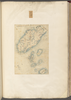
shelfmark: Maps 149.e.220
License: Public Domain
江戸後期写 Manuscript, early 19th century. Acquired 22 July 1868. Ex-Siebold.
リンク: 出所・参照情報
|
約3年 前 | 12個の基準点 | |
|
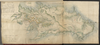
shelfmark: Maps 149.e.221
License: Public Domain
江戸後期写 *寛政6序刊図写。 Manuscript, early 19th century. Acquired 22 July 1868. Ex-Siebold. Copy of a map published in 1794.
リンク: 出所・参照情報
|
約3年 前 | 15個の基準点 | |
|
shelfmark: Maps 149.e.224
License: Public Domain
江戸後期写 Manuscript, early 19th century. Acquired 22 July 1868. Ex-Siebold.
リンク: 出所・参照情報
|
約3年 前 | 7個の基準点 | |
|
Image from the Map Collections courtesy Stanford University Libraries, licensed under a Creative Commons Attribution-Noncommercial 3.0 Unported License. © Stanford University. 【図幅名】 西紋鼈 【測量時期】 大正6年測図/昭和3年鉄道補入 【発行時期】 昭和5年4月発行 【記号】 室蘭2号(共14面) 【測量機関】 大日本帝国陸地測量部 【備考】 ( 1枚のレイヤー)
リンク: 出所・参照情報
|
約2年 前 | 4個の基準点 | |
|
Image from the Map Collections courtesy Stanford University Libraries, licensed under a Creative Commons Attribution-Noncommercial 3.0 Unported License. © Stanford University. 【図幅名】 伊那 【測量時期】 明治44年測図/昭和6年修正 【発行時期】 昭和8年11月発行 【記号】 飯田1号(共16面) 【測量機関】 大日本帝国陸地測量部 【備考】
リンク: 出所・参照情報
|
約2年 前 | 4個の基準点 | |
|
Image from the Map Collections courtesy Stanford University Libraries, licensed under a Creative Commons Attribution-Noncommercial 3.0 Unported License. © Stanford University. 【図幅名】 須崎 【測量時期】 明治39年測図の縮図/昭和8年修正、測図の縮図 【発行時期】 【記号】 高知12号(共16面) 【測量機関】 参謀本部 【備考】 秘
リンク: 出所・参照情報
|
約2年 前 | 4個の基準点 | |
|
Image from the Map Collections courtesy Stanford University Libraries, licensed under a Creative Commons Attribution-Noncommercial 3.0 Unported License. © Stanford University. 【図幅名】 伊集院 【測量時期】 明治35年測圖/昭和7年修正測圖及修正測圖之縮圖/昭和10年部分修正測圖 【発行時期】 【記号】 鹿児島十一号 【測量機関】 参謀本部 【備考】 祕
リンク: 出所・参照情報
|
約4年 前 | 4個の基準点 | |
|
この地図の作成に当たっては、国土地理院長の承認を得て、同院発行の20万分の1地勢図及び5万分の1地形図を使用した。(承認番号 平30情使、 第1148号)
リンク: 出所・参照情報
|
1947 | 5年以上 前 | 4個の基準点 |
|
Image from the Map Collections courtesy Stanford University Libraries. This item is in the public domain. There are no restrictions on use.
【図幅名】 伸津崎【測量時期】 大正4年測圖 【発行時期】昭和11年 【記号】 得撫嶋十一号 【測量機関】 参謀本部 【その他】千島列島 陸地測量部 ( 1枚のレイヤー)
リンク: 出所・参照情報
|
1936 | 1年以上 前 | 4個の基準点 |
|
Image from the Map Collections courtesy Stanford University Libraries. This item is in the public domain. There are no restrictions on use.
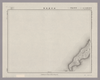
【図幅名】 伽藍崎【測量時期】 大正4年測圖 【発行時期】昭和11年 【記号】 千島列島五十六号 【測量機関】 参謀本部 【その他】千島列島 陸地測量部 ( 1枚のレイヤー)
リンク: 出所・参照情報
|
1936 | 1年以上 前 | 4個の基準点 |
|
Image from the Map Collections courtesy Stanford University Libraries, licensed under a Creative Commons Attribution-Noncommercial 3.0 Unported License. © Stanford University. 【図幅名】 但馬竹田 【測量時期】 明治31年測図/昭和7年要部修正 【発行時期】 【記号】 姫路1号(共16面) 【測量機関】 参謀本部 【備考】 秘
リンク: 出所・参照情報
|
約2年 前 | 4個の基準点 | |
|
Image from the Map Collections courtesy Stanford University Libraries, licensed under a Creative Commons Attribution-Noncommercial 3.0 Unported License. © Stanford University. 【図幅名】 住吉 【測量時期】 明治21年測量、測図の縮図/昭和15年第2回修正、測図の縮図 【発行時期】 【記号】 静岡12号(共15面) 【測量機関】 参謀本部 【備考】 秘
リンク: 出所・参照情報
|
約2年 前 | 4個の基準点 | |
|
Image from the Map Collections courtesy Stanford University Libraries, licensed under a Creative Commons Attribution-Noncommercial 3.0 Unported License. © Stanford University. 【図幅名】 佐世保 【測量時期】 明治33年測図の縮図/大正13年修正、測図の縮図/昭和20年部分修正 【発行時期】 昭和23年3月発行 【記号】 長崎5号(共15面) 【測量機関】 地理調査所 【備考】
リンク: 出所・参照情報
|
約4年 前 | 4個の基準点 | |
|
Image from the Map Collections courtesy Stanford University Libraries, licensed under a Creative Commons Attribution-Noncommercial 3.0 Unported License. © Stanford University. 【図幅名】 蠣ノ浦 【測量時期】 明治34年測図/大正13年修正/昭和20年部分修正 【発行時期】 昭和23年3月発行 【記号】 長崎6号(共15面) 【測量機関】 地理調査所 【備考】
リンク: 出所・参照情報
|
約4年 前 | 4個の基準点 | |
|
Image from the Map Collections courtesy Stanford University Libraries, licensed under a Creative Commons Attribution-Noncommercial 3.0 Unported License. © Stanford University. 【図幅名】 水窪 【測量時期】 明治44年測図/昭和8年要部修正 【発行時期】 昭和11年4月発行 【記号】 豊橋2号(共16面) 【測量機関】 大日本帝国陸地測量部 【備考】
リンク: 出所・参照情報
|
約2年 前 | 4個の基準点 | |
|
この地図の作成に当たっては、国土地理院長の承認を得て、同院発行の20万分の1地勢図及び5万分の1地形図を使用した。(承認番号 平30情使、 第1148号)
リンク: 出所・参照情報
|
1946 | 5年以上 前 | 4個の基準点 |
|
Image from the Map Collections courtesy Stanford University Libraries, licensed under a Creative Commons Attribution-Noncommercial 3.0 Unported License. © Stanford University. 【図幅名】 【測量時期】 【発行時期】 【記号】 【測量機関】 【備考】
リンク: 出所・参照情報
|
約4年 前 | 4個の基準点 | |
|
Image from the Map Collections courtesy Stanford University Libraries, licensed under a Creative Commons Attribution-Noncommercial 3.0 Unported License. © Stanford University. 【図幅名】 佐倉 【測量時期】 明治36年測図/大正10年修正/昭和4年部分修正 【発行時期】 昭和21年10月発行 【記号】 佐倉14号(共12面) 【測量機関】 内務省地理調査所 【備考】 ( 1枚のレイヤー)
リンク: 出所・参照情報
|
約2年 前 | 4個の基準点 | |
|
Image from the Map Collections courtesy Stanford University Libraries, licensed under a Creative Commons Attribution-Noncommercial 3.0 Unported License. © Stanford University. 【図幅名】 佐原 【測量時期】 明治36年測量、測図の縮図/昭和4年修正、測図の縮図/昭和9年第2回修正 【発行時期】 昭和22年1月発行 【記号】 佐倉9号(共12面) 【測量機関】 内務省地理調査所 【備考】 ( 1枚のレイヤー)
リンク: 出所・参照情報
|
3ヶ月 前 | 4個の基準点 | |
|
Image from the Map Collections courtesy Stanford University Libraries, licensed under a Creative Commons Attribution-Noncommercial 3.0 Unported License. © Stanford University. 【図幅名】 佐多岬 【測量時期】 明治34年測圖/昭和7年要部修正測圖/昭和10年部分修正測圖 【発行時期】 【記号】 開聞岳六号 【測量機関】 参謀本部 【備考】 祕
リンク: 出所・参照情報
|
2年以上 前 | 4個の基準点 | |
|
この地図の作成に当たっては、国土地理院長の承認を得て、同院発行の20万分の1地勢図及び5万分の1地形図を使用した。(承認番号 平30情使、 第1148号)
リンク: 出所・参照情報
|
1946 | 5年以上 前 | 4個の基準点 |
|
Image from the Map Collections courtesy Stanford University Libraries, licensed under a Creative Commons Attribution-Noncommercial 3.0 Unported License. © Stanford University. 【図幅名】 佐幌岳 【測量時期】 大正9年測圖 【発行時期】 【記号】 夕張岳一号 【測量機関】 参謀本部 【備考】 祕 ( 1枚のレイヤー)
リンク: 出所・参照情報
|
約2年 前 | 4個の基準点 | |
|
Image from the Map Collections courtesy Stanford University Libraries, licensed under a Creative Commons Attribution-Noncommercial 3.0 Unported License. © Stanford University. 【図幅名】 佐敷 【測量時期】 明治34年測圖/昭和7年要部修正測圖/昭和10年部分修正測圖 【発行時期】 昭和15年発行 【記号】 八代七号 【測量機関】 大日本帝國陸地測量部 【備考】
リンク: 出所・参照情報
|
約4年 前 | 4個の基準点 | |
|
Image from the Map Collections courtesy Stanford University Libraries, licensed under a Creative Commons Attribution-Noncommercial 3.0 Unported License. © Stanford University. 【図幅名】 佐用 【測量時期】 明治30年測圖/昭和7年要部修正測圖 【発行時期】 【記号】 姫路十号 【測量機関】 大日本帝國陸地測量部 【備考】
リンク: 出所・参照情報
|
約2年 前 | 4個の基準点 | |
|
Image from the Map Collections courtesy Stanford University Libraries, licensed under a Creative Commons Attribution-Noncommercial 3.0 Unported License. © Stanford University. 【図幅名】 佐賀 【測量時期】 明治33年及大正3年測圖之縮圖/大正15年修正測圖之縮圖 【発行時期】 【記号】 熊本九号 【測量機関】 参謀本部 【備考】 祕
リンク: 出所・参照情報
|
約4年 前 | 4個の基準点 | |

|
村岡碩市写 肥前一国絵図(元禄)の佐賀県部分模写 彩色手書
リンク: 出所・参照情報
|
1944 | 5年弱 前 | 4個の基準点 |
|
50%に縮小
|
1944 | 5年弱 前 | 13個の基準点 |
|
Image from the Map Collections courtesy Stanford University Libraries, licensed under a Creative Commons Attribution-Noncommercial 3.0 Unported License. © Stanford University. 【図幅名】 佐賀関 【測量時期】 明治36年測図/昭和2年第2回修正 【発行時期】 昭和21年9月発行 【記号】 大分1号(共16面) 【測量機関】 内務省地理調査所 【備考】
リンク: 出所・参照情報
|
約4年 前 | 4個の基準点 |