地図を見る
| 地図 | タイトル | 年 | 前回の更新 | ステータス  |
|---|---|---|---|---|
|
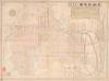
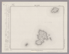
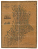
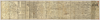
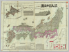
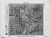
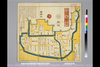
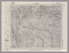
【Courtesy of the C. V. Starr East Asian Library University of California, Berkeley】 In Japanese. Oriented with north to the left. Relief shown pictorially. Includes distance chart and legend. Includes 1 map on verso.
リンク: 出所・参照情報
|
1895 | 3年以上 前 | 4個の基準点 |
|
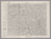
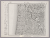
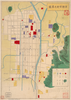
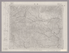
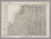
Image from the Map Collections courtesy Stanford University Libraries, licensed under a Creative Commons Attribution-Noncommercial 3.0 Unported License. © Stanford University. 【図幅名】 美保関 【測量時期】 明治32年測図/昭和9年第2回修正、測図の縮図 【発行時期】 昭和11年7月発行 【記号】 松江11号(共8面) 【測量機関】 大日本帝国陸地測量部 【備考】
リンク: 出所・参照情報
|
約2年 前 | 4個の基準点 | |
|
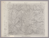
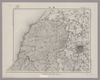
Image from the Map Collections courtesy Stanford University Libraries, licensed under a Creative Commons Attribution-Noncommercial 3.0 Unported License. © Stanford University. 【図幅名】 上石見 【測量時期】 明治32年測圖/昭和7年要部修正測圖 【発行時期】 【記号】 高梁十号 【測量機関】 参謀本部 【備考】 祕
リンク: 出所・参照情報
|
約2年 前 | 4個の基準点 | |
|
Image from the Map Collections courtesy Stanford University Libraries, licensed under a Creative Commons Attribution-Noncommercial 3.0 Unported License. © Stanford University. 【図幅名】 藺灘波島 【測量時期】 大正1年測圖/昭和10年修正測圖 【発行時期】 昭和11年発行 【記号】 御蔵島十一号 【測量機関】 大日本帝國陸地測量部 【備考】
リンク: 出所・参照情報
|
約2年 前 | 4個の基準点 | |
|
Image from the Map Collections courtesy Stanford University Libraries, licensed under a Creative Commons Attribution-Noncommercial 3.0 Unported License. © Stanford University. 【図幅名】 【測量時期】 【発行時期】 【記号】 【測量機関】 【備考】
リンク: 出所・参照情報
|
約2年 前 | 4個の基準点 | |
|
この地図の作成に当たっては、国土地理院長の承認を得て、同院発行の20万分の1地勢図及び5万分の1地形図を使用した。(承認番号 平30情使、 第1148号) ( 1枚のレイヤー)
リンク: 出所・参照情報
|
1947 | 約2年 前 | 4個の基準点 |
|
Image from the Map Collections courtesy Stanford University Libraries, licensed under a Creative Commons Attribution-Noncommercial 3.0 Unported License. © Stanford University. 【図幅名】 羽後和田 【測量時期】 大正1年測図/昭和13年修正、測図の縮図 【発行時期】 昭和15年10月発行 【記号】 秋田15号(共16面) 【測量機関】 大日本帝国陸地測量部 【備考】
リンク: 出所・参照情報
|
約2年 前 | 4個の基準点 | |
|
Image from the Map Collections courtesy Stanford University Libraries, licensed under a Creative Commons Attribution-Noncommercial 3.0 Unported License. © Stanford University. 【図幅名】 川尻 【測量時期】 大正2年測図/昭和9年修正 【発行時期】 昭和11年7月発行 【記号】 新庄1号(共16面) 【測量機関】 大日本帝国陸地測量部 【備考】
リンク: 出所・参照情報
|
約2年 前 | 4個の基準点 | |
|
|
2022 | 約2年 前 | 33個の基準点 |
|
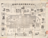
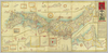
【Courtesy of the C. V. Starr East Asian Library University of California, Berkeley】 Mounted cover title. Wood block print. In Japanese. Relief shown pictorially. Oriented with north to the left. Includes distance chart and legend.
リンク: 出所・参照情報
|
1865 | 3年以上 前 | 4個の基準点 |
|
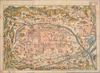
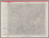
【Courtesy of the C. V. Starr East Asian Library University of California, Berkeley】 Mounted cover title. Copperplate print. In Japanese. Oriented with north to the upper right. Relief shown pictorially. Includes 2 insets, list of points of interest and legend. Shows distances of roads and sea routes. In color, folded in cover 19 x 8 cm. East Asian Library call number: J61.
リンク: 出所・参照情報
|
1892 | 3年以上 前 | 5個の基準点 |
|
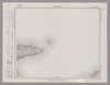
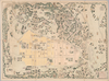
【Courtesy of the C. V. Starr East Asian Library University of California, Berkeley】 In Japanese. Oriented with north to the left. Relief shown pictorially. Includes distance chart and legend. Includes 1 map on verso.
リンク: 出所・参照情報
|
1895 | 3年以上 前 | 4個の基準点 |
|
【Courtesy of the C. V. Starr East Asian Library University of California, Berkeley】 Cover title. Wood block print, col. In Japanese. Covers Matsumae to Ryukyu. Includes lists of messenger fees and legend. Folded to 20 x 9 cm. East Asian Library call number: J9.1.
リンク: 出所・参照情報
|
1847 | 3年以上 前 | 5個の基準点 |
|
【Courtesy of the C. V. Starr East Asian Library University of California, Berkeley】 Mounted cover title. Wood block print. In Japanese. Relief shown pictorially. Oriented with north to the left.
リンク: 出所・参照情報
|
1850 | 3年以上 前 | 4個の基準点 |
|
【Courtesy of the C. V. Starr East Asian Library University of California, Berkeley】 Mounted cover title. Copperplate print, col. In Japanese. Orientation varies. Relief shown pictorially. Includes 2 insets, list of capitals and legend. Shows distance of roads and sea routes. Folded in cover 19 x 8 cm. East Asian Library call number: J36.
リンク: 出所・参照情報
|
1884 | 3年以上 前 | 5個の基準点 |
|
【Courtesy of the C. V. Starr East Asian Library University of California, Berkeley】 Mounted cover title. Title on map: Meiji shinpan Dai Nihon dochu saikenki. Copperplate print, col. In Japanese. Orientation varies. Relief shown pictorially. Includes 2 insets, list of prefectures and legend. Shows distances of roads and sea routes. Folded in cover 19 x 8 cm. East Asian Library call number: J58.
リンク: 出所・参照情報
|
1891 | 3年以上 前 | 5個の基準点 |
|
【Courtesy of the C. V. Starr East Asian Library University of California, Berkeley】 Copperplate print. In Japanese. Relief shown by hachures. Includes index.
リンク: 出所・参照情報
|
1868 | 3年以上 前 | 4個の基準点 |
|
【Courtesy of the C. V. Starr East Asian Library University of California, Berkeley】 Mounted cover title. Title on map: Kyoto ku kumi meisaizu. Copperplate print, col. In Japanese. Oriented with north to the left. Relief shown pictorially. Includes distance chart, index, and legend. Folded in cover 17 x 12 cm. East Asian Library call number: F87.
リンク: 出所・参照情報
|
1889 | 3年以上 前 | 4個の基準点 |
|
【Courtesy of the C. V. Starr East Asian Library University of California, Berkeley】 Mounted cover title. Copperplate print. In Japanese. Oriented with north to the upper right. Relief shown by hachures.
リンク: 出所・参照情報
|
1877 | 3年以上 前 | 4個の基準点 |
|
【Courtesy of the C. V. Starr East Asian Library University of California, Berkeley】 Wood block print. In Japanese. Relief shown pictorially. Oriented with north to the left.
リンク: 出所・参照情報
|
1865 | 3年以上 前 | 4個の基準点 |
|
【Courtesy of the C. V. Starr East Asian Library University of California, Berkeley】 Mounted cover title. Lithograph print. In Japanese. Oriented with north to the left. Includes text, views of tourist attractions, and distance chart.
リンク: 出所・参照情報
|
1895 | 3年以上 前 | 4個の基準点 |
|
【Courtesy of the C. V. Starr East Asian Library University of California, Berkeley】 Title added by hand. Wood block print. In Japanese. Oriented with north to the left. Relief shown pictorially. Includes index. Folded to 18 x 14 cm. East Asian Library call number: F57.
リンク: 出所・参照情報
|
1869 | 3年以上 前 | 4個の基準点 |
|
【Courtesy of the C. V. Starr East Asian Library University of California, Berkeley】 Lithograph. In Japanese. Oriented with north to the upper right. Relief shown by hachures. Includes 5 insets: Shinryochi Taiwanto -- Hokkaido -- Seinanbu Shoto ... et al.. Shows sea routes. Includes legend. In color. Folded in cover 19 x 14 cm. East Asian Library call number: Cb147.
リンク: 出所・参照情報
|
1899 | 3年以上 前 | 5個の基準点 |
|
【Courtesy of the C. V. Starr East Asian Library University of California, Berkeley】 Mounted cover title. Copperplate print. In Japanese. Orientation varies. Relief shown pictorially. Shows distance of roads and sea routes. Shows views of tourist attractions. Includes legend. Folded in cover 18 x 10 cm. East Asian Library call number: J32.
リンク: 出所・参照情報
|
1881 | 3年以上 前 | 4個の基準点 |
|
【Courtesy of the C. V. Starr East Asian Library University of California, Berkeley】 Cover title. Wood block print. In Japanese. Oriented with north to the left. Relief shown pictorially. Includes distance chart and seasonal tides. Folded in envelope 16 x 8 cm. East Asian Library call number: F22.
リンク: 出所・参照情報
|
1811 | 3年以上 前 | 4個の基準点 |
|
Image from the Map Collections courtesy Stanford University Libraries, licensed under a Creative Commons Attribution-Noncommercial 3.0 Unported License. © Stanford University. 【図幅名】 湯本 【測量時期】 明治32年測圖/昭和7年要部修正測圖 【発行時期】 昭和8年発行 【記号】 高梁五号 【測量機関】 大日本帝國陸地測量部 【備考】
リンク: 出所・参照情報
|
約2年 前 | 4個の基準点 | |
|
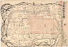
Image from the Map Collections courtesy Stanford University Libraries, licensed under a Creative Commons Attribution-Noncommercial 3.0 Unported License. © Stanford University. 【図幅名】 福井 【測量時期】 【発行時期】 【記号】 金沢16号(共13面) 【測量機関】 参謀本部 【備考】 秘 ( 1枚のレイヤー)
リンク: 出所・参照情報
|
約2年 前 | 4個の基準点 | |
|
【Courtesy of the C. V. Starr East Asian Library University of California, Berkeley】 Cover title. Title on map: Meiji kaisei Tokyo zenzu. Copperplate print. In Japanese. Oriented with north to the right. Relief shown by hachures. Includes address charts, guide for tourist, time table and legend. Shows views of tourist attractions.
リンク: 出所・参照情報
|
1888 | 3年以上 前 | 4個の基準点 |
|
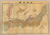
【Courtesy of the C. V. Starr East Asian Library University of California, Berkeley】 Mounted cover title. Copperplate print. In Japanese. Oriented with north to the upper right. Relief shown by hachures. 4 insets: Hokkaido zenzu ; Ryukyu Shoto no zu ; Chishima Shoto et al.. Includes charts of mountains and rivers, distance chart, and legend. Shows flags. In color, folded in cover 18 x 12 cm. East Asian Library call number: Cb129.
リンク: 出所・参照情報
|
1893 | 3年以上 前 | 4個の基準点 |
|
Image from the Map Collections courtesy Stanford University Libraries, licensed under a Creative Commons Attribution-Noncommercial 3.0 Unported License. © Stanford University. 【図幅名】 須佐 【測量時期】 明治32年測図/昭和7年要部修正 【発行時期】 昭和9年10月発行 【記号】 山口5号(共15面) 【測量機関】 大日本帝国陸地測量部 【備考】
リンク: 出所・参照情報
|
約2年 前 | 4個の基準点 | |
|
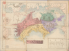
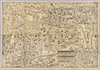
【Courtesy of the C. V. Starr East Asian Library University of California, Berkeley】 Copperplate print. In Japanese. Oriented with north to the upper right. Relief shown by hachures. 7 insets: Hokkaido zenbu -- Chishima zenbu -- Osumi Shichito Okinawa Shoto ... et al.. Includes views of points of interest, charts of mountains and rivers, list of prefectures, and legend. Shows sea routes with distance. In color, folded to 18 x 13 cm. East Asian Library call number: Cb110.
リンク: 出所・参照情報
|
1891 | 3年以上 前 | 5個の基準点 |
|
Image from the Map Collections courtesy Stanford University Libraries, licensed under a Creative Commons Attribution-Noncommercial 3.0 Unported License. © Stanford University. 【図幅名】 檜枝岐 【測量時期】 大正1年測図/昭和8年要部修正 【発行時期】 昭和11年1月発行 【記号】 日光10号(共16面) 【測量機関】 大日本帝国陸地測量部 【備考】
リンク: 出所・参照情報
|
約2年 前 | 4個の基準点 | |
|
【最初期発行】 この地図の作成に当たっては、国土地理院長の承認を得て、同院発行の20万分の1地勢図及び5万分の1地形図を使用した。(承認番号 平30情使、 第1148号) ( 1枚のレイヤー)
リンク: 出所・参照情報
|
1927 | 約2年 前 | 4個の基準点 |
|
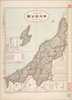
【Courtesy of the C. V. Starr East Asian Library University of California, Berkeley】 Title on envelope: Saishin Shiga-ken zenzu. Relief shown by hachures. Includes list of addresses and legend. In Japanese.
リンク: 出所・参照情報
|
1908 | 3年以上 前 | 4個の基準点 |
|
Image from the Map Collections courtesy Stanford University Libraries, licensed under a Creative Commons Attribution-Noncommercial 3.0 Unported License. © Stanford University. 【図幅名】 燧岳 【測量時期】 大正1年測図/昭和6年要部修正 【発行時期】 【記号】 日光11号(共16面) 【測量機関】 参謀本部 【備考】 秘
リンク: 出所・参照情報
|
約2年 前 | 4個の基準点 | |
|
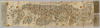
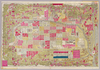
元禄9年(1696)作成、同15年(1702完成。約1/21,600。黒丸:一里塚。原図サイズ:東西349cm x 南北750cm。
リンク: 出所・参照情報
|
1702 | 約2年 前 | 35個の基準点 |
|
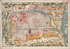
国立国会図書館デジタルコレクション
インターネット公開(保護期間満了) ( 4枚のレイヤー)
リンク: 出所・参照情報
|
1849 | 約2年 前 | 32個の基準点 |
|
Image from the Map Collections courtesy Stanford University Libraries, licensed under a Creative Commons Attribution-Noncommercial 3.0 Unported License. © Stanford University. 【図幅名】 仁尾 【測量時期】 明治30年測図/明治39年測図/昭和3年修正 【発行時期】 昭和7年3月発行 【記号】 岡山及丸亀7号(共16面) 【測量機関】 大日本帝国陸地測量部 【備考】
リンク: 出所・参照情報
|
約2年 前 | 4個の基準点 | |
|
Image from the Map Collections courtesy Stanford University Libraries, licensed under a Creative Commons Attribution-Noncommercial 3.0 Unported License. © Stanford University. 【図幅名】 男体山 【測量時期】 大正1年測図/昭和4年要部修正 【発行時期】 【記号】 日光12号(共16面) 【測量機関】 参謀本部 【備考】 秘
リンク: 出所・参照情報
|
約2年 前 | 4個の基準点 | |
|
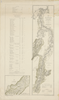
【Courtesy of the C. V. Starr East Asian Library University of California, Berkeley】 Title on envelope : Saishin Mie-ken zenzu. In Japanese. Relief shown by hachures. Includes list of addresses and legend. Shows distance of sea routes.
リンク: 出所・参照情報
|
1907 | 3年以上 前 | 4個の基準点 |
|
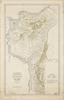
【Courtesy of the C. V. Starr East Asian Library University of California, Berkeley】 Title on envelope: Saishin Niigata-ken zenzu. In Japanese. Relief shown by hachures. Includes list of addresses and legend. Shows distance of sea routes.
リンク: 出所・参照情報
|
1907 | 3年以上 前 | 4個の基準点 |
|
リンク: 出所・参照情報
|
2021 | 2年以上 前 | 5個の基準点 |
|
リンク: 出所・参照情報
|
2021 | 2年以上 前 | 4個の基準点 |
|
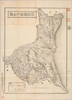
【Courtesy of the C. V. Starr East Asian Library University of California, Berkeley】 Lithograph. In Japanese. Relief shown by hachures. Includes legend.
リンク: 出所・参照情報
|
1897 | 3年以上 前 | 4個の基準点 |

|
|
2021 | 2年以上 前 | 3個の基準点 |
|
Image from the Map Collections courtesy Stanford University Libraries, licensed under a Creative Commons Attribution-Noncommercial 3.0 Unported License. © Stanford University. 【図幅名】 浜坂 【測量時期】 明治30年測圖及測圖之縮圖/明治31年測圖/昭和7年修正測圖及修正測圖之縮圖 【発行時期】 【記号】 鳥取十一号 【測量機関】 参謀本部 【備考】 祕
リンク: 出所・参照情報
|
約2年 前 | 4個の基準点 | |
|
Image from the Map Collections courtesy Stanford University Libraries, licensed under a Creative Commons Attribution-Noncommercial 3.0 Unported License. © Stanford University. 【図幅名】 邑知潟 【測量時期】 明治42年測図/昭和5年修正 【発行時期】 昭和11年12月発行 【記号】 七尾3号(共7面) 【測量機関】 大日本帝国陸地測量部 【備考】 ( 1枚のレイヤー)
リンク: 出所・参照情報
|
約2年 前 | 4個の基準点 | |
|
Image from the Map Collections courtesy Stanford University Libraries, licensed under a Creative Commons Attribution-Noncommercial 3.0 Unported License. © Stanford University. 【図幅名】 三瀬 【測量時期】 大正2年測図/昭和9年修正 【発行時期】 【記号】 酒田8号(共6面) 【測量機関】 参謀本部 【備考】 秘
リンク: 出所・参照情報
|
約2年 前 | 4個の基準点 | |
|
Image from the Map Collections courtesy Stanford University Libraries, licensed under a Creative Commons Attribution-Noncommercial 3.0 Unported License. © Stanford University. 【図幅名】 鳥海山 【測量時期】 大正2年測図/昭和9年修正 【発行時期】 昭和11年10月発行 【記号】 新庄14号(共16面) 【測量機関】 大日本帝国陸地測量部 【備考】
リンク: 出所・参照情報
|
約2年 前 | 4個の基準点 | |
|
Image from the Map Collections courtesy Stanford University Libraries, licensed under a Creative Commons Attribution-Noncommercial 3.0 Unported License. © Stanford University. 【図幅名】 栗駒山 【測量時期】 大正2年測図/昭和9年修正 【発行時期】 【記号】 新庄3号(共16面) 【測量機関】 参謀本部 【備考】 秘
リンク: 出所・参照情報
|
約2年 前 | 4個の基準点 |