地図を見る
| 地図 | タイトル | 年 | 前回の更新 | ステータス  |
|---|---|---|---|---|
|
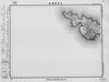
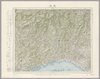
Image from the Map Collections courtesy Stanford University Libraries, licensed under a Creative Commons Attribution-Noncommercial 3.0 Unported License. © Stanford University.
リンク: 出所・参照情報
|
6年以上 前 | 4個の基準点 | |
|
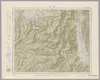
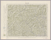
Image from the Map Collections courtesy Stanford University Libraries, licensed under a Creative Commons Attribution-Noncommercial 3.0 Unported License. © Stanford University.
リンク: 出所・参照情報
|
6年以上 前 | 4個の基準点 | |
|
Image from the Map Collections courtesy Stanford University Libraries, licensed under a Creative Commons Attribution-Noncommercial 3.0 Unported License. © Stanford University.
リンク: 出所・参照情報
|
6年以上 前 | 4個の基準点 | |
|
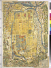
Image from the Map Collections courtesy Stanford University Libraries, licensed under a Creative Commons Attribution-Noncommercial 3.0 Unported License. © Stanford University.
リンク: 出所・参照情報
|
6年以上 前 | 4個の基準点 | |
|
この地図の作成に当たっては、国土地理院長の承認を得て、同院発行の20万分の1地勢図及び5万分の1地形図を使用した。(承認番号 平30情使、 第1148号)
リンク: 出所・参照情報
|
1946 | 2ヶ月 前 | 4個の基準点 |
|
Image from the Map Collections courtesy Stanford University Libraries, licensed under a Creative Commons Attribution-Noncommercial 3.0 Unported License. © Stanford University.
リンク: 出所・参照情報
|
6年以上 前 | 4個の基準点 | |
|
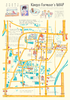
Mappin`Dropで作った案内図です。
http://mappindrop.info-mapping.com/pref-kyoto/
リンク: 出所・参照情報
|
2018 | 6年以上 前 | 7個の基準点 |
|
|
2018 | 6年以上 前 | 4個の基準点 |
|
Image from the Map Collections courtesy Stanford University Libraries, licensed under a Creative Commons Attribution-Noncommercial 3.0 Unported License. © Stanford University.
リンク: 出所・参照情報
|
6年以上 前 | 4個の基準点 | |
|
Image from the Map Collections courtesy Stanford University Libraries, licensed under a Creative Commons Attribution-Noncommercial 3.0 Unported License. © Stanford University.
リンク: 出所・参照情報
|
6年以上 前 | 4個の基準点 | |
|
Image from the Map Collections courtesy Stanford University Libraries, licensed under a Creative Commons Attribution-Noncommercial 3.0 Unported License. © Stanford University.
リンク: 出所・参照情報
|
6年以上 前 | 4個の基準点 | |
|
Image from the Map Collections courtesy Stanford University Libraries, licensed under a Creative Commons Attribution-Noncommercial 3.0 Unported License. © Stanford University.
リンク: 出所・参照情報
|
6年以上 前 | 4個の基準点 | |
|
金魚池や金魚やさんのマップ
|
2018 | 6年以上 前 | 7個の基準点 |
|
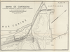
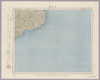
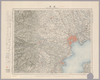
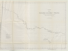
BAHÍA DE CARTAGENA. PLANO PARA ACOMPAÑAR AL INFORME DEL CORONEL P.R WARREN. DEL 16 DE SEPIEMBRE DE 1930. PLANO Nº1.
|
1930 | 11ヶ月 前 | 29個の基準点 |
|
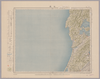
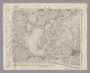
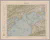
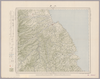
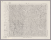
Image from the Map Collections courtesy Stanford University Libraries, licensed under a Creative Commons Attribution-Noncommercial 3.0 Unported License. © Stanford University. 【図幅名】 浜松 【測量時期】 明治23年測図/大正6年修正/昭和2年部分修正/昭和22年資料修正 【発行時期】 昭和22年2月発行 【記号】 豊橋8号(共16面) 【測量機関】 地理調査所 【備考】
リンク: 出所・参照情報
|
2ヶ月 前 | 4個の基準点 | |
|
京都府立京都学・歴彩館所蔵
下京区地籍図
リンク: 出所・参照情報
|
1884 | 6年以上 前 | 4個の基準点 |
|
Image from the Map Collections courtesy Stanford University Libraries, licensed under a Creative Commons Attribution-Noncommercial 3.0 Unported License. © Stanford University.
リンク: 出所・参照情報
|
6年以上 前 | 4個の基準点 | |
|
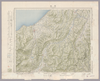
Image from the Map Collections courtesy Stanford University Libraries, licensed under a Creative Commons Attribution-Noncommercial 3.0 Unported License. © Stanford University. 【図幅名】 井出 【測量時期】 明治41年測図/昭和8年要部修正 【発行時期】 【記号】 白河1号東部(共17面) 【測量機関】 参謀本部 【備考】 秘
リンク: 出所・参照情報
|
6ヶ月 前 | 4個の基準点 | |
|
Image from the Map Collections courtesy Stanford University Libraries, licensed under a Creative Commons Attribution-Noncommercial 3.0 Unported License. © Stanford University.
リンク: 出所・参照情報
|
6年以上 前 | 4個の基準点 | |
|
京都府立京都学・歴彩館所蔵
下京区地籍図
リンク: 出所・参照情報
|
1884 | 6年以上 前 | 3個の基準点 |
|
Image from the Map Collections courtesy Stanford University Libraries, licensed under a Creative Commons Attribution-Noncommercial 3.0 Unported License. © Stanford University.
リンク: 出所・参照情報
|
6年以上 前 | 4個の基準点 | |
|
リンク: 出所・参照情報
|
1837 | 11ヶ月 前 | 3個の基準点 |
|
Image from the Map Collections courtesy Stanford University Libraries, licensed under a Creative Commons Attribution-Noncommercial 3.0 Unported License. © Stanford University. 【図幅名】 長沼 【測量時期】 明治42年測図/昭和4年修正/昭和7年測図の縮図 【発行時期】 【記号】 白河13号(共17面) 【測量機関】 参謀本部 【備考】 秘
リンク: 出所・参照情報
|
2年以上 前 | 4個の基準点 | |
|
京都府立京都学・歴彩館所蔵
下京区地籍図
リンク: 出所・参照情報
|
1884 | 6年以上 前 | 3個の基準点 |

|
|
5年以上 前 | 6個の基準点 | |
|
Image from the Map Collections courtesy Stanford University Libraries, licensed under a Creative Commons Attribution-Noncommercial 3.0 Unported License. © Stanford University.
リンク: 出所・参照情報
|
6年以上 前 | 4個の基準点 | |
|
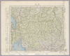
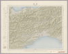
Image from the Map Collections courtesy Stanford University Libraries, licensed under a Creative Commons Attribution-Noncommercial 3.0 Unported License. © Stanford University. 【図幅名】 吉原 【測量時期】 明治20年測図/大正4年第2回修正/昭和5年部分修正 【発行時期】 昭和9年4月発行 【記号】 静岡6号(共15面) 【測量機関】 大日本帝国陸地測量部 【備考】
リンク: 出所・参照情報
|
約2ヶ月 前 | 4個の基準点 | |
|
|
2018 | 5年以上 前 | 9個の基準点 |
|
京都府立京都学・歴彩館所蔵
上京区地籍図
リンク: 出所・参照情報
|
1884 | 6年以上 前 | 4個の基準点 |
|
Image from the Map Collections courtesy Stanford University Libraries, licensed under a Creative Commons Attribution-Noncommercial 3.0 Unported License. © Stanford University.
リンク: 出所・参照情報
|
6年以上 前 | 4個の基準点 | |
|
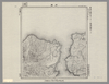
Image from the Map Collections courtesy Stanford University Libraries. This item is in the public domain. There are no restrictions on use.
【図幅名】 片岡【測量時期】 大正2年測圖 【発行時期】大正13年 【記号】 千島列島四号 【測量機関】 参謀本部 【その他】千島列島 陸地測量部 ( 1枚のレイヤー)
リンク: 出所・参照情報
|
1924 | 1年以上 前 | 4個の基準点 |
|
Image from the Map Collections courtesy Stanford University Libraries, licensed under a Creative Commons Attribution-Noncommercial 3.0 Unported License. © Stanford University.
リンク: 出所・参照情報
|
6年以上 前 | 4個の基準点 | |
|
Image from the Map Collections courtesy Stanford University Libraries, licensed under a Creative Commons Attribution-Noncommercial 3.0 Unported License. © Stanford University.
リンク: 出所・参照情報
|
6年以上 前 | 4個の基準点 | |
|
京都府立京都学・歴彩館所蔵
下京区地籍図 ( 1枚のレイヤー)
リンク: 出所・参照情報
|
1884 | 6年以上 前 | 4個の基準点 |
|
Image from the Map Collections courtesy Stanford University Libraries, licensed under a Creative Commons Attribution-Noncommercial 3.0 Unported License. © Stanford University.
リンク: 出所・参照情報
|
6年以上 前 | 4個の基準点 | |
|
Image from the Map Collections courtesy Stanford University Libraries, licensed under a Creative Commons Attribution-Noncommercial 3.0 Unported License. © Stanford University.
リンク: 出所・参照情報
|
6年以上 前 | 4個の基準点 | |
|
Image from the Map Collections courtesy Stanford University Libraries, licensed under a Creative Commons Attribution-Noncommercial 3.0 Unported License. © Stanford University.
リンク: 出所・参照情報
|
6年以上 前 | 4個の基準点 | |
|
Image from the Map Collections courtesy Stanford University Libraries, licensed under a Creative Commons Attribution-Noncommercial 3.0 Unported License. © Stanford University.
リンク: 出所・参照情報
|
6年以上 前 | 4個の基準点 | |
|
Image from the Map Collections courtesy Stanford University Libraries, licensed under a Creative Commons Attribution-Noncommercial 3.0 Unported License. © Stanford University.
リンク: 出所・参照情報
|
6年以上 前 | 4個の基準点 | |
|
リンク: 出所・参照情報
|
2021 | 1年以上 前 | 5個の基準点 |
|
|
2023 | 1年以上 前 | 3個の基準点 |
|
|
10ヶ月 前 | 61個の基準点 | |
|
Image from the Map Collections courtesy Stanford University Libraries, licensed under a Creative Commons Attribution-Noncommercial 3.0 Unported License. © Stanford University. 【図幅名】 小林 【測量時期】 大正2年測図/昭和8年要部修正 【発行時期】 昭和11年1月発行 【記号】 日光9号(共16面) 【測量機関】 大日本帝国陸地測量部 【備考】
リンク: 出所・参照情報
|
2年以上 前 | 4個の基準点 | |
|
Image from the Map Collections courtesy Stanford University Libraries, licensed under a Creative Commons Attribution-Noncommercial 3.0 Unported License. © Stanford University.
リンク: 出所・参照情報
|
6年以上 前 | 4個の基準点 | |
|
京都府立京都学・歴彩館所蔵
下京区地籍図
( 1枚のレイヤー)
リンク: 出所・参照情報
|
1884 | 6年以上 前 | 4個の基準点 |
|
Image from the Map Collections courtesy Stanford University Libraries, licensed under a Creative Commons Attribution-Noncommercial 3.0 Unported License. © Stanford University.
リンク: 出所・参照情報
|
6年以上 前 | 4個の基準点 | |
|
Image from the Map Collections courtesy Stanford University Libraries, licensed under a Creative Commons Attribution-Noncommercial 3.0 Unported License. © Stanford University.
リンク: 出所・参照情報
|
6年以上 前 | 4個の基準点 | |
|
Image from the Map Collections courtesy Stanford University Libraries, licensed under a Creative Commons Attribution-Noncommercial 3.0 Unported License. © Stanford University.
リンク: 出所・参照情報
|
6年以上 前 | 4個の基準点 | |
|
Image from the Map Collections courtesy Stanford University Libraries, licensed under a Creative Commons Attribution-Noncommercial 3.0 Unported License. © Stanford University.
リンク: 出所・参照情報
|
6年以上 前 | 4個の基準点 | |
|
Image from the Map Collections courtesy Stanford University Libraries, licensed under a Creative Commons Attribution-Noncommercial 3.0 Unported License. © Stanford University.
リンク: 出所・参照情報
|
6年以上 前 | 4個の基準点 |