地図を見る
| 地図 | タイトル | 年 | 前回の更新 | ステータス  |
|---|---|---|---|---|
|
|
2022 | 1年以上 前 | 7個の基準点 |
|
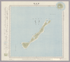
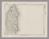
Image from the Map Collections courtesy Stanford University Libraries, licensed under a Creative Commons Attribution-Noncommercial 3.0 Unported License. © Stanford University. 【図幅名】 青瀬 【測量時期】 明治34年測図/昭和11年修正 【発行時期】 【記号】 甑島6号 【測量機関】 参謀本部 【備考】 秘
リンク: 出所・参照情報
|
4年弱 前 | 4個の基準点 | |
|
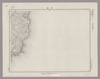
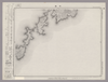
Image from the Map Collections courtesy Stanford University Libraries, licensed under a Creative Commons Attribution-Noncommercial 3.0 Unported License. © Stanford University. 【図幅名】 諸塚山 【測量時期】 明治35年測圖/昭和7年要部修正測圖 【発行時期】 【記号】 延岡九号 【測量機関】 参謀本部 【備考】 祕
リンク: 出所・参照情報
|
約4年 前 | 4個の基準点 | |
|
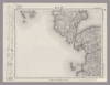
Image from the Map Collections courtesy Stanford University Libraries, licensed under a Creative Commons Attribution-Noncommercial 3.0 Unported License. © Stanford University. 【図幅名】 都農 【測量時期】 明治35年測圖/昭和7年要部修正測圖/昭和10年部分修正測圖 【発行時期】 【記号】 延岡七号 【測量機関】 参謀本部 【備考】 祕
リンク: 出所・参照情報
|
4年弱 前 | 4個の基準点 | |
|
Image from the Map Collections courtesy Stanford University Libraries, licensed under a Creative Commons Attribution-Noncommercial 3.0 Unported License. © Stanford University. 【図幅名】 高浜 【測量時期】 明治34年測圖/昭和7年要部修正測圖 【発行時期】 【記号】 野母崎二号 【測量機関】 参謀本部 【備考】 祕
リンク: 出所・参照情報
|
4年弱 前 | 4個の基準点 | |
|
Image from the Map Collections courtesy Stanford University Libraries, licensed under a Creative Commons Attribution-Noncommercial 3.0 Unported License. © Stanford University. 【図幅名】 須木 【測量時期】 明治35年測圖/昭和7年要部修正測圖/昭和10年部分修正測圖 【発行時期】 【記号】 延岡十六号 【測量機関】 参謀本部 【備考】 祕
リンク: 出所・参照情報
|
約4年 前 | 4個の基準点 | |
|
Image from the Map Collections courtesy Stanford University Libraries, licensed under a Creative Commons Attribution-Noncommercial 3.0 Unported License. © Stanford University. 【図幅名】 男女群島北部 【測量時期】 明治44年測圖/昭和11年要部修正測圖 【発行時期】 【記号】 富江十二号 【測量機関】 参謀本部 【備考】 祕
リンク: 出所・参照情報
|
4年弱 前 | 4個の基準点 | |
|
リンク: 出所・参照情報
|
2020 | 約1年 前 | 4個の基準点 |

|
Image from the Map Collections courtesy Stanford University Libraries, licensed under a Creative Commons Attribution-Noncommercial 3.0 Unported License. © Stanford University. 【図幅名】 岩川 【測量時期】 明治35年測圖/昭和7年第二回修正測圖及修正測圖之縮圖/昭和10年部分修正測圖 【発行時期】 【記号】 鹿児島三号 【測量機関】 参謀本部 【備考】 祕
リンク: 出所・参照情報
|
5年以上 前 | 4個の基準点 | |
|
|
1864 | 約6年 前 | 4個の基準点 |
|
|
2020 | 3年以上 前 | 4個の基準点 |
|
Image from the Map Collections courtesy Stanford University Libraries, licensed under a Creative Commons Attribution-Noncommercial 3.0 Unported License. © Stanford University. 【図幅名】 由良 【測量時期】 明治29年測図/昭和3年修正/昭和33年要部修正 【発行時期】 昭和36年6月発行 【記号】 徳島3号(共14面) 【測量機関】 国土地理院 【備考】
リンク: 出所・参照情報
|
5年以上 前 | 4個の基準点 | |
|
Image from the Map Collections courtesy Stanford University Libraries, licensed under a Creative Commons Attribution-Noncommercial 3.0 Unported License. © Stanford University. 【図幅名】 中津 【測量時期】 明治35年測圖/昭和16年第二回修正測圖 【発行時期】 【記号】 中津十五号 【測量機関】 参謀本部 【備考】 祕
リンク: 出所・参照情報
|
4年弱 前 | 4個の基準点 | |

|
|
2018 | 約6年 前 | 3個の基準点 |
|
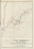
Map from Suikeichuzu
|
3年以上 前 | 5個の基準点 | |
|
Image from the Map Collections courtesy Stanford University Libraries, licensed under a Creative Commons Attribution-Noncommercial 3.0 Unported License. © Stanford University. 【図幅名】 浜津脇 【測量時期】 大正10年測図/昭和29年応急修正 【発行時期】 昭和37年10月 【記号】 屋久島1号(共8面) 【測量機関】 国土地理院 【備考】 応急修正版
リンク: 出所・参照情報
|
4年弱 前 | 4個の基準点 | |
|
Image from the Map Collections courtesy Stanford University Libraries, licensed under a Creative Commons Attribution-Noncommercial 3.0 Unported License. © Stanford University. 【図幅名】 屋久島東北部 【測量時期】 大正10年測図/昭和28年応急修正 【発行時期】 昭和37年4月 【記号】 屋久島6号(共8面) 【測量機関】 国土地理院 【備考】 応急修正版
リンク: 出所・参照情報
|
4年弱 前 | 4個の基準点 | |
|
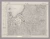
Image from the Map Collections courtesy Stanford University Libraries, licensed under a Creative Commons Attribution-Noncommercial 3.0 Unported License. © Stanford University. 【図幅名】 長崎 【測量時期】 明治34年測図/大正13年修正/昭和7年鉄道補入、測図の縮図 【発行時期】 昭和21年10月発行 【記号】 長崎4号(共15面) 【測量機関】 内務省地理調査所 【備考】
リンク: 出所・参照情報
|
4年弱 前 | 4個の基準点 | |
|
Image from the Map Collections courtesy Stanford University Libraries, licensed under a Creative Commons Attribution-Noncommercial 3.0 Unported License. © Stanford University. 【図幅名】 【測量時期】 【発行時期】 【記号】 【測量機関】 【備考】
リンク: 出所・参照情報
|
4年弱 前 | 4個の基準点 | |
|
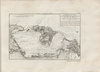
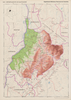
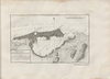
HOYA HIDROGRAFICA DEL RIO BOGOTA. PLANO PARA ACOMPAÑAR AL INFORME DE SIR. A.GIBB G.B.C G.B. DEL 25 DE JULIO DE 1931.
|
1931 | 6ヶ月 前 | 34個の基準点 |
|
|
2022 | 1年以上 前 | 6個の基準点 |
|
リンク: 出所・参照情報
|
2020 | 約1年 前 | 10個の基準点 |
|
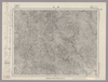
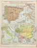
Image from the Map Collections courtesy Stanford University Libraries, licensed under a Creative Commons Attribution-Noncommercial 3.0 Unported License. © Stanford University.
リンク: 出所・参照情報
|
約6年 前 | 4個の基準点 | |
|
Image from the Map Collections courtesy Stanford University Libraries, licensed under a Creative Commons Attribution-Noncommercial 3.0 Unported License. © Stanford University. 【図幅名】 二神島 【測量時期】 大正12年測図の縮図/昭和10年修正、測図の縮図 【発行時期】 昭和21年11月発行 【記号】 唐津7号(共8面) 【測量機関】 内務省地理調査所 【備考】
リンク: 出所・参照情報
|
4年弱 前 | 4個の基準点 | |

|
Image from the Map Collections courtesy Stanford University Libraries, licensed under a Creative Commons Attribution-Noncommercial 3.0 Unported License. © Stanford University. 【図幅名】 片島 【測量時期】 明治34年測圖 【発行時期】 【記号】 野母崎四号 【測量機関】 参謀本部 【備考】 祕
リンク: 出所・参照情報
|
4年弱 前 | 4個の基準点 | |
|
Image from the Map Collections courtesy Stanford University Libraries, licensed under a Creative Commons Attribution-Noncommercial 3.0 Unported License. © Stanford University. 【図幅名】 古田 【測量時期】 大正10年測圖 【発行時期】 昭和11年発行 【記号】 大隅列島二号 【測量機関】 陸地測量部・参謀本部 【備考】 軍事極祕(戦地ニ在りテハ軍事祕密トス)
リンク: 出所・参照情報
|
4年弱 前 | 4個の基準点 | |
|
Image from the Map Collections courtesy Stanford University Libraries, licensed under a Creative Commons Attribution-Noncommercial 3.0 Unported License. © Stanford University. 【図幅名】 阿久根 【測量時期】 明治34年測圖/昭和7年要部修正測圖/昭和10年部分修正測圖 【発行時期】 昭和12年発行 【記号】 八代十六号 【測量機関】 大日本帝國陸地測量部 【備考】
リンク: 出所・参照情報
|
4年弱 前 | 4個の基準点 | |
|
Image from the Map Collections courtesy Stanford University Libraries, licensed under a Creative Commons Attribution-Noncommercial 3.0 Unported License. © Stanford University. 【図幅名】 国上 【測量時期】 大正10年測図/昭和28年応急修正 【発行時期】 昭和37年12月 【記号】 開聞岳4号東部(共11面) 【測量機関】 国土地理院 【備考】 応急修正版
リンク: 出所・参照情報
|
4年弱 前 | 4個の基準点 | |
|
リンク: 出所・参照情報
|
2020 | 1年以上 前 | 15個の基準点 |
|
Image from the Map Collections courtesy Stanford University Libraries, licensed under a Creative Commons Attribution-Noncommercial 3.0 Unported License. © Stanford University. 【図幅名】 出水 【測量時期】 明治34年測圖/昭和7年要部修正測圖/昭和10年部分修正測圖 【発行時期】 【記号】 八代十二号 【測量機関】 参謀本部 【備考】 祕
リンク: 出所・参照情報
|
5年以上 前 | 4個の基準点 | |
|
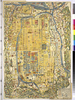
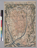
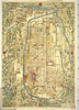
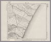
Mounted cover title.
Wood block print.
Oriented with north to the left.
In Japanese.
Relief shown pictorially.
Includes legend.
リンク: 出所・参照情報
|
2018 | 約6年 前 | 3個の基準点 |
|
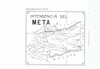
GIS day ワークショップ用
|
1863 | 約6年 前 | 3個の基準点 |
|
Image from the Map Collections courtesy Stanford University Libraries, licensed under a Creative Commons Attribution-Noncommercial 3.0 Unported License. © Stanford University. 【図幅名】 富高 【測量時期】 明治35年測圖/昭和7年要部修正測圖 【発行時期】 昭和10年発行 【記号】 延岡六号 【測量機関】 大日本帝國陸地測量部 【備考】
リンク: 出所・参照情報
|
4年弱 前 | 4個の基準点 | |
|
Image from the Map Collections courtesy Stanford University Libraries, licensed under a Creative Commons Attribution-Noncommercial 3.0 Unported License. © Stanford University. 【図幅名】 羽嶋 【測量時期】 明治35年測圖/昭和7年要部修正測圖/昭和10年部分修正測圖 【発行時期】 【記号】 鹿児島十四号 【測量機関】 参謀本部 【備考】 祕
リンク: 出所・参照情報
|
約4年 前 | 4個の基準点 | |
|
Image from the Map Collections courtesy Stanford University Libraries, licensed under a Creative Commons Attribution-Noncommercial 3.0 Unported License. © Stanford University. 【図幅名】 福江 【測量時期】 明治33年測図の縮図/昭和11年修正、測図の縮図/昭和13年測図の縮図 【発行時期】 昭和21年11月発行 【記号】 福江4号(共5面) 【測量機関】 地理調査所 【備考】
リンク: 出所・参照情報
|
4年弱 前 | 4個の基準点 | |
|
Image from the Map Collections courtesy Stanford University Libraries, licensed under a Creative Commons Attribution-Noncommercial 3.0 Unported License. © Stanford University. 【図幅名】 坊 【測量時期】 明治34年測圖/昭和7年要部修正測圖/昭和10年部分修正測圖 【発行時期】 【記号】 開聞岳十三号 【測量機関】 参謀本部 【備考】 祕
リンク: 出所・参照情報
|
約4年 前 | 4個の基準点 | |
|
Image from the Map Collections courtesy Stanford University Libraries, licensed under a Creative Commons Attribution-Noncommercial 3.0 Unported License. © Stanford University. 【図幅名】 中甑 【測量時期】 明治34年測図/昭和11年修正 【発行時期】 【記号】 甑島2号(共4面) 【測量機関】 参謀本部 【備考】 秘
リンク: 出所・参照情報
|
4年弱 前 | 4個の基準点 | |
|
|
2018 | 4年以上 前 | 17個の基準点 |
|
|
6ヶ月 前 | 9個の基準点 | |
|
リンク: 出所・参照情報
|
2020 | 約1年 前 | 5個の基準点 |
|
Image from the Map Collections courtesy Stanford University Libraries, licensed under a Creative Commons Attribution-Noncommercial 3.0 Unported License. © Stanford University. 【図幅名】 大樹 【測量時期】 大正9年測圖/昭和8年鐡道補入 【発行時期】 【記号】 広尾十号 【測量機関】 参謀本部 【備考】 祕
リンク: 出所・参照情報
|
約2年 前 | 4個の基準点 | |
|
リンク: 出所・参照情報
|
2020 | 約1年 前 | 6個の基準点 |
|
Image from the Map Collections courtesy Stanford University Libraries, licensed under a Creative Commons Attribution-Noncommercial 3.0 Unported License. © Stanford University. 【図幅名】 【測量時期】 【発行時期】 【記号】 【測量機関】 【備考】
リンク: 出所・参照情報
|
約2年 前 | 4個の基準点 | |
|
Image from the Map Collections courtesy Stanford University Libraries, licensed under a Creative Commons Attribution-Noncommercial 3.0 Unported License. © Stanford University. 【図幅名】 日向青島 【測量時期】 明治35年測図/昭和7年修正/昭和10年部分修正 【発行時期】 【記号】 宮崎10号(共8面) 【測量機関】 参謀本部 【備考】 秘
リンク: 出所・参照情報
|
4年弱 前 | 4個の基準点 | |
|
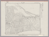
Image from the Map Collections courtesy Stanford University Libraries, licensed under a Creative Commons Attribution-Noncommercial 3.0 Unported License. © Stanford University. 【図幅名】 厚床 【測量時期】 大正11年測図 【発行時期】 昭和11年1月発行 【記号】 根室近傍5号(共11面) 【測量機関】 参謀本部・陸地測量部 【備考】 根室9号(共5面) 仮製版 軍事極秘
リンク: 出所・参照情報
|
約2年 前 | 4個の基準点 | |
|
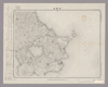
Image from the Map Collections courtesy Stanford University Libraries, licensed under a Creative Commons Attribution-Noncommercial 3.0 Unported License. © Stanford University. 【図幅名】 大口 【測量時期】 明治34年測圖/昭和7年要部修正測圖/昭和10年部分修正測圖 【発行時期】 【記号】 八代八号 【測量機関】 参謀本部 【備考】 祕
リンク: 出所・参照情報
|
約4年 前 | 4個の基準点 | |
|
Image from the Map Collections courtesy Stanford University Libraries, licensed under a Creative Commons Attribution-Noncommercial 3.0 Unported License. © Stanford University. 【図幅名】 開聞岳 【測量時期】 明治34年測圖/昭和7年要部修正測圖/昭和10年部分修正測圖 【発行時期】 【記号】 開聞岳五号 【測量機関】 参謀本部 【備考】 祕
リンク: 出所・参照情報
|
約4年 前 | 4個の基準点 | |
|
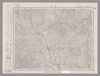
Image from the Map Collections courtesy Stanford University Libraries, licensed under a Creative Commons Attribution-Noncommercial 3.0 Unported License. © Stanford University. 【図幅名】 潮来 【測量時期】 明治36年測圖/昭和6年第二回修正測圖 【発行時期】 昭和11年発行 【記号】 佐倉五号 【測量機関】 大日本帝國陸地測量部 【備考】 ( 1枚のレイヤー)
リンク: 出所・参照情報
|
約2年 前 | 4個の基準点 | |
|
リンク: 出所・参照情報
|
2020 | 約1年 前 | 4個の基準点 |
|
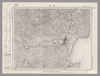
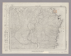
Image from the Map Collections courtesy Stanford University Libraries, licensed under a Creative Commons Attribution-Noncommercial 3.0 Unported License. © Stanford University. 【図幅名】 剣山 【測量時期】 明治40年測圖/昭和8年修正測圖 【発行時期】 【記号】 剣山十三号 【測量機関】 参謀本部 【備考】 祕
リンク: 出所・参照情報
|
約2年 前 | 4個の基準点 |