地図を見る
| 地図 | タイトル | 年 | 前回の更新 | ステータス  |
|---|---|---|---|---|
|
|
2023 | 12ヶ月 前 | 4個の基準点 |
|
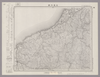
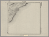
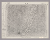
Image from the Map Collections courtesy Stanford University Libraries, licensed under a Creative Commons Attribution-Noncommercial 3.0 Unported License. © Stanford University. 【図幅名】 西津 【測量時期】 明治25年測図の縮図/昭和7年第2回修正、測図の縮図 【発行時期】 昭和10年1月発行 【記号】 宮津3号(共12面) 【測量機関】 大日本帝国陸地測量部 【備考】
リンク: 出所・参照情報
|
約2年 前 | 4個の基準点 | |
|
Image from the Map Collections courtesy Stanford University Libraries. This item is in the public domain. There are no restrictions on use.
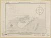
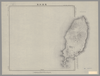
【図幅名】 ピリカモヘ崎【測量時期】 大正4年測圖 【発行時期】昭和11年 【記号】 千島列島五十七号 【測量機関】 参謀本部 【その他】千島列島 陸地測量部 ( 1枚のレイヤー)
リンク: 出所・参照情報
|
1936 | 1年以上 前 | 4個の基準点 |
|
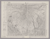
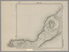
Image from the Map Collections courtesy Stanford University Libraries, licensed under a Creative Commons Attribution-Noncommercial 3.0 Unported License. © Stanford University. 【図幅名】 八ヶ岳 【測量時期】 明治43年測図/昭和4年要部修正 【発行時期】 昭和21年12月発行 【記号】 甲府9号(共16面) 【測量機関】 内務省地理調査所 【備考】
リンク: 出所・参照情報
|
約2年 前 | 4個の基準点 | |
|
Image from the Map Collections courtesy Stanford University Libraries. This item is in the public domain. There are no restrictions on use.
【図幅名】 知理保以南嶋【測量時期】 大正5年測圖 【発行時期】昭和11年 【記号】 千島列島四十六号 【測量機関】 参謀本部 【その他】千島列島 陸地測量部 ( 1枚のレイヤー)
リンク: 出所・参照情報
|
1936 | 1年以上 前 | 4個の基準点 |
|
|
2022 | 1年以上 前 | 5個の基準点 |
|
Image from the Map Collections courtesy Stanford University Libraries. This item is in the public domain. There are no restrictions on use.
【図幅名】 白妙山【測量時期】 大正4年測圖 【発行時期】昭和11年 【記号】 千島列島五十八号 【測量機関】 参謀本部 【その他】千島列島 陸地測量部 ( 1枚のレイヤー)
リンク: 出所・参照情報
|
1936 | 1年以上 前 | 4個の基準点 |
|
リンク: 出所・参照情報
|
2020 | 1年以上 前 | 11個の基準点 |
|
Image from the Map Collections courtesy Stanford University Libraries. This item is in the public domain. There are no restrictions on use.
【図幅名】 知理保以北嶋【測量時期】 大正5年測圖 【発行時期】昭和11年 【記号】 知理保以島一号 【測量機関】 参謀本部 【その他】千島列島 陸地測量部 ( 1枚のレイヤー)
リンク: 出所・参照情報
|
1936 | 1年以上 前 | 4個の基準点 |
|
Image from the Map Collections courtesy Stanford University Libraries, licensed under a Creative Commons Attribution-Noncommercial 3.0 Unported License. © Stanford University. 【図幅名】 美濃太田 【測量時期】 明治44年測図/昭和8年要部修正 【発行時期】 【記号】 飯田16号(共16面) 【測量機関】 参謀本部 【備考】 秘
リンク: 出所・参照情報
|
約2年 前 | 4個の基準点 | |
|
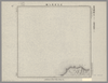
Image from the Map Collections courtesy Stanford University Libraries, licensed under a Creative Commons Attribution-Noncommercial 3.0 Unported License. © Stanford University. 【図幅名】 大曲 【測量時期】 大正2年測図/昭和9年修正 【発行時期】 昭和11年12月発行 【記号】 秋田12号(共16面) 【測量機関】 大日本帝国陸地測量部 【備考】
リンク: 出所・参照情報
|
2ヶ月 前 | 4個の基準点 | |
|
|
2017 | 7年弱 前 | 3個の基準点 |
|
|
2023 | 12ヶ月 前 | 4個の基準点 |
|
Image from the Map Collections courtesy Stanford University Libraries, licensed under a Creative Commons Attribution-Noncommercial 3.0 Unported License. © Stanford University. 【図幅名】 野母崎 【測量時期】 明治34年測図/大正13年修正 【発行時期】 昭和21年10月発行 【記号】 野母崎5号(共5面) 【測量機関】 内務省地理調査所 【備考】
リンク: 出所・参照情報
|
約4年 前 | 4個の基準点 | |
|
Image from the Map Collections courtesy Stanford University Libraries, licensed under a Creative Commons Attribution-Noncommercial 3.0 Unported License. © Stanford University. 【図幅名】 宿毛 【測量時期】 明治37年測図/昭和8年修正 【発行時期】 昭和17年12月発行 【記号】 宇和島7号 【測量機関】 大日本帝国陸地測量部 【備考】 ( 1枚のレイヤー)
リンク: 出所・参照情報
|
3ヶ月 前 | 4個の基準点 | |
|
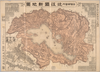
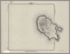
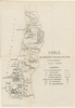
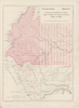
【Courtesy of the C. V. Starr East Asian Library University of California, Berkeley】 In Japanese. Oriented with north to the upper left. Relief shown by hachures. Includes 3 insets and legend. Includes distance chart and text on districts on verso.
リンク: 出所・参照情報
|
1903 | 3年以上 前 | 4個の基準点 |
|
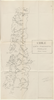
Image from the Map Collections courtesy Stanford University Libraries, licensed under a Creative Commons Attribution-Noncommercial 3.0 Unported License. © Stanford University. 【図幅名】 津島 【測量時期】 明治24年測図の縮図/昭和7年第2回修正、測図の縮図 【発行時期】 昭和10年7月発行 【記号】 名古屋5号(共16面) 【測量機関】 大日本帝国陸地測量部 【備考】
リンク: 出所・参照情報
|
2ヶ月 前 | 4個の基準点 | |
|
( 1枚のレイヤー)
|
2020 | 3年以上 前 | 7個の基準点 |
|
|
2023 | 12ヶ月 前 | 4個の基準点 |
|
Image from the Map Collections courtesy Stanford University Libraries, licensed under a Creative Commons Attribution-Noncommercial 3.0 Unported License. © Stanford University. 【図幅名】 佐倉 【測量時期】 明治36年測図/大正10年修正/昭和4年部分修正 【発行時期】 昭和21年10月発行 【記号】 佐倉14号(共12面) 【測量機関】 内務省地理調査所 【備考】 ( 1枚のレイヤー)
リンク: 出所・参照情報
|
約2年 前 | 4個の基準点 | |
|
この地図の作成に当たっては、国土地理院長の承認を得て、同院発行の20万分の1地勢図及び5万分の1地形図を使用した。(承認番号 平30情使、 第1148号)
リンク: 出所・参照情報
|
1947 | 11ヶ月 前 | 4個の基準点 |
|
( 1枚のレイヤー)
|
2020 | 3年以上 前 | 10個の基準点 |
|
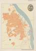
Image from the Map Collections courtesy Stanford University Libraries, licensed under a Creative Commons Attribution-Noncommercial 3.0 Unported License. © Stanford University. 【図幅名】 江津 【測量時期】 明治32年測図の縮図/昭和7年修正、測図の縮図 【発行時期】 昭和9年10月発行 【記号】 浜田14号(共15面) 【測量機関】 大日本帝国陸地測量部 【備考】
リンク: 出所・参照情報
|
11ヶ月 前 | 4個の基準点 | |
|
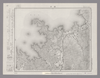
Image from the Map Collections courtesy Stanford University Libraries, licensed under a Creative Commons Attribution-Noncommercial 3.0 Unported License. © Stanford University. 【図幅名】 美濃町 【測量時期】 明治42年測図/昭和8年要部修正 【発行時期】 昭和11年4月発行 【記号】 岐阜3号(共16面) 【測量機関】 大日本帝国陸地測量部 【備考】
リンク: 出所・参照情報
|
約2年 前 | 4個の基準点 | |
|
Image from the Map Collections courtesy Stanford University Libraries, licensed under a Creative Commons Attribution-Noncommercial 3.0 Unported License. © Stanford University. 【図幅名】 石見大田 【測量時期】 明治32年測図/昭和7年修正、測図の縮図/昭和23年資料修正 【発行時期】 昭和23年12月発行 【記号】 浜田5号(共15面) 【測量機関】 地理調査所 【備考】
リンク: 出所・参照情報
|
11ヶ月 前 | 4個の基準点 | |
|
Image from the Map Collections courtesy Stanford University Libraries, licensed under a Creative Commons Attribution-Noncommercial 3.0 Unported License. © Stanford University. 【図幅名】 付知 【測量時期】 明治44年測図/昭和8年要部修正 【発行時期】 昭和11年2月発行 【記号】 飯田11号(共16面) 【測量機関】 大日本帝国陸地測量部 【備考】
リンク: 出所・参照情報
|
約2年 前 | 4個の基準点 | |
|
shelfmark: Maps 5.c.45
License: Public Domain
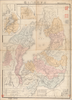
明治9 *銅板。多色刷り。朱印「定價金貳圓」。 Copperplate. Acquired 21 December 1878.
リンク: 出所・参照情報
|
1876 | 約1年 前 | 53個の基準点 |
|
リンク: 出所・参照情報
|
1879 | 6年以上 前 | 4個の基準点 |
|
Image from the Map Collections courtesy Stanford University Libraries. This item is in the public domain. There are no restrictions on use.
【図幅名】 武魯頓嶋【測量時期】 大正5年測圖 【発行時期】昭和11年 【記号】 千島列島四十七号、知理保以嶋一号西北部 【測量機関】 参謀本部 【その他】千島列島 陸地測量部 ( 1枚のレイヤー)
リンク: 出所・参照情報
|
1936 | 1年以上 前 | 5個の基準点 |
|
リンク: 出所・参照情報
|
2021 | 約1年 前 | 8個の基準点 |
|
Image from the Map Collections courtesy Stanford University Libraries. This item is in the public domain. There are no restrictions on use.
【図幅名】 宇志知島【測量時期】 大正6年測圖 【発行時期】昭和11年 【記号】 羅処和島三号 【測量機関】 参謀本部 【その他】千島列島 陸地測量部 ( 1枚のレイヤー)
リンク: 出所・参照情報
|
1936 | 1年以上 前 | 4個の基準点 |
|
( 1枚のレイヤー)
|
2020 | 3年以上 前 | 5個の基準点 |
|
Image from the Map Collections courtesy Stanford University Libraries. This item is in the public domain. There are no restrictions on use.
【図幅名】 末廣嶽 【測量時期】 大正5年測圖 【発行時期】昭和11年 【記号】 新知島七号 【測量機関】 参謀本部 【その他】千島列島 陸地測量部 ( 1枚のレイヤー)
リンク: 出所・参照情報
|
1936 | 1年以上 前 | 4個の基準点 |
|
リンク: 出所・参照情報
|
2021 | 約1年 前 | 4個の基準点 |
|
Image from the Map Collections courtesy Stanford University Libraries. This item is in the public domain. There are no restrictions on use.
【図幅名】 新知灣 【測量時期】 大正5年測圖 【発行時期】昭和11年 【記号】 新知島十一号 【測量機関】 参謀本部【その他】千島列島 陸地測量部 ( 1枚のレイヤー)
リンク: 出所・参照情報
|
1936 | 1年以上 前 | 4個の基準点 |
|
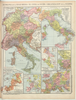
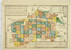
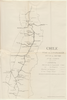
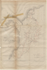
【Courtesy of the C. V. Starr East Asian Library University of California, Berkeley】 Mounted cover title. Title on map: Fukui-ken kannai chizu. Wood block print. In Japanese. Relief shown by hachures.
リンク: 出所・参照情報
|
1883 | 3年以上 前 | 4個の基準点 |
|
Image from the Map Collections courtesy Stanford University Libraries. This item is in the public domain. There are no restrictions on use.
【図幅名】 羅處和島【測量時期】 大正6年測圖 【発行時期】昭和11年 【記号】 羅處和島二号 【測量機関】 参謀本部 【その他】千島列島 陸地測量部 ( 1枚のレイヤー)
リンク: 出所・参照情報
|
1936 | 1年以上 前 | 4個の基準点 |
|
Image from the Map Collections courtesy Stanford University Libraries, licensed under a Creative Commons Attribution-Noncommercial 3.0 Unported License. © Stanford University. 【図幅名】 飯田 【測量時期】 明治44年測圖/昭和6年修正測圖 【発行時期】 【記号】 飯田三号 【測量機関】 参謀本部 【備考】 祕
リンク: 出所・参照情報
|
約2年 前 | 4個の基準点 | |
|
Image from the Map Collections courtesy Stanford University Libraries. This item is in the public domain. There are no restrictions on use.
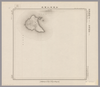
【図幅名】 松輪島 【測量時期】 大正6年測圖 【発行時期】昭和11年 【記号】 松輪島十七号 【測量機関】 参謀本部 【その他】千島列島 陸地測量部 ( 1枚のレイヤー)
リンク: 出所・参照情報
|
1936 | 1年以上 前 | 5個の基準点 |
|
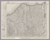
【Courtesy of the C. V. Starr East Asian Library University of California, Berkeley】 Lithograph. Relief shown by hachures. Includes 3 insets and legend. Includes distance chart and text on districts on verso. In Japanese.
リンク: 出所・参照情報
|
1909 | 3年以上 前 | 4個の基準点 |
|
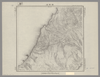
Image from the Map Collections courtesy Stanford University Libraries, licensed under a Creative Commons Attribution-Noncommercial 3.0 Unported License. © Stanford University. 【図幅名】 倉橋島 【測量時期】 明治32年測図/大正14年修正 【発行時期】 【記号】 呉要塞近傍6号(共15面) 【測量機関】 陸地測量部・参謀本部 【備考】 広島8号(共16面) 軍事極秘
リンク: 出所・参照情報
|
約2ヶ月 前 | 4個の基準点 | |
|
Image from the Map Collections courtesy Stanford University Libraries, licensed under a Creative Commons Attribution-Noncommercial 3.0 Unported License. © Stanford University. 【図幅名】 斜里 【測量時期】 大正13年測圖/昭和19年部分修正測圖 【発行時期】 【記号】 斜里五号 【測量機関】 参謀本部 【備考】 軍事祕密(戦地ニ限リ極祕) ( 1枚のレイヤー)
リンク: 出所・参照情報
|
約2年 前 | 4個の基準点 | |
|
|
2023 | 12ヶ月 前 | 4個の基準点 |
|
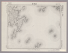
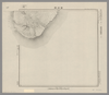
Image from the Map Collections courtesy Stanford University Libraries, licensed under a Creative Commons Attribution-Noncommercial 3.0 Unported License. © Stanford University. 【図幅名】 【測量時期】 【発行時期】 【記号】 【測量機関】 【備考】 ( 1枚のレイヤー)
リンク: 出所・参照情報
|
約2年 前 | 4個の基準点 | |
|
|
2023 | 12ヶ月 前 | 4個の基準点 |
|
Image from the Map Collections courtesy Stanford University Libraries, licensed under a Creative Commons Attribution-Noncommercial 3.0 Unported License. © Stanford University. 【図幅名】 苫前 【測量時期】 大正11年測図/昭和8年鉄道補入 【発行時期】 昭和10年5月発行 【記号】 羽幌7号(共8面) 【測量機関】 大日本帝国陸地測量部 【備考】 仮製版
リンク: 出所・参照情報
|
5年以上 前 | 4個の基準点 | |
|
|
2023 | 12ヶ月 前 | 5個の基準点 |
|
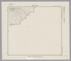
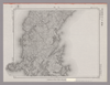
Image from the Map Collections courtesy Stanford University Libraries, licensed under a Creative Commons Attribution-Noncommercial 3.0 Unported License. © Stanford University. 【図幅名】 【測量時期】 【発行時期】 【記号】 【測量機関】 【備考】 ( 1枚のレイヤー)
リンク: 出所・参照情報
|
約2年 前 | 4個の基準点 | |
|
Image from the Map Collections courtesy Stanford University Libraries. This item is in the public domain. There are no restrictions on use.
【図幅名】 新知嶽 【測量時期】 大正5年測圖 【発行時期】昭和11年 【記号】 新知島十二号 【測量機関】 参謀本部 【その他】千島列島 陸地測量部 ( 1枚のレイヤー)
リンク: 出所・参照情報
|
1936 | 1年以上 前 | 4個の基準点 |
|
Image from the Map Collections courtesy Stanford University Libraries, licensed under a Creative Commons Attribution-Noncommercial 3.0 Unported License. © Stanford University. 【図幅名】 仁位 【測量時期】 大正1年測図/大正11年測図の縮図/昭和10年修正、第2回修正、測図の縮図 【発行時期】 昭和21年11月発行 【記号】 厳原10号(共7面) 【測量機関】 地理調査所 【備考】
リンク: 出所・参照情報
|
5年以上 前 | 4個の基準点 |