地図を見る
| 地図 | タイトル | 年  |
前回の更新 | ステータス |
|---|---|---|---|---|

|
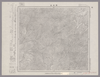
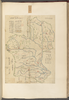
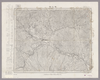
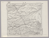
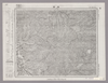
Image from the Map Collections courtesy Stanford University Libraries, licensed under a Creative Commons Attribution-Noncommercial 3.0 Unported License. © Stanford University. 【図幅名】 防府 【測量時期】 明治32年測図/昭和2年修正 【発行時期】 昭和13年7月発行 【記号】 山口8号(共15面) 【測量機関】 大日本帝国陸地測量部 【備考】
リンク: 出所・参照情報
|
約2年 前 | 4個の基準点 | |
|
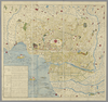
Image from the Map Collections courtesy Stanford University Libraries, licensed under a Creative Commons Attribution-Noncommercial 3.0 Unported License. © Stanford University. 【図幅名】 【測量時期】 【発行時期】 【記号】 【測量機関】 【備考】 ( 1枚のレイヤー)
リンク: 出所・参照情報
|
約2年 前 | 4個の基準点 | |
|
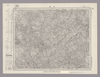
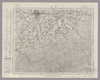
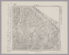
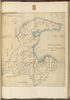
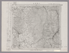
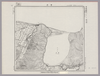
Image from the Map Collections courtesy Stanford University Libraries, licensed under a Creative Commons Attribution-Noncommercial 3.0 Unported License. © Stanford University. 【図幅名】 青森東部 【測量時期】 大正1年測図/昭和14年修正、測図の縮図 【発行時期】 【記号】 青森4号 【測量機関】 内務省地理調査所 【備考】
リンク: 出所・参照情報
|
約2年 前 | 4個の基準点 | |
|
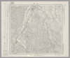
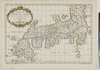
Owned by Sainsbury Institute for the Study of Japanese Arts and Cultures 【Atlas / Book Title】 In: A new Sett of Mapps of Ancient and Present Geography. . .together with a geographical treatise. . .By Edward Wells, D.D. sometime student of Christ Church, Oxon, and late rector of Cotesbach in Leicestershire 【Engraver】 【Map Size】 35.5x0.0 cm 【Medium】 銅版画
リンク: 出所・参照情報
|
6年弱 前 | 整形を解除する | |
|
|
5年以上 前 | 整形を解除する | |
|
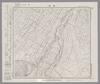
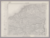
Image from the Map Collections courtesy Stanford University Libraries, licensed under a Creative Commons Attribution-Noncommercial 3.0 Unported License. © Stanford University. 【図幅名】 楽古岳 【測量時期】 大正9年測圖 【発行時期】 【記号】 広尾十五号 【測量機関】 参謀本部 【備考】 祕 ( 1枚のレイヤー)
リンク: 出所・参照情報
|
約2年 前 | 4個の基準点 | |
|
Image from the Map Collections courtesy Stanford University Libraries, licensed under a Creative Commons Attribution-Noncommercial 3.0 Unported License. © Stanford University. 【図幅名】 江別 【測量時期】 大正5年測図の縮図/昭和10年修正改版、測図の縮図 【発行時期】 昭和12年4月発行 【記号】 札幌6号(共16面) 【測量機関】 大日本帝国陸地測量部 【備考】 ( 1枚のレイヤー)
リンク: 出所・参照情報
|
約2年 前 | 4個の基準点 | |
|
Image from the Map Collections courtesy Stanford University Libraries, licensed under a Creative Commons Attribution-Noncommercial 3.0 Unported License. © Stanford University. 【図幅名】 【測量時期】 【発行時期】 【記号】 【測量機関】 【備考】
リンク: 出所・参照情報
|
約2年 前 | 4個の基準点 | |
|
Image from the Map Collections courtesy Stanford University Libraries, licensed under a Creative Commons Attribution-Noncommercial 3.0 Unported License. © Stanford University. 【図幅名】 久住 【測量時期】 明治36年測圖/昭和7年要部修正測圖 【発行時期】 【記号】 大分十号 【測量機関】 参謀本部 【備考】 祕
リンク: 出所・参照情報
|
約4年 前 | 4個の基準点 | |
|
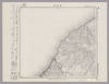
Image from the Map Collections courtesy Stanford University Libraries, licensed under a Creative Commons Attribution-Noncommercial 3.0 Unported License. © Stanford University. 【図幅名】 奥 【測量時期】 大正10年測圖 【発行時期】 大正12年発行 【記号】 沖縄郡島一号 【測量機関】 陸地測量部・参謀本部 【備考】 軍事極祕(戦地ニ在りテハ軍事祕密トス)
リンク: 出所・参照情報
|
5年以上 前 | 4個の基準点 | |
|
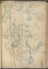
Image from the Map Collections courtesy Stanford University Libraries, licensed under a Creative Commons Attribution-Noncommercial 3.0 Unported License. © Stanford University. 【図幅名】 目梨泊 【測量時期】 大正12年測図 【発行時期】 大正13年6月発行 【記号】 枝幸6号(共12面) 【測量機関】 大日本帝国陸地測量部 【備考】 仮製版 ( 1枚のレイヤー)
リンク: 出所・参照情報
|
約2年 前 | 4個の基準点 | |
|
Image from the Map Collections courtesy Stanford University Libraries, licensed under a Creative Commons Attribution-Noncommercial 3.0 Unported License. © Stanford University. 【図幅名】 名古屋北部 【測量時期】 明治24年測図の縮図/昭和13年第4回修正、測図の縮図 【発行時期】 昭和16年4月発行 【記号】 名古屋1号 【測量機関】 大日本帝国陸地測量部 【備考】
リンク: 出所・参照情報
|
約2年 前 | 4個の基準点 | |
|
shelfmark: Maps 63140.8
License: Public Domain
安政年間刊 *多色刷り。大英図書館蔵図(Maps 63140.9)に同版なれど、御城、水戸殿邸などに紋なし。(刊記)東都書肆/須原屋茂兵衛・山城屋佐兵衛・小林新兵衛・出雲寺万次郎・山崎屋政七・岡田屋嘉七・山城屋平助・蔦屋吉蔵。刊年刪去カ Xylograph. Acquired 22 July 1868. Ex-Siebold.
リンク: 出所・参照情報
|
4年以上 前 | 整形を解除する | |
|
shelfmark: Maps 149.e.241
License: Public Domain
江戸後期刊 Manuscript, early 19th century. Acquired 22 July 1868. Ex-Siebold.
リンク: 出所・参照情報
|
4年以上 前 | 整形を解除する | |
|
shelfmark: Maps 63140.9
License: Public Domain
安政年間刊 *多色刷り。(刊記)東都書肆/須原屋茂兵衛・山城屋佐兵衛・小林新兵衛・出雲寺万次郎・山崎屋政七・岡田屋嘉七・山城屋平助・蔦屋吉蔵。刊年刪去力。題箋に英国古本目録切り抜きを貼る。 Xylograph. Cutting from bookseller’s catalogue reading, ‘Yeddo eds ie, ezu. Map of Edo. One large sheet folded and coloured. 10shillings.', attached to cover title.
リンク: 出所・参照情報
|
4年以上 前 | 整形を解除する | |
|
Image from the Map Collections courtesy Stanford University Libraries, licensed under a Creative Commons Attribution-Noncommercial 3.0 Unported License. © Stanford University. 【図幅名】 甲府 【測量時期】 明治21年測図/昭和4年第3回修正 【発行時期】 昭和21年10月発行 【記号】 甲府7号(共16面) 【測量機関】 内務省地理調査所 【備考】
リンク: 出所・参照情報
|
約2年 前 | 4個の基準点 | |
|
Image from the Map Collections courtesy Stanford University Libraries, licensed under a Creative Commons Attribution-Noncommercial 3.0 Unported License. © Stanford University. 【図幅名】 美幌 【測量時期】 大正13年測圖/昭和3年鐡道補入 【発行時期】 【記号】 斜里十四号 【測量機関】 参謀本部 【備考】 祕 假製版 ( 1枚のレイヤー)
リンク: 出所・参照情報
|
約2年 前 | 4個の基準点 | |
|
Image from the Map Collections courtesy Stanford University Libraries, licensed under a Creative Commons Attribution-Noncommercial 3.0 Unported License. © Stanford University. 【図幅名】 中之条 【測量時期】 大正1年測図/昭和4年要部修正 【発行時期】 昭和7年3月発行 【記号】 長野1号(共16面) 【測量機関】 大日本帝国陸地測量部 【備考】
リンク: 出所・参照情報
|
約2年 前 | 4個の基準点 | |
|
shelfmark: Maps 63135.3
License: Public Domain
江戸後期 *手彩色。無題図。「相川御役所」の記載あり。 Xylograph.
リンク: 出所・参照情報
|
4年以上 前 | 整形を解除する | |
|
Image from the Map Collections courtesy Stanford University Libraries, licensed under a Creative Commons Attribution-Noncommercial 3.0 Unported License. © Stanford University. 【図幅名】 上渚滑 【測量時期】 大正12年測図 【発行時期】 昭和13年10月発行 【記号】 紋別11号(共11面) 【測量機関】 大日本帝国陸地測量部 【備考】 仮製版 ( 1枚のレイヤー)
リンク: 出所・参照情報
|
約2年 前 | 4個の基準点 | |
|
Image from the Map Collections courtesy Stanford University Libraries, licensed under a Creative Commons Attribution-Noncommercial 3.0 Unported License. © Stanford University. 【図幅名】 幸震 【測量時期】 大正9年測図/昭和5年部分修正 【発行時期】 昭和7年12月発行 【記号】 帯広16号(共16面) 【測量機関】 大日本帝国陸地測量部 【備考】 ( 1枚のレイヤー)
リンク: 出所・参照情報
|
約2年 前 | 4個の基準点 | |
|
Image from the Map Collections courtesy Stanford University Libraries, licensed under a Creative Commons Attribution-Noncommercial 3.0 Unported License. © Stanford University.
リンク: 出所・参照情報
|
6年以上 前 | 4個の基準点 | |
|
shelfmark: Maps 149.e.250
License: Public Domain
江戸後期写 Manuscript, early 19th century. Acquired 22 July 1868. Ex-Siebold.
リンク: 出所・参照情報
|
4年以上 前 | 整形を解除する | |
|
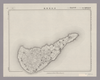
Image from the Map Collections courtesy Stanford University Libraries, licensed under a Creative Commons Attribution-Noncommercial 3.0 Unported License. © Stanford University. 【図幅名】 沖永良部島 【測量時期】 大正9年測圖 【発行時期】 昭和11年発行 【記号】 奄美大島要塞近傍十八号 【測量機関】 陸地測量部・参謀本部 【備考】 軍事極祕(戦地ニ在りテハ軍事祕密トス)
リンク: 出所・参照情報
|
5年以上 前 | 4個の基準点 | |
|
shelfmark: Maps 149.e.258
License: Public Domain
江戸後期写 Manuscript, early 19th century. Acquired 22 July 1868. Ex-Siebold.
リンク: 出所・参照情報
|
4年以上 前 | 整形を解除する | |
|
Image from the Map Collections courtesy Stanford University Libraries, licensed under a Creative Commons Attribution-Noncommercial 3.0 Unported License. © Stanford University.
リンク: 出所・参照情報
|
6年以上 前 | 4個の基準点 | |
|
shelfmark: Maps 149.e.26
License: Public Domain
江戸後期刊 Manuscript, early 19th century. Acquired 22 July 1868. Ex-Siebold.
リンク: 出所・参照情報
|
4年以上 前 | 整形を解除する | |
|
Image from the Map Collections courtesy Stanford University Libraries, licensed under a Creative Commons Attribution-Noncommercial 3.0 Unported License. © Stanford University. 【図幅名】 サロマ湖 【測量時期】 大正13年測圖 【発行時期】 【記号】 紋別四号 【測量機関】 参謀本部 【備考】 祕 假製版 ( 1枚のレイヤー)
リンク: 出所・参照情報
|
約2年 前 | 4個の基準点 | |
|
shelfmark: Maps 149.e.260
License: Public Domain
江戸後期刊 *多色刷。(刊記書肆)書林/京都、菊屋七郎兵衛/大坂、河内屋喜兵衛・河内屋茂兵衛/江戸、須原屋茂兵衛・須原屋佐助・須原屋伊八・岡田屋嘉七・和泉屋金右衛門・小林新兵衛・山城屋佐兵衛・菊屋幸三郎板。外題「信濃国絵図」。 Xylograph. Acquired 22 July 1868. Ex-Siebold.
リンク: 出所・参照情報
|
4年以上 前 | 整形を解除する | |
|
Image from the Map Collections courtesy Stanford University Libraries, licensed under a Creative Commons Attribution-Noncommercial 3.0 Unported License. © Stanford University. 【図幅名】 仲尾次 【測量時期】 大正10年測圖 【発行時期】 大正12年発行 【記号】 沖縄郡島六号 【測量機関】 陸地測量部・参謀本部 【備考】 軍事極祕(戦地ニ在りテハ軍事祕密トス)
リンク: 出所・参照情報
|
3ヶ月 前 | 4個の基準点 | |
|
立命館大学古地図データベースより引用
|
1年以上 前 | 156個の基準点 | |
|
立命館大学ARCのDBより引用
|
1年以上 前 | 111個の基準点 | |
|
Image from the Map Collections courtesy Stanford University Libraries, licensed under a Creative Commons Attribution-Noncommercial 3.0 Unported License. © Stanford University. 【図幅名】 西表島西南部 【測量時期】 大正10年測図 【発行時期】 大正12年発行 【記号】 先島群島18号 【測量機関】 陸地測量部・参謀本部 【備考】 西表島7号
リンク: 出所・参照情報
|
4年以上 前 | 4個の基準点 | |
|
Owned by 立命館大学アート・リサーチセンター 【成立・出版年】
リンク: 出所・参照情報
|
6年弱 前 | 整形を解除する | |
|
shelfmark: Maps 149.e.261
License: Public Domain
江戸後期写 *刊図写力。 Manuscript, early 19th century. Acquired 22 July 1868. Ex-Siebold.
リンク: 出所・参照情報
|
4年以上 前 | 整形を解除する | |
|
Image from the Map Collections courtesy Stanford University Libraries, licensed under a Creative Commons Attribution-Noncommercial 3.0 Unported License. © Stanford University. 【図幅名】 宇治山田 【測量時期】 明治25年測図の縮図/昭和12年第2回修正、測図の縮図 【発行時期】 昭和15年4月発行 【記号】 宇治山田6号(共14面) 【測量機関】 大日本帝国陸地測量部 【備考】
リンク: 出所・参照情報
|
約2年 前 | 4個の基準点 | |
|
Image from the Map Collections courtesy Stanford University Libraries, licensed under a Creative Commons Attribution-Noncommercial 3.0 Unported License. © Stanford University. 【図幅名】 比宇 【測量時期】 大正8年測圖 【発行時期】 【記号】 浦河九号 【測量機関】 参謀本部 【備考】 祕 ( 1枚のレイヤー)
リンク: 出所・参照情報
|
約2年 前 | 4個の基準点 | |
|
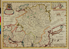
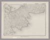
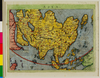
Owned by Sainsbury Institute for the Study of Japanese Arts and Cultures 【Atlas / Book Title】 From: GEO- | GRAPHIAE | VNIVERSAE | TVM VETERIS, TVM | NOVAE ABSOLVTISSIMVM | opus, duobus voluminibus distinctum, In quorum priore habentur | CL. PTOLEMAI PELVSIENSIS | Geographica. . .a | IO ANTONIO MAGINO PATAVINO. . . | Anno 1597. IN CELEBERRIMA AGRIPPINENSIVM COLONIA EXCVDEBAT | PETRVS KESCHEDT. Other editions in 1608 and 1617. 【Engraver】 【Map Size】 13.0x8.0 cm 【Medium】 銅版画
リンク: 出所・参照情報
|
6年弱 前 | 整形を解除する | |
|
Image from the Map Collections courtesy Stanford University Libraries, licensed under a Creative Commons Attribution-Noncommercial 3.0 Unported License. © Stanford University. 【図幅名】 西別 【測量時期】 大正11年測圖 【発行時期】 【記号】 標津十六号 【測量機関】 参謀本部 【備考】 祕 ( 1枚のレイヤー)
リンク: 出所・参照情報
|
約2年 前 | 4個の基準点 | |
|
Image from the Map Collections courtesy Stanford University Libraries, licensed under a Creative Commons Attribution-Noncommercial 3.0 Unported License. © Stanford University. 【図幅名】 夕張炭山 【測量時期】 大正5年測図/昭和10年修正改版 【発行時期】 【記号】 札幌2号(共16面) 【測量機関】 参謀本部 【備考】 秘 ( 1枚のレイヤー)
リンク: 出所・参照情報
|
約2年 前 | 4個の基準点 | |
|
Image from the Map Collections courtesy Stanford University Libraries, licensed under a Creative Commons Attribution-Noncommercial 3.0 Unported License. © Stanford University. 【図幅名】 島古丹 【測量時期】 大正6年測圖 【発行時期】 【記号】 岩内十一号 【測量機関】 参謀本部 【備考】 祕 ( 1枚のレイヤー)
リンク: 出所・参照情報
|
約2年 前 | 4個の基準点 | |
|
|
7ヶ月 前 | 3個の基準点 | |
|
Image from the Map Collections courtesy Stanford University Libraries, licensed under a Creative Commons Attribution-Noncommercial 3.0 Unported License. © Stanford University. 【図幅名】 【測量時期】 【発行時期】 【記号】 【測量機関】 【備考】
リンク: 出所・参照情報
|
約4年 前 | 4個の基準点 | |
|
Image from the Map Collections courtesy Stanford University Libraries, licensed under a Creative Commons Attribution-Noncommercial 3.0 Unported License. © Stanford University.
リンク: 出所・参照情報
|
6年以上 前 | 4個の基準点 | |
|
Image from the Map Collections courtesy Stanford University Libraries, licensed under a Creative Commons Attribution-Noncommercial 3.0 Unported License. © Stanford University. 【図幅名】 鵡川 【測量時期】 大正8年測圖/昭和10年修正測圖 【発行時期】 【記号】 苫小牧一号 【測量機関】 参謀本部 【備考】 祕 ( 1枚のレイヤー)
リンク: 出所・参照情報
|
約2年 前 | 4個の基準点 | |
|
Image from the Map Collections courtesy Stanford University Libraries, licensed under a Creative Commons Attribution-Noncommercial 3.0 Unported License. © Stanford University. 【図幅名】 経ヶ岳 【測量時期】 明治43年測図/昭和5年要部修正 【発行時期】 昭和7年11月発行 【記号】 金沢8号(共13面) 【測量機関】 大日本帝国陸地測量部 【備考】
リンク: 出所・参照情報
|
約2年 前 | 4個の基準点 | |
|
shelfmark: Maps 63140.4
License: Public Domain
江戸後期写 *刊図写しカ。 Xylograph. Acquired 22 July 1868. Ex-Siebold.
リンク: 出所・参照情報
|
4年以上 前 | 整形を解除する | |
|
Image from the Map Collections courtesy Stanford University Libraries, licensed under a Creative Commons Attribution-Noncommercial 3.0 Unported License. © Stanford University. 【図幅名】 常呂 【測量時期】 大正13年測圖 【発行時期】 【記号】 網走十六号 【測量機関】 参謀本部 【備考】 祕 假製版 ( 1枚のレイヤー)
リンク: 出所・参照情報
|
約2年 前 | 4個の基準点 | |
|
Image from the Map Collections courtesy Stanford University Libraries, licensed under a Creative Commons Attribution-Noncommercial 3.0 Unported License. © Stanford University. 【図幅名】 宝立山 【測量時期】 明治43年測図/昭和9年修正 【発行時期】 昭和12年1月発行 【記号】 珠洲岬16号(共4面) 【測量機関】 大日本帝国陸地測量部 【備考】
リンク: 出所・参照情報
|
約2年 前 | 4個の基準点 | |
|
Image from the Map Collections courtesy Stanford University Libraries, licensed under a Creative Commons Attribution-Noncommercial 3.0 Unported License. © Stanford University. 【図幅名】 笹川 【測量時期】 大正2年測図/昭和9年修正 【発行時期】 昭和11年4月発行 【記号】 村上10号(共12面) 【測量機関】 大日本帝国陸地測量部 【備考】
リンク: 出所・参照情報
|
約2年 前 | 4個の基準点 |