Browse Maps
| map | Title | Year | Last Updated  |
Status |
|---|---|---|---|---|
|
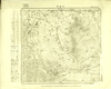
Image from the Map Collections courtesy Tohoku University. © 2023, the Committee for the Creation of the Gaihozu Digital Archives. 【図幅名】 小山子 【測量時期】 - 【発行時期】 昭和8年発行sネンハッコウ 【記号】 寧古塔21号 【測量機関】 大日本帝國陸地測量部
Links: Source / Biblio Ref
|
1933 | 4 months ago | 4 control points |
|
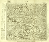
Image from the Map Collections courtesy Tohoku University. © 2023, the Committee for the Creation of the Gaihozu Digital Archives. 【図幅名】 敦化 【測量時期】 昭和13年複製同年鐡道補入sネンフクセイドウネンテツホ 【発行時期】 - 【記号】 寧古塔20号 【測量機関】 大日本帝國陸地測量部
Links: Source / Biblio Ref
|
4 months ago | 4 control points | |
|
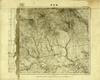
Image from the Map Collections courtesy Tohoku University. © 2023, the Committee for the Creation of the Gaihozu Digital Archives. 【図幅名】 額稗索 【測量時期】 - 【発行時期】 - 【記号】 寧古塔19号 【測量機関】 大日本帝國陸地測量部
Links: Source / Biblio Ref
|
4 months ago | 4 control points | |
|
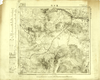
Image from the Map Collections courtesy Tohoku University. © 2023, the Committee for the Creation of the Gaihozu Digital Archives. 【図幅名】 葦沙河 【測量時期】 - 【発行時期】 昭和8年発行sネンハッコウ 【記号】 寧古塔16号 【測量機関】 大日本帝國陸地測量部
Links: Source / Biblio Ref
|
1933 | 4 months ago | 4 control points |
|
Image from the Map Collections courtesy Tohoku University. © 2023, the Committee for the Creation of the Gaihozu Digital Archives. 【図幅名】 爾站 【測量時期】 - 【発行時期】 昭和8年発行sネンハッコウ 【記号】 寧古塔14号 【測量機関】 大日本帝國陸地測量部
Links: Source / Biblio Ref
|
1933 | 4 months ago | 4 control points |
|
Image from the Map Collections courtesy Tohoku University. © 2023, the Committee for the Creation of the Gaihozu Digital Archives. 【図幅名】 沙拉站 【測量時期】 - 【発行時期】 昭和8年発行sネンハッコウ 【記号】 寧古塔13号 【測量機関】 大日本帝國陸地測量部
Links: Source / Biblio Ref
|
1933 | 4 months ago | 4 control points |
|
Image from the Map Collections courtesy Tohoku University. © 2023, the Committee for the Creation of the Gaihozu Digital Archives. 【図幅名】 萬丈溝 【測量時期】 - 【発行時期】 昭和11年発行sネンハッコウ 【記号】 寧古塔12号 【測量機関】 大日本帝國陸地測量部
Links: Source / Biblio Ref
|
1936 | 4 months ago | 4 control points |
|
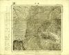
Image from the Map Collections courtesy Tohoku University. © 2023, the Committee for the Creation of the Gaihozu Digital Archives. 【図幅名】 石頭河子驛 【測量時期】 - 【発行時期】 昭和8年発行sネンハッコウ 【記号】 寧古塔11号 【測量機関】 大日本帝國陸地測量部
Links: Source / Biblio Ref
|
1933 | 4 months ago | 4 control points |
|
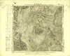
Image from the Map Collections courtesy Tohoku University. © 2023, the Committee for the Creation of the Gaihozu Digital Archives. 【図幅名】 磖門 【測量時期】 - 【発行時期】 昭和8年発行sネンハッコウ 【記号】 寧古塔10号 【測量機関】 大日本帝國陸地測量部
Links: Source / Biblio Ref
|
1933 | 4 months ago | 4 control points |
|
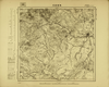
Image from the Map Collections courtesy Tohoku University. © 2023, the Committee for the Creation of the Gaihozu Digital Archives. 【図幅名】 王把街子 【測量時期】 - 【発行時期】 昭和8年発行sネンハッコウ 【記号】 寧古塔9号 【測量機関】 大日本帝國陸地測量部
Links: Source / Biblio Ref
|
1933 | 4 months ago | 4 control points |
|
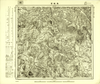
Image from the Map Collections courtesy Tohoku University. © 2023, the Committee for the Creation of the Gaihozu Digital Archives. 【図幅名】 烏吉密河 【測量時期】 - 【発行時期】 昭和7年発行sネンハッコウ 【記号】 依蘭25号 【測量機関】 大日本帝國陸地測量部
Links: Source / Biblio Ref
|
1932 | 4 months ago | 4 control points |
|
Image from the Map Collections courtesy Tohoku University. © 2023, the Committee for the Creation of the Gaihozu Digital Archives. 【図幅名】 黑龍宮 【測量時期】 - 【発行時期】 昭和7年発行sネンハッコウ 【記号】 依蘭24号 【測量機関】 大日本帝國陸地測量部
Links: Source / Biblio Ref
|
1932 | 4 months ago | 4 control points |
|
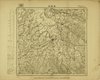
Image from the Map Collections courtesy Tohoku University. © 2023, the Committee for the Creation of the Gaihozu Digital Archives. 【図幅名】 枷板站 【測量時期】 - 【発行時期】 昭和7年発行sネンハッコウ 【記号】 依蘭23号 【測量機関】 大日本帝國陸地測量部
Links: Source / Biblio Ref
|
1932 | 4 months ago | 4 control points |
|
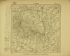
Image from the Map Collections courtesy Tohoku University. © 2023, the Committee for the Creation of the Gaihozu Digital Archives. 【図幅名】 石頭河子 【測量時期】 - 【発行時期】 昭和7年発行sネンハッコウ 【記号】 依蘭22号 【測量機関】 大日本帝國陸地測量部
Links: Source / Biblio Ref
|
1932 | 4 months ago | 4 control points |
|
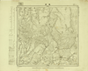
Image from the Map Collections courtesy Tohoku University. © 2023, the Committee for the Creation of the Gaihozu Digital Archives. 【図幅名】 東興 【測量時期】 - 【発行時期】 昭和10年発行 【記号】 依蘭21号 【測量機関】 大日本帝國陸地測量部
Links: Source / Biblio Ref
|
1935 | 4 months ago | 4 control points |
|
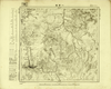
Image from the Map Collections courtesy Tohoku University. © 2023, the Committee for the Creation of the Gaihozu Digital Archives. 【図幅名】 一面坡 【測量時期】 - 【発行時期】 昭和7年発行sネンハッコウ 【記号】 依蘭20号 【測量機関】 大日本帝國陸地測量部
Links: Source / Biblio Ref
|
1932 | 4 months ago | 4 control points |
|
Image from the Map Collections courtesy Tohoku University. © 2023, the Committee for the Creation of the Gaihozu Digital Archives. 【図幅名】 同賓縣 【測量時期】 - 【発行時期】 昭和8年発行sネンハッコウ 【記号】 依蘭19号 【測量機関】 大日本帝國陸地測量部
Links: Source / Biblio Ref
|
1933 | 4 months ago | 4 control points |
|
Image from the Map Collections courtesy Tohoku University. © 2023, the Committee for the Creation of the Gaihozu Digital Archives. 【図幅名】 木蘭縣 【測量時期】 - 【発行時期】 昭和7年発行sネンハッコウ 【記号】 依蘭18号 【測量機関】 大日本帝國陸地測量部
Links: Source / Biblio Ref
|
1932 | 4 months ago | 4 control points |
|
Image from the Map Collections courtesy Tohoku University. © 2023, the Committee for the Creation of the Gaihozu Digital Archives. 【図幅名】 老石房 【測量時期】 - 【発行時期】 昭和7年発行sネンハッコウ 【記号】 依蘭17号 【測量機関】 大日本帝國陸地測量部
Links: Source / Biblio Ref
|
1932 | 4 months ago | 4 control points |
|
Image from the Map Collections courtesy Tohoku University. © 2023, the Committee for the Creation of the Gaihozu Digital Archives. 【図幅名】 亮珠河 【測量時期】 - 【発行時期】 昭和7年発行sネンハッコウ 【記号】 依蘭15号 【測量機関】 大日本帝國陸地測量部
Links: Source / Biblio Ref
|
1932 | 4 months ago | 4 control points |
|
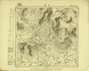
Image from the Map Collections courtesy Tohoku University. © 2023, the Committee for the Creation of the Gaihozu Digital Archives. 【図幅名】 三站 【測量時期】 - 【発行時期】 昭和7年発行sネンハッコウ 【記号】 依蘭12号 【測量機関】 大日本帝國陸地測量部
Links: Source / Biblio Ref
|
1932 | 4 months ago | 4 control points |
|
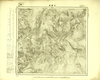
Image from the Map Collections courtesy Tohoku University. © 2023, the Committee for the Creation of the Gaihozu Digital Archives. 【図幅名】 芳家溝 【測量時期】 - 【発行時期】 昭和8年発行sネンハッコウ 【記号】 依蘭10号 【測量機関】 大日本帝國陸地測量部
Links: Source / Biblio Ref
|
1933 | 4 months ago | 4 control points |
|
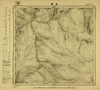
Image from the Map Collections courtesy Tohoku University. © 2023, the Committee for the Creation of the Gaihozu Digital Archives. 【図幅名】 老嶺 【測量時期】 - 【発行時期】 昭和8年発行sネンハッコウ 【記号】 依蘭9号 【測量機関】 大日本帝國陸地測量部
Links: Source / Biblio Ref
|
1933 | 4 months ago | 4 control points |
|
Image from the Map Collections courtesy Tohoku University. © 2023, the Committee for the Creation of the Gaihozu Digital Archives. 【図幅名】 大羅勒密 【測量時期】 - 【発行時期】 昭和7年発行sネンハッコウ 【記号】 依蘭8号 【測量機関】 大日本帝國陸地測量部
Links: Source / Biblio Ref
|
1932 | 4 months ago | 4 control points |
|
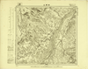
Image from the Map Collections courtesy Tohoku University. © 2023, the Committee for the Creation of the Gaihozu Digital Archives. 【図幅名】 祥順山 【測量時期】 - 【発行時期】 昭和7年発行sネンハッコウ 【記号】 依蘭7号 【測量機関】 大日本帝國陸地測量部
Links: Source / Biblio Ref
|
1932 | 4 months ago | 4 control points |
|
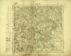
Image from the Map Collections courtesy Tohoku University. © 2023, the Committee for the Creation of the Gaihozu Digital Archives. 【図幅名】 黑龍宮 【測量時期】 - 【発行時期】 昭和7年発行sネンハッコウ 【記号】 三姓24号 【測量機関】 大日本帝國陸地測量部
Links: Source / Biblio Ref
|
1932 | 4 months ago | 4 control points |
|
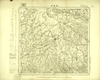
Image from the Map Collections courtesy Tohoku University. © 2023, the Committee for the Creation of the Gaihozu Digital Archives. 【図幅名】 枷板站 【測量時期】 - 【発行時期】 昭和7年発行sネンハッコウ 【記号】 三姓23号 【測量機関】 大日本帝國陸地測量部
Links: Source / Biblio Ref
|
1932 | 4 months ago | 4 control points |
|
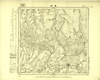
Image from the Map Collections courtesy Tohoku University. © 2023, the Committee for the Creation of the Gaihozu Digital Archives. 【図幅名】 東興 【測量時期】 - 【発行時期】 昭和10年発行 【記号】 三姓21号 【測量機関】 大日本帝國陸地測量部
Links: Source / Biblio Ref
|
1935 | 4 months ago | 4 control points |
|
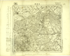
Image from the Map Collections courtesy Tohoku University. © 2023, the Committee for the Creation of the Gaihozu Digital Archives. 【図幅名】 木蘭縣 【測量時期】 - 【発行時期】 昭和7年発行sネンハッコウ 【記号】 三姓18号 【測量機関】 大日本帝國陸地測量部
Links: Source / Biblio Ref
|
1932 | 4 months ago | 4 control points |
|
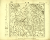
Image from the Map Collections courtesy Tohoku University. © 2023, the Committee for the Creation of the Gaihozu Digital Archives. 【図幅名】 老石房 【測量時期】 - 【発行時期】 昭和7年発行sネンハッコウ 【記号】 三姓17号 【測量機関】 大日本帝國陸地測量部
Links: Source / Biblio Ref
|
1932 | 4 months ago | 4 control points |
|
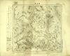
Image from the Map Collections courtesy Tohoku University. © 2023, the Committee for the Creation of the Gaihozu Digital Archives. 【図幅名】 鳳山縣 【測量時期】 - 【発行時期】 昭和10年発行 【記号】 三姓16号 【測量機関】 大日本帝國陸地測量部
Links: Source / Biblio Ref
|
1935 | 4 months ago | 4 control points |
|
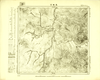
Image from the Map Collections courtesy Tohoku University. © 2023, the Committee for the Creation of the Gaihozu Digital Archives. 【図幅名】 亮珠河 【測量時期】 - 【発行時期】 昭和7年発行sネンハッコウ 【記号】 三姓15号 【測量機関】 大日本帝國陸地測量部
Links: Source / Biblio Ref
|
1932 | 4 months ago | 4 control points |
|
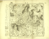
Image from the Map Collections courtesy Tohoku University. © 2023, the Committee for the Creation of the Gaihozu Digital Archives. 【図幅名】 三站 【測量時期】 - 【発行時期】 昭和7年発行sネンハッコウ 【記号】 三姓12号 【測量機関】 陸地測量部・参謀本部
Links: Source / Biblio Ref
|
1932 | 4 months ago | 4 control points |
|
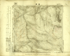
Image from the Map Collections courtesy Tohoku University. © 2023, the Committee for the Creation of the Gaihozu Digital Archives. 【図幅名】 老嶺 【測量時期】 - 【発行時期】 昭和8年発行sネンハッコウ 【記号】 三姓9号 【測量機関】 陸地測量部・参謀本部
Links: Source / Biblio Ref
|
1933 | 4 months ago | 4 control points |
|
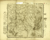
Image from the Map Collections courtesy Tohoku University. © 2023, the Committee for the Creation of the Gaihozu Digital Archives. 【図幅名】 イーマーヘー 【測量時期】 - 【発行時期】 大正10年発行 【記号】 西三行北七段三姓14号ニシ3ギョウキタ 【測量機関】 陸地測量部・参謀本部
Links: Source / Biblio Ref
|
1921 | 4 months ago | 4 control points |
|
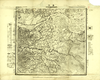
Image from the Map Collections courtesy Tohoku University. © 2023, the Committee for the Creation of the Gaihozu Digital Archives. 【図幅名】 通河 【測量時期】 - 【発行時期】 - 【記号】 西三行北七段三姓13号ニシ3ギョウキタ 【測量機関】 陸地測量部・参謀本部
Links: Source / Biblio Ref
|
4 months ago | 4 control points | |
|
Image from the Map Collections courtesy Tohoku University. © 2023, the Committee for the Creation of the Gaihozu Digital Archives. 【図幅名】 五道崗 【測量時期】 - 【発行時期】 昭和10年発行 【記号】 鐵驪24号 【測量機関】 大日本帝國陸地測量部
Links: Source / Biblio Ref
|
1935 | 4 months ago | 4 control points |
|
Image from the Map Collections courtesy Tohoku University. © 2023, the Committee for the Creation of the Gaihozu Digital Archives. 【図幅名】 鐵山包 【測量時期】 - 【発行時期】 昭和10年発行 【記号】 鐵驪20号 【測量機関】 大日本帝國陸地測量部
Links: Source / Biblio Ref
|
1935 | 4 months ago | 4 control points |
|
Image from the Map Collections courtesy Tohoku University. © 2023, the Committee for the Creation of the Gaihozu Digital Archives. 【図幅名】 伊吉密河原 【測量時期】 - 【発行時期】 昭和10年発行 【記号】 鐵驪19号 【測量機関】 大日本帝國陸地測量部
Links: Source / Biblio Ref
|
1935 | 4 months ago | 4 control points |
|
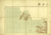
Image from the Map Collections courtesy Tohoku University. © 2023, the Committee for the Creation of the Gaihozu Digital Archives. 【図幅名】 【測量時期】 大正12年編纂 【発行時期】 大正13年発行 【記号】 関東州全図-右上 【測量機関】 關東廰・陸地測量部
Links: Source / Biblio Ref
|
1924 | 4 months ago | 4 control points |
|
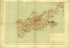
Image from the Map Collections courtesy Tohoku University. © 2023, the Committee for the Creation of the Gaihozu Digital Archives. 【図幅名】 【測量時期】 大正12年編纂 【発行時期】 大正13年発行 【記号】 関東州全図-左上 【測量機関】 關東廰・陸地測量部
Links: Source / Biblio Ref
|
1924 | 4 months ago | 4 control points |
|
Image from the Map Collections courtesy Tohoku University. © 2023, the Committee for the Creation of the Gaihozu Digital Archives. 【図幅名】 【測量時期】 大正12年編纂 【発行時期】 大正13年発行 【記号】 関東州全図-左下 【測量機関】 關東廰・陸地測量部
Links: Source / Biblio Ref
|
1924 | 4 months ago | 4 control points |

|
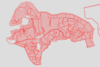
冠島のマップ
|
2026 | 4 months ago | Unrectified |
|
【最初期発行】 この地図の作成に当たっては、国土地理院長の承認を得て、同院発行の20万分の1地勢図及び5万分の1地形図を使用した。(承認番号 平30情使、 第1148号) (In 1 layer)
Links: Source / Biblio Ref
|
1930 | 4 months ago | 4 control points |
|
Image from the Map Collections courtesy Stanford University Libraries, licensed under a Creative Commons Attribution-Noncommercial 3.0 Unported License. © Stanford University. 【図幅名】 浅芽野台地 【測量時期】 大正12年測図 【発行時期】 大正13年6月発行 【記号】 枝幸9号(共12面) 【測量機関】 大日本帝国陸地測量部 【備考】 仮製版
Links: Source / Biblio Ref
|
4 months ago | 4 control points | |
|
Image from the Map Collections courtesy Stanford University Libraries, licensed under a Creative Commons Attribution-Noncommercial 3.0 Unported License. © Stanford University. 【図幅名】 沖大東島 【測量時期】 大正6年測図/昭和8年修正 【発行時期】 昭和11年11月 【記号】 大東島近傍2号(共2面) 【測量機関】 参謀本部・陸地測量部 【備考】 沖大東島14号(共1面)軍事極秘
Links: Source / Biblio Ref
|
5 months ago | 4 control points | |
|
この地図の作成に当たっては、国土地理院長の承認を得て、同院発行の20万分の1地勢図及び5万分の1地形図を使用した。(承認番号 平30情使、 第1148号)
Links: Source / Biblio Ref
|
1923 | 5 months ago | 4 control points |
|
Links: Source / Biblio Ref
|
2026 | 5 months ago | Unrectified |
|
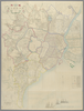
shelfmark: Maps 5.c.45
License: Public Domain
明治9 *銅板。多色刷り。朱印「定價金貳圓」。 Copperplate. Acquired 21 December 1878.
Links: Source / Biblio Ref
|
1876 | 5 months ago | 53 control points |
|
出典:北海道デジタル地域資料アーカイブズ
|
1899 | 5 months ago | 3 control points |


