Browse Maps
| map | Title  |
Year | Last Updated | Status |
|---|---|---|---|---|
|
Image from the Map Collections courtesy Stanford University Libraries. This item is in the public domain. There are no restrictions on use.
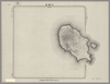
【図幅名】 松輪島 【測量時期】 大正6年測圖 【発行時期】昭和11年 【記号】 松輪島十七号 【測量機関】 参謀本部 【その他】千島列島 陸地測量部 (In 1 layer)
Links: Source / Biblio Ref
|
1936 | over 1 year ago | 5 control points |
|
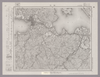
Image from the Map Collections courtesy Stanford University Libraries, licensed under a Creative Commons Attribution-Noncommercial 3.0 Unported License. © Stanford University. 【図幅名】 松江 【測量時期】 明治32年測図/昭和9年第2回修正、測図の縮図 【発行時期】 昭和12年4月発行 【記号】 松江16号(共8面) 【測量機関】 大日本帝国陸地測量部 【備考】
Links: Source / Biblio Ref
|
about 2 years ago | 4 control points | |
|
【最初期発行】 この地図の作成に当たっては、国土地理院長の承認を得て、同院発行の20万分の1地勢図及び5万分の1地形図を使用した。(承認番号 平30情使、 第1148号) (In 1 layer)
Links: Source / Biblio Ref
|
1904 | about 4 years ago | 4 control points |
|
この地図の作成に当たっては、国土地理院長の承認を得て、同院発行の20万分の1地勢図及び5万分の1地形図を使用した。(承認番号 平30情使、 第1148号)
Links: Source / Biblio Ref
|
1947 | over 5 years ago | 4 control points |
|
Image from the Map Collections courtesy Stanford University Libraries, licensed under a Creative Commons Attribution-Noncommercial 3.0 Unported License. © Stanford University. 【図幅名】 松本 【測量時期】 明治43年測図/昭和5年測図/昭和6年修正 【発行時期】 昭和8年7月発行 【記号】 高山3号(共16面) 【測量機関】 大日本帝国陸地測量部 【備考】
Links: Source / Biblio Ref
|
about 2 years ago | 4 control points | |
|
この地図の作成に当たっては、国土地理院長の承認を得て、同院発行の20万分の1地勢図及び5万分の1地形図を使用した。(承認番号 平30情使、 第1148号)
Links: Source / Biblio Ref
|
1946 | over 5 years ago | 4 control points |
|
Image from the Map Collections courtesy Stanford University Libraries, licensed under a Creative Commons Attribution-Noncommercial 3.0 Unported License. © Stanford University. 【図幅名】 松山南部 【測量時期】 明治36年測図/昭和3年修正、測図の縮図/昭和7年鉄道補入、測図の縮図 【発行時期】 昭和8年11月発行 【記号】 松山2号(共15面) 【測量機関】 大日本帝国陸地測量部 【備考】 (In 1 layer)
Links: Source / Biblio Ref
|
5 months ago | 4 control points | |
|
Public Domain. © Stanford University.
【図幅名】 松山南部 【記号】松山近傍8号(共12面)
Links: Source / Biblio Ref
|
about 1 month ago | 4 control points | |
|
Image from the Map Collections courtesy Stanford University Libraries, licensed under a Creative Commons Attribution-Noncommercial 3.0 Unported License. © Stanford University. 【図幅名】 松山北部 【測量時期】 明治36年測図/昭和37年修正 【発行時期】 昭和6年8月発行 【記号】 松山1号(共15面) 【測量機関】 大日本帝国陸地測量部 【備考】 (In 2 layers)
Links: Source / Biblio Ref
|
5 months ago | 4 control points | |
|
Public Domain. © Stanford University. 【図幅名】 松山北部 【記号】松山近傍7号(共12面)
Links: Source / Biblio Ref
|
about 1 month ago | 4 control points | |
|
この地図の作成に当たっては、国土地理院長の承認を得て、同院発行の20万分の1地勢図及び5万分の1地形図を使用した。(承認番号 平30情使、 第1148号)
Links: Source / Biblio Ref
|
1947 | over 5 years ago | 4 control points |
|
【最初期発行】 この地図の作成に当たっては、国土地理院長の承認を得て、同院発行の20万分の1地勢図及び5万分の1地形図を使用した。(承認番号 平30情使、 第1148号)
Links: Source / Biblio Ref
|
1916 | over 5 years ago | 4 control points |
|
この地図の作成に当たっては、国土地理院長の承認を得て、同院発行の20万分の1地勢図及び5万分の1地形図を使用した。(承認番号 平30情使、 第1148号)
Links: Source / Biblio Ref
|
1946 | over 5 years ago | 4 control points |
|
Image from the Map Collections courtesy Stanford University Libraries, licensed under a Creative Commons Attribution-Noncommercial 3.0 Unported License. © Stanford University. 【図幅名】 松之山温泉 【測量時期】 明治44年測圖/昭和6年修正測圖 【発行時期】 【記号】 高田六号 【測量機関】 参謀本部 【備考】 祕
Links: Source / Biblio Ref
|
about 2 years ago | 4 control points | |
|
Image from the Map Collections courtesy Stanford University Libraries, licensed under a Creative Commons Attribution-Noncommercial 3.0 Unported License. © Stanford University. 【図幅名】 春立 【測量時期】 大正8年測圖 【発行時期】 【記号】 浦河十一号 【測量機関】 参謀本部 【備考】 祕 (In 1 layer)
Links: Source / Biblio Ref
|
about 2 years ago | 4 control points | |
|
Image from the Map Collections courtesy Stanford University Libraries, licensed under a Creative Commons Attribution-Noncommercial 3.0 Unported License. © Stanford University. 【図幅名】 東金 【測量時期】 明治36年測量、測図の縮図/昭和9年第2回修正/昭和19年部分修正 【発行時期】 昭和21年11月発行 【記号】 佐倉11号(共12面) 【測量機関】 内務省地理調査所 【備考】 (In 1 layer)
Links: Source / Biblio Ref
|
about 2 years ago | 4 control points | |
|
Image from the Map Collections courtesy Stanford University Libraries, licensed under a Creative Commons Attribution-Noncommercial 3.0 Unported License. © Stanford University. 【図幅名】 【測量時期】 【発行時期】 【記号】 【測量機関】 【備考】
Links: Source / Biblio Ref
|
about 2 years ago | 4 control points | |
|
|
2018 | over 6 years ago | 4 control points |
|
Image from the Map Collections courtesy Stanford University Libraries, licensed under a Creative Commons Attribution-Noncommercial 3.0 Unported License. © Stanford University. 【図幅名】 東京西南部 【測量時期】 明治42年測図/昭和4年第2回修正/昭和7年要部修正 【発行時期】 【記号】 東京7号(共16面) 【測量機関】 参謀本部 【備考】 仮製版 秘 (In 1 layer)
Links: Source / Biblio Ref
|
about 2 years ago | 11 control points | |
|
この地図の作成に当たっては、国土地理院長の承認を得て、同院発行の20万分の1地勢図及び5万分の1地形図を使用した。(承認番号 平30情使、 第1148号) (In 1 layer)
Links: Source / Biblio Ref
|
1946 | about 2 years ago | 4 control points |
|
この地図の作成に当たっては、国土地理院長の承認を得て、同院発行の20万分の1地勢図及び5万分の1地形図を使用した。(承認番号 平30情使、 第1148号) (In 2 layers)
Links: Source / Biblio Ref
|
1948 | about 2 years ago | 4 control points |
|
Image from the Map Collections courtesy Stanford University Libraries, licensed under a Creative Commons Attribution-Noncommercial 3.0 Unported License. © Stanford University. 【図幅名】 東京東北部 【測量時期】 明治42年測図/大正10年第2回修正/昭和4年測図/昭和7年要部修正 【発行時期】 昭和7年12月発行 【記号】 東京2号 【測量機関】 大日本帝国陸地測量部 【備考】 (In 1 layer)
Links: Source / Biblio Ref
|
about 2 years ago | 4 control points | |
|
Image from the Map Collections courtesy Stanford University Libraries, licensed under a Creative Commons Attribution-Noncommercial 3.0 Unported License. © Stanford University.
Links: Source / Biblio Ref
|
over 6 years ago | 4 control points | |
|
(In 1 layer)
Links: Source / Biblio Ref
|
1924 | about 1 year ago | 4 control points |
|
(In 1 layer)
Links: Source / Biblio Ref
|
1924 | about 1 year ago | 4 control points |
|
(In 1 layer)
Links: Source / Biblio Ref
|
1924 | about 1 year ago | 4 control points |
|
(In 1 layer)
Links: Source / Biblio Ref
|
1923 | about 1 year ago | 4 control points |
|
(In 1 layer)
Links: Source / Biblio Ref
|
1924 | about 1 year ago | 4 control points |
|
(In 1 layer)
Links: Source / Biblio Ref
|
1923 | about 1 year ago | 4 control points |
|
(In 1 layer)
Links: Source / Biblio Ref
|
1924 | about 1 year ago | 4 control points |
|
(In 1 layer)
Links: Source / Biblio Ref
|
1924 | about 1 year ago | 4 control points |
|
(In 1 layer)
Links: Source / Biblio Ref
|
1924 | about 1 year ago | 4 control points |
|
【最初期発行】 この地図の作成に当たっては、国土地理院長の承認を得て、同院発行の20万分の1地勢図及び5万分の1地形図を使用した。(承認番号 平30情使、 第1148号) (In 1 layer)
Links: Source / Biblio Ref
|
1916 | about 2 years ago | 4 control points |
|
Image from the Map Collections courtesy Stanford University Libraries, licensed under a Creative Commons Attribution-Noncommercial 3.0 Unported License. © Stanford University. 【図幅名】 村所 【測量時期】 明治35年測図/昭和10年要部修正、部分修正 【発行時期】 昭和21年11月発行 【記号】 延岡15号(共13面) 【測量機関】 地理調査所 【備考】
Links: Source / Biblio Ref
|
about 4 years ago | 4 control points | |
|
Image from the Map Collections courtesy Stanford University Libraries, licensed under a Creative Commons Attribution-Noncommercial 3.0 Unported License. © Stanford University. 【図幅名】 村岡 【測量時期】 明治31年測図/昭和7年修正 【発行時期】 昭和10年2月発行 【記号】 鳥取8号(共9面) 【測量機関】 大日本帝国陸地測量部 【備考】
Links: Source / Biblio Ref
|
3 months ago | 4 control points | |
|
Image from the Map Collections courtesy Stanford University Libraries, licensed under a Creative Commons Attribution-Noncommercial 3.0 Unported License. © Stanford University.
Links: Source / Biblio Ref
|
over 6 years ago | 4 control points | |
|
この地図の作成に当たっては、国土地理院長の承認を得て、同院発行の20万分の1地勢図及び5万分の1地形図を使用した。(承認番号 平30情使、 第1148号)
Links: Source / Biblio Ref
|
1947 | over 5 years ago | 4 control points |
|
【最初期発行】 この地図の作成に当たっては、国土地理院長の承認を得て、同院発行の20万分の1地勢図及び5万分の1地形図を使用した。(承認番号 平30情使、 第1148号) (In 1 layer)
Links: Source / Biblio Ref
|
1922 | about 2 years ago | 4 control points |
|
Image from the Map Collections courtesy Stanford University Libraries, licensed under a Creative Commons Attribution-Noncommercial 3.0 Unported License. © Stanford University. 【図幅名】 【測量時期】 【発行時期】 【記号】 【測量機関】 【備考】
Links: Source / Biblio Ref
|
about 2 years ago | 4 control points | |
|
Image from the Map Collections courtesy Stanford University Libraries, licensed under a Creative Commons Attribution-Noncommercial 3.0 Unported License. © Stanford University.
Links: Source / Biblio Ref
|
over 6 years ago | 4 control points | |
|
Image from the Map Collections courtesy Stanford University Libraries, licensed under a Creative Commons Attribution-Noncommercial 3.0 Unported License. © Stanford University. 【図幅名】 札幌 【測量時期】 大正5年測図の縮図/昭和10年修正、測図の縮図 【発行時期】 【記号】 札幌10号 【測量機関】 参謀本部 【備考】 秘 (In 1 layer)
Links: Source / Biblio Ref
|
about 2 years ago | 4 control points | |
|
【最初期発行】 この地図の作成に当たっては、国土地理院長の承認を得て、同院発行の20万分の1地勢図及び5万分の1地形図を使用した。(承認番号 平30情使、 第1148号) (In 1 layer)
Links: Source / Biblio Ref
|
1926 | over 2 years ago | 17 control points |
|
Image from the Map Collections courtesy Stanford University Libraries, licensed under a Creative Commons Attribution-Noncommercial 3.0 Unported License. © Stanford University. 【図幅名】 札内川上流 【測量時期】 大正9年測圖 【発行時期】 【記号】 浦河一号 【測量機関】 参謀本部 【備考】 祕
Links: Source / Biblio Ref
|
about 2 years ago | 4 control points | |
|
この地図の作成に当たっては、国土地理院長の承認を得て、同院発行の20万分の1地勢図及び5万分の1地形図を使用した。(承認番号 平30情使、 第1148号)
Links: Source / Biblio Ref
|
1946 | over 5 years ago | 4 control points |
|
Image from the Map Collections courtesy Stanford University Libraries, licensed under a Creative Commons Attribution-Noncommercial 3.0 Unported License. © Stanford University. 【図幅名】 本荘 【測量時期】 大正2年測図/大正14年鉄道補入 【発行時期】 大正15年11月発行 【記号】 秋田16号(共16面) 【測量機関】 大日本帝国陸地測量部 【備考】
Links: Source / Biblio Ref
|
over 5 years ago | 4 control points | |
|
|
2022 | about 2 years ago | 4 control points |
|
|
2022 | about 2 years ago | 4 control points |
|
Image from the Map Collections courtesy Stanford University Libraries, licensed under a Creative Commons Attribution-Noncommercial 3.0 Unported License. © Stanford University. 【図幅名】 本渡 【測量時期】 明治34年測圖/昭和7年要部修正測圖 【発行時期】 【記号】 八代十四号 【測量機関】 参謀本部 【備考】 祕
Links: Source / Biblio Ref
|
about 4 years ago | 4 control points | |
|
shelfmark: Or.75.f.11
License: Public Domain
貞享4 *ケンペル旧蔵。 Xylograph. Ex-Kaempfer. Gardner #563. Kurita 17.
Links: Source / Biblio Ref
|
1687 | about 3 years ago | 22 control points |
|
|
1864 | over 6 years ago | 3 control points |