Browse Maps
| map | Title | Year | Last Updated | Status  |
|---|---|---|---|---|
|
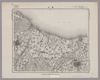
Image from the Map Collections courtesy Stanford University Libraries, licensed under a Creative Commons Attribution-Noncommercial 3.0 Unported License. © Stanford University.
Links: Source / Biblio Ref
|
over 6 years ago | 4 control points | |
|
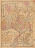
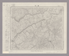
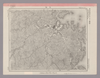
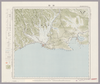
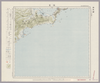
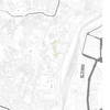
【Courtesy of the C. V. Starr East Asian Library University of California, Berkeley】 In Japanese. Relief shown by hachures. Includes 4 insets and legend. Includes distance chart and texts on districts on verso.
Links: Source / Biblio Ref
|
1901 | over 1 year ago | 3 control points |
|
Image from the Map Collections courtesy Stanford University Libraries, licensed under a Creative Commons Attribution-Noncommercial 3.0 Unported License. © Stanford University. 【図幅名】 【測量時期】 【発行時期】 【記号】 【測量機関】 【備考】
Links: Source / Biblio Ref
|
over 2 years ago | 4 control points | |
|
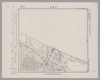
Image from the Map Collections courtesy Stanford University Libraries, licensed under a Creative Commons Attribution-Noncommercial 3.0 Unported License. © Stanford University. 【図幅名】 中湧別 【測量時期】 大正13年測圖 【発行時期】 【記号】 紋別七号 【測量機関】 参謀本部 【備考】 祕 假製版 (In 1 layer)
Links: Source / Biblio Ref
|
over 2 years ago | 4 control points | |
|
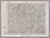
Image from the Map Collections courtesy Stanford University Libraries, licensed under a Creative Commons Attribution-Noncommercial 3.0 Unported License. © Stanford University. 【図幅名】 熊川 【測量時期】 明治26年測図/大正9年修正 【発行時期】 【記号】 宮津4号(共5面) 【測量機関】 参謀本部 【備考】 秘
Links: Source / Biblio Ref
|
2 months ago | 4 control points | |
|
|
11 months ago | 19 control points | |
|
Image from the Map Collections courtesy Stanford University Libraries, licensed under a Creative Commons Attribution-Noncommercial 3.0 Unported License. © Stanford University. 【図幅名】 驫木 【測量時期】 大正3年測図/昭和14年修正 【発行時期】 昭和15年11月発行 【記号】 青森16号西部(共14面) 【測量機関】 大日本帝国陸地測量部 【備考】
Links: Source / Biblio Ref
|
2 months ago | 4 control points | |
|
|
2018 | over 6 years ago | 3 control points |
|
Image from the Map Collections courtesy Stanford University Libraries, licensed under a Creative Commons Attribution-Noncommercial 3.0 Unported License. © Stanford University. 【図幅名】 岩村 【測量時期】 明治44年測圖/昭和8年要部修正測圖 【発行時期】 【記号】 飯田十二号 【測量機関】 参謀本部 【備考】 祕
Links: Source / Biblio Ref
|
2 months ago | 4 control points | |
|
Image from the Map Collections courtesy Stanford University Libraries, licensed under a Creative Commons Attribution-Noncommercial 3.0 Unported License. © Stanford University. 【図幅名】 高瀬 【測量時期】 明治33年測圖/大正15年第二回修正測圖/昭和6年部分修正測圖 【発行時期】 【記号】 熊本七号 【測量機関】 参謀本部 【備考】 祕
Links: Source / Biblio Ref
|
about 1 month ago | 4 control points | |
|
Links: Source / Biblio Ref
|
2020 | about 2 years ago | 5 control points |
|
|
1864 | over 4 years ago | 3 control points |
|
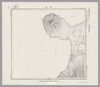
Image from the Map Collections courtesy Stanford University Libraries, licensed under a Creative Commons Attribution-Noncommercial 3.0 Unported License. © Stanford University. 【図幅名】 【測量時期】 【発行時期】 【記号】 【測量機関】 【備考】
Links: Source / Biblio Ref
|
about 1 month ago | 4 control points | |
|
Image from the Map Collections courtesy Stanford University Libraries, licensed under a Creative Commons Attribution-Noncommercial 3.0 Unported License. © Stanford University.
Links: Source / Biblio Ref
|
over 6 years ago | 4 control points | |
|
Links: Source / Biblio Ref
|
2020 | about 2 years ago | 16 control points |
|
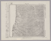
Image from the Map Collections courtesy Stanford University Libraries, licensed under a Creative Commons Attribution-Noncommercial 3.0 Unported License. © Stanford University.
Links: Source / Biblio Ref
|
over 6 years ago | 4 control points | |
|
Image from the Map Collections courtesy Stanford University Libraries, licensed under a Creative Commons Attribution-Noncommercial 3.0 Unported License. © Stanford University.
Links: Source / Biblio Ref
|
over 6 years ago | 4 control points | |
|
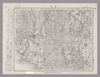
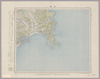
【Courtesy of the C. V. Starr East Asian Library University of California, Berkeley】 Oriented with north to the upper left. In Japanese. Relief shown by hachures. Includes 4 insets and legend. Includes text on districts and distance chart on verso.
Links: Source / Biblio Ref
|
1902 | over 1 year ago | 3 control points |
|
Image from the Map Collections courtesy Stanford University Libraries, licensed under a Creative Commons Attribution-Noncommercial 3.0 Unported License. © Stanford University. 【図幅名】 関 【測量時期】 明治41年測図/昭和6年要部修正 【発行時期】 昭和8年1月発行 【記号】 福島9号(共18面) 【測量機関】 大日本帝国陸地測量部 【備考】
Links: Source / Biblio Ref
|
2 months ago | 4 control points | |
|
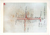
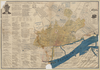
京都府立京都学・歴彩館所蔵
下京区地籍図
Links: Source / Biblio Ref
|
1884 | over 6 years ago | 3 control points |
|
Image from the Map Collections courtesy Stanford University Libraries, licensed under a Creative Commons Attribution-Noncommercial 3.0 Unported License. © Stanford University. 【図幅名】 沢木 【測量時期】 大正12年測図 【発行時期】 昭和13年10月発行 【記号】 紋別13号(共11面) 【測量機関】 大日本帝国陸地測量部 【備考】 仮製版 (In 1 layer)
Links: Source / Biblio Ref
|
2 months ago | 4 control points | |
|
Image from the Map Collections courtesy Stanford University Libraries, licensed under a Creative Commons Attribution-Noncommercial 3.0 Unported License. © Stanford University. 【図幅名】 初山別 【測量時期】 大正12年測図 【発行時期】 大正13年8月発行 【記号】 羽幌1号(共8面) 【測量機関】 大日本帝国陸地測量部 【備考】 仮製版 (In 1 layer)
Links: Source / Biblio Ref
|
2 months ago | 4 control points | |
|
Image from the Map Collections courtesy Stanford University Libraries, licensed under a Creative Commons Attribution-Noncommercial 3.0 Unported License. © Stanford University. 【図幅名】 羽幌 【測量時期】 大正11年測図/昭和8年鉄道補入 【発行時期】 昭和9年10月発行 【記号】 羽幌6号(共8面) 【測量機関】 大日本帝国陸地測量部 【備考】 仮製版 (In 1 layer)
Links: Source / Biblio Ref
|
2 months ago | 4 control points | |
|
Image from the Map Collections courtesy Stanford University Libraries, licensed under a Creative Commons Attribution-Noncommercial 3.0 Unported License. © Stanford University. 【図幅名】 飫肥 【測量時期】 明治35年測図/昭和7年修正/昭和10年部分修正 【発行時期】 昭和21年12月発行 【記号】 宮崎11号(共8面) 【測量機関】 内務省地理調査所 【備考】
Links: Source / Biblio Ref
|
about 1 month ago | 4 control points | |
|
Image from the Map Collections courtesy Stanford University Libraries, licensed under a Creative Commons Attribution-Noncommercial 3.0 Unported License. © Stanford University. 【図幅名】 富山 【測量時期】 明治43年測図/昭和5年修正 【発行時期】 昭和9年2月発行 【記号】 富山16号(共11面) 【測量機関】 大日本帝国陸地測量部 【備考】 (In 1 layer)
Links: Source / Biblio Ref
|
3 months ago | 4 control points | |
|
Image from the Map Collections courtesy Stanford University Libraries, licensed under a Creative Commons Attribution-Noncommercial 3.0 Unported License. © Stanford University. 【図幅名】 鹿部 【測量時期】 大正4年測圖 【発行時期】 【記号】 室蘭四号 【測量機関】 参謀本部 【備考】 祕 (In 1 layer)
Links: Source / Biblio Ref
|
2 months ago | 4 control points | |
|
Image from the Map Collections courtesy Stanford University Libraries, licensed under a Creative Commons Attribution-Noncommercial 3.0 Unported License. © Stanford University. 【図幅名】 奥津 【測量時期】 明治31年測圖/昭和7年要部修正測圖 【発行時期】 【記号】 高梁一号 【測量機関】 参謀本部 【備考】 祕
Links: Source / Biblio Ref
|
6 months ago | 4 control points | |
|
Image from the Map Collections courtesy Stanford University Libraries, licensed under a Creative Commons Attribution-Noncommercial 3.0 Unported License. © Stanford University. 【図幅名】 鳥取北部 【測量時期】 明治30年測図の縮図/昭和7年修正 【発行時期】 昭和9年1月発行 【記号】 鳥取15号(共9面) 【測量機関】 大日本帝国陸地測量部 【備考】
Links: Source / Biblio Ref
|
almost 6 years ago | 4 control points | |
|
京都府立京都学・歴彩館所蔵
下京地籍図
Links: Source / Biblio Ref
|
1884 | over 6 years ago | 4 control points |
|
Image from the Map Collections courtesy Stanford University Libraries, licensed under a Creative Commons Attribution-Noncommercial 3.0 Unported License. © Stanford University. 【図幅名】 岡野町 【測量時期】 明治44年測図/昭和6年修正 【発行時期】 昭和8年12月発行 【記号】 高田5号(共15面) 【測量機関】 大日本帝国陸地測量部 【備考】
Links: Source / Biblio Ref
|
2 months ago | 4 control points | |
|
Image from the Map Collections courtesy Stanford University Libraries, licensed under a Creative Commons Attribution-Noncommercial 3.0 Unported License. © Stanford University. 【図幅名】 乙忠部 【測量時期】 大正12年測図 【発行時期】 大正13年6月発行 【記号】 枝幸8号(共12面) 【測量機関】 大日本帝国陸地測量部 【備考】 仮製版
Links: Source / Biblio Ref
|
2 months ago | 4 control points | |
|
Image from the Map Collections courtesy Stanford University Libraries, licensed under a Creative Commons Attribution-Noncommercial 3.0 Unported License. © Stanford University. 【図幅名】 上興部 【測量時期】 大正12年測図 【発行時期】 大正13年6月発行 【記号】 名寄2号(共16面) 【測量機関】 大日本帝国陸地測量部 【備考】 仮製版 (In 1 layer)
Links: Source / Biblio Ref
|
2 months ago | 4 control points | |
|
Image from the Map Collections courtesy Stanford University Libraries, licensed under a Creative Commons Attribution-Noncommercial 3.0 Unported License. © Stanford University. 【図幅名】 紋別 【測量時期】 大正12年測図 【発行時期】 昭和13年10月発行 【記号】 紋別10号(共11面) 【測量機関】 大日本帝国陸地測量部 【備考】 仮製版 (In 1 layer)
Links: Source / Biblio Ref
|
2 months ago | 4 control points | |
|
|
2023 | over 1 year ago | 5 control points |
|
Links: Source / Biblio Ref
|
2021 | about 2 years ago | 4 control points |
|
|
2022 | about 2 years ago | 9 control points |
|
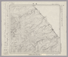
Image from the Map Collections courtesy Stanford University Libraries, licensed under a Creative Commons Attribution-Noncommercial 3.0 Unported License. © Stanford University. 【図幅名】 【測量時期】 【発行時期】 【記号】 【測量機関】 【備考】
Links: Source / Biblio Ref
|
over 2 years ago | 4 control points | |
|
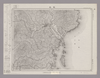
Image from the Map Collections courtesy Stanford University Libraries, licensed under a Creative Commons Attribution-Noncommercial 3.0 Unported License. © Stanford University.
Links: Source / Biblio Ref
|
over 6 years ago | 4 control points | |
|
Image from the Map Collections courtesy Stanford University Libraries, licensed under a Creative Commons Attribution-Noncommercial 3.0 Unported License. © Stanford University.
Links: Source / Biblio Ref
|
over 6 years ago | 4 control points | |
|
Image from the Map Collections courtesy Stanford University Libraries, licensed under a Creative Commons Attribution-Noncommercial 3.0 Unported License. © Stanford University.
Links: Source / Biblio Ref
|
over 6 years ago | 4 control points | |
|
Image from the Map Collections courtesy Stanford University Libraries, licensed under a Creative Commons Attribution-Noncommercial 3.0 Unported License. © Stanford University.
Links: Source / Biblio Ref
|
over 6 years ago | 4 control points | |
|
Image from the Map Collections courtesy Stanford University Libraries, licensed under a Creative Commons Attribution-Noncommercial 3.0 Unported License. © Stanford University. 【図幅名】 音標 【測量時期】 大正12年測図 【発行時期】 大正13年6月発行 【記号】 枝幸4号(共12面) 【測量機関】 大日本帝国陸地測量部 【備考】 仮製版
Links: Source / Biblio Ref
|
2 months ago | 4 control points | |
|
Image from the Map Collections courtesy Stanford University Libraries, licensed under a Creative Commons Attribution-Noncommercial 3.0 Unported License. © Stanford University. 【図幅名】 雄武 【測量時期】 大正12年測図 【発行時期】 大正13年6月発行 【記号】 名寄1号(共16面) 【測量機関】 大日本帝国陸地測量部 【備考】 仮製版 (In 1 layer)
Links: Source / Biblio Ref
|
2 months ago | 4 control points | |
|
明治18年国道図
Links: Source / Biblio Ref
|
1885 | over 3 years ago | 5 control points |

|
|
2018 | over 6 years ago | 3 control points |
|
|
2023 | 10 months ago | 12 control points |
|
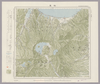
Image from the Map Collections courtesy Stanford University Libraries, licensed under a Creative Commons Attribution-Noncommercial 3.0 Unported License. © Stanford University. 【図幅名】 荒島岳 【測量時期】 明治43年測圖/昭和5年要部修正測圖 【発行時期】 【記号】 岐阜五号 【測量機関】 参謀本部 【備考】 祕
Links: Source / Biblio Ref
|
2 months ago | 4 control points | |
|
|
11 months ago | 10 control points | |
|
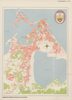
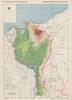
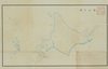
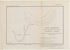
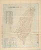
【Courtesy of the C. V. Starr East Asian Library University of California, Berkeley】 Title on envelope: Shinpan shizu Dai Nippon Teikoku Taiwanto zenzu. In Japanese. Relief shown by form lines. Includes list of ferries' fare table and legend. Col. map folded in envelope 20 x 13 cm. East Asian Library call number Bd7.
Links: Source / Biblio Ref
|
1897 | over 3 years ago | 4 control points |
|
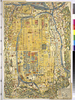
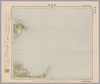
【Courtesy of the C. V. Starr East Asian Library University of California, Berkeley】 Mounted cover title. Wood block print. In Japanese. Relief shown pictorially. Includes texts on main temples and shrines and legend. Engraved by Inoue Jihe. East Asian Library call number: F28.
Links: Source / Biblio Ref
|
1831 | over 3 years ago | 4 control points |