Browse Maps
| map | Title  |
Year | Last Updated | Status |
|---|---|---|---|---|
|
この地図の作成に当たっては、国土地理院長の承認を得て、同院発行の20万分の1地勢図及び5万分の1地形図を使用した。(承認番号 平30情使、 第1148号)
Links: Source / Biblio Ref
|
1947 | over 5 years ago | 4 control points |
|
この地図の作成に当たっては、国土地理院長の承認を得て、同院発行の20万分の1地勢図及び5万分の1地形図を使用した。(承認番号 平30情使、 第1148号)
Links: Source / Biblio Ref
|
1946 | over 5 years ago | 4 control points |
|
Image from the Map Collections courtesy Stanford University Libraries, licensed under a Creative Commons Attribution-Noncommercial 3.0 Unported License. © Stanford University. 【図幅名】 徳舜暼 【測量時期】 大正6年測図の縮図/昭和10年修正、測図の縮図 【発行時期】 昭和12年4月発行 【記号】 苫小牧13号(共5面) 【測量機関】 大日本帝国陸地測量部 【備考】
Links: Source / Biblio Ref
|
about 2 years ago | 4 control points | |
|
この地図の作成に当たっては、国土地理院長の承認を得て、同院発行の20万分の1地勢図及び5万分の1地形図を使用した。(承認番号 平30情使、 第1148号)
Links: Source / Biblio Ref
|
1946 | over 5 years ago | 4 control points |
|
Image from the Map Collections courtesy Stanford University Libraries, licensed under a Creative Commons Attribution-Noncommercial 3.0 Unported License. © Stanford University. 【図幅名】 志々伎 【測量時期】 明治33年測図/大正14年修正/昭和20年部分修正 【発行時期】 昭和23年2月発行 【記号】 長崎9号(共15面) 【測量機関】 地理調査所 【備考】
Links: Source / Biblio Ref
|
over 5 years ago | 4 control points | |
|
Image from the Map Collections courtesy Stanford University Libraries, licensed under a Creative Commons Attribution-Noncommercial 3.0 Unported License. © Stanford University. 【図幅名】 志布志 【測量時期】 明治34年測図/昭和7年第2回修正、測図の縮図/昭和10年部分修正/昭和24年資料修正 【発行時期】 昭和24年6月発行 【記号】 宮崎16号(共8面) 【測量機関】 地理調査所 【備考】
Links: Source / Biblio Ref
|
about 4 years ago | 4 control points | |
|
Image from the Map Collections courtesy Stanford University Libraries. This item is in the public domain. There are no restrictions on use.
【図幅名】 志林規嶋【測量時期】 大正3年測圖 【発行時期】大正13年 【記号】 幌筵島十五号 【測量機関】 参謀本部 【その他】千島列島 陸地測量部 (In 1 layer)
Links: Source / Biblio Ref
|
1924 | over 1 year ago | 4 control points |
|
Image from the Map Collections courtesy Stanford University Libraries, licensed under a Creative Commons Attribution-Noncommercial 3.0 Unported License. © Stanford University. 【図幅名】 志比内 【測量時期】 大正6年測圖 【発行時期】 【記号】 旭川七号 【測量機関】 参謀本部 【備考】 祕 (In 1 layer)
Links: Source / Biblio Ref
|
about 2 years ago | 4 control points | |
|
この地図の作成に当たっては、国土地理院長の承認を得て、同院発行の20万分の1地勢図及び5万分の1地形図を使用した。(承認番号 平30情使、 第1148号)
Links: Source / Biblio Ref
|
1947 | over 5 years ago | 4 control points |
|
Image from the Map Collections courtesy Stanford University Libraries, licensed under a Creative Commons Attribution-Noncommercial 3.0 Unported License. © Stanford University. 【図幅名】 生花苗 【測量時期】 大正9年測図/昭和5年鉄道補入 【発行時期】 昭和7年6月発行 【記号】 広尾9号(共9面) 【測量機関】 大日本帝国陸地測量部 【備考】 (In 1 layer)
Links: Source / Biblio Ref
|
about 2 years ago | 4 control points | |
|
Image from the Map Collections courtesy Stanford University Libraries, licensed under a Creative Commons Attribution-Noncommercial 3.0 Unported License. © Stanford University. 【図幅名】 恩根内 【測量時期】 大正12年測図 【発行時期】 大正13年10月発行 【記号】 名寄9号(共16面) 【測量機関】 大日本帝国陸地測量部 【備考】 仮製版 (In 1 layer)
Links: Source / Biblio Ref
|
about 2 years ago | 4 control points | |
|
この地図の作成に当たっては、国土地理院長の承認を得て、同院発行の20万分の1地勢図及び5万分の1地形図を使用した。(承認番号 平30情使、 第1148号)
Links: Source / Biblio Ref
|
1946 | over 5 years ago | 4 control points |
|
Image from the Map Collections courtesy Stanford University Libraries, licensed under a Creative Commons Attribution-Noncommercial 3.0 Unported License. © Stanford University. 【図幅名】 恵庭 【測量時期】 大正5年測圖及測圖之縮圖/昭和10年修正測圖及修正測圖之縮圖 【発行時期】 【記号】 札幌七号 【測量機関】 参謀本部 【備考】 祕 (In 1 layer)
Links: Source / Biblio Ref
|
about 2 years ago | 4 control points | |
|
この地図の作成に当たっては、国土地理院長の承認を得て、同院発行の20万分の1地勢図及び5万分の1地形図を使用した。(承認番号 平30情使、 第1148号)
Links: Source / Biblio Ref
|
1952 | over 5 years ago | 4 control points |
|
Image from the Map Collections courtesy Stanford University Libraries, licensed under a Creative Commons Attribution-Noncommercial 3.0 Unported License. © Stanford University. 【図幅名】 恵比島 【測量時期】 大正8年測図/昭和6年鉄道補入 【発行時期】 昭和7年7月発行 【記号】 留萌1号(共11面) 【測量機関】 大日本帝国陸地測量部 【備考】 (In 1 layer)
Links: Source / Biblio Ref
|
about 2 years ago | 4 control points | |
|
Image from the Map Collections courtesy Stanford University Libraries, licensed under a Creative Commons Attribution-Noncommercial 3.0 Unported License. © Stanford University. 【図幅名】 岩村 【測量時期】 明治44年測圖/昭和8年要部修正測圖 【発行時期】 【記号】 飯田十二号 【測量機関】 参謀本部 【備考】 祕
Links: Source / Biblio Ref
|
about 2 years ago | 4 control points | |
|
Image from the Map Collections courtesy Stanford University Libraries, licensed under a Creative Commons Attribution-Noncommercial 3.0 Unported License. © Stanford University. 【図幅名】 愛別 【測量時期】 大正8年測図/昭和3年鉄道補入 【発行時期】 昭和6年10月発行 【記号】 旭川5号(共16面) 【測量機関】 大日本帝国陸地測量部 【備考】 (In 1 layer)
Links: Source / Biblio Ref
|
about 2 years ago | 4 control points | |
|
Image from the Map Collections courtesy Stanford University Libraries, licensed under a Creative Commons Attribution-Noncommercial 3.0 Unported License. © Stanford University. 【図幅名】 慶良間列島南部 【測量時期】 大正10年測圖 【発行時期】 昭和11年発行 【記号】 沖縄郡島十八号 【測量機関】 陸地測量部・参謀本部 【備考】 軍事極祕(戦地ニ在りテハ軍事祕密トス)
Links: Source / Biblio Ref
|
3 months ago | 4 control points | |
|
この地図の作成に当たっては、国土地理院長の承認を得て、同院発行の20万分の1地勢図及び5万分の1地形図を使用した。(承認番号 平30情使、 第1148号) (In 1 layer)
Links: Source / Biblio Ref
|
1947 | about 2 years ago | 4 control points |
|
Image from the Map Collections courtesy Stanford University Libraries, licensed under a Creative Commons Attribution-Noncommercial 3.0 Unported License. © Stanford University. 【図幅名】 戸賀 【測量時期】 大正1年測図/昭和14年修正 【発行時期】 昭和16年1月発行 【記号】 男鹿島5号(共2面) 【測量機関】 大日本帝国陸地測量部 【備考】
Links: Source / Biblio Ref
|
over 5 years ago | 4 control points | |
|
Image from the Map Collections courtesy Stanford University Libraries, licensed under a Creative Commons Attribution-Noncommercial 3.0 Unported License. © Stanford University. 【図幅名】 戸隠 【測量時期】 大正1年測図/昭和6年修正 【発行時期】 【記号】 高田16号(共15面) 【測量機関】 参謀本部 【備考】 秘
Links: Source / Biblio Ref
|
about 2 years ago | 4 control points | |
|
Image from the Map Collections courtesy Stanford University Libraries, licensed under a Creative Commons Attribution-Noncommercial 3.0 Unported License. © Stanford University. 【図幅名】 手ノ予 【測量時期】 大正2年測図/昭和6年部分修正 【発行時期】 昭和8年1月発行 【記号】 村上4号(共12面) 【測量機関】 大日本帝国陸地測量部 【備考】
Links: Source / Biblio Ref
|
about 2 years ago | 4 control points | |
|
Image from the Map Collections courtesy Stanford University Libraries, licensed under a Creative Commons Attribution-Noncommercial 3.0 Unported License. © Stanford University. 【図幅名】 青瀬 【測量時期】 明治34年測図/昭和11年修正 【発行時期】 【記号】 甑島6号 【測量機関】 参謀本部 【備考】 秘
Links: Source / Biblio Ref
|
about 4 years ago | 4 control points | |
|
Image from the Map Collections courtesy Stanford University Libraries, licensed under a Creative Commons Attribution-Noncommercial 3.0 Unported License. © Stanford University. 【図幅名】 手打 【測量時期】 明治34年測図/昭和11年修正 【発行時期】 【記号】 甑島7号(共4面) 【測量機関】 参謀本部 【備考】 秘
Links: Source / Biblio Ref
|
about 4 years ago | 4 control points | |
|
Image from the Map Collections courtesy Stanford University Libraries, licensed under a Creative Commons Attribution-Noncommercial 3.0 Unported License. © Stanford University. 【図幅名】 手結 【測量時期】 明治40年測図の縮図/昭和8年修正、測図の縮図 【発行時期】 昭和11年5月発行 【記号】 高知3号(共16面) 【測量機関】 大日本帝国陸地測量部 【備考】
Links: Source / Biblio Ref
|
about 2 years ago | 4 control points | |
|
この地図の作成に当たっては、国土地理院長の承認を得て、同院発行の20万分の1地勢図及び5万分の1地形図を使用した。(承認番号 平30情使、 第1148号)
Links: Source / Biblio Ref
|
1946 | about 4 years ago | 4 control points |
|
Image from the Map Collections courtesy Stanford University Libraries, licensed under a Creative Commons Attribution-Noncommercial 3.0 Unported License. © Stanford University. 【図幅名】 抜海 【測量時期】 昭和29年測図 【発行時期】 昭和31年11月発行 【記号】 天塩5号 【測量機関】 地理調査所 【備考】 (In 1 layer)
Links: Source / Biblio Ref
|
about 2 years ago | 4 control points | |
|
Image from the Map Collections courtesy Stanford University Libraries, licensed under a Creative Commons Attribution-Noncommercial 3.0 Unported License. © Stanford University.
Links: Source / Biblio Ref
|
over 6 years ago | 4 control points | |
|
Image from the Map Collections courtesy Stanford University Libraries, licensed under a Creative Commons Attribution-Noncommercial 3.0 Unported License. © Stanford University. 【図幅名】 掛塚 【測量時期】 明治22年測図縮図/昭和13年第2回修正、測図の縮図 【発行時期】 昭和15年3月発行 【記号】 伊良湖岬1号(共3面) 【測量機関】 大日本帝国陸地測量部 【備考】
Links: Source / Biblio Ref
|
about 2 years ago | 4 control points | |
|
Image from the Map Collections courtesy Stanford University Libraries, licensed under a Creative Commons Attribution-Noncommercial 3.0 Unported License. © Stanford University. 【図幅名】 掛川 【測量時期】 明治22年測図/大正5年第2回修正/昭和5年鉄道補入 【発行時期】 昭和7年2月発行 【記号】 静岡16号(共15面) 【測量機関】 大日本帝国陸地測量部 【備考】
Links: Source / Biblio Ref
|
about 2 years ago | 4 control points | |
|
Image from the Map Collections courtesy Stanford University Libraries, licensed under a Creative Commons Attribution-Noncommercial 3.0 Unported License. © Stanford University. 【図幅名】 摩周湖 【測量時期】 大正13年測圖/昭和7年鐡道補入 【発行時期】 【記号】 斜里七号 【測量機関】 参謀本部 【備考】 祕 假製版 (In 1 layer)
Links: Source / Biblio Ref
|
about 2 years ago | 4 control points | |
|
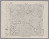
Image from the Map Collections courtesy Stanford University Libraries, licensed under a Creative Commons Attribution-Noncommercial 3.0 Unported License. © Stanford University. 【図幅名】 【測量時期】 【発行時期】 【記号】 【測量機関】 【備考】 (In 1 layer)
Links: Source / Biblio Ref
|
about 2 years ago | 4 control points | |
|
Image from the Map Collections courtesy Stanford University Libraries, licensed under a Creative Commons Attribution-Noncommercial 3.0 Unported License. © Stanford University. 【図幅名】 播州赤穂 【測量時期】 明治28年測図/大正5年第2回修正/昭和24年応急修正 【発行時期】 昭和35年9月発行 【記号】 姫路12号(共16面) 【測量機関】 国土地理院 【備考】 応急修正版
Links: Source / Biblio Ref
|
about 2 years ago | 4 control points | |

|
|
2017 | about 7 years ago | 3 control points |

|
gisday2019
|
1912 | over 4 years ago | 8 control points |
|
GISDay2019 Mapwarper
TEST 01
|
2019 | over 5 years ago | 3 control points |

|
|
1868 | over 6 years ago | 5 control points |
|
shelfmark: Maps 38.b.168
License: Public Domain
天保13 *多色刷り。刊記「浪花書林/石川屋和助」。英字書き入れ多し。 Xylograph.
Links: Source / Biblio Ref
|
1842 | about 3 years ago | 3 control points |
|
shelfmark: Maps 63090.5
License: Public Domain
文化8 *多色刷り。外題欠。序題「新刻日本輿地路程全図」。安永乙未序。(刊記書肆)東都、須原茂兵衛/浪華、松邑九兵衛・柳原喜兵衛・吉田善蔵・赤松九兵衛・浅野弥兵衛/京師、井上治兵衛鐫字。 Xylograph. Purchased from Martinus Nijhof, The Hague, 8 November 1893.
Links: Source / Biblio Ref
|
1811 | about 3 years ago | 18 control points |

|
|
1944 | 3 months ago | 4 control points |

|
Links: Source / Biblio Ref
|
1944 | over 6 years ago | 64 control points |
|
Links: Source / Biblio Ref
|
1851 | about 6 years ago | 4 control points |
|
説明
|
1944 | about 4 years ago | 4 control points |
|
Image from the Map Collections courtesy Stanford University Libraries, licensed under a Creative Commons Attribution-Noncommercial 3.0 Unported License. © Stanford University. 【図幅名】 敏音知 【測量時期】 大正12年測図/昭和3年鉄道補入 【発行時期】 昭和5年3月発行 【記号】 枝幸15号(共12面) 【測量機関】 大日本帝国陸地測量部 【備考】 仮製版
Links: Source / Biblio Ref
|
about 2 years ago | 4 control points | |
|
この地図の作成に当たっては、国土地理院長の承認を得て、同院発行の20万分の1地勢図及び5万分の1地形図を使用した。(承認番号 平30情使、 第1148号)
Links: Source / Biblio Ref
|
1947 | over 5 years ago | 4 control points |
|
Image from the Map Collections courtesy Stanford University Libraries, licensed under a Creative Commons Attribution-Noncommercial 3.0 Unported License. © Stanford University. 【図幅名】 敦賀 【測量時期】 明治25年測図/明治42年測図の縮図/昭和7年第2回修正、測図の縮図 【発行時期】 昭和9年11月発行 【記号】 岐阜15号(共16面) 【測量機関】 大日本帝国陸地測量部 【備考】 (In 1 layer)
Links: Source / Biblio Ref
|
about 2 years ago | 4 control points | |

|
|
2018 | over 6 years ago | 6 control points |

|
|
2017 | almost 7 years ago | 9 control points |

|
Owned by 立命館大学アート・リサーチセンター 【成立・出版年】 文久031863
Links: Source / Biblio Ref
|
1863 | about 3 years ago | 27 control points |
|
|
1863 | about 7 years ago | 8 control points |