Browse Maps
| map | Title | Year | Last Updated  |
Status |
|---|---|---|---|---|
|
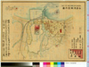
shelfmark: Maps 63140.14
License: Public Domain
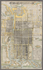
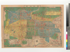
明治初期 *多色刷り。銅板。外題「改正東京御絵図」。無刊記。英字ペン書書入れあり。 Copperplate.
Links: Source / Biblio Ref
|
12 months ago | 4 control points | |

|
国際日本文化研究センター 所蔵
Links: Source / Biblio Ref
|
12 months ago | 65 control points | |

|
秋田県公文書館 所蔵
Links: Source / Biblio Ref
|
1916 | 12 months ago | 13 control points |
|
秋田県公文書館所蔵
Links: Source / Biblio Ref
|
2025 | 12 months ago | 61 control points |

|
国際日本文化研究センター 所蔵
Links: Source / Biblio Ref
|
2025 | 12 months ago | 25 control points |
|
国際日本文化研究センター 所蔵
Links: Source / Biblio Ref
|
1930 | 12 months ago | 10 control points |

|
秋田市近郊_附営業者名鑑
|
2025 | 12 months ago | 54 control points |
|
発行:秋田出版協会
所蔵:秋田県公文書館
Links: Source / Biblio Ref
|
1916 | 12 months ago | 12 control points |
|
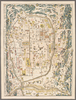
shelfmark: Maps *63155.7
License: Public Domain
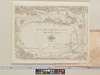
天和3 *二色刷り、手彩色。 Manuscript, 1798. Acquired 22 July 1868. Ex-Siebold. Depicts sea route from Edo to Osaka with details for coastal navigation.
Links: Source / Biblio Ref
|
1683 | 12 months ago | 10 control points |
|
|
2024 | 12 months ago | 12 control points |
|
|
1987 | 12 months ago | 5 control points |
|
shelfmark: Maps 63150.9
License: Public Domain
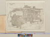
幕末 *多色刷り。蔵書印「小林蔵書」。 Manuscript, 18th century. Acquired 22 July 1868. Ex-Siebold.
Links: Source / Biblio Ref
|
12 months ago | 7 control points | |
|
|
12 months ago | 8 control points | |
|
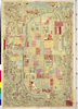
村岡碩市写 肥前一国絵図(元禄)の佐賀県部分模写 彩色手書
Links: Source / Biblio Ref
|
1944 | 12 months ago | 4 control points |
|
Owned by 立命館大学アート・リサーチセンター 【成立・出版年】 明治 頃1868~1911
Links: Source / Biblio Ref
|
1911 | 12 months ago | 40 control points |
|
|
1868 | 12 months ago | 12 control points |

|
|
1936 | about 1 year ago | 160 control points |

|
秋田市全域
|
2025 | about 1 year ago | 13 control points |

|
国際日本文化研究センター所蔵
|
1936 | about 1 year ago | 361 control points |
|
|
2025 | about 1 year ago | 6 control points |

|
|
2025 | about 1 year ago | 4 control points |
|
秋田県公文書館所蔵
|
1917 | about 1 year ago | 50 control points |
|
国立国会図書館デジタルコレクション インターネット公開(保護期間満了) (In 2 layers)
Links: Source / Biblio Ref
|
1856 | about 1 year ago | 19 control points |
|
国立国会図書館デジタルコレクション インターネット公開(保護期間満了) (In 2 layers)
Links: Source / Biblio Ref
|
1856 | about 1 year ago | 15 control points |
|
国立国会図書館デジタルコレクション インターネット公開(保護期間満了) (In 2 layers)
Links: Source / Biblio Ref
|
1853 | about 1 year ago | 26 control points |

|
|
1975 | about 1 year ago | 13 control points |
|
|
1917 | over 1 year ago | 17 control points |

|
国際日本文化研究センター所蔵
|
1936 | over 1 year ago | 351 control points |
|
国際日本文化研究センター所蔵
|
1936 | over 1 year ago | 301 control points |

|
国際日本文化研究センター所蔵
|
1936 | over 1 year ago | 241 control points |
|
|
2024 | over 1 year ago | 3 control points |
|
|
2024 | almost 2 years ago | 4 control points |
|
多色刷り。刊記「文化八年辛未閏二月御免/同十年酉春正月新刻」。
|
1813 | almost 2 years ago | 9 control points |
|
この地図の作成に当たっては、国土地理院長の承認を得て、同院発行の20万分の1地勢図及び5万分の1地形図を使用した。(承認番号 平30情使、 第1148号)
Links: Source / Biblio Ref
|
1947 | almost 2 years ago | 4 control points |
|
課題のため、許諾を得てアップロード。
Links: Source / Biblio Ref
|
2024 | almost 2 years ago | 5 control points |
|
講義の課題で作成したものです。
Links: Source / Biblio Ref
|
2024 | almost 2 years ago | 3 control points |
|
明治20年、早島町大橋家蔵
|
1887 | almost 2 years ago | 3 control points |
|
文化14年、早島町大橋家蔵
|
1817 | almost 2 years ago | 4 control points |
|
Public Domain. © Stanford University. 【図幅名】 郡中 【記号】松山近傍11号(共12面)
Links: Source / Biblio Ref
|
almost 2 years ago | 4 control points | |
|
Public Domain. © Stanford University. 【図幅名】 松山北部 【記号】松山近傍7号(共12面)
Links: Source / Biblio Ref
|
about 2 years ago | 4 control points | |
|
Public Domain. © Stanford University.
【図幅名】 松山南部 【記号】松山近傍8号(共12面)
Links: Source / Biblio Ref
|
about 2 years ago | 4 control points | |
|
|
about 2 years ago | 42 control points | |
|
【最初期発行】 この地図の作成に当たっては、国土地理院長の承認を得て、同院発行の20万分の1地勢図及び5万分の1地形図を使用した。(承認番号 平30情使、 第1148号) (In 1 layer)
Links: Source / Biblio Ref
|
1921 | about 2 years ago | 4 control points |
|
|
1944 | over 2 years ago | 4 control points |
|
Links: Source / Biblio Ref
|
1873 | over 2 years ago | 27 control points |
|
「The guide to the celebrated places in Kiyoto & the surrounding places for the foreign visitors」(同志社大学所蔵)一部です。
Links: Source / Biblio Ref
|
2024 | over 2 years ago | 18 control points |
|
|
1927 | over 2 years ago | 4 control points |
|
Japan City Plans 1:12,500
U.S. Army Map Service, 1945-1946
https://maps.lib.utexas.edu/maps/ams/japan_city_plans/
Links: Source / Biblio Ref
|
1945 | over 2 years ago | 4 control points |
|
|
2023 | over 2 years ago | 4 control points |
|
|
2023 | over 2 years ago | 12 control points |