Browse Maps
| map | Title | Year | Last Updated | Status  |
|---|---|---|---|---|
|
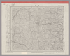
Image from the Map Collections courtesy Stanford University Libraries, licensed under a Creative Commons Attribution-Noncommercial 3.0 Unported License. © Stanford University. 【図幅名】 喜連川 【測量時期】 明治42年測図/昭和4年第2回修正 【発行時期】 昭和8年5月発行 【記号】 白河16号(共17面) 【測量機関】 大日本帝国陸地測量部 【備考】 (In 1 layer)
Links: Source / Biblio Ref
|
about 2 years ago | 4 control points | |
|
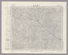
Image from the Map Collections courtesy Stanford University Libraries, licensed under a Creative Commons Attribution-Noncommercial 3.0 Unported License. © Stanford University. 【図幅名】 赤湯 【測量時期】 明治43年測図/昭和6年修正 【発行時期】 昭和9年5月発行 【記号】 仙台16号(共16面) 【測量機関】 大日本帝国陸地測量部 【備考】
Links: Source / Biblio Ref
|
about 2 years ago | 4 control points | |
|
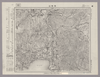
Image from the Map Collections courtesy Stanford University Libraries, licensed under a Creative Commons Attribution-Noncommercial 3.0 Unported License. © Stanford University. 【図幅名】 二本松 【測量時期】 明治41年測図/昭和6年要部修正 【発行時期】 【記号】 福島11号(共18面) 【測量機関】 参謀本部 【備考】 秘
Links: Source / Biblio Ref
|
about 2 years ago | 4 control points | |
|
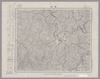
Image from the Map Collections courtesy Stanford University Libraries, licensed under a Creative Commons Attribution-Noncommercial 3.0 Unported License. © Stanford University. 【図幅名】 襟裳岬 【測量時期】 大正9年測圖 【発行時期】 【記号】 襟裳岬十三号 【測量機関】 参謀本部 【備考】 祕
Links: Source / Biblio Ref
|
over 5 years ago | 4 control points | |
|
Image from the Map Collections courtesy Stanford University Libraries, licensed under a Creative Commons Attribution-Noncommercial 3.0 Unported License. © Stanford University. 【図幅名】 小滝 【測量時期】 明治44年測図/昭和5年修正 【発行時期】 【記号】 富山3号 【測量機関】 参謀本部 【備考】 秘 (In 1 layer)
Links: Source / Biblio Ref
|
about 2 years ago | 4 control points | |
|
Image from the Map Collections courtesy Stanford University Libraries, licensed under a Creative Commons Attribution-Noncommercial 3.0 Unported License. © Stanford University. 【図幅名】 上猿払 【測量時期】 大正12年測図 【発行時期】 大正13年9月発行 【記号】 枝幸14号(共12面) 【測量機関】 大日本帝国陸地測量部 【備考】 仮製版
Links: Source / Biblio Ref
|
over 5 years ago | 4 control points | |
|
Image from the Map Collections courtesy Stanford University Libraries, licensed under a Creative Commons Attribution-Noncommercial 3.0 Unported License. © Stanford University. 【図幅名】 【測量時期】 【発行時期】 【記号】 【測量機関】 【備考】
Links: Source / Biblio Ref
|
about 2 years ago | 4 control points | |
|
Image from the Map Collections courtesy Stanford University Libraries, licensed under a Creative Commons Attribution-Noncommercial 3.0 Unported License. © Stanford University. 【図幅名】 川俣 【測量時期】 明治41年測図/昭和8年要部修正 【発行時期】 昭和11年4月発行 【記号】 福島7号(共18面) 【測量機関】 大日本帝国陸地測量部 【備考】
Links: Source / Biblio Ref
|
about 2 years ago | 4 control points | |
|
Image from the Map Collections courtesy Stanford University Libraries, licensed under a Creative Commons Attribution-Noncommercial 3.0 Unported License. © Stanford University. 【図幅名】 岩管山 【測量時期】 大正1年測図/昭和6年要部修正 【発行時期】 昭和8年2月発行 【記号】 高田8号(共15面) 【測量機関】 大日本帝国陸地測量部 【備考】
Links: Source / Biblio Ref
|
about 2 years ago | 4 control points | |
|
Links: Source / Biblio Ref
|
2020 | over 1 year ago | 9 control points |
|
Image from the Map Collections courtesy Stanford University Libraries, licensed under a Creative Commons Attribution-Noncommercial 3.0 Unported License. © Stanford University. 【図幅名】 喜多方 【測量時期】 明治43年測図/昭和6年修正 【発行時期】 昭和9年6月発行 【記号】 新潟3号(共16面) 【測量機関】 大日本帝国陸地測量部 【備考】
Links: Source / Biblio Ref
|
about 2 years ago | 4 control points | |
|
Image from the Map Collections courtesy Stanford University Libraries, licensed under a Creative Commons Attribution-Noncommercial 3.0 Unported License. © Stanford University. 【図幅名】 御神楽岳 【測量時期】 明治44年測図/昭和6年要部修正 【発行時期】 昭和8年10月発行 【記号】 新潟11号(共16面) 【測量機関】 大日本帝国陸地測量部 【備考】
Links: Source / Biblio Ref
|
about 2 years ago | 4 control points | |
|
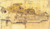
【Courtesy of the C. V. Starr East Asian Library University of California, Berkeley】 Japanese date Genji 1 1864. Folded. Mounted cover title. Wood block print. In Japanese. Relief shown pictorially. Includes distance chart. Shows land tenures of daimyo.
Links: Source / Biblio Ref
|
1864 | over 3 years ago | 4 control points |
|
Image from the Map Collections courtesy Stanford University Libraries, licensed under a Creative Commons Attribution-Noncommercial 3.0 Unported License. © Stanford University. 【図幅名】 宿根木 【測量時期】 大正2年測図/昭和9年修正 【発行時期】 【記号】 長岡14号(共11面) 【測量機関】 参謀本部 【備考】 秘
Links: Source / Biblio Ref
|
over 5 years ago | 4 control points | |
|
【Courtesy of the C. V. Starr East Asian Library University of California, Berkeley】 Colored manuscript map. Relief shown pictorially. East Asian Library call number: MJ11.
Links: Source / Biblio Ref
|
1874 | over 2 years ago | 16 control points |
|
Image from the Map Collections courtesy Stanford University Libraries, licensed under a Creative Commons Attribution-Noncommercial 3.0 Unported License. © Stanford University. 【図幅名】 田島 【測量時期】 大正2年測図/昭和8年要部修正 【発行時期】 【記号】 日光1号(共16面) 【測量機関】 参謀本部 【備考】 秘
Links: Source / Biblio Ref
|
about 2 years ago | 4 control points | |
|
Image from the Map Collections courtesy Stanford University Libraries, licensed under a Creative Commons Attribution-Noncommercial 3.0 Unported License. © Stanford University. 【図幅名】 青海川 【測量時期】 明治43年測図/昭和5年修正 【発行時期】 昭和8年10月発行 【記号】 長岡12号(共11面) 【測量機関】 大日本帝国陸地測量部 【備考】
Links: Source / Biblio Ref
|
about 2 years ago | 4 control points | |
|
Image from the Map Collections courtesy Stanford University Libraries, licensed under a Creative Commons Attribution-Noncommercial 3.0 Unported License. © Stanford University. 【図幅名】 船川 【測量時期】 大正1年測図/大正14年鉄道補入 【発行時期】 昭和2年2月発行 【記号】 男鹿島1号(共2面) 【測量機関】 大日本帝国陸地測量部 【備考】
Links: Source / Biblio Ref
|
about 2 years ago | 4 control points | |
|
Image from the Map Collections courtesy Stanford University Libraries, licensed under a Creative Commons Attribution-Noncommercial 3.0 Unported License. © Stanford University. 【図幅名】 新津 【測量時期】 明治44年測図/昭和6年要部修正 【発行時期】 昭和9年6月発行 【記号】 新潟14号(共16面) 【測量機関】 大日本帝国陸地測量部 【備考】
Links: Source / Biblio Ref
|
about 2 years ago | 4 control points | |
|
Image from the Map Collections courtesy Stanford University Libraries, licensed under a Creative Commons Attribution-Noncommercial 3.0 Unported License. © Stanford University. 【図幅名】 小木 【測量時期】 大正2年測図/昭和9年修正 【発行時期】 【記号】 長岡10号(共11面) 【測量機関】 参謀本部 【備考】 秘
Links: Source / Biblio Ref
|
about 2 years ago | 4 control points | |
|
Image from the Map Collections courtesy Stanford University Libraries, licensed under a Creative Commons Attribution-Noncommercial 3.0 Unported License. © Stanford University. 【図幅名】 岩沼 【測量時期】 明治40年測図/昭和3年修正/昭和4年鉄道補入 【発行時期】 昭和6年11月発行 【記号】 仙台4号(共16面) 【測量機関】 大日本帝国陸地測量部 【備考】
Links: Source / Biblio Ref
|
about 2 years ago | 4 control points | |
|
Image from the Map Collections courtesy Stanford University Libraries, licensed under a Creative Commons Attribution-Noncommercial 3.0 Unported License. © Stanford University.
Links: Source / Biblio Ref
|
over 6 years ago | 4 control points | |
|
|
over 1 year ago | 31 control points | |
|
【Courtesy of the C. V. Starr East Asian Library University of California, Berkeley】 Col. map.
Links: Source / Biblio Ref
|
1895 | almost 4 years ago | 47 control points |
|
Image from the Map Collections courtesy Stanford University Libraries, licensed under a Creative Commons Attribution-Noncommercial 3.0 Unported License. © Stanford University. 【図幅名】 川前 【測量時期】 明治41年測図/昭和8年要部修正 【発行時期】 昭和10年12月発行 【記号】 白河1号(共17面) 【測量機関】 大日本帝国陸地測量部 【備考】
Links: Source / Biblio Ref
|
about 2 years ago | 4 control points | |
|
Image from the Map Collections courtesy Stanford University Libraries, licensed under a Creative Commons Attribution-Noncommercial 3.0 Unported License. © Stanford University. 【図幅名】 小野新町 【測量時期】 明治41年測図/昭和8年要部修正 【発行時期】 【記号】 白河5号(共17面) 【測量機関】 参謀本部 【備考】 秘
Links: Source / Biblio Ref
|
about 2 years ago | 4 control points | |
|
Image from the Map Collections courtesy Stanford University Libraries, licensed under a Creative Commons Attribution-Noncommercial 3.0 Unported License. © Stanford University. 【図幅名】 磐梯山 【測量時期】 明治41年測図/昭和6年要部修正 【発行時期】 昭和21年11月発行 【記号】 福島15号 【測量機関】 内務省地理調査所 【備考】
Links: Source / Biblio Ref
|
about 2 years ago | 4 control points | |
|
Image from the Map Collections courtesy Stanford University Libraries, licensed under a Creative Commons Attribution-Noncommercial 3.0 Unported License. © Stanford University. 【図幅名】 野沢 【測量時期】 大正2年測図/昭和6年要部修正 【発行時期】 昭和9年3月発行 【記号】 新潟7号(共16面) 【測量機関】 大日本帝国陸地測量部 【備考】
Links: Source / Biblio Ref
|
about 2 years ago | 4 control points | |
|
Image from the Map Collections courtesy Stanford University Libraries, licensed under a Creative Commons Attribution-Noncommercial 3.0 Unported License. © Stanford University. 【図幅名】 新発田 【測量時期】 明治44年測図/昭和6年修正 【発行時期】 【記号】 新潟9号(共16面) 【測量機関】 参謀本部 【備考】 秘
Links: Source / Biblio Ref
|
about 2 years ago | 4 control points | |
|
Image from the Map Collections courtesy Stanford University Libraries, licensed under a Creative Commons Attribution-Noncommercial 3.0 Unported License. © Stanford University.
Links: Source / Biblio Ref
|
over 6 years ago | 4 control points | |
|
Owned by 立命館大学アート・リサーチセンター 【成立・出版年】
Links: Source / Biblio Ref
|
over 5 years ago | 10 control points | |
|
Links: Source / Biblio Ref
|
2021 | about 1 year ago | 8 control points |
|
(In 1 layer)
Links: Source / Biblio Ref
|
2020 | over 1 year ago | 5 control points |
|
Image from the Map Collections courtesy Stanford University Libraries, licensed under a Creative Commons Attribution-Noncommercial 3.0 Unported License. © Stanford University. 【図幅名】 大子 【測量時期】 明治42年測図/昭和8年要部修正 【発行時期】 昭和11年1月発行 【記号】 白河12号(共17面) 【測量機関】 大日本帝国陸地測量部 【備考】 (In 1 layer)
Links: Source / Biblio Ref
|
about 2 years ago | 4 control points | |
|
Image from the Map Collections courtesy Stanford University Libraries, licensed under a Creative Commons Attribution-Noncommercial 3.0 Unported License. © Stanford University. 【図幅名】 須賀川 【測量時期】 明治41年測図/昭和8年要部修正 【発行時期】 【記号】 白河9号 【測量機関】 参謀本部 【備考】 秘
Links: Source / Biblio Ref
|
about 2 years ago | 4 control points | |
|
Image from the Map Collections courtesy Stanford University Libraries, licensed under a Creative Commons Attribution-Noncommercial 3.0 Unported License. © Stanford University. 【図幅名】 四万 【測量時期】 大正1年測図/昭和4年要部修正 【発行時期】 【記号】 高田4号(共15面) 【測量機関】 参謀本部 【備考】 秘
Links: Source / Biblio Ref
|
about 2 years ago | 4 control points | |
|
明治18年国道図.第二回目
|
1885 | over 3 years ago | 3 control points |

|
|
1741 | over 4 years ago | 6 control points |
|
Image from the Map Collections courtesy Stanford University Libraries, licensed under a Creative Commons Attribution-Noncommercial 3.0 Unported License. © Stanford University.
Links: Source / Biblio Ref
|
over 6 years ago | 4 control points | |
|
Image from the Map Collections courtesy Stanford University Libraries, licensed under a Creative Commons Attribution-Noncommercial 3.0 Unported License. © Stanford University. 【図幅名】 白木峰 【測量時期】 大正1年測図/昭和5年要部修正 【発行時期】 【記号】 高山14号(共16面) 【測量機関】 参謀本部 【備考】 秘
Links: Source / Biblio Ref
|
about 2 years ago | 4 control points | |
|
Image from the Map Collections courtesy Stanford University Libraries, licensed under a Creative Commons Attribution-Noncommercial 3.0 Unported License. © Stanford University. 【図幅名】 八尾 【測量時期】 明治44年測図/昭和5年修正/昭和28年応急修正 【発行時期】 昭和32年10月発行 【記号】 高山13号(共16面) 【測量機関】 国土地理院 【備考】 (In 1 layer)
Links: Source / Biblio Ref
|
about 2 years ago | 4 control points | |
|
Image from the Map Collections courtesy Stanford University Libraries. This item is in the public domain. There are no restrictions on use.
【図幅名】 後鏃岳【測量時期】 大正3年測圖 【発行時期】大正13年 【記号】 幌筵島十五号 【測量機関】 参謀本部 【その他】千島列島 陸地測量部 (In 1 layer)
Links: Source / Biblio Ref
|
1924 | over 1 year ago | 4 control points |
|
Image from the Map Collections courtesy Stanford University Libraries, licensed under a Creative Commons Attribution-Noncommercial 3.0 Unported License. © Stanford University. 【図幅名】 【測量時期】 【発行時期】 【記号】 【測量機関】 【備考】 (In 1 layer)
Links: Source / Biblio Ref
|
about 2 years ago | 4 control points | |
|
Image from the Map Collections courtesy Stanford University Libraries, licensed under a Creative Commons Attribution-Noncommercial 3.0 Unported License. © Stanford University. 【図幅名】 追貝 【測量時期】 大正1年測図/昭和33年要部修正 【発行時期】 昭和35年4月発行 【記号】 日光16号 【測量機関】 国土地理院 【備考】
Links: Source / Biblio Ref
|
about 2 years ago | 4 control points | |
|
Image from the Map Collections courtesy Stanford University Libraries, licensed under a Creative Commons Attribution-Noncommercial 3.0 Unported License. © Stanford University. 【図幅名】 小諸 【測量時期】 大正1年測図/昭和4年修正 【発行時期】 【記号】 長野11号 【測量機関】 参謀本部 【備考】 秘
Links: Source / Biblio Ref
|
about 2 years ago | 4 control points | |
|
Image from the Map Collections courtesy Stanford University Libraries, licensed under a Creative Commons Attribution-Noncommercial 3.0 Unported License. © Stanford University. 【図幅名】 乗鞍岳 【測量時期】 大正1年測図/昭和5年修正/昭和6年部分修正 【発行時期】 昭和8年3月発行 【記号】 高山8号(共16面) 【測量機関】 大日本帝国陸地測量部 【備考】
Links: Source / Biblio Ref
|
about 2 years ago | 4 control points | |
|
|
1741 | over 4 years ago | 9 control points |
|
Image from the Map Collections courtesy Stanford University Libraries, licensed under a Creative Commons Attribution-Noncommercial 3.0 Unported License. © Stanford University. 【図幅名】 本荘 【測量時期】 大正2年測図/大正14年鉄道補入 【発行時期】 大正15年11月発行 【記号】 秋田16号(共16面) 【測量機関】 大日本帝国陸地測量部 【備考】
Links: Source / Biblio Ref
|
over 5 years ago | 4 control points | |
|
Links: Source / Biblio Ref
|
2020 | over 1 year ago | 5 control points |
|
Image from the Map Collections courtesy Stanford University Libraries, licensed under a Creative Commons Attribution-Noncommercial 3.0 Unported License. © Stanford University. 【図幅名】 洲本 【測量時期】 明治29年測図/昭和3年修正/昭和33年要部修正 【発行時期】 昭和37年1月発行 【記号】 徳島2号(共14面) 【測量機関】 国土地理院 【備考】
Links: Source / Biblio Ref
|
over 4 years ago | 7 control points |