Browse Maps
| map | Title | Year | Last Updated  |
Status |
|---|---|---|---|---|
|
【最初期発行】 この地図の作成に当たっては、国土地理院長の承認を得て、同院発行の20万分の1地勢図及び5万分の1地形図を使用した。(承認番号 平30情使、 第1148号) (In 1 layer)
Links: Source / Biblio Ref
|
1921 | about 4 years ago | 4 control points |
|
【最初期発行】 この地図の作成に当たっては、国土地理院長の承認を得て、同院発行の20万分の1地勢図及び5万分の1地形図を使用した。(承認番号 平30情使、 第1148号) (In 1 layer)
Links: Source / Biblio Ref
|
1921 | about 4 years ago | 4 control points |
|
【最初期発行】 この地図の作成に当たっては、国土地理院長の承認を得て、同院発行の20万分の1地勢図及び5万分の1地形図を使用した。(承認番号 平30情使、 第1148号) (In 1 layer)
Links: Source / Biblio Ref
|
1910 | about 4 years ago | 4 control points |
|
【最初期発行】 この地図の作成に当たっては、国土地理院長の承認を得て、同院発行の20万分の1地勢図及び5万分の1地形図を使用した。(承認番号 平30情使、 第1148号) (In 1 layer)
Links: Source / Biblio Ref
|
1910 | about 4 years ago | 4 control points |
|
【最初期発行】 この地図の作成に当たっては、国土地理院長の承認を得て、同院発行の20万分の1地勢図及び5万分の1地形図を使用した。(承認番号 平30情使、 第1148号) (In 1 layer)
Links: Source / Biblio Ref
|
1910 | about 4 years ago | 4 control points |
|
【最初期発行】 この地図の作成に当たっては、国土地理院長の承認を得て、同院発行の20万分の1地勢図及び5万分の1地形図を使用した。(承認番号 平30情使、 第1148号)
Links: Source / Biblio Ref
|
1917 | about 4 years ago | 4 control points |
|
この地図の作成に当たっては、国土地理院長の承認を得て、同院発行の20万分の1地勢図及び5万分の1地形図を使用した。(承認番号 平30情使、 第1148号)
Links: Source / Biblio Ref
|
1947 | about 4 years ago | 4 control points |
|
【最初期発行】 この地図の作成に当たっては、国土地理院長の承認を得て、同院発行の20万分の1地勢図及び5万分の1地形図を使用した。(承認番号 平30情使、 第1148号)
Links: Source / Biblio Ref
|
1917 | about 4 years ago | 4 control points |
|
【最初期発行】 この地図の作成に当たっては、国土地理院長の承認を得て、同院発行の20万分の1地勢図及び5万分の1地形図を使用した。(承認番号 平30情使、 第1148号) (In 1 layer)
Links: Source / Biblio Ref
|
1919 | about 4 years ago | 4 control points |
|
【最初期発行】 この地図の作成に当たっては、国土地理院長の承認を得て、同院発行の20万分の1地勢図及び5万分の1地形図を使用した。(承認番号 平30情使、 第1148号) (In 1 layer)
Links: Source / Biblio Ref
|
1921 | about 4 years ago | 4 control points |
|
【最初期発行】 この地図の作成に当たっては、国土地理院長の承認を得て、同院発行の20万分の1地勢図及び5万分の1地形図を使用した。(承認番号 平30情使、 第1148号) (In 1 layer)
Links: Source / Biblio Ref
|
1920 | about 4 years ago | 4 control points |
|
【最初期発行】 この地図の作成に当たっては、国土地理院長の承認を得て、同院発行の20万分の1地勢図及び5万分の1地形図を使用した。(承認番号 平30情使、 第1148号) (In 1 layer)
Links: Source / Biblio Ref
|
1919 | about 4 years ago | 4 control points |
|
【最初期発行】 この地図の作成に当たっては、国土地理院長の承認を得て、同院発行の20万分の1地勢図及び5万分の1地形図を使用した。(承認番号 平30情使、 第1148号) (In 1 layer)
Links: Source / Biblio Ref
|
1919 | about 4 years ago | 4 control points |
|
【最初期発行】 この地図の作成に当たっては、国土地理院長の承認を得て、同院発行の20万分の1地勢図及び5万分の1地形図を使用した。(承認番号 平30情使、 第1148号) (In 1 layer)
Links: Source / Biblio Ref
|
1917 | about 4 years ago | 4 control points |
|
【最初期発行】 この地図の作成に当たっては、国土地理院長の承認を得て、同院発行の20万分の1地勢図及び5万分の1地形図を使用した。(承認番号 平30情使、 第1148号) (In 1 layer)
Links: Source / Biblio Ref
|
1916 | about 4 years ago | 4 control points |
|
Links: Source / Biblio Ref
|
about 4 years ago | 4 control points | |
|
明治の国道図
|
1885 | over 4 years ago | 11 control points |
|
【Courtesy of the C. V. Starr East Asian Library University of California, Berkeley】 Wood block print. In Japanese. Oriented with north toward right. East Asian Library call number: A15.
Links: Source / Biblio Ref
|
1856 | over 4 years ago | 8 control points |
|
【Courtesy of the C. V. Starr East Asian Library University of California, Berkeley】 Description 1 map : col. ; on sheet 133 x 228 cm., folded in cover 34 x 20 cm. Mounted cover title. Wood block print. In Japanese. Covers Matsumae to Tsushima, Okinoerabu, and Hachijojima. Shows Kuroshio and distance of sea routes and main roads. Includes legend. Text by Shoto Sanjin and preface by Shino Odo. East Asian Library call number Ca 17.
Links: Source / Biblio Ref
|
1808 | over 4 years ago | 19 control points |
|
元禄9年(1696)作成、同15年(1702完成。約1/21,600。黒丸:一里塚。原図サイズ:東西349cm x 南北750cm。
Links: Source / Biblio Ref
|
1702 | over 4 years ago | 35 control points |

|
【Courtesy of the C. V. Starr East Asian Library University of California, Berkeley】 1 atlas 44, 4 leaves : 20 maps ; 13 cm. Mounted cover title. Copperplate print. In Japanese. Shows views of tourist attractions. Includes text. Alternate Title Dai Nihon dochu annai. East Asian Library call number: J45 SPEC-Map.
Links: Source / Biblio Ref
|
1887 | over 4 years ago | 14 control points |
|
【Courtesy of the C. V. Starr East Asian Library University of California, Berkeley】 Colored manuscript map. Relief shown pictorially. East Asian Library call number: MJ11.
Links: Source / Biblio Ref
|
1874 | over 4 years ago | 15 control points |
|
【Courtesy of the C. V. Starr East Asian Library University of California, Berkeley】 Colored manuscript map. Relief shown pictorially. East Asian Library call number: MJ11.
Links: Source / Biblio Ref
|
1874 | over 4 years ago | 16 control points |
|
【最初期発行】 この地図の作成に当たっては、国土地理院長の承認を得て、同院発行の20万分の1地勢図及び5万分の1地形図を使用した。(承認番号 平30情使、 第1148号) (In 1 layer)
Links: Source / Biblio Ref
|
1929 | over 4 years ago | 4 control points |
|
【最初期発行】 この地図の作成に当たっては、国土地理院長の承認を得て、同院発行の20万分の1地勢図及び5万分の1地形図を使用した。(承認番号 平30情使、 第1148号) (In 1 layer)
Links: Source / Biblio Ref
|
1930 | over 4 years ago | 4 control points |
|
国立国会図書館デジタルコレクション
インターネット公開(保護期間満了) (In 4 layers)
Links: Source / Biblio Ref
|
1849 | over 4 years ago | 32 control points |
|
|
2019 | over 4 years ago | 10 control points |
|
【Courtesy of the C. V. Starr East Asian Library University of California, Berkeley】 Wood block print. In Japanese. Oriented with north toward lower right. East Asian Library call number: A15.
Links: Source / Biblio Ref
|
1856 | over 4 years ago | 9 control points |
|
【Courtesy of the C. V. Starr East Asian Library University of California, Berkeley】 Wood block print. In Japanese. Shows New Zealand in inset. East Asian Library call number: A15.
Links: Source / Biblio Ref
|
1856 | over 4 years ago | 9 control points |
|
|
2018 | over 4 years ago | 6 control points |
|
shelfmark: Maps 38.c.216
License: Public Domain
天保14 *無刊記。外題「(富士見十三州)輿地之全図」。江戸湾に「御台場」なし。凡例末を入れ木して「故名焉」と改む。 Xylograph.
Links: Source / Biblio Ref
|
1843 | over 4 years ago | 22 control points |
|
【Courtesy of the C. V. Starr East Asian Library University of California, Berkeley】 Mounted cover title. Copperplate print. In Japanese. Relief shown by hachures. Includes 1 inset: Mito shigai no zu. Oriented with north to the upper left. Includes list of place names and legend. Shows distance of roads.
Links: Source / Biblio Ref
|
1880 | over 4 years ago | 7 control points |
|
shelfmark: Maps 149.e.256
License: Public Domain
江戸後期刊 *(刊記書肆)書林/京都、菊屋七郎兵衛/大坂、河内屋喜兵衛・河内屋茂兵衛/江戸、須原屋茂兵衛・須原屋佐助・須原屋伊八・岡田屋嘉七・英大助・小林新兵衛・山城屋佐兵衛・菊屋幸三郎板。外題「相模国全図」。 Xylograph. Acquired 22 July 1868. Ex-Siebold.
Links: Source / Biblio Ref
|
over 4 years ago | 35 control points | |
|
(In 1 layer)
Links: Source / Biblio Ref
|
2020 | over 4 years ago | 8 control points |
|
(In 1 layer)
Links: Source / Biblio Ref
|
2020 | over 4 years ago | 10 control points |
|
(In 1 layer)
Links: Source / Biblio Ref
|
2020 | over 4 years ago | 3 control points |
|
国立国会図書館デジタルコレクション
インターネット公開(保護期間満了) (In 4 layers)
Links: Source / Biblio Ref
|
1849 | over 4 years ago | 62 control points |
|
国立国会図書館デジタルコレクション インターネット公開(保護期間満了) (In 2 layers)
Links: Source / Biblio Ref
|
1850 | over 4 years ago | 20 control points |
|
【最初期発行】 この地図の作成に当たっては、国土地理院長の承認を得て、同院発行の20万分の1地勢図及び5万分の1地形図を使用した。(承認番号 平30情使、 第1148号) (In 1 layer)
Links: Source / Biblio Ref
|
1927 | over 4 years ago | 4 control points |
|
|
2022 | over 4 years ago | 33 control points |
|
Links: Source / Biblio Ref
|
2021 | over 4 years ago | 25 control points |
|
|
2021 | over 4 years ago | 24 control points |
|
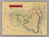
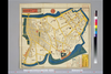
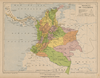
Mapa geopolítico de Colombia 1930
|
1930 | over 4 years ago | 12 control points |
|
Mapa geopolítico de Colombia 1930
|
1913 | over 4 years ago | 7 control points |
|
Links: Source / Biblio Ref
|
2022 | over 4 years ago | 4 control points |
|
北を上に置いた地図
|
2022 | over 4 years ago | 11 control points |
|
shelfmark: Maps 31.a.31
License: Public Domain
明治3 *多色刷り。英語の地名記載あり。刊記書肆「東京、大黒屋金之助/横浜、佐野屋富五郎・小林屋銀次」。存原外袋(「Map of Yokohama/(新版)横浜全図/吟香閣蔵版」)。 Xylograph; some place names printed in roman letters.
Links: Source / Biblio Ref
|
1870 | over 4 years ago | 20 control points |
|
|
2021 | over 4 years ago | 4 control points |
|
【最初期発行】 この地図の作成に当たっては、国土地理院長の承認を得て、同院発行の20万分の1地勢図及び5万分の1地形図を使用した。(承認番号 平30情使、 第1148号) (In 1 layer)
Links: Source / Biblio Ref
|
1906 | over 4 years ago | 4 control points |
|
|
2021 | over 4 years ago | 4 control points |