Browse Maps
| map | Title | Year | Last Updated  |
Status |
|---|---|---|---|---|
|
【最初期発行】 この地図の作成に当たっては、国土地理院長の承認を得て、同院発行の20万分の1地勢図及び5万分の1地形図を使用した。(承認番号 平30情使、 第1148号) (In 1 layer)
Links: Source / Biblio Ref
|
1930 | over 4 years ago | 4 control points |
|
国立国会図書館デジタルコレクション
インターネット公開(保護期間満了) (In 4 layers)
Links: Source / Biblio Ref
|
1849 | over 4 years ago | 32 control points |
|
|
2019 | over 4 years ago | 10 control points |
|
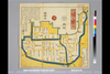
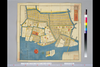
【Courtesy of the C. V. Starr East Asian Library University of California, Berkeley】 Wood block print. In Japanese. Oriented with north toward lower right. East Asian Library call number: A15.
Links: Source / Biblio Ref
|
1856 | over 4 years ago | 9 control points |
|
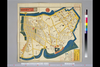
【Courtesy of the C. V. Starr East Asian Library University of California, Berkeley】 Wood block print. In Japanese. Shows New Zealand in inset. East Asian Library call number: A15.
Links: Source / Biblio Ref
|
1856 | over 4 years ago | 9 control points |
|
|
2018 | over 4 years ago | 6 control points |
|
shelfmark: Maps 38.c.216
License: Public Domain
天保14 *無刊記。外題「(富士見十三州)輿地之全図」。江戸湾に「御台場」なし。凡例末を入れ木して「故名焉」と改む。 Xylograph.
Links: Source / Biblio Ref
|
1843 | over 4 years ago | 22 control points |
|
【Courtesy of the C. V. Starr East Asian Library University of California, Berkeley】 Mounted cover title. Copperplate print. In Japanese. Relief shown by hachures. Includes 1 inset: Mito shigai no zu. Oriented with north to the upper left. Includes list of place names and legend. Shows distance of roads.
Links: Source / Biblio Ref
|
1880 | over 4 years ago | 7 control points |
|
shelfmark: Maps 149.e.256
License: Public Domain
江戸後期刊 *(刊記書肆)書林/京都、菊屋七郎兵衛/大坂、河内屋喜兵衛・河内屋茂兵衛/江戸、須原屋茂兵衛・須原屋佐助・須原屋伊八・岡田屋嘉七・英大助・小林新兵衛・山城屋佐兵衛・菊屋幸三郎板。外題「相模国全図」。 Xylograph. Acquired 22 July 1868. Ex-Siebold.
Links: Source / Biblio Ref
|
over 4 years ago | 35 control points | |
|
(In 1 layer)
Links: Source / Biblio Ref
|
2020 | over 4 years ago | 8 control points |
|
(In 1 layer)
Links: Source / Biblio Ref
|
2020 | over 4 years ago | 10 control points |
|
(In 1 layer)
Links: Source / Biblio Ref
|
2020 | over 4 years ago | 3 control points |
|
国立国会図書館デジタルコレクション
インターネット公開(保護期間満了) (In 4 layers)
Links: Source / Biblio Ref
|
1849 | over 4 years ago | 62 control points |
|
国立国会図書館デジタルコレクション インターネット公開(保護期間満了) (In 2 layers)
Links: Source / Biblio Ref
|
1850 | over 4 years ago | 20 control points |
|
【最初期発行】 この地図の作成に当たっては、国土地理院長の承認を得て、同院発行の20万分の1地勢図及び5万分の1地形図を使用した。(承認番号 平30情使、 第1148号) (In 1 layer)
Links: Source / Biblio Ref
|
1927 | over 4 years ago | 4 control points |
|
|
2022 | over 4 years ago | 33 control points |
|
|
1864 | over 4 years ago | 1 control point |
|
Links: Source / Biblio Ref
|
2021 | over 4 years ago | 25 control points |
|
|
2021 | over 4 years ago | 24 control points |
|
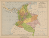
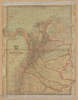
Mapa geopolítico de Colombia 1930
|
1930 | over 4 years ago | 12 control points |
|
Mapa geopolítico de Colombia 1930
|
1913 | over 4 years ago | 7 control points |
|
Links: Source / Biblio Ref
|
2022 | over 4 years ago | 4 control points |
|
北を上に置いた地図
|
2022 | over 4 years ago | 11 control points |
|
奈良県立図書館まほろばライブラリ
Links: Source / Biblio Ref
|
2022 | over 4 years ago | Unrectified |
|
shelfmark: Maps 31.a.31
License: Public Domain
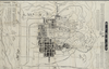
明治3 *多色刷り。英語の地名記載あり。刊記書肆「東京、大黒屋金之助/横浜、佐野屋富五郎・小林屋銀次」。存原外袋(「Map of Yokohama/(新版)横浜全図/吟香閣蔵版」)。 Xylograph; some place names printed in roman letters.
Links: Source / Biblio Ref
|
1870 | over 4 years ago | 20 control points |
|
|
2021 | over 4 years ago | 4 control points |
|
|
2022 | over 4 years ago | Unrectified |

|
|
2022 | over 4 years ago | Unrectified |
|
|
|
2022 | over 4 years ago | Unrectified |
|
shelfmark: Maps *63155.1
License: Public Domain
寛政1 *多色刷り。洋数字など墨筆書入れあり。 Xylograph.
Links: Source / Biblio Ref
|
1789 | over 4 years ago | Unrectified |
|
【最初期発行】 この地図の作成に当たっては、国土地理院長の承認を得て、同院発行の20万分の1地勢図及び5万分の1地形図を使用した。(承認番号 平30情使、 第1148号) (In 1 layer)
Links: Source / Biblio Ref
|
1906 | over 4 years ago | 4 control points |
|
|
2021 | over 4 years ago | 4 control points |
|
|
|
2021 | over 4 years ago | Unrectified |
|
【最初期発行】 この地図の作成に当たっては、国土地理院長の承認を得て、同院発行の20万分の1地勢図及び5万分の1地形図を使用した。(承認番号 平30情使、 第1148号)
Links: Source / Biblio Ref
|
1936 | over 4 years ago | 4 control points |
|
【最初期発行】 この地図の作成に当たっては、国土地理院長の承認を得て、同院発行の20万分の1地勢図及び5万分の1地形図を使用した。(承認番号 平30情使、 第1148号)
Links: Source / Biblio Ref
|
1916 | over 4 years ago | 4 control points |
|
【最初期発行】 この地図の作成に当たっては、国土地理院長の承認を得て、同院発行の20万分の1地勢図及び5万分の1地形図を使用した。(承認番号 平30情使、 第1148号)
Links: Source / Biblio Ref
|
1908 | over 4 years ago | 4 control points |
|
【最初期発行】 この地図の作成に当たっては、国土地理院長の承認を得て、同院発行の20万分の1地勢図及び5万分の1地形図を使用した。(承認番号 平30情使、 第1148号)
Links: Source / Biblio Ref
|
1910 | over 4 years ago | 4 control points |
|
【最初期発行】 この地図の作成に当たっては、国土地理院長の承認を得て、同院発行の20万分の1地勢図及び5万分の1地形図を使用した。(承認番号 平30情使、 第1148号)
Links: Source / Biblio Ref
|
1919 | over 4 years ago | 4 control points |
|
【最初期発行】 この地図の作成に当たっては、国土地理院長の承認を得て、同院発行の20万分の1地勢図及び5万分の1地形図を使用した。(承認番号 平30情使、 第1148号) (In 1 layer)
Links: Source / Biblio Ref
|
1925 | over 4 years ago | 4 control points |
|
【最初期発行】 この地図の作成に当たっては、国土地理院長の承認を得て、同院発行の20万分の1地勢図及び5万分の1地形図を使用した。(承認番号 平30情使、 第1148号) (In 1 layer)
Links: Source / Biblio Ref
|
1918 | over 4 years ago | 4 control points |

|
|
2021 | over 4 years ago | 3 control points |
|
Links: Source / Biblio Ref
|
2021 | over 4 years ago | 9 control points |
|
shelfmark: Maps 63100.20
License: Public Domain
江戸中期 *二色刷り、手彩色。無刊記。外題「伊勢三宮之図」。 Xylograph
Links: Source / Biblio Ref
|
over 4 years ago | Unrectified | |
|
Links: Source / Biblio Ref
|
2021 | over 4 years ago | 9 control points |
|
Links: Source / Biblio Ref
|
2020 | over 4 years ago | 4 control points |
|
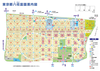
名古屋市中京土地区画整理組合事業地の国有地を示した地図。事業実施前の道路、水路などの情報が詳細に描かれている。
|
almost 5 years ago | 8 control points | |
|
|
|
2021 | almost 5 years ago | Unrectified |
|
Links: Source / Biblio Ref
|
2020 | almost 5 years ago | 3 control points |
|
Links: Source / Biblio Ref
|
2020 | almost 5 years ago | 4 control points |
|
|
2021 | almost 5 years ago | 3 control points |