Browse Maps
| map | Title | Year | Last Updated  |
Status |
|---|---|---|---|---|
|
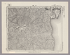
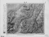
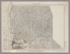
Image from the Map Collections courtesy Stanford University Libraries, licensed under a Creative Commons Attribution-Noncommercial 3.0 Unported License. © Stanford University. 【図幅名】 岩国 【測量時期】 明治27年測図の縮図/明治34年測図/昭和2年修正、測図の縮図/昭和7年鉄道補入、測図の縮図 【発行時期】 昭和22年2月発行 【記号】 広島16号(共16面) 【測量機関】 内務省地理調査所 【備考】
Links: Source / Biblio Ref
|
2 months ago | 4 control points | |
|
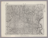
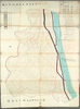
Image from the Map Collections courtesy Stanford University Libraries, licensed under a Creative Commons Attribution-Noncommercial 3.0 Unported License. © Stanford University. 【図幅名】 津田 【測量時期】 明治32年測圖/昭和2年修正測圖 【発行時期】 【記号】 広島十四号 【測量機関】 参謀本部 【備考】 祕
Links: Source / Biblio Ref
|
2 months ago | 4 control points | |
|
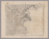
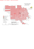
Image from the Map Collections courtesy Stanford University Libraries, licensed under a Creative Commons Attribution-Noncommercial 3.0 Unported License. © Stanford University. 【図幅名】 横浜 【測量時期】 明治39年測図/昭和7年測図の縮図、第2回修正、測図の縮図 【発行時期】 昭和21年8月発行 【記号】 東京8号 【測量機関】 内務省地理調査所 【備考】 (In 1 layer)
Links: Source / Biblio Ref
|
2 months ago | 4 control points | |
|
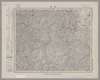
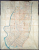
Image from the Map Collections courtesy Stanford University Libraries, licensed under a Creative Commons Attribution-Noncommercial 3.0 Unported License. © Stanford University. 【図幅名】 寄居 【測量時期】 明治40年測図/昭和4年修正/昭和9年要部修正/昭和14年部分修正 【発行時期】 昭和15年8月発行 【記号】 宇都宮16号 【測量機関】 大日本帝国陸地測量部 【備考】 (In 1 layer)
Links: Source / Biblio Ref
|
2 months ago | 4 control points | |
|
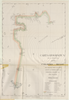
【最初期発行】 この地図の作成に当たっては、国土地理院長の承認を得て、同院発行の20万分の1地勢図及び5万分の1地形図を使用した。(承認番号 平30情使、 第1148号) (In 1 layer)
Links: Source / Biblio Ref
|
1921 | about 2 months ago | 4 control points |
|
|
about 2 months ago | 42 control points | |
|
Image from the Map Collections courtesy Stanford University Libraries, licensed under a Creative Commons Attribution-Noncommercial 3.0 Unported License. © Stanford University. 【図幅名】 平塚 【測量時期】 明治20年測図の縮図/昭和14年第2回修正、測図の縮図 【発行時期】 昭和21年9月発行 【記号】 横須賀9号 【測量機関】 内務省地理調査所 【備考】 (In 1 layer)
Links: Source / Biblio Ref
|
about 1 month ago | 4 control points | |
|
Public Domain. © Stanford University.
【図幅名】 松山南部 【記号】松山近傍8号(共12面)
Links: Source / Biblio Ref
|
about 1 month ago | 4 control points | |
|
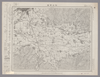
Public Domain. © Stanford University. 【図幅名】 松山北部 【記号】松山近傍7号(共12面)
Links: Source / Biblio Ref
|
about 1 month ago | 4 control points | |
|
|
2024 | 28 days ago | 5 control points |
|
明治20年、早島町大橋家蔵
|
1887 | 8 days ago | 3 control points |
|
文化14年、早島町大橋家蔵
|
1817 | 7 days ago | 4 control points |