Browse Maps
| map | Title | Year | Last Updated | Status  |
|---|---|---|---|---|
|
shelfmark: Maps 63145.2
License: Public Domain
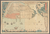
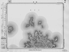
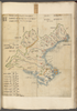
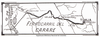
幕末 *多色刷り。外題「御開港横浜全図」。 Copperplate. Acquired 21 Dec 1878. Not in Beans.
Links: Source / Biblio Ref
|
about 2 years ago | 3 control points | |
|
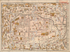
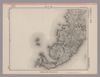
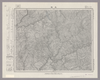
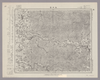
【Courtesy of the C. V. Starr East Asian Library University of California, Berkeley】 Mounted cover title. Wood block print. In Japanese. Oriented with north to the left. Relief shown pictorially. Includes legend.
Links: Source / Biblio Ref
|
1786 | over 3 years ago | 4 control points |
|
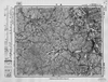
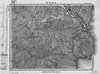
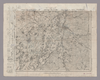
この地図の作成に当たっては、国土地理院長の承認を得て、同院発行の20万分の1地勢図及び5万分の1地形図を使用した。(承認番号 平30情使、 第1148号)
Links: Source / Biblio Ref
|
1946 | over 5 years ago | 4 control points |
|
【Courtesy of the C. V. Starr East Asian Library University of California, Berkeley】 In Japanese. Relief shown by hachures. Includes advertisement on verso. Oriented with north to the right. Includes legend.
Links: Source / Biblio Ref
|
1907 | over 3 years ago | 4 control points |
|
この地図の作成に当たっては、国土地理院長の承認を得て、同院発行の20万分の1地勢図及び5万分の1地形図を使用した。(承認番号 平30情使、 第1148号)
Links: Source / Biblio Ref
|
1946 | over 5 years ago | 4 control points |
|
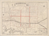
Image from the Map Collections courtesy Stanford University Libraries, licensed under a Creative Commons Attribution-Noncommercial 3.0 Unported License. © Stanford University. 【図幅名】 志々伎 【測量時期】 明治33年測図/大正14年修正/昭和20年部分修正 【発行時期】 昭和23年2月発行 【記号】 長崎9号(共15面) 【測量機関】 地理調査所 【備考】
Links: Source / Biblio Ref
|
over 5 years ago | 4 control points | |
|
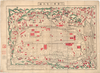
shelfmark: Maps 62980.20
License: Public Domain
文久2 *多色刷り。天保15序。(刊記書肆)文久二壬戌年十二月/発行書林/江戸、山城屋佐兵衛/京都、越後屋治兵衛/大阪、加賀屋善蔵・藤屋徳兵衛・伊丹屋善兵衛・河内屋太助・河内屋吉兵衛・河内屋喜兵衛。 Xylograph.
Links: Source / Biblio Ref
|
1862 | almost 4 years ago | 27 control points |
|
Image from the Map Collections courtesy Stanford University Libraries, licensed under a Creative Commons Attribution-Noncommercial 3.0 Unported License. © Stanford University. 【図幅名】 白川村 【測量時期】 明治43年測図/昭和5年要部修正 【発行時期】 昭和21年10月発行 【記号】 金沢3号(共13面) 【測量機関】 地理調査所 【備考】
Links: Source / Biblio Ref
|
about 2 years ago | 4 control points | |
|
この地図の作成に当たっては、国土地理院長の承認を得て、同院発行の20万分の1地勢図及び5万分の1地形図を使用した。(承認番号 平30情使、 第1148号)
Links: Source / Biblio Ref
|
1946 | over 5 years ago | 4 control points |
|
Links: Source / Biblio Ref
|
2021 | over 1 year ago | 4 control points |
|
この地図の作成に当たっては、国土地理院長の承認を得て、同院発行の20万分の1地勢図及び5万分の1地形図を使用した。(承認番号 平30情使、 第1148号)
Links: Source / Biblio Ref
|
1946 | about 4 years ago | 4 control points |
|
Image from the Map Collections courtesy Stanford University Libraries, licensed under a Creative Commons Attribution-Noncommercial 3.0 Unported License. © Stanford University. 【図幅名】 菱 【測量時期】 大正1年測図/昭和9年修正/昭和28年応急修正 【発行時期】 昭和34年8月発行 【記号】 西郷16号(共4面) 【測量機関】 国土地理院 【備考】 応急修正版
Links: Source / Biblio Ref
|
over 5 years ago | 4 control points | |
|
Links: Source / Biblio Ref
|
2020 | almost 3 years ago | 4 control points |
|
Image from the Map Collections courtesy Stanford University Libraries, licensed under a Creative Commons Attribution-Noncommercial 3.0 Unported License. © Stanford University.
Links: Source / Biblio Ref
|
over 6 years ago | 4 control points | |
|
この地図の作成に当たっては、国土地理院長の承認を得て、同院発行の20万分の1地勢図及び5万分の1地形図を使用した。(承認番号 平30情使、 第1148号)
Links: Source / Biblio Ref
|
1946 | about 4 years ago | 4 control points |
|
Image from the Map Collections courtesy Stanford University Libraries, licensed under a Creative Commons Attribution-Noncommercial 3.0 Unported License. © Stanford University. 【図幅名】 留萌 【測量時期】 大正8年測図/昭和6年鉄道補入 【発行時期】 昭和7年9月発行 【記号】 留萌5号(共11面) 【測量機関】 大日本帝国陸地測量部 【備考】 (In 1 layer)
Links: Source / Biblio Ref
|
about 2 years ago | 4 control points | |
|
shelfmark: Maps 149.e.224
License: Public Domain
江戸後期写 Manuscript, early 19th century. Acquired 22 July 1868. Ex-Siebold.
Links: Source / Biblio Ref
|
about 3 years ago | 7 control points | |
|
Image from the Map Collections courtesy Stanford University Libraries, licensed under a Creative Commons Attribution-Noncommercial 3.0 Unported License. © Stanford University. 【図幅名】 大栃 【測量時期】 明治40年測図/昭和8年修正 【発行時期】 昭和11年6月発行 【記号】 高知2号(共16面) 【測量機関】 大日本帝国陸地測量部 【備考】
Links: Source / Biblio Ref
|
about 2 years ago | 4 control points | |
|
この地図の作成に当たっては、国土地理院長の承認を得て、同院発行の20万分の1地勢図及び5万分の1地形図を使用した。(承認番号 平30情使、 第1148号)
Links: Source / Biblio Ref
|
1946 | about 2 years ago | 4 control points |
|
Image from the Map Collections courtesy Stanford University Libraries, licensed under a Creative Commons Attribution-Noncommercial 3.0 Unported License. © Stanford University. 【図幅名】 【測量時期】 【発行時期】 【記号】 【測量機関】 【備考】
Links: Source / Biblio Ref
|
about 2 years ago | 4 control points | |
|
Links: Source / Biblio Ref
|
2020 | over 1 year ago | 5 control points |
|
Image from the Map Collections courtesy Stanford University Libraries, licensed under a Creative Commons Attribution-Noncommercial 3.0 Unported License. © Stanford University. 【図幅名】 永平寺 【測量時期】 【発行時期】 昭和8年7月発行 【記号】 金沢12号(共13面) 【測量機関】 大日本帝国陸地測量部 【備考】
Links: Source / Biblio Ref
|
about 2 years ago | 4 control points | |
|
この地図の作成に当たっては、国土地理院長の承認を得て、同院発行の20万分の1地勢図及び5万分の1地形図を使用した。(承認番号 平30情使、 第1148号)
Links: Source / Biblio Ref
|
1947 | over 5 years ago | 4 control points |
|
【Courtesy of the C. V. Starr East Asian Library University of California, Berkeley】 Copperplate print. In Japanese. Oriented with north to the left. Relief shown pictorially. Includes distance chart and legend.
Links: Source / Biblio Ref
|
1879 | over 3 years ago | 4 control points |
|
Image from the Map Collections courtesy Stanford University Libraries, licensed under a Creative Commons Attribution-Noncommercial 3.0 Unported License. © Stanford University. 【図幅名】 岡崎 【測量時期】 明治24年測図/大正9年修正/昭和5年鉄道補入 【発行時期】 昭和7年5月発行 【記号】 豊橋15号(共16面) 【測量機関】 大日本帝国陸地測量部 【備考】
Links: Source / Biblio Ref
|
about 2 years ago | 4 control points | |
|
【Courtesy of the C. V. Starr East Asian Library University of California, Berkeley】 Mounted cover title. Wood block print. Oriented with north to the left. In Japanese. Relief shown pictorially. Includes legend. Engraved by Okada Mohe.
Links: Source / Biblio Ref
|
1843 | over 3 years ago | 4 control points |
|
|
2018 | over 5 years ago | 18 control points |
|
【Courtesy of the C. V. Starr East Asian Library University of California, Berkeley】 Mounted cover title. Wood block print. In Japanese. Relief shown pictorially. Presumed date of publication is between 1741 and 1764.
Links: Source / Biblio Ref
|
1764 | over 3 years ago | 4 control points |
|
この地図の作成に当たっては、国土地理院長の承認を得て、同院発行の20万分の1地勢図及び5万分の1地形図を使用した。(承認番号 平30情使、 第1148号)
Links: Source / Biblio Ref
|
1947 | over 5 years ago | 4 control points |
|
【Courtesy of the C. V. Starr East Asian Library University of California, Berkeley】 Mounted cover title. Wood block print. In Japanese. Shows distance. Includes legend.
Links: Source / Biblio Ref
|
1781 | over 3 years ago | 4 control points |
|
この地図の作成に当たっては、国土地理院長の承認を得て、同院発行の20万分の1地勢図及び5万分の1地形図を使用した。(承認番号 平30情使、 第1148号)
Links: Source / Biblio Ref
|
1947 | over 5 years ago | 4 control points |
|
|
1879 | over 6 years ago | 3 control points |
|
Links: Source / Biblio Ref
|
2021 | over 2 years ago | 9 control points |
|
Image from the Map Collections courtesy Stanford University Libraries, licensed under a Creative Commons Attribution-Noncommercial 3.0 Unported License. © Stanford University.
Links: Source / Biblio Ref
|
over 6 years ago | 4 control points | |
|
Links: Source / Biblio Ref
|
2020 | over 2 years ago | 4 control points |
|
Image from the Map Collections courtesy Stanford University Libraries, licensed under a Creative Commons Attribution-Noncommercial 3.0 Unported License. © Stanford University. 【図幅名】 大町 【測量時期】 大正1年測図/昭和5年測図/昭和6年修正 【発行時期】 昭和8年7月発行 【記号】 高山1号(共16面) 【測量機関】 大日本帝国陸地測量部 【備考】
Links: Source / Biblio Ref
|
about 2 years ago | 4 control points | |
|
|
2023 | about 1 year ago | 5 control points |
|
この地図の作成に当たっては、国土地理院長の承認を得て、同院発行の20万分の1地勢図及び5万分の1地形図を使用した。(承認番号 平30情使、 第1148号)
Links: Source / Biblio Ref
|
1947 | over 5 years ago | 4 control points |
|
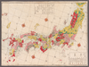
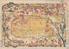
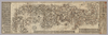
【Courtesy of the C. V. Starr East Asian Library University of California, Berkeley】 1 map: hand col.; on sheet 71 x 163 cm., folded in cover 24 x 14 cm. Mounted cover title. Wood block print. In Japanese. Covers Matsumae to Tsushima and Ryukyu. Includes text and legend. Shows the distance of sea routes. Alternate Title: Nihonkoku oezu. East Asian Library call number Ca 43.
Links: Source / Biblio Ref
|
1685 | over 3 years ago | 5 control points |
|
この地図の作成に当たっては、国土地理院長の承認を得て、同院発行の20万分の1地勢図及び5万分の1地形図を使用した。(承認番号 平30情使、 第1148号)
Links: Source / Biblio Ref
|
1947 | over 5 years ago | 4 control points |
|
Image from the Map Collections courtesy Stanford University Libraries, licensed under a Creative Commons Attribution-Noncommercial 3.0 Unported License. © Stanford University. 【図幅名】 石動 【測量時期】 明治42年測圖/昭和5年修正測圖 【発行時期】 【記号】 七尾四号 【測量機関】 参謀本部 【備考】 祕 (In 1 layer)
Links: Source / Biblio Ref
|
about 2 years ago | 4 control points | |
|
Image from the Map Collections courtesy Stanford University Libraries, licensed under a Creative Commons Attribution-Noncommercial 3.0 Unported License. © Stanford University. 【図幅名】 上江丹別 【測量時期】 大正8年測図/昭和6年鉄道補入 【発行時期】 昭和8年1月発行 【記号】 旭川13号(共16面) 【測量機関】 大日本帝国陸地測量部 【備考】 (In 1 layer)
Links: Source / Biblio Ref
|
about 2 years ago | 4 control points | |
|
Links: Source / Biblio Ref
|
2020 | almost 3 years ago | 4 control points |
|
【Courtesy of the C. V. Starr East Asian Library University of California, Berkeley】 Title from :Kyoto zu somokuroku /Otsuka Takashi, p.56. Wood block print. Oriented with north to the left. In Japanese. Relief shown pictorially. Drawn by Nakamura Yurakusai.
Links: Source / Biblio Ref
|
1861 | over 3 years ago | 4 control points |
|
【Courtesy of the C. V. Starr East Asian Library University of California, Berkeley】 Cover title. Wood block print. In Japanese. Covers Matsumae to Kyūshū. Includes lists of messenger fees and legend. Several small holes backed with conservation tape. Folded to 19 x 8 cm.
Links: Source / Biblio Ref
|
1845 | over 3 years ago | 5 control points |
|
Image from the Map Collections courtesy Stanford University Libraries, licensed under a Creative Commons Attribution-Noncommercial 3.0 Unported License. © Stanford University. 【図幅名】 剣山 【測量時期】 明治40年測圖/昭和8年修正測圖 【発行時期】 【記号】 剣山十三号 【測量機関】 参謀本部 【備考】 祕
Links: Source / Biblio Ref
|
about 2 years ago | 4 control points | |
|
Links: Source / Biblio Ref
|
2020 | over 1 year ago | 10 control points |
|
【Courtesy of the C. V. Starr East Asian Library University of California, Berkeley】 Copperplate print. In Japanese. Oriented with north to the left. Relief shown pictorially. Includes distance chart, index, and legend.
Links: Source / Biblio Ref
|
1879 | over 3 years ago | 4 control points |
|
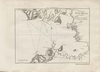
【Courtesy of the C. V. Starr East Asian Library University of California, Berkeley】 1 map : col. ; 107 x 72 cm., folded in cover 28 x 14 cm. In Japanese. Relief shown by hachures. Shows distance of sea routes. Includes 10 insets and legend. East Asian Library call number Bc 22.
Links: Source / Biblio Ref
|
1910 | over 3 years ago | 4 control points |
|
【Courtesy of the C. V. Starr East Asian Library University of California, Berkeley】 Mounted cover title. Wood block print. In Japanese. Shows distances.
Links: Source / Biblio Ref
|
1763 | over 3 years ago | 4 control points |