Browse Maps
| map | Title | Year | Last Updated  |
Status |
|---|---|---|---|---|
|
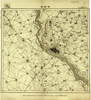
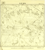
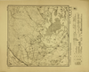
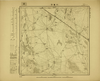
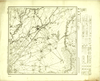
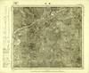
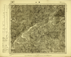
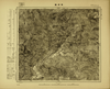
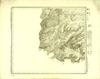
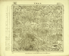
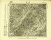
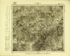
Image from the Map Collections courtesy Tohoku University. © 2023, the Committee for the Creation of the Gaihozu Digital Archives. 【図幅名】 伯都訥 【測量時期】 明治41年測圖/大正15年修正測圖mネンソクズ 【発行時期】 - 【記号】 西五行北七段伯都訥5号 【測量機関】 -
Links: Source / Biblio Ref
|
about 1 month ago | 4 control points | |
|
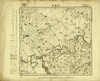
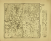
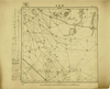
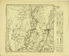
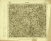
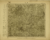
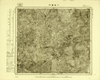
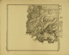
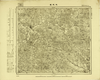
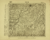
Image from the Map Collections courtesy Tohoku University. © 2023, the Committee for the Creation of the Gaihozu Digital Archives. 【図幅名】 茂興站 【測量時期】 - 【発行時期】 - 【記号】 西五行北七段伯都訥4号 【測量機関】 -
Links: Source / Biblio Ref
|
about 1 month ago | 4 control points | |
|
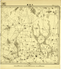
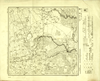
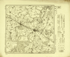
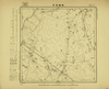
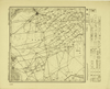
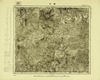
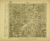
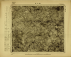
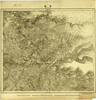
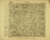
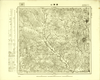
Image from the Map Collections courtesy Tohoku University. © 2023, the Committee for the Creation of the Gaihozu Digital Archives. 【図幅名】 頭台 【測量時期】 - 【発行時期】 - 【記号】 西五行北七段伯都訥3号 【測量機関】 -
Links: Source / Biblio Ref
|
about 1 month ago | 4 control points | |
|
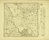
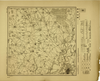
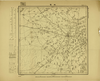
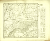
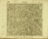
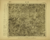
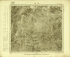
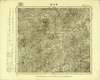
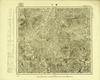
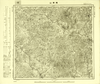
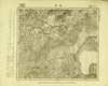
Image from the Map Collections courtesy Tohoku University. © 2023, the Committee for the Creation of the Gaihozu Digital Archives. 【図幅名】 大通鎮 【測量時期】 - 【発行時期】 - 【記号】 西五行北七段伯都訥2号 【測量機関】 -
Links: Source / Biblio Ref
|
about 1 month ago | 4 control points | |
|
Image from the Map Collections courtesy Tohoku University. © 2023, the Committee for the Creation of the Gaihozu Digital Archives. 【図幅名】 軋葫芦泡 【測量時期】 大正7年測圖 【発行時期】 - 【記号】 西五行北七段伯都訥1号 【測量機関】 -
Links: Source / Biblio Ref
|
about 1 month ago | 4 control points | |
|
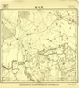
Image from the Map Collections courtesy Tohoku University. © 2023, the Committee for the Creation of the Gaihozu Digital Archives. 【図幅名】 茂興站 【測量時期】 - 【発行時期】 昭和8年発行 【記号】 西五行北七段白城子4号ニシ5ギョウキタナナダン 【測量機関】 大日本帝國陸地測量部
Links: Source / Biblio Ref
|
1933 | about 1 month ago | 4 control points |
|
Image from the Map Collections courtesy Tohoku University. © 2023, the Committee for the Creation of the Gaihozu Digital Archives. 【図幅名】 頭站 【測量時期】 昭和8年測圖sネンソクズ 【発行時期】 昭和10年発行 【記号】 齊齊哈爾20号 【測量機関】 大日本帝國陸地測量部
Links: Source / Biblio Ref
|
1935 | about 1 month ago | 4 control points |
|
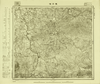
Image from the Map Collections courtesy Tohoku University. © 2023, the Committee for the Creation of the Gaihozu Digital Archives. 【図幅名】 景星 【測量時期】 - 【発行時期】 昭和10年発行 【記号】 齊齊哈爾19号 【測量機関】 大日本帝國陸地測量部
Links: Source / Biblio Ref
|
1935 | about 1 month ago | 4 control points |
|
Image from the Map Collections courtesy Tohoku University. © 2023, the Committee for the Creation of the Gaihozu Digital Archives. 【図幅名】 梁家大崗子 【測量時期】 昭和8年測圖sネンソクズ 【発行時期】 昭和10年発行 【記号】 齊齊哈爾18号 【測量機関】 大日本帝國陸地測量部
Links: Source / Biblio Ref
|
1935 | about 1 month ago | 4 control points |
|
Image from the Map Collections courtesy Tohoku University. © 2023, the Committee for the Creation of the Gaihozu Digital Archives. 【図幅名】 江橋 【測量時期】 昭和8年測圖sネンソクズ 【発行時期】 昭和10年発行 【記号】 齊齊哈爾15号 【測量機関】 大日本帝國陸地測量部
Links: Source / Biblio Ref
|
1935 | about 1 month ago | 4 control points |
|
Image from the Map Collections courtesy Tohoku University. © 2023, the Committee for the Creation of the Gaihozu Digital Archives. 【図幅名】 昴昴渓 【測量時期】 昭和8年測圖sネンソクズ 【発行時期】 昭和10年発行 【記号】 齊齊哈爾14号 【測量機関】 大日本帝國陸地測量部
Links: Source / Biblio Ref
|
1935 | about 1 month ago | 4 control points |
|
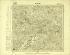
Image from the Map Collections courtesy Tohoku University. © 2023, the Committee for the Creation of the Gaihozu Digital Archives. 【図幅名】 齊齊哈爾 【測量時期】 昭和8年測圖sネンソクズ 【発行時期】 昭和10年発行 【記号】 齊齊哈爾13号 【測量機関】 大日本帝國陸地測量部
Links: Source / Biblio Ref
|
1935 | about 1 month ago | 4 control points |
|
Image from the Map Collections courtesy Tohoku University. © 2023, the Committee for the Creation of the Gaihozu Digital Archives. 【図幅名】 小藁子 【測量時期】 - 【発行時期】 昭和10年発行 【記号】 齊齊哈爾10号 【測量機関】 大日本帝國陸地測量部
Links: Source / Biblio Ref
|
1935 | about 1 month ago | 4 control points |
|
Image from the Map Collections courtesy Tohoku University. © 2023, the Committee for the Creation of the Gaihozu Digital Archives. 【図幅名】 煙筒屯 【測量時期】 - 【発行時期】 昭和10年発行 【記号】 齊齊哈爾9号 【測量機関】 大日本帝國陸地測量部
Links: Source / Biblio Ref
|
1935 | about 1 month ago | 4 control points |
|
Image from the Map Collections courtesy Tohoku University. © 2023, the Committee for the Creation of the Gaihozu Digital Archives. 【図幅名】 喇嘛甸子 【測量時期】 - 【発行時期】 昭和10年発行 【記号】 齊齊哈爾5号 【測量機関】 大日本帝國陸地測量部
Links: Source / Biblio Ref
|
1935 | about 1 month ago | 4 control points |
|
Image from the Map Collections courtesy Tohoku University. © 2023, the Committee for the Creation of the Gaihozu Digital Archives. 【図幅名】 林甸 【測量時期】 - 【発行時期】 昭和10年発行 【記号】 齊齊哈爾4号 【測量機関】 大日本帝國陸地測量部
Links: Source / Biblio Ref
|
1935 | about 1 month ago | 4 control points |
|
Image from the Map Collections courtesy Tohoku University. © 2023, the Committee for the Creation of the Gaihozu Digital Archives. 【図幅名】 塔哈站 【測量時期】 昭和11年測量sネンソクリョウ 【発行時期】 昭和15年発行sネンハッコウ 【記号】 西五行北八段齊齊哈爾8号 【測量機関】 大日本帝國陸地測量部
Links: Source / Biblio Ref
|
1940 | about 1 month ago | 4 control points |
|
Image from the Map Collections courtesy Tohoku University. © 2023, the Committee for the Creation of the Gaihozu Digital Archives. 【図幅名】 興揚鎮 【測量時期】 昭和11年測量sネンソクリョウ 【発行時期】 昭和15年発行sネンハッコウ 【記号】 西五行北八段齊齊哈爾7号 【測量機関】 大日本帝國陸地測量部
Links: Source / Biblio Ref
|
1940 | about 1 month ago | 4 control points |
|
Image from the Map Collections courtesy Tohoku University. © 2023, the Committee for the Creation of the Gaihozu Digital Archives. 【図幅名】 富裕 【測量時期】 昭和11年測量sネンソクリョウ 【発行時期】 昭和15年発行sネンハッコウ 【記号】 西五行北八段齊齊哈爾3号 【測量機関】 大日本帝國陸地測量部
Links: Source / Biblio Ref
|
1940 | about 1 month ago | 4 control points |
|
Image from the Map Collections courtesy Tohoku University. © 2023, the Committee for the Creation of the Gaihozu Digital Archives. 【図幅名】 富海 【測量時期】 昭和11年測量sネンソクリョウ 【発行時期】 昭和15年発行sネンハッコウ 【記号】 西五行北八段齊齊哈爾2号 【測量機関】 大日本帝國陸地測量部
Links: Source / Biblio Ref
|
1940 | about 1 month ago | 4 control points |
|
Image from the Map Collections courtesy Tohoku University. © 2023, the Committee for the Creation of the Gaihozu Digital Archives. 【図幅名】 昌城 【測量時期】 - 【発行時期】 昭和8年発行 【記号】 懐仁24号 【測量機関】 大日本帝國陸地測量部
Links: Source / Biblio Ref
|
1933 | about 1 month ago | 4 control points |
|
Image from the Map Collections courtesy Tohoku University. © 2023, the Committee for the Creation of the Gaihozu Digital Archives. 【図幅名】 太平哨 【測量時期】 - 【発行時期】 昭和8年発行 【記号】 懐仁23号 【測量機関】 大日本帝國陸地測量部
Links: Source / Biblio Ref
|
1933 | about 1 month ago | 4 control points |
|
Image from the Map Collections courtesy Tohoku University. © 2023, the Committee for the Creation of the Gaihozu Digital Archives. 【図幅名】 懐仁 【測量時期】 - 【発行時期】 昭和8年発行 【記号】 懐仁22号 【測量機関】 大日本帝國陸地測量部
Links: Source / Biblio Ref
|
1933 | about 1 month ago | 4 control points |
|
Image from the Map Collections courtesy Tohoku University. © 2023, the Committee for the Creation of the Gaihozu Digital Archives. 【図幅名】 旺清邊門 【測量時期】 - 【発行時期】 昭和8年発行 【記号】 懐仁21号 【測量機関】 大日本帝國陸地測量部
Links: Source / Biblio Ref
|
1933 | about 1 month ago | 4 control points |
|
Image from the Map Collections courtesy Tohoku University. © 2023, the Committee for the Creation of the Gaihozu Digital Archives. 【図幅名】 楚山 【測量時期】 - 【発行時期】 昭和7年発行 【記号】 懐仁18号 【測量機関】 大日本帝國陸地測量部
Links: Source / Biblio Ref
|
1932 | about 1 month ago | 4 control points |
|
Image from the Map Collections courtesy Tohoku University. © 2023, the Committee for the Creation of the Gaihozu Digital Archives. 【図幅名】 台上 【測量時期】 - 【発行時期】 昭和8年発行 【記号】 懐仁17号 【測量機関】 大日本帝國陸地測量部
Links: Source / Biblio Ref
|
1933 | about 1 month ago | 4 control points |
|
Image from the Map Collections courtesy Tohoku University. © 2023, the Committee for the Creation of the Gaihozu Digital Archives. 【図幅名】 大泉源 【測量時期】 - 【発行時期】 昭和8年発行 【記号】 懐仁16号 【測量機関】 大日本帝國陸地測量部
Links: Source / Biblio Ref
|
1933 | about 1 month ago | 4 control points |
|
Image from the Map Collections courtesy Tohoku University. © 2023, the Committee for the Creation of the Gaihozu Digital Archives. 【図幅名】 渭原 【測量時期】 - 【発行時期】 昭和8年発行 【記号】 懐仁13号 【測量機関】 大日本帝國陸地測量部
Links: Source / Biblio Ref
|
1933 | about 1 month ago | 4 control points |
|
Image from the Map Collections courtesy Tohoku University. © 2023, the Committee for the Creation of the Gaihozu Digital Archives. 【図幅名】 滿浦鎮 【測量時期】 - 【発行時期】 昭和8年発行 【記号】 懐仁12号 【測量機関】 大日本帝國陸地測量部
Links: Source / Biblio Ref
|
1933 | about 1 month ago | 4 control points |
|
Image from the Map Collections courtesy Tohoku University. © 2023, the Committee for the Creation of the Gaihozu Digital Archives. 【図幅名】 六道溝門 【測量時期】 - 【発行時期】 昭和8年発行 【記号】 懐仁11号 【測量機関】 大日本帝國陸地測量部
Links: Source / Biblio Ref
|
1933 | about 1 month ago | 4 control points |
|
Image from the Map Collections courtesy Tohoku University. © 2023, the Committee for the Creation of the Gaihozu Digital Archives. 【図幅名】 院坪里 【測量時期】 - 【発行時期】 昭和8年発行 【記号】 懐仁7号 【測量機関】 大日本帝國陸地測量部
Links: Source / Biblio Ref
|
1933 | about 1 month ago | 4 control points |
|
Image from the Map Collections courtesy Tohoku University. © 2023, the Committee for the Creation of the Gaihozu Digital Archives. 【図幅名】 慈城 【測量時期】 - 【発行時期】 昭和8年発行 【記号】 懐仁6号 【測量機関】 大日本帝國陸地測量部
Links: Source / Biblio Ref
|
1933 | about 1 month ago | 4 control points |
|
Image from the Map Collections courtesy Tohoku University. © 2023, the Committee for the Creation of the Gaihozu Digital Archives. 【図幅名】 厚昌 【測量時期】 昭和12年測量sネンソクリョウ 【発行時期】 昭和15年発行sネンハッコウ 【記号】 輯安1号アツムアン 【測量機関】 大日本帝國陸地測量部
Links: Source / Biblio Ref
|
1940 | about 1 month ago | 4 control points |
|
Image from the Map Collections courtesy Tohoku University. © 2023, the Committee for the Creation of the Gaihozu Digital Archives. 【図幅名】 厚昌 【測量時期】 昭和12年測量(空中寫眞測量)sネンソクリョウクウチュウシャシンソクリョウ 【発行時期】 - 【記号】 輯安1号アツムアン 【測量機関】 大日本帝國陸地測量部
Links: Source / Biblio Ref
|
about 1 month ago | 4 control points | |
|
Image from the Map Collections courtesy Tohoku University. © 2023, the Committee for the Creation of the Gaihozu Digital Archives. 【図幅名】 厚昌 【測量時期】 - 【発行時期】 - 【記号】 懐仁1号 【測量機関】 臨時測圖部リンジソクズブ
Links: Source / Biblio Ref
|
about 1 month ago | 4 control points | |
|
Image from the Map Collections courtesy Tohoku University. © 2023, the Committee for the Creation of the Gaihozu Digital Archives. 【図幅名】 新兵堡 【測量時期】 - 【発行時期】 昭和8年発行 【記号】 海龍城25号 【測量機関】 大日本帝國陸地測量部
Links: Source / Biblio Ref
|
1933 | about 1 month ago | 4 control points |
|
Image from the Map Collections courtesy Tohoku University. © 2023, the Committee for the Creation of the Gaihozu Digital Archives. 【図幅名】 北山城子 【測量時期】 - 【発行時期】 昭和8年発行 【記号】 海龍城23号 【測量機関】 大日本帝國陸地測量部
Links: Source / Biblio Ref
|
1933 | about 1 month ago | 4 control points |
|
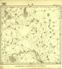
Image from the Map Collections courtesy Tohoku University. © 2023, the Committee for the Creation of the Gaihozu Digital Archives. 【図幅名】 大疙疸 【測量時期】 - 【発行時期】 - 【記号】 海龍城22号 【測量機関】 -
Links: Source / Biblio Ref
|
about 1 month ago | 4 control points | |
|
Image from the Map Collections courtesy Tohoku University. © 2023, the Committee for the Creation of the Gaihozu Digital Archives. 【図幅名】 二道河子街 【測量時期】 - 【発行時期】 昭和8年発行 【記号】 海龍城21号 【測量機関】 大日本帝國陸地測量部
Links: Source / Biblio Ref
|
1933 | about 1 month ago | 4 control points |
|
Image from the Map Collections courtesy Tohoku University. © 2023, the Committee for the Creation of the Gaihozu Digital Archives. 【図幅名】 通化 【測量時期】 - 【発行時期】 - 【記号】 海龍城20号 【測量機関】 -
Links: Source / Biblio Ref
|
about 1 month ago | 4 control points | |
|
Image from the Map Collections courtesy Tohoku University. © 2023, the Committee for the Creation of the Gaihozu Digital Archives. 【図幅名】 柳河鎮 【測量時期】 - 【発行時期】 昭和8年発行 【記号】 海龍城19号 【測量機関】 大日本帝國陸地測量部
Links: Source / Biblio Ref
|
1933 | about 1 month ago | 4 control points |
|
Image from the Map Collections courtesy Tohoku University. © 2023, the Committee for the Creation of the Gaihozu Digital Archives. 【図幅名】 海龍城 【測量時期】 - 【発行時期】 - 【記号】 海龍城18号 【測量機関】 -
Links: Source / Biblio Ref
|
about 1 month ago | 4 control points | |
|
Image from the Map Collections courtesy Tohoku University. © 2023, the Committee for the Creation of the Gaihozu Digital Archives. 【図幅名】 磨磐山 【測量時期】 - 【発行時期】 - 【記号】 海龍城17号 【測量機関】 -
Links: Source / Biblio Ref
|
about 1 month ago | 4 control points | |
|
Image from the Map Collections courtesy Tohoku University. © 2023, the Committee for the Creation of the Gaihozu Digital Archives. 【図幅名】 煙筩山 【測量時期】 - 【発行時期】 昭和8年発行 【記号】 海龍城16号 【測量機関】 大日本帝國陸地測量部
Links: Source / Biblio Ref
|
1933 | about 1 month ago | 4 control points |
|
Image from the Map Collections courtesy Tohoku University. © 2023, the Committee for the Creation of the Gaihozu Digital Archives. 【図幅名】 八道江 【測量時期】 - 【発行時期】 - 【記号】 海龍城15号 【測量機関】 -
Links: Source / Biblio Ref
|
about 1 month ago | 4 control points | |
|
Image from the Map Collections courtesy Tohoku University. © 2023, the Committee for the Creation of the Gaihozu Digital Archives. 【図幅名】 通溝 【測量時期】 - 【発行時期】 - 【記号】 海龍城14号 【測量機関】 -
Links: Source / Biblio Ref
|
about 1 month ago | 4 control points | |
|
Image from the Map Collections courtesy Tohoku University. © 2023, the Committee for the Creation of the Gaihozu Digital Archives. 【図幅名】 様子哨 【測量時期】 - 【発行時期】 - 【記号】 海龍城13号 【測量機関】 -
Links: Source / Biblio Ref
|
about 1 month ago | 4 control points | |
|
Image from the Map Collections courtesy Tohoku University. © 2023, the Committee for the Creation of the Gaihozu Digital Archives. 【図幅名】 朝陽鎮 【測量時期】 - 【発行時期】 - 【記号】 海龍城12号 【測量機関】 -
Links: Source / Biblio Ref
|
about 1 month ago | 4 control points | |
|
Image from the Map Collections courtesy Tohoku University. © 2023, the Committee for the Creation of the Gaihozu Digital Archives. 【図幅名】 取麻菜河 【測量時期】 - 【発行時期】 昭和8年発行 【記号】 海龍城11号 【測量機関】 大日本帝國陸地測量部
Links: Source / Biblio Ref
|
1933 | about 1 month ago | 4 control points |
|
Image from the Map Collections courtesy Tohoku University. © 2023, the Committee for the Creation of the Gaihozu Digital Archives. 【図幅名】 帽兒山 【測量時期】 - 【発行時期】 昭和8年発行 【記号】 海龍城10号 【測量機関】 大日本帝國陸地測量部
Links: Source / Biblio Ref
|
1933 | about 1 month ago | 4 control points |