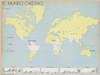
Browse Maps
| map | Title | Year | Last Updated  |
Status |
|---|---|---|---|---|
|
Links: Source / Biblio Ref
|
2020 | almost 6 years ago | Unrectified |
|
Links: Source / Biblio Ref
|
2020 | almost 6 years ago | Unrectified |
|
Links: Source / Biblio Ref
|
2020 | almost 6 years ago | Unrectified |
|
Links: Source / Biblio Ref
|
2020 | almost 6 years ago | Unrectified |
|
Links: Source / Biblio Ref
|
2020 | almost 6 years ago | Unrectified |
|
Links: Source / Biblio Ref
|
2020 | almost 6 years ago | Unrectified |
|
Links: Source / Biblio Ref
|
2020 | almost 6 years ago | Unrectified |
|
Links: Source / Biblio Ref
|
2020 | almost 6 years ago | Unrectified |
|
Links: Source / Biblio Ref
|
2020 | almost 6 years ago | Unrectified |
|
Links: Source / Biblio Ref
|
2020 | almost 6 years ago | Unrectified |
|
|
2020 | almost 6 years ago | 4 control points |
|
test
|
2020 | almost 6 years ago | 4 control points |
|
test
|
2020 | almost 6 years ago | 4 control points |
|
Links: Source / Biblio Ref
|
2020 | almost 6 years ago | 8 control points |
|
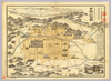
【Courtesy of the C. V. Starr East Asian Library University of California, Berkeley】 In Japanese. Oriented with north to the left. Relief shown pictorially. Includes distance chart, a fare table and a view of a temple. Folded to 27 x 13 cm. Col. East Asian Library call number: F131.
Links: Source / Biblio Ref
|
1902 | almost 6 years ago | 18 control points |
|
Links: Source / Biblio Ref
|
2020 | almost 6 years ago | Unrectified |
|
Links: Source / Biblio Ref
|
2020 | almost 6 years ago | Unrectified |
|
Links: Source / Biblio Ref
|
2020 | almost 6 years ago | Unrectified |
|
Links: Source / Biblio Ref
|
2020 | almost 6 years ago | Unrectified |
|
Links: Source / Biblio Ref
|
2020 | almost 6 years ago | Unrectified |
|
Links: Source / Biblio Ref
|
2020 | almost 6 years ago | Unrectified |
|
Links: Source / Biblio Ref
|
2020 | almost 6 years ago | Unrectified |
|
Links: Source / Biblio Ref
|
2020 | almost 6 years ago | Unrectified |

|
Links: Source / Biblio Ref
|
2020 | almost 6 years ago | Unrectified |
|
Links: Source / Biblio Ref
|
2020 | almost 6 years ago | Unrectified |
|
Links: Source / Biblio Ref
|
2020 | almost 6 years ago | Unrectified |
|
Links: Source / Biblio Ref
|
2020 | almost 6 years ago | Unrectified |
|
Links: Source / Biblio Ref
|
2020 | almost 6 years ago | Unrectified |
|
Links: Source / Biblio Ref
|
2020 | almost 6 years ago | Unrectified |
|
Links: Source / Biblio Ref
|
2020 | almost 6 years ago | Unrectified |
|
Links: Source / Biblio Ref
|
2020 | almost 6 years ago | Unrectified |
|
Links: Source / Biblio Ref
|
2020 | almost 6 years ago | Unrectified |
|
Links: Source / Biblio Ref
|
2020 | almost 6 years ago | Unrectified |
|
Links: Source / Biblio Ref
|
2020 | almost 6 years ago | Unrectified |
|
Links: Source / Biblio Ref
|
2020 | almost 6 years ago | Unrectified |
|
Links: Source / Biblio Ref
|
2020 | almost 6 years ago | Unrectified |
|
Links: Source / Biblio Ref
|
2020 | almost 6 years ago | Unrectified |
|
|
2020 | almost 6 years ago | Unrectified |
|
|
2020 | almost 6 years ago | Unrectified |
|
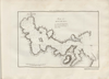
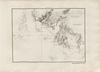
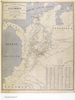
El “Mapa de las líneas marítimas”, un plegable que Julio Parga Polanía incluyó en su Guía del comercio de Bogotá, publicada en 1904 por la Imprenta de El Nuevo Tiempo. El autor se destacó por dirigir una variada colección de publicación de vocación comerciales, entre guías de ciudades de Colombia y publicaciones periodísticas como El Pabellón y El Ciclón. El mapa traza parte de la costa atlántica colombiana, desde Cartagena hasta la península de La Guajira, centrando su interés en Puerto Colombia, renovada terminal marítima de Barranquilla inaugurada en 1893. En tal sentido el documento tuvo la intención de persuadir al lector de la guía para enseñar las posibilidades de transporte marítimo. A través de 11 rutas que conectaron al muelle con distintos puertos de la Europa Occidental, de las Antillas, de México y de E.E.U.U.
Links: Source / Biblio Ref
|
2020 | almost 6 years ago | 4 control points |
|
Links: Source / Biblio Ref
|
2020 | almost 6 years ago | 9 control points |
|
Links: Source / Biblio Ref
|
2020 | almost 6 years ago | 15 control points |
|
Links: Source / Biblio Ref
|
2020 | almost 6 years ago | Unrectified |
|
Links: Source / Biblio Ref
|
2020 | almost 6 years ago | Unrectified |
|
Links: Source / Biblio Ref
|
2020 | almost 6 years ago | Unrectified |
|
Links: Source / Biblio Ref
|
2020 | almost 6 years ago | Unrectified |
|
Links: Source / Biblio Ref
|
2020 | almost 6 years ago | Unrectified |
|
Links: Source / Biblio Ref
|
2020 | almost 6 years ago | Unrectified |
|
Links: Source / Biblio Ref
|
2020 | almost 6 years ago | Unrectified |
|
Links: Source / Biblio Ref
|
2020 | almost 6 years ago | Unrectified |