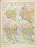
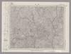
Browse Maps
| map | Title | Year | Last Updated | Status  |
|---|---|---|---|---|
|
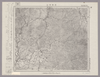
Image from the Map Collections courtesy Stanford University Libraries, licensed under a Creative Commons Attribution-Noncommercial 3.0 Unported License. © Stanford University. 【図幅名】 羽前金山 【測量時期】 大正2年測図/昭和9年修正 【発行時期】 昭和11年10月発行 【記号】 新庄11号(共16面) 【測量機関】 大日本帝国陸地測量部 【備考】
Links: Source / Biblio Ref
|
about 2 years ago | 4 control points | |
|
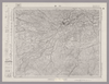
Image from the Map Collections courtesy Stanford University Libraries, licensed under a Creative Commons Attribution-Noncommercial 3.0 Unported License. © Stanford University. 【図幅名】 竹田 【測量時期】 明治35年測圖/昭和7年要部修正測圖 【発行時期】 【記号】 大分十一号 【測量機関】 参謀本部 【備考】 祕
Links: Source / Biblio Ref
|
about 4 years ago | 4 control points | |
|
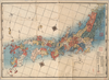
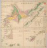
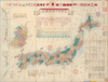
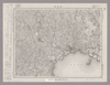
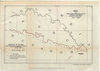
【Courtesy of the C. V. Starr East Asian Library University of California, Berkeley】 Wood block print. In Japanese. Orinted with north to the upper right. Covers Matsumae to Tsushima, Okinoerabu, and Hachijojima. Shows longitude and latitude. Shows the distance of sea routes and explanation of Kuroshio. Title on library's envelope. Col. map folded in cover 19 x 10 cm., in envelope 23 x 16 cm. East Asian Library call number Ca31.
Links: Source / Biblio Ref
|
1843 | over 3 years ago | 5 control points |
|
Links: Source / Biblio Ref
|
2020 | over 2 years ago | 5 control points |
|
(In 1 layer)
Links: Source / Biblio Ref
|
2020 | over 3 years ago | 16 control points |
|
Links: Source / Biblio Ref
|
2020 | over 3 years ago | 11 control points |
|
(In 1 layer)
Links: Source / Biblio Ref
|
2020 | over 3 years ago | 11 control points |
|
Image from the Map Collections courtesy Stanford University Libraries, licensed under a Creative Commons Attribution-Noncommercial 3.0 Unported License. © Stanford University. 【図幅名】 八幡浜 【測量時期】 明治37年測図/昭和8年修正/昭和28年応急修正 【発行時期】 昭和33年4月発行 【記号】 松山12号(共15面) 【測量機関】 地理調査所 【備考】 応急修正版 (In 1 layer)
Links: Source / Biblio Ref
|
about 2 years ago | 4 control points | |
|
Image from the Map Collections courtesy Stanford University Libraries, licensed under a Creative Commons Attribution-Noncommercial 3.0 Unported License. © Stanford University. 【図幅名】 十日町 【測量時期】 明治44年測図/昭和6年修正 【発行時期】 昭和10年5月発行 【記号】 高田2号(共15面) 【測量機関】 大日本帝国陸地測量部 【備考】
Links: Source / Biblio Ref
|
about 2 years ago | 4 control points | |
|
|
2022 | almost 2 years ago | 6 control points |
|
Image from the Map Collections courtesy Stanford University Libraries, licensed under a Creative Commons Attribution-Noncommercial 3.0 Unported License. © Stanford University. 【図幅名】 八海山 【測量時期】 大正1年測図/昭和6年要部修正/昭和28年応急修正 【発行時期】 昭和34年8月発行 【記号】 日光14号(共16面) 【測量機関】 国土地理院 【備考】 応急修正版
Links: Source / Biblio Ref
|
about 2 years ago | 4 control points | |
|
Image from the Map Collections courtesy Stanford University Libraries, licensed under a Creative Commons Attribution-Noncommercial 3.0 Unported License. © Stanford University. 【図幅名】 三田井 【測量時期】 明治35年測圖/昭和7年要部修正測圖 【発行時期】 昭和10年発行 【記号】 大分十二号 【測量機関】 大日本帝國陸地測量部 【備考】
Links: Source / Biblio Ref
|
about 4 years ago | 4 control points | |
|
|
2022 | almost 2 years ago | 7 control points |
|
Image from the Map Collections courtesy Stanford University Libraries, licensed under a Creative Commons Attribution-Noncommercial 3.0 Unported License. © Stanford University. 【図幅名】 熊田 【測量時期】 明治36年測圖/昭和7年要部修正測圖 【発行時期】 【記号】 大分八号 【測量機関】 参謀本部 【備考】 祕
Links: Source / Biblio Ref
|
about 4 years ago | 4 control points | |
|
Links: Source / Biblio Ref
|
2021 | over 3 years ago | 14 control points |
|
Image from the Map Collections courtesy Stanford University Libraries, licensed under a Creative Commons Attribution-Noncommercial 3.0 Unported License. © Stanford University. 【図幅名】 島原 【測量時期】 明治33年測圖/大正15年修正測圖/昭和7年要部修正測圖 【発行時期】 昭和9年発行 【記号】 熊本十二号 【測量機関】 大日本帝國陸地測量部 【備考】
Links: Source / Biblio Ref
|
about 4 years ago | 4 control points | |
|
【Courtesy of the C. V. Starr East Asian Library University of California, Berkeley】 Mounted cover title. Copperplate print. In Japanese. Relief shown by hachures. Includes legend. Title on map: Nihon chishiryaku yakuzu : sono ni. Col. map folded in cover 18 x 13 cm. East Asian Library call number Cb55.
Links: Source / Biblio Ref
|
1877 | over 3 years ago | 4 control points |
|
Image from the Map Collections courtesy Stanford University Libraries, licensed under a Creative Commons Attribution-Noncommercial 3.0 Unported License. © Stanford University. 【図幅名】 神門 【測量時期】 明治35年測図/昭和7年要部修正 【発行時期】 【記号】 延岡10号(共13面) 【測量機関】 参謀本部 【備考】 秘
Links: Source / Biblio Ref
|
about 4 years ago | 4 control points | |
|
Links: Source / Biblio Ref
|
2020 | about 1 year ago | 7 control points |
|
Image from the Map Collections courtesy Stanford University Libraries, licensed under a Creative Commons Attribution-Noncommercial 3.0 Unported License. © Stanford University. 【図幅名】 肥前高島 【測量時期】 明治34年測図/大正13年修正/昭和20年部分修正 【発行時期】 昭和23年2月発行 【記号】 野母崎1号(共5面) 【測量機関】 地理調査所 【備考】
Links: Source / Biblio Ref
|
about 4 years ago | 4 control points | |
|
【Courtesy of the C. V. Starr East Asian Library University of California, Berkeley】 Contents :1 Hokkaido ansha yakuzu -- 2 Ryukyu Shoto ansha yakuzu. Mounted cover title. Copperplate print. In Japanese. Relief shown by hachures. Oriented with north to the upper right. Includes 2 insets. 2 maps on 1 sheet : col.; 19 x 48 cm.and 28 x 48 cm. on sheet 53 x 51 cm., folded in cover 18 x 13 cm. East Asian Library call number Cb41.
Links: Source / Biblio Ref
|
1876 | over 3 years ago | 4 control points |
|
Image from the Map Collections courtesy Stanford University Libraries, licensed under a Creative Commons Attribution-Noncommercial 3.0 Unported License. © Stanford University. 【図幅名】 三重 【測量時期】 明治34年測図/大正13年修正/昭和20年部分修正 【発行時期】 昭和23年2月発行 【記号】 長崎8号(共15面) 【測量機関】 地理調査所 【備考】 仮製版
Links: Source / Biblio Ref
|
about 4 years ago | 4 control points | |
|
Image from the Map Collections courtesy Stanford University Libraries, licensed under a Creative Commons Attribution-Noncommercial 3.0 Unported License. © Stanford University. 【図幅名】 高浜 【測量時期】 明治34年測圖/昭和7年要部修正測圖 【発行時期】 【記号】 野母崎二号 【測量機関】 参謀本部 【備考】 祕
Links: Source / Biblio Ref
|
about 4 years ago | 4 control points | |
|
Image from the Map Collections courtesy Stanford University Libraries, licensed under a Creative Commons Attribution-Noncommercial 3.0 Unported License. © Stanford University. 【図幅名】 野尻 【測量時期】 明治34年測圖/大正4年測圖之縮圖/昭和7年第二回修正測圖及修正測圖之縮圖/昭和10年部分修正測圖 【発行時期】 【記号】 宮崎十三号 【測量機関】 参謀本部 【備考】 祕
Links: Source / Biblio Ref
|
about 4 years ago | 4 control points | |
|
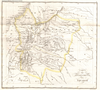
【Courtesy of the C. V. Starr East Asian Library University of California, Berkeley】 Mounted cover title. Copperplate print. In Japanese. Relief shown by hachures. Oriented with north to the upper right. 3 insets: Chishima no Kuni Shoto -- Ryukyu no Kuni Shoto -- Mujinto. Includes text, list of district names and legend. Title on map: Shochu Nihon zenzu : fu Chosen Kaikyo zu. Col. map folded in cover 18 x 18 cm. East Asian Library call number Cb42.
Links: Source / Biblio Ref
|
1876 | over 3 years ago | 5 control points |
|
Image from the Map Collections courtesy Stanford University Libraries, licensed under a Creative Commons Attribution-Noncommercial 3.0 Unported License. © Stanford University. 【図幅名】 高鍋 【測量時期】 明治35年測図/昭和7年要部修正/昭和10年部分修正 【発行時期】 【記号】 延岡8号(共13面) 【測量機関】 参謀本部 【備考】 秘
Links: Source / Biblio Ref
|
about 4 years ago | 4 control points | |
|
【Courtesy of the C. V. Starr East Asian Library University of California, Berkeley】 Copperplate print. In Japanese. Relief shown by hachures. Includes tables of mountains and rivers, 5 insets and legend. Col. map folded in cover 17 x 9 cm. East Asian Library call number Cb47.1.
Links: Source / Biblio Ref
|
1876 | over 3 years ago | 5 control points |
|
Image from the Map Collections courtesy Stanford University Libraries, licensed under a Creative Commons Attribution-Noncommercial 3.0 Unported License. © Stanford University. 【図幅名】 都井岬 【測量時期】 明治35年測図/昭和7年修正/昭和10年部分修正 【発行時期】 昭和21年11月発行 【記号】 宮崎12号(共8面) 【測量機関】 地理調査所 【備考】
Links: Source / Biblio Ref
|
about 4 years ago | 4 control points | |
|
Links: Source / Biblio Ref
|
2021 | over 3 years ago | 6 control points |
|
Image from the Map Collections courtesy Stanford University Libraries, licensed under a Creative Commons Attribution-Noncommercial 3.0 Unported License. © Stanford University. 【図幅名】 加治木 【測量時期】 明治35年測圖/昭和7年要部修正測圖及修正測圖之縮圖/昭和10年部分修正測圖 【発行時期】 昭和11年発行 【記号】 鹿児島六号 【測量機関】 大日本帝國陸地測量部 【備考】 祕
Links: Source / Biblio Ref
|
about 4 years ago | 4 control points | |
|
Image from the Map Collections courtesy Stanford University Libraries, licensed under a Creative Commons Attribution-Noncommercial 3.0 Unported License. © Stanford University. 【図幅名】 相島 【測量時期】 明治32年測図/昭和2年要部修正/昭和7年鉄道補入 【発行時期】 昭和9年8月発行 【記号】 山口9号(共15面) 【測量機関】 大日本帝国陸地測量部 【備考】
Links: Source / Biblio Ref
|
about 2 years ago | 4 control points | |
|
|
8 months ago | 3 control points | |
|
Image from the Map Collections courtesy Stanford University Libraries, licensed under a Creative Commons Attribution-Noncommercial 3.0 Unported License. © Stanford University. 【図幅名】 糸沢 【測量時期】 大正1年測図/昭和8年要部修正 【発行時期】 【記号】 日光6号(共16面) 【測量機関】 参謀本部 【備考】 秘
Links: Source / Biblio Ref
|
about 2 years ago | 4 control points | |
|
|
2022 | almost 2 years ago | 3 control points |
|
Image from the Map Collections courtesy Stanford University Libraries, licensed under a Creative Commons Attribution-Noncommercial 3.0 Unported License. © Stanford University. 【図幅名】 大田原 【測量時期】 明治42年測図/昭和4年修正 【発行時期】 昭和8年4月発行 【記号】 白河15号(共17面) 【測量機関】 大日本帝国陸地測量部 【備考】
Links: Source / Biblio Ref
|
about 2 years ago | 4 control points | |
|
Links: Source / Biblio Ref
|
2020 | over 1 year ago | 11 control points |
|
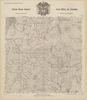
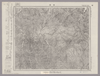
Image from the Map Collections courtesy Stanford University Libraries, licensed under a Creative Commons Attribution-Noncommercial 3.0 Unported License. © Stanford University.
Links: Source / Biblio Ref
|
over 6 years ago | 4 control points | |
|
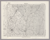
Image from the Map Collections courtesy Stanford University Libraries, licensed under a Creative Commons Attribution-Noncommercial 3.0 Unported License. © Stanford University. 【図幅名】 久米島東部 【測量時期】 大正10年測圖 【発行時期】 昭和11年発行 【記号】 沖縄郡島二十二号 【測量機関】 陸地測量部・参謀本部 【備考】 軍事極祕(戦地ニ在りテハ軍事祕密トス)
Links: Source / Biblio Ref
|
3 months ago | 4 control points | |
|
|
2022 | over 1 year ago | 3 control points |
|
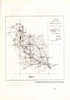
Image from the Map Collections courtesy Stanford University Libraries, licensed under a Creative Commons Attribution-Noncommercial 3.0 Unported License. © Stanford University. 【図幅名】 伊平屋後島 【測量時期】 大正10年測圖 【発行時期】 昭和11年発行 【記号】 沖縄郡島七号 【測量機関】 陸地測量部・参謀本部 【備考】 軍事極祕(戦地ニ在りテハ軍事祕密トス)
Links: Source / Biblio Ref
|
3 months ago | 4 control points | |
|
Image from the Map Collections courtesy Stanford University Libraries, licensed under a Creative Commons Attribution-Noncommercial 3.0 Unported License. © Stanford University. 【図幅名】 小口瀬戸 【測量時期】 明治43年測図/昭和9年修正 【発行時期】 昭和11年10月発行 【記号】 富山14号(共11面) 【測量機関】 大日本帝国陸地測量部 【備考】
Links: Source / Biblio Ref
|
about 2 years ago | 4 control points | |
|
Image from the Map Collections courtesy Stanford University Libraries, licensed under a Creative Commons Attribution-Noncommercial 3.0 Unported License. © Stanford University. 【図幅名】 久米島南部 【測量時期】 大正10年測圖 【発行時期】 昭和11年発行 【記号】 沖縄郡島二十三号 【測量機関】 陸地測量部・参謀本部 【備考】 軍事極祕(戦地ニ在りテハ軍事祕密トス)
Links: Source / Biblio Ref
|
3 months ago | 4 control points | |
|
この地図の作成に当たっては、国土地理院長の承認を得て、同院発行の20万分の1地勢図及び5万分の1地形図を使用した。(承認番号 平30情使、 第1148号)
Links: Source / Biblio Ref
|
1947 | over 5 years ago | 4 control points |
|
Image from the Map Collections courtesy Stanford University Libraries, licensed under a Creative Commons Attribution-Noncommercial 3.0 Unported License. © Stanford University. 【図幅名】 請島 【測量時期】 大正8年測圖 【発行時期】 大正11年発行 【記号】 奄美大島要塞近傍十四号 【測量機関】 陸地測量部・参謀本部 【備考】 軍事極祕(戦地ニ在りテハ軍事祕密トス)
Links: Source / Biblio Ref
|
3 months ago | 4 control points | |
|
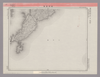
【Courtesy of the C. V. Starr East Asian Library University of California, Berkeley】 Col. map folded in cover 19 x 13 cm. Cover title. Title on map: Hokkaido zenzu. Copperplate print. In Japanese. Relief shown by hachures. Includes 3 insets, distance charts and legend. Shows the sea routes with distances. East Asian Library call number D16.
Links: Source / Biblio Ref
|
1892 | over 3 years ago | 4 control points |
|
この地図の作成に当たっては、国土地理院長の承認を得て、同院発行の20万分の1地勢図及び5万分の1地形図を使用した。(承認番号 平30情使、 第1148号)
Links: Source / Biblio Ref
|
1946 | over 5 years ago | 4 control points |
|
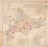
【Courtesy of the C. V. Starr East Asian Library University of California, Berkeley】 Col. map folded to 21 x 14 cm. In Japanese and English. Includes geological survey notes, table of amount of coal and legend. East Asian Library call number D5.1.
Links: Source / Biblio Ref
|
1876 | over 3 years ago | 4 control points |
|
この地図の作成に当たっては、国土地理院長の承認を得て、同院発行の20万分の1地勢図及び5万分の1地形図を使用した。(承認番号 平30情使、 第1148号)
Links: Source / Biblio Ref
|
1947 | over 5 years ago | 4 control points |
|
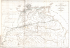
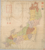
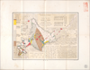
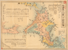
【Courtesy of the C. V. Starr East Asian Library University of California, Berkeley】 Mounted cover title. Title on map: Hokkaido 12-kakoku 86-gun meisaizu. Wood block print. In Japanese. Oriented with north to the left. Includes distance chart and legend. Col. map folded in cover 19 x 10 cm. East Asian Library call number D2.
Links: Source / Biblio Ref
|
1869 | over 3 years ago | 4 control points |
|
この地図の作成に当たっては、国土地理院長の承認を得て、同院発行の20万分の1地勢図及び5万分の1地形図を使用した。(承認番号 平30情使、 第1148号)
Links: Source / Biblio Ref
|
1946 | over 5 years ago | 4 control points |