地図を見る
| 地図 | タイトル | 年 | 前回の更新  |
ステータス |
|---|---|---|---|---|
|
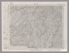
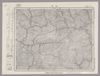
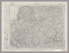
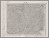
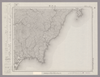
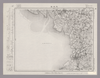
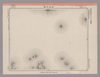
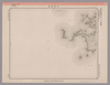
Image from the Map Collections courtesy Stanford University Libraries, licensed under a Creative Commons Attribution-Noncommercial 3.0 Unported License. © Stanford University. 【図幅名】 手結 【測量時期】 明治40年測図の縮図/昭和8年修正、測図の縮図 【発行時期】 昭和11年5月発行 【記号】 高知3号(共16面) 【測量機関】 大日本帝国陸地測量部 【備考】
リンク: 出所・参照情報
|
4ヶ月 前 | 4個の基準点 | |
|
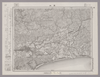
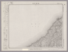
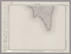
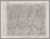
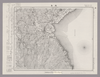
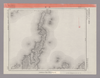
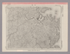
Image from the Map Collections courtesy Stanford University Libraries, licensed under a Creative Commons Attribution-Noncommercial 3.0 Unported License. © Stanford University. 【図幅名】 高知 【測量時期】 明治40年測図の縮図/昭和8年修正、測図の縮図 【発行時期】 昭和11年4月発行 【記号】 高知7号(共16面) 【測量機関】 大日本帝国陸地測量部 【備考】
リンク: 出所・参照情報
|
4ヶ月 前 | 4個の基準点 | |
|
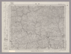
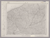
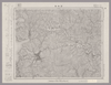
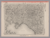
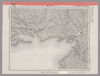
Image from the Map Collections courtesy Stanford University Libraries, licensed under a Creative Commons Attribution-Noncommercial 3.0 Unported License. © Stanford University. 【図幅名】 須崎 【測量時期】 明治39年測図の縮図/昭和8年修正、測図の縮図 【発行時期】 【記号】 高知12号(共16面) 【測量機関】 参謀本部 【備考】 秘
リンク: 出所・参照情報
|
4ヶ月 前 | 4個の基準点 | |
|
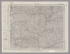
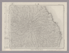
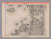
Image from the Map Collections courtesy Stanford University Libraries, licensed under a Creative Commons Attribution-Noncommercial 3.0 Unported License. © Stanford University. 【図幅名】 越知 【測量時期】 明治39年測図/昭和8年修正 【発行時期】 昭和11年8月発行 【記号】 高知15号(共16面) 【測量機関】 大日本帝国陸地測量部 【備考】
リンク: 出所・参照情報
|
4ヶ月 前 | 4個の基準点 | |
|
Image from the Map Collections courtesy Stanford University Libraries, licensed under a Creative Commons Attribution-Noncommercial 3.0 Unported License. © Stanford University. 【図幅名】 久万 【測量時期】 明治37年測図/昭和8年修正 【発行時期】 昭和22年2月発行 【記号】 松山3号(共15面) 【測量機関】 内務省地理調査所 【備考】 ( 1枚のレイヤー)
リンク: 出所・参照情報
|
4ヶ月 前 | 4個の基準点 | |
|
Image from the Map Collections courtesy Stanford University Libraries, licensed under a Creative Commons Attribution-Noncommercial 3.0 Unported License. © Stanford University. 【図幅名】 伊予長浜 【測量時期】 明治37年測図/昭和8年修正 【発行時期】 昭和11年5月発行 【記号】 松山11号(共15面) 【測量機関】 大日本帝国陸地測量部 【備考】 ( 1枚のレイヤー)
リンク: 出所・参照情報
|
4ヶ月 前 | 4個の基準点 | |
|
Image from the Map Collections courtesy Stanford University Libraries, licensed under a Creative Commons Attribution-Noncommercial 3.0 Unported License. © Stanford University. 【図幅名】 大洲 【測量時期】 明治37年測図/昭和8年修正 【発行時期】 昭和11年7月発行 【記号】 松山7号(共15面) 【測量機関】 大日本帝国陸地測量部 【備考】 ( 1枚のレイヤー)
リンク: 出所・参照情報
|
4ヶ月 前 | 4個の基準点 | |
|
Image from the Map Collections courtesy Stanford University Libraries, licensed under a Creative Commons Attribution-Noncommercial 3.0 Unported License. © Stanford University. 【図幅名】 鶴川 【測量時期】 明治36年測圖/昭和2年要部修正測圖 【発行時期】 【記号】 中津七号 【測量機関】 参謀本部 【備考】 祕
リンク: 出所・参照情報
|
4ヶ月 前 | 4個の基準点 | |
|
Image from the Map Collections courtesy Stanford University Libraries, licensed under a Creative Commons Attribution-Noncommercial 3.0 Unported License. © Stanford University. 【図幅名】 宇佐 【測量時期】 明治36年測圖/昭和2年修正測圖 【発行時期】 【記号】 中津十一号 【測量機関】 参謀本部 【備考】 祕
リンク: 出所・参照情報
|
4ヶ月 前 | 4個の基準点 | |
|
Image from the Map Collections courtesy Stanford University Libraries, licensed under a Creative Commons Attribution-Noncommercial 3.0 Unported License. © Stanford University. 【図幅名】 中津 【測量時期】 明治35年測圖/昭和16年第二回修正測圖 【発行時期】 【記号】 中津十五号 【測量機関】 参謀本部 【備考】 祕
リンク: 出所・参照情報
|
4ヶ月 前 | 4個の基準点 | |
|
Image from the Map Collections courtesy Stanford University Libraries, licensed under a Creative Commons Attribution-Noncommercial 3.0 Unported License. © Stanford University. 【図幅名】 後藤寺 【測量時期】 明治33年測図/昭和12年第2回修正 【発行時期】 【記号】 小倉3号 【測量機関】 参謀本部 【備考】 秘
リンク: 出所・参照情報
|
4ヶ月 前 | 4個の基準点 | |
|
Image from the Map Collections courtesy Stanford University Libraries, licensed under a Creative Commons Attribution-Noncommercial 3.0 Unported License. © Stanford University. 【図幅名】 太宰府 【測量時期】 明治33年測圖之縮圖/昭和11年修正測圖及第二回修正測圖並修正測圖之縮圖 【発行時期】 【記号】 小倉七号 【測量機関】 参謀本部 【備考】 祕
リンク: 出所・参照情報
|
4ヶ月 前 | 4個の基準点 | |
|
Image from the Map Collections courtesy Stanford University Libraries, licensed under a Creative Commons Attribution-Noncommercial 3.0 Unported License. © Stanford University. 【図幅名】 福岡 【測量時期】 明治33年測圖之縮圖/昭和11年第二回修正測圖之縮圖 【発行時期】 【記号】 小倉十一号 【測量機関】 参謀本部 【備考】 祕
リンク: 出所・参照情報
|
4ヶ月 前 | 4個の基準点 | |
|
Image from the Map Collections courtesy Stanford University Libraries, licensed under a Creative Commons Attribution-Noncommercial 3.0 Unported License. © Stanford University. 【図幅名】 二神島 【測量時期】 大正12年測図の縮図/昭和10年修正、測図の縮図 【発行時期】 昭和21年11月発行 【記号】 唐津7号(共8面) 【測量機関】 内務省地理調査所 【備考】
リンク: 出所・参照情報
|
4ヶ月 前 | 4個の基準点 | |
|
Image from the Map Collections courtesy Stanford University Libraries, licensed under a Creative Commons Attribution-Noncommercial 3.0 Unported License. © Stanford University. 【図幅名】 奈半利 【測量時期】 明治40年測図/昭和8年修正 【発行時期】 昭和11年8月発行 【記号】 剣山16号(共11面) 【測量機関】 大日本帝国陸地測量部 【備考】
リンク: 出所・参照情報
|
4ヶ月 前 | 4個の基準点 | |
|
Image from the Map Collections courtesy Stanford University Libraries, licensed under a Creative Commons Attribution-Noncommercial 3.0 Unported License. © Stanford University. 【図幅名】 安芸 【測量時期】 明治40年測図/昭和8年修正 【発行時期】 昭和11年1月発行 【記号】 高知4号(共16面) 【測量機関】 大日本帝国陸地測量部 【備考】
リンク: 出所・参照情報
|
4ヶ月 前 | 4個の基準点 | |
|
Image from the Map Collections courtesy Stanford University Libraries, licensed under a Creative Commons Attribution-Noncommercial 3.0 Unported License. © Stanford University. 【図幅名】 土佐長浜 【測量時期】 明治39年測図の縮図/昭和8年修正、測図の縮図 【発行時期】 昭和11年2月発行 【記号】 高知8号(共16面) 【測量機関】 大日本帝国陸地測量部 【備考】
リンク: 出所・参照情報
|
4ヶ月 前 | 4個の基準点 | |
|
Image from the Map Collections courtesy Stanford University Libraries, licensed under a Creative Commons Attribution-Noncommercial 3.0 Unported License. © Stanford University. 【図幅名】 【測量時期】 【発行時期】 【記号】 【測量機関】 【備考】
リンク: 出所・参照情報
|
4ヶ月 前 | 4個の基準点 | |
|
Image from the Map Collections courtesy Stanford University Libraries, licensed under a Creative Commons Attribution-Noncommercial 3.0 Unported License. © Stanford University. 【図幅名】 新田 【測量時期】 明治39年測図/昭和8年修正 【発行時期】 昭和11年8月発行 【記号】 高知16号(共16面) 【測量機関】 大日本帝国陸地測量部 【備考】
リンク: 出所・参照情報
|
4ヶ月 前 | 4個の基準点 | |
|
Image from the Map Collections courtesy Stanford University Libraries, licensed under a Creative Commons Attribution-Noncommercial 3.0 Unported License. © Stanford University. 【図幅名】 卯之町 【測量時期】 明治37年測図/昭和8年修正/昭和22年資料修正 【発行時期】 昭和22年11月発行 【記号】 松山8号(共15面) 【測量機関】 地理調査所 【備考】 ( 1枚のレイヤー)
リンク: 出所・参照情報
|
4ヶ月 前 | 4個の基準点 | |
|
Image from the Map Collections courtesy Stanford University Libraries, licensed under a Creative Commons Attribution-Noncommercial 3.0 Unported License. © Stanford University. 【図幅名】 八幡浜 【測量時期】 明治37年測図/昭和8年修正/昭和28年応急修正 【発行時期】 昭和33年4月発行 【記号】 松山12号(共15面) 【測量機関】 地理調査所 【備考】 応急修正版 ( 1枚のレイヤー)
リンク: 出所・参照情報
|
4ヶ月 前 | 4個の基準点 | |
|
Image from the Map Collections courtesy Stanford University Libraries, licensed under a Creative Commons Attribution-Noncommercial 3.0 Unported License. © Stanford University. 【図幅名】 伊予三崎 【測量時期】 明治37年測図/昭和9年第2回修正、測図の縮図/昭和28年応急修正 【発行時期】 昭和36年8月発行 【記号】 松山16号(共15面) 【測量機関】 国土地理院 【備考】 応急修正版 ( 1枚のレイヤー)
リンク: 出所・参照情報
|
4ヶ月 前 | 4個の基準点 | |
|
Image from the Map Collections courtesy Stanford University Libraries, licensed under a Creative Commons Attribution-Noncommercial 3.0 Unported License. © Stanford University. 【図幅名】 豊後杵築 【測量時期】 明治36年測圖/昭和2年要部修正測圖 【発行時期】 【記号】 中津八号 【測量機関】 参謀本部 【備考】 祕
リンク: 出所・参照情報
|
4ヶ月 前 | 4個の基準点 | |
|
Image from the Map Collections courtesy Stanford University Libraries, licensed under a Creative Commons Attribution-Noncommercial 3.0 Unported License. © Stanford University. 【図幅名】 豊岡 【測量時期】 明治36年測圖/昭和2年要部修正測圖 【発行時期】 【記号】 中津十二号 【測量機関】 参謀本部 【備考】 祕
リンク: 出所・参照情報
|
4ヶ月 前 | 4個の基準点 | |
|
Image from the Map Collections courtesy Stanford University Libraries, licensed under a Creative Commons Attribution-Noncommercial 3.0 Unported License. © Stanford University. 【図幅名】 耶馬溪 【測量時期】 明治36年測圖/昭和7年要部修正測圖 【発行時期】 【記号】 中津十六号 【測量機関】 参謀本部 【備考】 祕
リンク: 出所・参照情報
|
4ヶ月 前 | 4個の基準点 | |
|
Image from the Map Collections courtesy Stanford University Libraries, licensed under a Creative Commons Attribution-Noncommercial 3.0 Unported License. © Stanford University. 【図幅名】 吉井 【測量時期】 明治33年測圖/昭和11年修正測圖 【発行時期】 昭和13年発行 【記号】 小倉四号 【測量機関】 大日本帝國陸地測量部 【備考】
リンク: 出所・参照情報
|
4ヶ月 前 | 4個の基準点 | |
|
Image from the Map Collections courtesy Stanford University Libraries, licensed under a Creative Commons Attribution-Noncommercial 3.0 Unported License. © Stanford University. 【図幅名】 甘木 【測量時期】 明治33年測圖之縮圖/昭和11年第三回修正測圖之縮圖/昭和13年測圖之縮圖 【発行時期】 【記号】 小倉八号 【測量機関】 参謀本部 【備考】 祕
リンク: 出所・参照情報
|
4ヶ月 前 | 4個の基準点 | |
|
Image from the Map Collections courtesy Stanford University Libraries, licensed under a Creative Commons Attribution-Noncommercial 3.0 Unported License. © Stanford University. 【図幅名】 背振山 【測量時期】 明治33年測圖之縮圖/昭和11年第三回修正測圖及修正測圖之縮圖/昭和13年測圖之縮圖 【発行時期】 【記号】 小倉十二号 【測量機関】 参謀本部 【備考】 祕
リンク: 出所・参照情報
|
4ヶ月 前 | 4個の基準点 | |
|
Image from the Map Collections courtesy Stanford University Libraries, licensed under a Creative Commons Attribution-Noncommercial 3.0 Unported License. © Stanford University. 【図幅名】 浜崎 【測量時期】 明治33年測圖/昭和11年修正測圖 【発行時期】 【記号】 小倉十六号 【測量機関】 参謀本部 【備考】 祕
リンク: 出所・参照情報
|
4ヶ月 前 | 4個の基準点 | |
|
Image from the Map Collections courtesy Stanford University Libraries, licensed under a Creative Commons Attribution-Noncommercial 3.0 Unported License. © Stanford University. 【図幅名】 平戸 【測量時期】 大正12年測図の縮図/昭和10年修正、測図の縮図 【発行時期】 昭和21年11月発行 【記号】 唐津8号(共12面) 【測量機関】 地理調査所 【備考】
リンク: 出所・参照情報
|
4ヶ月 前 | 4個の基準点 | |
|
Image from the Map Collections courtesy Stanford University Libraries, licensed under a Creative Commons Attribution-Noncommercial 3.0 Unported License. © Stanford University. 【図幅名】 生月 【測量時期】 大正12年測図の縮図/昭和10年修正、測図の縮図 【発行時期】 昭和21年11月発行 【記号】 唐津12号(共8面) 【測量機関】 地理調査所 【備考】
リンク: 出所・参照情報
|
4ヶ月 前 | 4個の基準点 | |
|
Image from the Map Collections courtesy Stanford University Libraries, licensed under a Creative Commons Attribution-Noncommercial 3.0 Unported License. © Stanford University. 【図幅名】 室戸岬 【測量時期】 明治40年測圖/昭和8年修正測圖 【発行時期】 【記号】 剣山十六号南部 【測量機関】 参謀本部 【備考】 祕
リンク: 出所・参照情報
|
4ヶ月 前 | 4個の基準点 | |
|
Image from the Map Collections courtesy Stanford University Libraries, licensed under a Creative Commons Attribution-Noncommercial 3.0 Unported License. © Stanford University. 【図幅名】 石碆 【測量時期】 明治39年測図/昭和8年修正 【発行時期】 昭和11年4月発行 【記号】 窪川9号(共4面) 【測量機関】 大日本帝国陸地測量部 【備考】
リンク: 出所・参照情報
|
4ヶ月 前 | 4個の基準点 | |
|
Image from the Map Collections courtesy Stanford University Libraries, licensed under a Creative Commons Attribution-Noncommercial 3.0 Unported License. © Stanford University. 【図幅名】 窪川 【測量時期】 明治39年測図/昭和8年修正 【発行時期】 昭和11年6月発行 【記号】 窪川13号(共4面) 【測量機関】 大日本帝国陸地測量部 【備考】
リンク: 出所・参照情報
|
4ヶ月 前 | 4個の基準点 | |
|
Image from the Map Collections courtesy Stanford University Libraries, licensed under a Creative Commons Attribution-Noncommercial 3.0 Unported License. © Stanford University. 【図幅名】 田野々 【測量時期】 明治39年測図/昭和8年修正 【発行時期】 昭和11年5月発行 【記号】 宇和島1号(共13面) 【測量機関】 大日本帝国陸地測量部 【備考】 ( 1枚のレイヤー)
リンク: 出所・参照情報
|
4ヶ月 前 | 4個の基準点 | |
|
Image from the Map Collections courtesy Stanford University Libraries, licensed under a Creative Commons Attribution-Noncommercial 3.0 Unported License. © Stanford University. 【図幅名】 宇和島 【測量時期】 明治37年測図/昭和8年修正 【発行時期】 昭和11年8月発行 【記号】 宇和島5号(共13面) 【測量機関】 大日本帝国陸地測量部 【備考】 ( 1枚のレイヤー)
リンク: 出所・参照情報
|
4ヶ月 前 | 4個の基準点 | |
|
Image from the Map Collections courtesy Stanford University Libraries, licensed under a Creative Commons Attribution-Noncommercial 3.0 Unported License. © Stanford University. 【図幅名】 上川口 【測量時期】 明治39年測図/昭和8年修正 【発行時期】 昭和11年4月発行 【記号】 窪川14号(共4面) 【測量機関】 大日本帝国陸地測量部 【備考】
リンク: 出所・参照情報
|
4ヶ月 前 | 4個の基準点 | |
|
Image from the Map Collections courtesy Stanford University Libraries, licensed under a Creative Commons Attribution-Noncommercial 3.0 Unported License. © Stanford University. 【図幅名】 犬飼 【測量時期】 明治35年測図/昭和7年要部修正/昭和23年資料修正 【発行時期】 昭和23年11月発行 【記号】 大分6号(共16面) 【測量機関】 地理調査所 【備考】
リンク: 出所・参照情報
|
4ヶ月 前 | 4個の基準点 | |
|
Image from the Map Collections courtesy Stanford University Libraries, licensed under a Creative Commons Attribution-Noncommercial 3.0 Unported License. © Stanford University. 【図幅名】 久住 【測量時期】 明治36年測圖/昭和7年要部修正測圖 【発行時期】 【記号】 大分十号 【測量機関】 参謀本部 【備考】 祕
リンク: 出所・参照情報
|
4ヶ月 前 | 4個の基準点 | |
|
Image from the Map Collections courtesy Stanford University Libraries, licensed under a Creative Commons Attribution-Noncommercial 3.0 Unported License. © Stanford University. 【図幅名】 宮原 【測量時期】 明治36年測圖/昭和2年要部修正測圖 【発行時期】 昭和4年発行 【記号】 大分十四号 【測量機関】 大日本帝國陸地測量部 【備考】
リンク: 出所・参照情報
|
4ヶ月 前 | 4個の基準点 | |
|
Image from the Map Collections courtesy Stanford University Libraries, licensed under a Creative Commons Attribution-Noncommercial 3.0 Unported License. © Stanford University. 【図幅名】 大牟田 【測量時期】 明治34年測圖/大正15年第二回修正測圖/昭和6年鐡道補入 【発行時期】 【記号】 熊本十号 【測量機関】 参謀本部 【備考】 祕
リンク: 出所・参照情報
|
4ヶ月 前 | 4個の基準点 | |
|
Image from the Map Collections courtesy Stanford University Libraries, licensed under a Creative Commons Attribution-Noncommercial 3.0 Unported License. © Stanford University. 【図幅名】 鹿島 【測量時期】 明治33年及大正3年測圖之縮圖/大正6年修正測圖/昭和6年鐡道補入/昭和7年部分修正測圖 【発行時期】 【記号】 熊本十四号 【測量機関】 参謀本部 【備考】 祕
リンク: 出所・参照情報
|
4ヶ月 前 | 4個の基準点 | |
|
Image from the Map Collections courtesy Stanford University Libraries, licensed under a Creative Commons Attribution-Noncommercial 3.0 Unported License. © Stanford University. 【図幅名】 早岐 【測量時期】 明治34年測図の縮図/大正14年修正、測図の縮図/昭和7年部分修正、測図の縮図 【発行時期】 昭和21年10月発行 【記号】 長崎2号(共15面) 【測量機関】 内務省地理調査所 【備考】
リンク: 出所・参照情報
|
4ヶ月 前 | 4個の基準点 | |
|
Image from the Map Collections courtesy Stanford University Libraries, licensed under a Creative Commons Attribution-Noncommercial 3.0 Unported License. © Stanford University. 【図幅名】 蠣ノ浦 【測量時期】 明治34年測図/大正13年修正/昭和20年部分修正 【発行時期】 昭和23年3月発行 【記号】 長崎6号(共15面) 【測量機関】 地理調査所 【備考】
リンク: 出所・参照情報
|
4ヶ月 前 | 4個の基準点 | |
|
Image from the Map Collections courtesy Stanford University Libraries, licensed under a Creative Commons Attribution-Noncommercial 3.0 Unported License. © Stanford University. 【図幅名】 肥前江ノ島 【測量時期】 大正13年測図の縮図/大正13年修正/昭和11年部分修正、測図の縮図 【発行時期】 昭和21年10月発行 【記号】 長崎10号(共15面) 【測量機関】 内務省地理調査所 【備考】
リンク: 出所・参照情報
|
4ヶ月 前 | 4個の基準点 | |
|
Image from the Map Collections courtesy Stanford University Libraries, licensed under a Creative Commons Attribution-Noncommercial 3.0 Unported License. © Stanford University. 【図幅名】 立串 【測量時期】 明治33年測図/大正13年測図/昭和13年測図の縮図/昭和11年修正、測図の縮図 【発行時期】 昭和21年11月発行 【記号】 長崎14号(共15面) 【測量機関】 地理調査所 【備考】
リンク: 出所・参照情報
|
4ヶ月 前 | 4個の基準点 | |
|
Image from the Map Collections courtesy Stanford University Libraries, licensed under a Creative Commons Attribution-Noncommercial 3.0 Unported License. © Stanford University. 【図幅名】 肥前平島 【測量時期】 明治36年測図/昭和11年修正 【発行時期】 昭和21年11月発行 【記号】 福江2号(共5面) 【測量機関】 地理調査所 【備考】
リンク: 出所・参照情報
|
4ヶ月 前 | 4個の基準点 | |
|
Image from the Map Collections courtesy Stanford University Libraries, licensed under a Creative Commons Attribution-Noncommercial 3.0 Unported License. © Stanford University. 【図幅名】 宿毛 【測量時期】 明治37年測図/昭和8年修正 【発行時期】 昭和17年12月発行 【記号】 宇和島7号 【測量機関】 大日本帝国陸地測量部 【備考】 ( 1枚のレイヤー)
リンク: 出所・参照情報
|
4ヶ月 前 | 4個の基準点 | |
|
Image from the Map Collections courtesy Stanford University Libraries, licensed under a Creative Commons Attribution-Noncommercial 3.0 Unported License. © Stanford University. 【図幅名】 伊予鹿島 【測量時期】 明治37年測図/昭和8年修正/昭和20年部分修正 【発行時期】 昭和23年2月発行 【記号】 宇和島11号(共13面) 【測量機関】 地理調査所 【備考】 ( 1枚のレイヤー)
リンク: 出所・参照情報
|
4ヶ月 前 | 4個の基準点 | |
|
Image from the Map Collections courtesy Stanford University Libraries, licensed under a Creative Commons Attribution-Noncommercial 3.0 Unported License. © Stanford University. 【図幅名】 【測量時期】 【発行時期】 【記号】 【測量機関】 【備考】
リンク: 出所・参照情報
|
4ヶ月 前 | 4個の基準点 |