地図を見る
| 地図 | タイトル | 年 | 前回の更新  |
ステータス |
|---|---|---|---|---|
|
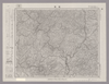
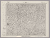
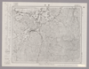
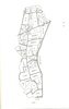
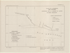
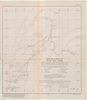
Image from the Map Collections courtesy Stanford University Libraries, licensed under a Creative Commons Attribution-Noncommercial 3.0 Unported License. © Stanford University. 【図幅名】 福渡 【測量時期】 明治30年測圖/昭和7年要部修正測圖 【発行時期】 【記号】 高梁三号 【測量機関】 参謀本部 【備考】 祕
リンク: 出所・参照情報
|
6ヶ月 前 | 4個の基準点 | |
|
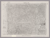
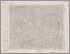
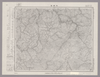
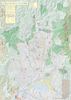
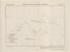
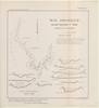
Image from the Map Collections courtesy Stanford University Libraries, licensed under a Creative Commons Attribution-Noncommercial 3.0 Unported License. © Stanford University. 【図幅名】 津山西部 【測量時期】 明治31年測量/昭和7年要部修正、測図の縮図 【発行時期】 昭和9年7月発行 【記号】 高梁2号(共16面) 【測量機関】 大日本帝国陸地測量部 【備考】
リンク: 出所・参照情報
|
6ヶ月 前 | 4個の基準点 | |
|
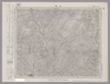
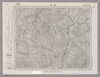
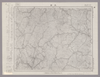
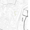
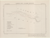
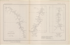
Image from the Map Collections courtesy Stanford University Libraries, licensed under a Creative Commons Attribution-Noncommercial 3.0 Unported License. © Stanford University. 【図幅名】 山崎 【測量時期】 明治30年測図/昭和7年要部修正 【発行時期】 【記号】 姫路6号(共16面) 【測量機関】 参謀本部 【備考】 秘
リンク: 出所・参照情報
|
6ヶ月 前 | 4個の基準点 | |
|
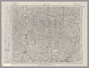
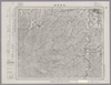
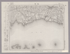
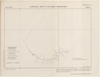
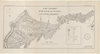
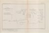
Image from the Map Collections courtesy Stanford University Libraries, licensed under a Creative Commons Attribution-Noncommercial 3.0 Unported License. © Stanford University. 【図幅名】 龍野 【測量時期】 明治28年測図/大正12年第2回修正/昭和7年鉄道補入 【発行時期】 【記号】 姫路7号(共16面) 【測量機関】 参謀本部 【備考】 秘
リンク: 出所・参照情報
|
6ヶ月 前 | 4個の基準点 | |
|
Image from the Map Collections courtesy Stanford University Libraries, licensed under a Creative Commons Attribution-Noncommercial 3.0 Unported License. © Stanford University. 【図幅名】 津山東部 【測量時期】 明治30年測図/大正14年測図の縮図/昭和7年第2回修正 【発行時期】 昭和35年9月発行 【記号】 姫路14号(共16面) 【測量機関】 国土地理院 【備考】 応急修正版
リンク: 出所・参照情報
|
6ヶ月 前 | 4個の基準点 | |
|
Image from the Map Collections courtesy Stanford University Libraries, licensed under a Creative Commons Attribution-Noncommercial 3.0 Unported License. © Stanford University. 【図幅名】 智頭 【測量時期】 明治31年測図/昭和7年要部修正 【発行時期】 昭和9年7月発行 【記号】 姫路13号 【測量機関】 大日本帝国陸地測量部 【備考】
リンク: 出所・参照情報
|
6ヶ月 前 | 4個の基準点 | |
|
Image from the Map Collections courtesy Stanford University Libraries, licensed under a Creative Commons Attribution-Noncommercial 3.0 Unported License. © Stanford University. 【図幅名】 奥津 【測量時期】 明治31年測圖/昭和7年要部修正測圖 【発行時期】 【記号】 高梁一号 【測量機関】 参謀本部 【備考】 祕
リンク: 出所・参照情報
|
6ヶ月 前 | 4個の基準点 | |
|
Image from the Map Collections courtesy Stanford University Libraries, licensed under a Creative Commons Attribution-Noncommercial 3.0 Unported License. © Stanford University. 【図幅名】 鳥取南部 【測量時期】 明治30年測図/明治31年測図の縮図/昭和7年修正 【発行時期】 昭和9年8月発行 【記号】 鳥取16号(共9面) 【測量機関】 大日本帝国陸地測量部 【備考】
リンク: 出所・参照情報
|
6ヶ月 前 | 4個の基準点 | |
|
Image from the Map Collections courtesy Stanford University Libraries, licensed under a Creative Commons Attribution-Noncommercial 3.0 Unported License. © Stanford University. 【図幅名】 倉吉 【測量時期】 明治31年測量/昭和7年修正測量 【発行時期】 昭和9年7月発行 【記号】 松江4号 【測量機関】 大日本帝国陸地測量部 【備考】
リンク: 出所・参照情報
|
6ヶ月 前 | 4個の基準点 | |
|
Image from the Map Collections courtesy Stanford University Libraries, licensed under a Creative Commons Attribution-Noncommercial 3.0 Unported License. © Stanford University. 【図幅名】 木都賀 【測量時期】 明治32年測圖/昭和7年修正測圖 【発行時期】 【記号】 浜田十六号 【測量機関】 参謀本部 【備考】 祕
リンク: 出所・参照情報
|
6ヶ月 前 | 4個の基準点 | |
|
Image from the Map Collections courtesy Stanford University Libraries, licensed under a Creative Commons Attribution-Noncommercial 3.0 Unported License. © Stanford University. 【図幅名】 大朝 【測量時期】 明治32年測図/昭和7年修正 【発行時期】 昭和10年5月発行 【記号】 浜田12号(共15面) 【測量機関】 大日本帝国陸地測量部 【備考】
リンク: 出所・参照情報
|
6ヶ月 前 | 4個の基準点 | |
|
Image from the Map Collections courtesy Stanford University Libraries, licensed under a Creative Commons Attribution-Noncommercial 3.0 Unported License. © Stanford University. 【図幅名】 姫路 【測量時期】 明治26年測図/明治28年測図/大正12年第2回修正/昭和7年鉄道補入/昭和24年応急修正/昭和35年資料修正 【発行時期】 昭和35年6月発行 【記号】 姫路8号 【測量機関】 国土地理院 【備考】
リンク: 出所・参照情報
|
6ヶ月 前 | 4個の基準点 | |
|
この地図の作成に当たっては、国土地理院長の承認を得て、同院発行の20万分の1地勢図及び5万分の1地形図を使用した。(承認番号 平30情使、 第1148号)
リンク: 出所・参照情報
|
1947 | 6ヶ月 前 | 4個の基準点 |
|
Image from the Map Collections courtesy Stanford University Libraries, licensed under a Creative Commons Attribution-Noncommercial 3.0 Unported License. © Stanford University. 【図幅名】 水戸 【測量時期】 明治36年測図/昭和15年第2回修正、測図の縮図/昭和27年応急修正 【発行時期】 昭和34年6月発行 【記号】 水戸10号(共12面) 【測量機関】 国土地理院 【備考】 応急修正版 ( 1枚のレイヤー)
リンク: 出所・参照情報
|
6ヶ月 前 | 4個の基準点 | |
|
|
1944 | 6ヶ月 前 | 4個の基準点 |
|
リンク: 出所・参照情報
|
1873 | 7ヶ月 前 | 27個の基準点 |
|
「The guide to the celebrated places in Kiyoto & the surrounding places for the foreign visitors」(同志社大学所蔵)一部です。
リンク: 出所・参照情報
|
2024 | 7ヶ月 前 | 18個の基準点 |
|
|
1927 | 7ヶ月 前 | 4個の基準点 |
|
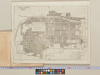
Japan City Plans 1:12,500
U.S. Army Map Service, 1945-1946
https://maps.lib.utexas.edu/maps/ams/japan_city_plans/
リンク: 出所・参照情報
|
1945 | 7ヶ月 前 | 4個の基準点 |

|
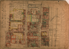
Japan City Plans 1:12,500
U.S. Army Map Service, 1945-1946
https://maps.lib.utexas.edu/maps/ams/japan_city_plans/
リンク: 出所・参照情報
|
1945 | 7ヶ月 前 | 整形を解除する |
|
Image from the Map Collections courtesy Stanford University Libraries, licensed under a Creative Commons Attribution-Noncommercial 3.0 Unported License. © Stanford University. 【図幅名】 鶴来 【測量時期】 明治42年測図/昭和5年修正 【発行時期】 昭和8年10月発行 【記号】 金沢6号(共13面) 【測量機関】 大日本帝国陸地測量部 【備考】 (改) ( 2枚のレイヤー)
リンク: 出所・参照情報
|
9ヶ月 前 | 4個の基準点 | |
|
|
1875 | 9ヶ月 前 | 整形を解除する |
|
|
2023 | 10ヶ月 前 | 4個の基準点 |
|
|
2023 | 10ヶ月 前 | 12個の基準点 |
|
|
10ヶ月 前 | 5個の基準点 | |
|
|
10ヶ月 前 | 6個の基準点 | |
|
|
10ヶ月 前 | 10個の基準点 | |
|
|
10ヶ月 前 | 2個の基準点 | |
|
|
10ヶ月 前 | 1個の基準点 | |
|
|
10ヶ月 前 | 10個の基準点 | |
|
|
10ヶ月 前 | 9個の基準点 | |
|
|
10ヶ月 前 | 3個の基準点 | |
|
|
10ヶ月 前 | 4個の基準点 | |
|
|
10ヶ月 前 | 4個の基準点 | |
|
|
10ヶ月 前 | 5個の基準点 | |
|
|
10ヶ月 前 | 3個の基準点 | |
|
|
1917 | 10ヶ月 前 | 6個の基準点 |
|
|
1917 | 10ヶ月 前 | 5個の基準点 |
|
|
1943 | 10ヶ月 前 | 6個の基準点 |
|
|
1943 | 10ヶ月 前 | 12個の基準点 |
|
|
1943 | 10ヶ月 前 | 10個の基準点 |
|
|
1932 | 10ヶ月 前 | 2個の基準点 |
|
|
10ヶ月 前 | 2個の基準点 | |
|
|
1939 | 10ヶ月 前 | 7個の基準点 |
|
|
10ヶ月 前 | 3個の基準点 | |
|
|
10ヶ月 前 | 15個の基準点 | |
|
|
1931 | 10ヶ月 前 | 8個の基準点 |
|
|
10ヶ月 前 | 12個の基準点 | |
|
|
1930 | 10ヶ月 前 | 5個の基準点 |
|
|
1932 | 10ヶ月 前 | 1個の基準点 |