地図を見る
| 地図 | タイトル | 年 | 前回の更新  |
ステータス |
|---|---|---|---|---|
|
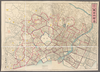
shelfmark: Maps 63140.15
License: Public Domain
明治9 *多色刷り。銅板。 Xylograph. Beans 40.
リンク: 出所・参照情報
|
1876 | 4ヶ月 前 | 18個の基準点 |
|
|
2026 | 4ヶ月 前 | 整形を解除する |
|
|
2026 | 4ヶ月 前 | 整形を解除する |
|
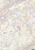
当地区の「古墳マップ」を作成したい」
既広島県編集の「福山市神辺町遺跡地図」を活用し、地理院地図と合体のうえ仕上げたい
|
2026 | 4ヶ月 前 | 整形を解除する |
|
【最初期発行】 この地図の作成に当たっては、国土地理院長の承認を得て、同院発行の20万分の1地勢図及び5万分の1地形図を使用した。(承認番号 平30情使、 第1148号) ( 1枚のレイヤー)
リンク: 出所・参照情報
|
1923 | 4ヶ月 前 | 4個の基準点 |
|
【最初期発行】 この地図の作成に当たっては、国土地理院長の承認を得て、同院発行の20万分の1地勢図及び5万分の1地形図を使用した。(承認番号 平30情使、 第1148号) ( 1枚のレイヤー)
リンク: 出所・参照情報
|
1926 | 4ヶ月 前 | 4個の基準点 |
|
【最初期発行】 この地図の作成に当たっては、国土地理院長の承認を得て、同院発行の20万分の1地勢図及び5万分の1地形図を使用した。(承認番号 平30情使、 第1148号) ( 1枚のレイヤー)
リンク: 出所・参照情報
|
1926 | 4ヶ月 前 | 4個の基準点 |
|
【最初期発行】 この地図の作成に当たっては、国土地理院長の承認を得て、同院発行の20万分の1地勢図及び5万分の1地形図を使用した。(承認番号 平30情使、 第1148号) ( 1枚のレイヤー)
リンク: 出所・参照情報
|
1926 | 4ヶ月 前 | 4個の基準点 |
|
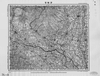
この地図の作成に当たっては、国土地理院長の承認を得て、同院発行の20万分の1地勢図及び5万分の1地形図を使用した。(承認番号 平30情使、 第1148号)
リンク: 出所・参照情報
|
1945 | 4ヶ月 前 | 4個の基準点 |
|
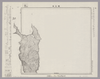
Image from the Map Collections courtesy Stanford University Libraries, licensed under a Creative Commons Attribution-Noncommercial 3.0 Unported License. © Stanford University. 【図幅名】 礼文島 【測量時期】 大正12年測図 【発行時期】 昭和21年10月発行 【記号】 宗谷16号(共1面) 【測量機関】 内務省地理調査所 【備考】 ( 1枚のレイヤー)
リンク: 出所・参照情報
|
4ヶ月 前 | 4個の基準点 | |
|
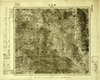
Image from the Map Collections courtesy Tohoku University. © 2023, the Committee for the Creation of the Gaihozu Digital Archives. 【図幅名】 獨石口 【測量時期】 明治44年測圖/昭和8年方眼描入 【発行時期】 昭和8年発行 【記号】 宣化17号 【測量機関】 臨時測圖部・陸地測量部・参謀本部
リンク: 出所・参照情報
|
1933 | 4ヶ月 前 | 4個の基準点 |
|
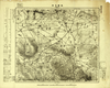
Image from the Map Collections courtesy Tohoku University. © 2023, the Committee for the Creation of the Gaihozu Digital Archives. 【図幅名】 張營子井コ 【測量時期】 明治44年測圖/昭和8年方眼描入 【発行時期】 昭和8年発行 【記号】 宣化16号 【測量機関】 臨時測圖部・陸地測量部・参謀本部
リンク: 出所・参照情報
|
1933 | 4ヶ月 前 | 4個の基準点 |
|
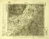
Image from the Map Collections courtesy Tohoku University. © 2023, the Committee for the Creation of the Gaihozu Digital Archives. 【図幅名】 延慶 【測量時期】 明治44年測圖/昭和8年方眼描入/昭和9年要部修正略測圖mネンソクズsネンヨウブシュウセイリャクソクズ 【発行時期】 昭和10年発行 【記号】 宣化14号 【測量機関】 支那駐屯軍司令部・陸地測量部・参謀本部
リンク: 出所・参照情報
|
1935 | 4ヶ月 前 | 4個の基準点 |
|
Image from the Map Collections courtesy Tohoku University. © 2023, the Committee for the Creation of the Gaihozu Digital Archives. 【図幅名】 上廟 【測量時期】 - 【発行時期】 昭和10年発行 【記号】 宣化14号 【測量機関】 大日本帝國陸地測量部
リンク: 出所・参照情報
|
1935 | 4ヶ月 前 | 4個の基準点 |
|
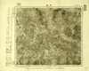
Image from the Map Collections courtesy Tohoku University. © 2023, the Committee for the Creation of the Gaihozu Digital Archives. 【図幅名】 赤城 【測量時期】 明治44年測圖/昭和8年方眼描入 【発行時期】 昭和8年発行 【記号】 宣化13号 【測量機関】 臨時測圖部・陸地測量部・参謀本部
リンク: 出所・参照情報
|
1933 | 4ヶ月 前 | 4個の基準点 |
|
Image from the Map Collections courtesy Tohoku University. © 2023, the Committee for the Creation of the Gaihozu Digital Archives. 【図幅名】 黒達營子 【測量時期】 - 【発行時期】 昭和10年発行 【記号】 宣化13号 【測量機関】 大日本帝國陸地測量部
リンク: 出所・参照情報
|
1935 | 4ヶ月 前 | 4個の基準点 |
|
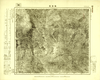
Image from the Map Collections courtesy Tohoku University. © 2023, the Committee for the Creation of the Gaihozu Digital Archives. 【図幅名】 鎮安堡 【測量時期】 明治44年測圖/昭和8年方眼描入 【発行時期】 昭和8年発行 【記号】 宣化12号 【測量機関】 臨時測圖部・陸地測量部・参謀本部
リンク: 出所・参照情報
|
1933 | 4ヶ月 前 | 4個の基準点 |
|
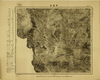
Image from the Map Collections courtesy Tohoku University. © 2023, the Committee for the Creation of the Gaihozu Digital Archives. 【図幅名】 辛營子 【測量時期】 - 【発行時期】 昭和10年発行 【記号】 宣化12号 【測量機関】 大日本帝國陸地測量部
リンク: 出所・参照情報
|
1935 | 4ヶ月 前 | 4個の基準点 |
|
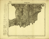
Image from the Map Collections courtesy Tohoku University. © 2023, the Committee for the Creation of the Gaihozu Digital Archives. 【図幅名】 海子溝口 【測量時期】 - 【発行時期】 昭和10年発行 【記号】 宣化9号 【測量機関】 大日本帝國陸地測量部
リンク: 出所・参照情報
|
1935 | 4ヶ月 前 | 4個の基準点 |
|
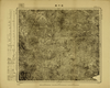
Image from the Map Collections courtesy Tohoku University. © 2023, the Committee for the Creation of the Gaihozu Digital Archives. 【図幅名】 湯河溝 【測量時期】 明治44年測圖/昭和8年方眼描入 【発行時期】 昭和8年発行 【記号】 宣化8号 【測量機関】 臨時測圖部・陸地測量部・参謀本部
リンク: 出所・参照情報
|
1933 | 4ヶ月 前 | 4個の基準点 |
|
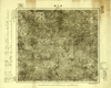
Image from the Map Collections courtesy Tohoku University. © 2023, the Committee for the Creation of the Gaihozu Digital Archives. 【図幅名】 湯河溝 【測量時期】 - 【発行時期】 昭和10年発行 【記号】 宣化8号 【測量機関】 大日本帝國陸地測量部
リンク: 出所・参照情報
|
1935 | 4ヶ月 前 | 4個の基準点 |
|
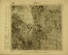
Image from the Map Collections courtesy Tohoku University. © 2023, the Committee for the Creation of the Gaihozu Digital Archives. 【図幅名】 大閣鎮 【測量時期】 - 【発行時期】 昭和10年発行 【記号】 宣化7号 【測量機関】 大日本帝國陸地測量部
リンク: 出所・参照情報
|
1935 | 4ヶ月 前 | 4個の基準点 |
|
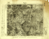
Image from the Map Collections courtesy Tohoku University. © 2023, the Committee for the Creation of the Gaihozu Digital Archives. 【図幅名】 上黄旗 【測量時期】 明治44年測圖/昭和8年方眼描入msネンホウガンエガイ 【発行時期】 昭和8年発行sネンハッコウ 【記号】 宣化6号 【測量機関】 臨時測圖部・陸地測量部・参謀本部リンジソクズブ
リンク: 出所・参照情報
|
1933 | 4ヶ月 前 | 4個の基準点 |
|
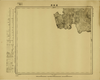
Image from the Map Collections courtesy Tohoku University. © 2023, the Committee for the Creation of the Gaihozu Digital Archives. 【図幅名】 羅家溝 【測量時期】 - 【発行時期】 昭和10年発行 【記号】 宣化5号 【測量機関】 大日本帝國陸地測量部
リンク: 出所・参照情報
|
1935 | 4ヶ月 前 | 4個の基準点 |
|
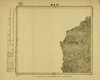
Image from the Map Collections courtesy Tohoku University. © 2023, the Committee for the Creation of the Gaihozu Digital Archives. 【図幅名】 南營寨 【測量時期】 - 【発行時期】 昭和10年発行 【記号】 宣化4号 【測量機関】 大日本帝國陸地測量部
リンク: 出所・参照情報
|
1935 | 4ヶ月 前 | 4個の基準点 |
|
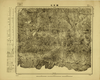
Image from the Map Collections courtesy Tohoku University. © 2023, the Committee for the Creation of the Gaihozu Digital Archives. 【図幅名】 鞍匠屯 【測量時期】 - 【発行時期】 昭和10年発行 【記号】 宣化3号 【測量機関】 大日本帝國陸地測量部
リンク: 出所・参照情報
|
1935 | 4ヶ月 前 | 4個の基準点 |
|
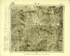
Image from the Map Collections courtesy Tohoku University. © 2023, the Committee for the Creation of the Gaihozu Digital Archives. 【図幅名】 豊寧 【測量時期】 - 【発行時期】 昭和10年発行 【記号】 宣化2号 【測量機関】 大日本帝國陸地測量部
リンク: 出所・参照情報
|
1935 | 4ヶ月 前 | 4個の基準点 |
|
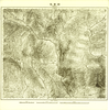
Image from the Map Collections courtesy Tohoku University. © 2023, the Committee for the Creation of the Gaihozu Digital Archives. 【図幅名】 郭家屯 【測量時期】 - 【発行時期】 - 【記号】 宣化1号 【測量機関】 -
リンク: 出所・参照情報
|
4ヶ月 前 | 4個の基準点 | |
|
Image from the Map Collections courtesy Tohoku University. © 2023, the Committee for the Creation of the Gaihozu Digital Archives. 【図幅名】 薊州 【測量時期】 明治43年測圖/昭和8年方眼描入/昭和10年要部修正測圖メイジネンソクハカリsネンホウガンエガイsネンヨウブシュウセイソクズ 【発行時期】 昭和11年発行 【記号】 西八行北四段宣化5号 【測量機関】 支那駐屯軍司令部・陸地測量部・参謀本部ササトモチュウトングンシレイブ
リンク: 出所・参照情報
|
1936 | 4ヶ月 前 | 4個の基準点 |
|
Image from the Map Collections courtesy Tohoku University. © 2023, the Committee for the Creation of the Gaihozu Digital Archives. 【図幅名】 石匣鎮 【測量時期】 明治43年測圖/昭和8年方眼描入/昭和10年要部修正測圖メイジネンソクハカリsネンホウガンエガイsネンヨウブシュウセイソクズ 【発行時期】 昭和11年発行 【記号】 西八行北四段宣化4号ニシ8ギョウキタ 【測量機関】 支那駐屯軍司令部・陸地測量部・参謀本部ササトモチュウトングンシレイブ
リンク: 出所・参照情報
|
1936 | 4ヶ月 前 | 4個の基準点 |
|
Image from the Map Collections courtesy Tohoku University. © 2023, the Committee for the Creation of the Gaihozu Digital Archives. 【図幅名】 昌端山 【測量時期】 - 【発行時期】 昭和10年発行 【記号】 承徳25号 【測量機関】 大日本帝國陸地測量部
リンク: 出所・参照情報
|
1935 | 4ヶ月 前 | 4個の基準点 |
|
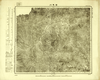
Image from the Map Collections courtesy Tohoku University. © 2023, the Committee for the Creation of the Gaihozu Digital Archives. 【図幅名】 曹家路城 【測量時期】 明治43年測圖/昭和8年方眼描入msネンホウガンエガイ 【発行時期】 昭和8年発行 【記号】 承徳24号 【測量機関】 臨時測圖部・陸地測量部・参謀本部リンジソクズブ
リンク: 出所・参照情報
|
1933 | 4ヶ月 前 | 4個の基準点 |
|
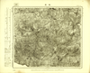
Image from the Map Collections courtesy Tohoku University. © 2023, the Committee for the Creation of the Gaihozu Digital Archives. 【図幅名】 白馬川 【測量時期】 - 【発行時期】 昭和10年発行 【記号】 承徳24号 【測量機関】 大日本帝國陸地測量部
リンク: 出所・参照情報
|
1935 | 4ヶ月 前 | 4個の基準点 |
|
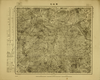
Image from the Map Collections courtesy Tohoku University. © 2023, the Committee for the Creation of the Gaihozu Digital Archives. 【図幅名】 承徳 【測量時期】 - 【発行時期】 昭和10年発行 【記号】 承徳23号 【測量機関】 大日本帝國陸地測量部
リンク: 出所・参照情報
|
1935 | 4ヶ月 前 | 4個の基準点 |
|
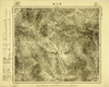
Image from the Map Collections courtesy Tohoku University. © 2023, the Committee for the Creation of the Gaihozu Digital Archives. 【図幅名】 黄姑屯 【測量時期】 - 【発行時期】 - 【記号】 承徳22号 【測量機関】 -
リンク: 出所・参照情報
|
4ヶ月 前 | 4個の基準点 | |
|
Image from the Map Collections courtesy Tohoku University. © 2023, the Committee for the Creation of the Gaihozu Digital Archives. 【図幅名】 張三營 【測量時期】 - 【発行時期】 昭和10年発行 【記号】 承徳21号 【測量機関】 大日本帝國陸地測量部
リンク: 出所・参照情報
|
1935 | 4ヶ月 前 | 4個の基準点 |
|
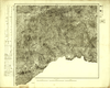
Image from the Map Collections courtesy Tohoku University. © 2023, the Committee for the Creation of the Gaihozu Digital Archives. 【図幅名】 氷窖 【測量時期】 - 【発行時期】 昭和10年発行 【記号】 承徳19号 【測量機関】 大日本帝國陸地測量部
リンク: 出所・参照情報
|
1935 | 4ヶ月 前 | 4個の基準点 |
|
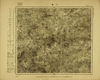
Image from the Map Collections courtesy Tohoku University. © 2023, the Committee for the Creation of the Gaihozu Digital Archives. 【図幅名】 六溝 【測量時期】 - 【発行時期】 昭和10年発行 【記号】 承徳18号 【測量機関】 大日本帝國陸地測量部
リンク: 出所・参照情報
|
1935 | 4ヶ月 前 | 4個の基準点 |
|
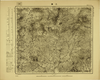
Image from the Map Collections courtesy Tohoku University. © 2023, the Committee for the Creation of the Gaihozu Digital Archives. 【図幅名】 三溝 【測量時期】 - 【発行時期】 昭和10年発行 【記号】 承徳17号 【測量機関】 大日本帝國陸地測量部
リンク: 出所・参照情報
|
1935 | 4ヶ月 前 | 4個の基準点 |
|
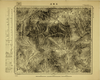
Image from the Map Collections courtesy Tohoku University. © 2023, the Committee for the Creation of the Gaihozu Digital Archives. 【図幅名】 王家店 【測量時期】 - 【発行時期】 昭和10年発行 【記号】 承徳16号 【測量機関】 大日本帝國陸地測量部
リンク: 出所・参照情報
|
1935 | 4ヶ月 前 | 4個の基準点 |
|
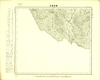
Image from the Map Collections courtesy Tohoku University. © 2023, the Committee for the Creation of the Gaihozu Digital Archives. 【図幅名】 蕭家營子 【測量時期】 - 【発行時期】 昭和10年発行 【記号】 承徳15号 【測量機関】 大日本帝國陸地測量部
リンク: 出所・参照情報
|
1935 | 4ヶ月 前 | 4個の基準点 |
|
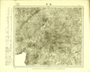
Image from the Map Collections courtesy Tohoku University. © 2023, the Committee for the Creation of the Gaihozu Digital Archives. 【図幅名】 寛城 【測量時期】 - 【発行時期】 昭和10年発行 【記号】 承徳14号 【測量機関】 大日本帝國陸地測量部
リンク: 出所・参照情報
|
1935 | 4ヶ月 前 | 4個の基準点 |
|
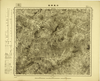
Image from the Map Collections courtesy Tohoku University. © 2023, the Committee for the Creation of the Gaihozu Digital Archives. 【図幅名】 平泉南部 【測量時期】 - 【発行時期】 昭和10年発行 【記号】 承徳13号 【測量機関】 大日本帝國陸地測量部
リンク: 出所・参照情報
|
1935 | 4ヶ月 前 | 4個の基準点 |
|
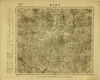
Image from the Map Collections courtesy Tohoku University. © 2023, the Committee for the Creation of the Gaihozu Digital Archives. 【図幅名】 平泉北部 【測量時期】 - 【発行時期】 昭和10年発行 【記号】 承徳12号 【測量機関】 大日本帝國陸地測量部
リンク: 出所・参照情報
|
1935 | 4ヶ月 前 | 4個の基準点 |
|
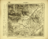
Image from the Map Collections courtesy Tohoku University. © 2023, the Committee for the Creation of the Gaihozu Digital Archives. 【図幅名】 八里罕甸子 【測量時期】 - 【発行時期】 昭和10年発行 【記号】 承徳11号 【測量機関】 大日本帝國陸地測量部
リンク: 出所・参照情報
|
1935 | 4ヶ月 前 | 4個の基準点 |
|
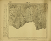
Image from the Map Collections courtesy Tohoku University. © 2023, the Committee for the Creation of the Gaihozu Digital Archives. 【図幅名】 界嶺口 【測量時期】 - 【発行時期】 昭和10年発行 【記号】 承徳10号 【測量機関】 大日本帝國陸地測量部
リンク: 出所・参照情報
|
1935 | 4ヶ月 前 | 4個の基準点 |
|
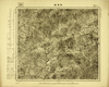
Image from the Map Collections courtesy Tohoku University. © 2023, the Committee for the Creation of the Gaihozu Digital Archives. 【図幅名】 乾溝鎮 【測量時期】 - 【発行時期】 昭和10年発行 【記号】 承徳9号 【測量機関】 大日本帝國陸地測量部
リンク: 出所・参照情報
|
1935 | 4ヶ月 前 | 4個の基準点 |
|
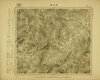
Image from the Map Collections courtesy Tohoku University. © 2023, the Committee for the Creation of the Gaihozu Digital Archives. 【図幅名】 叨?噔 【測量時期】 - 【発行時期】 昭和10年発行 【記号】 承徳8号 【測量機関】 大日本帝國陸地測量部
リンク: 出所・参照情報
|
1935 | 4ヶ月 前 | 4個の基準点 |
|
Image from the Map Collections courtesy Tohoku University. © 2023, the Committee for the Creation of the Gaihozu Digital Archives. 【図幅名】 建昌 【測量時期】 - 【発行時期】 昭和10年発行 【記号】 承徳7号 【測量機関】 大日本帝國陸地測量部
リンク: 出所・参照情報
|
1935 | 4ヶ月 前 | 4個の基準点 |
|
Image from the Map Collections courtesy Tohoku University. © 2023, the Committee for the Creation of the Gaihozu Digital Archives. 【図幅名】 杜家窩棚 【測量時期】 - 【発行時期】 昭和10年発行 【記号】 承徳6号 【測量機関】 大日本帝國陸地測量部
リンク: 出所・参照情報
|
1935 | 4ヶ月 前 | 4個の基準点 |


