地図を見る
| 地図 | タイトル | 年 | 前回の更新 | ステータス  |
|---|---|---|---|---|
|
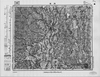
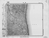
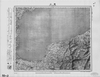
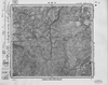
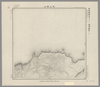
Image from the Map Collections courtesy Stanford University Libraries, licensed under a Creative Commons Attribution-Noncommercial 3.0 Unported License. © Stanford University. 【図幅名】 霞露岳 【測量時期】 大正5年測図 【発行時期】 【記号】 盛岡4号東部(共18面) 【測量機関】 参謀本部 【備考】 秘
リンク: 出所・参照情報
|
約2年 前 | 4個の基準点 | |
|
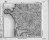
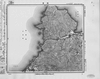
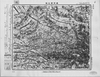
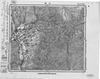
Image from the Map Collections courtesy Stanford University Libraries, licensed under a Creative Commons Attribution-Noncommercial 3.0 Unported License. © Stanford University. 【図幅名】 八幡平 【測量時期】 大正5年測図/昭和4年鉄道補入 【発行時期】 昭和6年6月発行 【記号】 秋田1号(共16面) 【測量機関】 大日本帝国陸地測量部 【備考】
リンク: 出所・参照情報
|
約2年 前 | 4個の基準点 | |
|
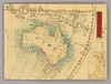
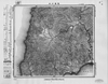
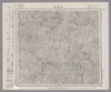
Image from the Map Collections courtesy Stanford University Libraries, licensed under a Creative Commons Attribution-Noncommercial 3.0 Unported License. © Stanford University. 【図幅名】 日詰 【測量時期】 大正1年測図 【発行時期】 大正5年3月発行 【記号】 盛岡15号(共18面) 【測量機関】 大日本帝国陸地測量部 【備考】
リンク: 出所・参照情報
|
約2年 前 | 4個の基準点 | |
|
リンク: 出所・参照情報
|
2020 | 1年以上 前 | 10個の基準点 |
|
リンク: 出所・参照情報
|
2020 | 1年以上 前 | 10個の基準点 |
|
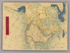
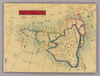
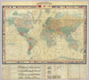
【Courtesy of the C. V. Starr East Asian Library University of California, Berkeley】 Japanese date Meiji 17 1884. In color. Folded. Mounted cover title. Copperplate print. In Japanese. Relief shown pictorially. Orientation varies. Shows distance of roads and sea routes. Shows views of tourist attractions. Includes legend.
リンク: 出所・参照情報
|
1884 | 3年以上 前 | 4個の基準点 |
|
この地図の作成に当たっては、国土地理院長の承認を得て、同院発行の20万分の1地勢図及び5万分の1地形図を使用した。(承認番号 平30情使、 第1148号)
リンク: 出所・参照情報
|
1946 | 5年以上 前 | 4個の基準点 |
|
Image from the Map Collections courtesy Stanford University Libraries, licensed under a Creative Commons Attribution-Noncommercial 3.0 Unported License. © Stanford University. 【図幅名】 春立 【測量時期】 大正8年測圖 【発行時期】 【記号】 浦河十一号 【測量機関】 参謀本部 【備考】 祕 ( 1枚のレイヤー)
リンク: 出所・参照情報
|
約2年 前 | 4個の基準点 | |
|
この地図の作成に当たっては、国土地理院長の承認を得て、同院発行の20万分の1地勢図及び5万分の1地形図を使用した。(承認番号 平30情使、 第1148号)
リンク: 出所・参照情報
|
1948 | 5年以上 前 | 4個の基準点 |
|
この地図の作成に当たっては、国土地理院長の承認を得て、同院発行の20万分の1地勢図及び5万分の1地形図を使用した。(承認番号 平30情使、 第1148号)
リンク: 出所・参照情報
|
1946 | 5年以上 前 | 4個の基準点 |
|
この地図の作成に当たっては、国土地理院長の承認を得て、同院発行の20万分の1地勢図及び5万分の1地形図を使用した。(承認番号 平30情使、 第1148号)
リンク: 出所・参照情報
|
1946 | 5年以上 前 | 4個の基準点 |
|
Image from the Map Collections courtesy Stanford University Libraries, licensed under a Creative Commons Attribution-Noncommercial 3.0 Unported License. © Stanford University. 【図幅名】 遊楽部岳 【測量時期】 大正6年測図 【発行時期】 大正8年12月発行 【記号】 室蘭15号(共14面) 【測量機関】 大日本帝国陸地測量部 【備考】 ( 1枚のレイヤー)
リンク: 出所・参照情報
|
4年以上 前 | 4個の基準点 | |
|
Image from the Map Collections courtesy Stanford University Libraries, licensed under a Creative Commons Attribution-Noncommercial 3.0 Unported License. © Stanford University. 【図幅名】 奥尻西南部 【測量時期】 大正6年測圖 【発行時期】 【記号】 久遠十二号 【測量機関】 参謀本部 【備考】 祕 ( 1枚のレイヤー)
リンク: 出所・参照情報
|
約2年 前 | 4個の基準点 | |
|
リンク: 出所・参照情報
|
2020 | 1年以上 前 | 12個の基準点 |
|
【最初期発行】 この地図の作成に当たっては、国土地理院長の承認を得て、同院発行の20万分の1地勢図及び5万分の1地形図を使用した。(承認番号 平30情使、 第1148号) ( 1枚のレイヤー)
リンク: 出所・参照情報
|
1917 | 約2年 前 | 4個の基準点 |
|
この地図の作成に当たっては、国土地理院長の承認を得て、同院発行の20万分の1地勢図及び5万分の1地形図を使用した。(承認番号 平30情使、 第1148号)
リンク: 出所・参照情報
|
1946 | 5年以上 前 | 4個の基準点 |
|
この地図の作成に当たっては、国土地理院長の承認を得て、同院発行の20万分の1地勢図及び5万分の1地形図を使用した。(承認番号 平30情使、 第1148号) ( 1枚のレイヤー)
リンク: 出所・参照情報
|
1947 | 約2年 前 | 4個の基準点 |
|
この地図の作成に当たっては、国土地理院長の承認を得て、同院発行の20万分の1地勢図及び5万分の1地形図を使用した。(承認番号 平30情使、 第1148号)
リンク: 出所・参照情報
|
1946 | 8ヶ月 前 | 4個の基準点 |
|
【Courtesy of the C. V. Starr East Asian Library University of California, Berkeley】 Wood block print. In Japanese. Shows New Zealand in inset. East Asian Library call number: A15.
リンク: 出所・参照情報
|
1856 | 2年以上 前 | 9個の基準点 |
|
Image from the Map Collections courtesy Stanford University Libraries, licensed under a Creative Commons Attribution-Noncommercial 3.0 Unported License. © Stanford University. 【図幅名】 登別温泉 【測量時期】 大正6年測図の縮図/昭和10年修正、測図の縮図 【発行時期】 昭和12年6月発行 【記号】 苫小牧14号(共5面) 【測量機関】 大日本帝国陸地測量部 【備考】 ( 1枚のレイヤー)
リンク: 出所・参照情報
|
5年以上 前 | 4個の基準点 | |
|
この地図の作成に当たっては、国土地理院長の承認を得て、同院発行の20万分の1地勢図及び5万分の1地形図を使用した。(承認番号 平30情使、 第1148号)
リンク: 出所・参照情報
|
1946 | 5年以上 前 | 4個の基準点 |
|
この地図の作成に当たっては、国土地理院長の承認を得て、同院発行の20万分の1地勢図及び5万分の1地形図を使用した。(承認番号 平30情使、 第1148号)
リンク: 出所・参照情報
|
1946 | 5年以上 前 | 4個の基準点 |
|
この地図の作成に当たっては、国土地理院長の承認を得て、同院発行の20万分の1地勢図及び5万分の1地形図を使用した。(承認番号 平30情使、 第1148号)
リンク: 出所・参照情報
|
1946 | 5年以上 前 | 4個の基準点 |
|
【Courtesy of the C. V. Starr East Asian Library University of California, Berkeley】 Wood block print. In Japanese. Oriented with north toward upper right. Includes an oversize Puget Sound and shows 3 of the Great Lakes as one large body. East Asian Library call number: A15.
リンク: 出所・参照情報
|
1856 | 3年以上 前 | 4個の基準点 |
|
【最初期発行】 この地図の作成に当たっては、国土地理院長の承認を得て、同院発行の20万分の1地勢図及び5万分の1地形図を使用した。(承認番号 平30情使、 第1148号) ( 1枚のレイヤー)
リンク: 出所・参照情報
|
1920 | 約2年 前 | 4個の基準点 |
|
この地図の作成に当たっては、国土地理院長の承認を得て、同院発行の20万分の1地勢図及び5万分の1地形図を使用した。(承認番号 平30情使、 第1148号) ( 1枚のレイヤー)
リンク: 出所・参照情報
|
1946 | 約2年 前 | 4個の基準点 |
|
【Courtesy of the C. V. Starr East Asian Library University of California, Berkeley】 Wood block print. In Japanese. Oriented with north toward right. East Asian Library call number: A15.
リンク: 出所・参照情報
|
1856 | 2年以上 前 | 8個の基準点 |
|
この地図の作成に当たっては、国土地理院長の承認を得て、同院発行の20万分の1地勢図及び5万分の1地形図を使用した。(承認番号 平30情使、 第1148号)
リンク: 出所・参照情報
|
1946 | 5年以上 前 | 4個の基準点 |
|
この地図の作成に当たっては、国土地理院長の承認を得て、同院発行の20万分の1地勢図及び5万分の1地形図を使用した。(承認番号 平30情使、 第1148号)
リンク: 出所・参照情報
|
1947 | 5年以上 前 | 4個の基準点 |
|
この地図の作成に当たっては、国土地理院長の承認を得て、同院発行の20万分の1地勢図及び5万分の1地形図を使用した。(承認番号 平30情使、 第1148号)
リンク: 出所・参照情報
|
1947 | 5年以上 前 | 4個の基準点 |
|
この地図の作成に当たっては、国土地理院長の承認を得て、同院発行の20万分の1地勢図及び5万分の1地形図を使用した。(承認番号 平30情使、 第1148号)
リンク: 出所・参照情報
|
1947 | 5年以上 前 | 4個の基準点 |
|
Image from the Map Collections courtesy Stanford University Libraries, licensed under a Creative Commons Attribution-Noncommercial 3.0 Unported License. © Stanford University. 【図幅名】 神威岳 【測量時期】 大正9年測圖 【発行時期】 【記号】 浦河二号 【測量機関】 参謀本部 【備考】 祕
リンク: 出所・参照情報
|
約2年 前 | 4個の基準点 | |
|
Image from the Map Collections courtesy Stanford University Libraries, licensed under a Creative Commons Attribution-Noncommercial 3.0 Unported License. © Stanford University. 【図幅名】 苫小牧 【測量時期】 大正8年測圖/昭和10年修正測圖 【発行時期】 【記号】 苫小牧五号 【測量機関】 参謀本部 【備考】 祕 ( 1枚のレイヤー)
リンク: 出所・参照情報
|
約2年 前 | 4個の基準点 | |
|
Image from the Map Collections courtesy Stanford University Libraries, licensed under a Creative Commons Attribution-Noncommercial 3.0 Unported License. © Stanford University. 【図幅名】 札内川上流 【測量時期】 大正9年測圖 【発行時期】 【記号】 浦河一号 【測量機関】 参謀本部 【備考】 祕
リンク: 出所・参照情報
|
約2年 前 | 4個の基準点 | |
|
Image from the Map Collections courtesy Stanford University Libraries, licensed under a Creative Commons Attribution-Noncommercial 3.0 Unported License. © Stanford University. 【図幅名】 長万部 【測量時期】 大正6年測圖/昭和3年鐡道補入 【発行時期】 【記号】 室蘭九号 【測量機関】 参謀本部 【備考】 祕 ( 1枚のレイヤー)
リンク: 出所・参照情報
|
約2年 前 | 4個の基準点 | |
|
|
2020 | 3年以上 前 | 4個の基準点 |
|
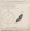
Image from the Map Collections courtesy Stanford University Libraries. This item is in the public domain. There are no restrictions on use.
【図幅名】 大三頭山【測量時期】 大正4年測圖 【発行時期】昭和11年 【記号】 千島列島四十九号 【測量機関】 参謀本部 【その他】千島列島 陸地測量部 ( 1枚のレイヤー)
リンク: 出所・参照情報
|
1936 | 1年以上 前 | 4個の基準点 |
|
この地図の作成に当たっては、国土地理院長の承認を得て、同院発行の20万分の1地勢図及び5万分の1地形図を使用した。(承認番号 平30情使、 第1148号) ( 1枚のレイヤー)
リンク: 出所・参照情報
|
1947 | 約4年 前 | 4個の基準点 |
|
Image from the Map Collections courtesy Stanford University Libraries, licensed under a Creative Commons Attribution-Noncommercial 3.0 Unported License. © Stanford University. 【図幅名】 音別 【測量時期】 大正9年測図 【発行時期】 大正11年3月発行 【記号】 帯広3号(共16面) 【測量機関】 大日本帝国陸地測量部 【備考】 ( 1枚のレイヤー)
リンク: 出所・参照情報
|
約2年 前 | 4個の基準点 | |
|
リンク: 出所・参照情報
|
2021 | 1年以上 前 | 4個の基準点 |
|
リンク: 出所・参照情報
|
2021 | 3年弱 前 | 4個の基準点 |
|
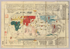
【Courtesy of the C. V. Starr East Asian Library University of California, Berkeley】 Mounted cover title. Wood block print. In Japanese. Title on map: Chikyu Bankoku sankai yochi zen zusetsu. Includes texts on the earth and climate zones, etc. Col., folded to 19 x 12 cm. East Asian Library call number: A3.
リンク: 出所・参照情報
|
1850 | 3年以上 前 | 4個の基準点 |
|
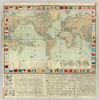
【Courtesy of the C. V. Starr East Asian Library University of California, Berkeley】 Mounted cover title. Copperplate print. In Japanese. Relief shown by hachures. Shows sea routes. Includes 4 insets, text on history, national flags, and legend. Prime meridian: Tokyo. Col., folded in cover 19 x 12 cm. East Asian Library call number: A20.
リンク: 出所・参照情報
|
1874 | 3年以上 前 | 4個の基準点 |
|
この地図の作成に当たっては、国土地理院長の承認を得て、同院発行の20万分の1地勢図及び5万分の1地形図を使用した。(承認番号 平30情使、 第1148号)
リンク: 出所・参照情報
|
1947 | 約2年 前 | 4個の基準点 |
|
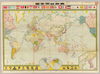
【Courtesy of the C. V. Starr East Asian Library University of California, Berkeley】 In Japanese. Relief shown by hachures. Shows distance of sea routes. Includes 2 insets, national flags, drawings of races, and legend. Col., folded to 27 x 19 cm. + 1 booklet not scanned. East Asian Library call number: A58.1.
リンク: 出所・参照情報
|
1905 | 3年以上 前 | 4個の基準点 |
|
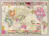
【Courtesy of the C. V. Starr East Asian Library University of California, Berkeley】 Mounted cover title. Title on map: Bankoku seizu. Copperplate print. In Japanese. Shows views of capital cities. Includes 3 insets, charts of rivers, and mountains, and national flags. Prime meridian: Tokyo. Col., folded in cover 21 x 15 cm. East Asian Library call number: A32.
リンク: 出所・参照情報
|
1886 | 3年以上 前 | 4個の基準点 |
|
【Courtesy of the C. V. Starr East Asian Library University of California, Berkeley】 Title added by hand. Title in Kobe Shiritsu Hakubutsukan kanzobin mokuroku p.11 : Zotei yochi kokai zenzu. Wood block print. In Japanese. Relief shown by hachures. Shows sea routes and views of capital cities. Includes distance chart of sea routes, charts of mountains, and rivers, and national flags. Includes preface and legend. Col., folded in cover 32 x 20 cm. East Asian Library call number: A27.
リンク: 出所・参照情報
|
1875 | 3年以上 前 | 4個の基準点 |
|
リンク: 出所・参照情報
|
2021 | 3年弱 前 | 3個の基準点 |
|
リンク: 出所・参照情報
|
2020 | 1年以上 前 | 13個の基準点 |
|
|
1854 | 6年以上 前 | 4個の基準点 |